The Palisade
March 23, 2014
2160m
Jasper, AB
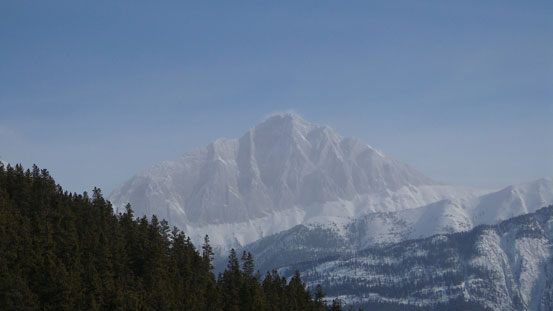
While driving towards Jasper from Hinton, one would not miss an impressive rock face on the right (west) side, and that’s the East face of The Palisade. This is one of the lowest summits in Victoria Cross Range, but just like the nearby Skyline area, anything on V. C. Range involves a long slog up one of the approach trails. For this one it’s the Pyramid Fire Road. This road brought up some good memories from June 2013 when Eric, Ben and I started at 1:30 am and did this entire approach in dark, the start of 21-hour epic 1-day traverse of 4 peaks. This time I visited in March on snowshoes so everything except for the length would be different.
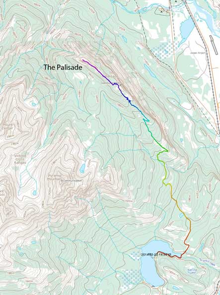
The Palisade via Pyramid Fire Road. GPX DL
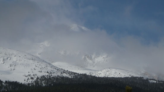
Given the questionable weather forecast everywhere in the Rockies I wasn’t really expecting much in terms of views. I chose this one because it has a good approach road and more importantly, it’s at/below treeline so route-finding wouldn’t be an issue in poor visibility. And yet, it’s long enough to make a full day outing (26.5 km round trip distance). I figured the worst case I’d have enough workout so that’s still better than staying home doing nothing… It turned out way better than expected. Weather played a joke with me and it was pretty funny to watch storms on west side and blue sky on east side during the entire day…
After waking up in miserable weather in Jasper townsite I decided to sleep in till whenever I wanted. Eventually I (somehow) managed to drag myself up. After a quick breakfast in A&W I drove up Pyramid Road. The last 2 km passing the Lodge was covered with fresh snow and I was the first one arriving at the parking lot on this day. With not-so-good spirit I started the long trek, with snowshoes in my backpack. The first 1.5 km or so was contouring around Pyramid Lake without gaining elevation. The road was essentially a cross country ski route so gets maintained often. It was rock hard so I figured it’s more efficient to boot the initial flat section. Once starting to gain elevation I strapped the ‘shoes on for extra traction. I was fully aware of the boredness so brought my iPod with full battery. That was crucial for surviving the hours and hours of foot numbing walk. With musics on time went by pretty fast and in short time I arrived at a smaller lake. By now the weather had improved significantly and I could see blue sky above.
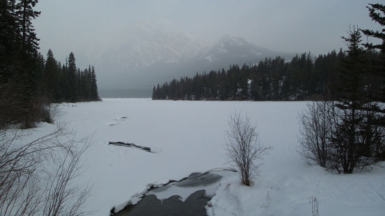
The day started in bad weather
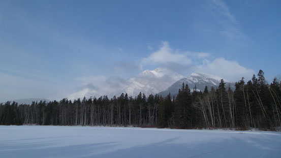
Soon the clouds lifted up. This is from a smaller lake
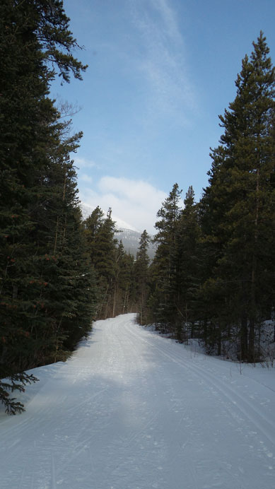
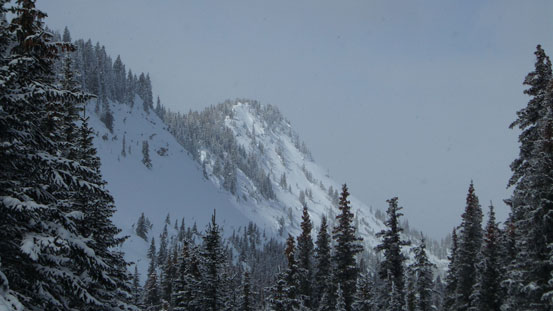
Typical view from the Fire Road
The groomed track stopped at shortly below the Y-junction, but luckily I was able to pick up a set of old snowshoe tracks which saved a lot of energy. Based on the post-holing suffer fest the day before I wasn’t really looking forward to any sort of trail-breaking on this day. At the Y-junction the snowshoe tracks turned right towards Palisade Lookout which was very good. But soon enough they stopped and I was left to my own. Thankfully the snowpack was way better in this area than in Willmore. The snowshoe penetration was about 10-20 cm and post-holing was minimal. But this section seemed to be freakin’ long. It’s only 3.5 km from the junction to Palisade Lookout but it was endless. Towards the end I followed this road climber’s right of an impressive rock face. There’s supposed to be a “Lookout” somewhere near the edge but I didn’t spend time looking for it. Here’s also the official end of this road/trail. The true summit of The Palisade lies near 2 km down the ridge.
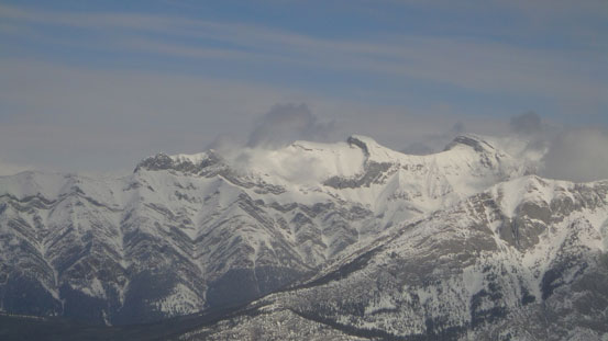
From one of the few viewpoints, I could see Mt. Colin
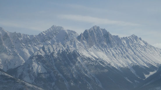
And, Meisner Ridge
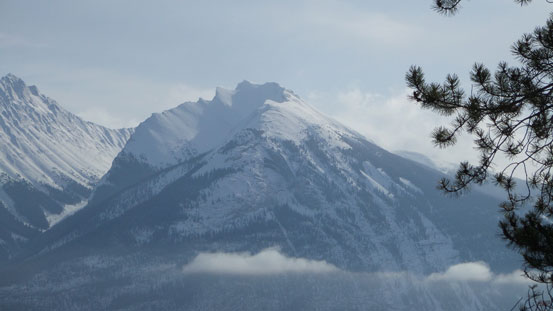
Roche Bonhomme
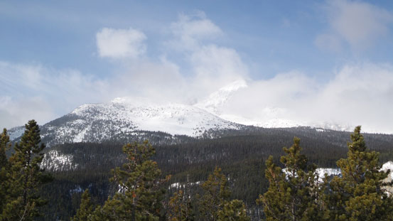
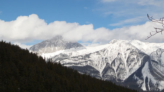
Pyramid Mountain
The summit of Pyramid was still shy to show up

As you can see, Jasper and the Parkway was soaked
The road led me climber’s right around this rock face. (Or, probably the previous one I don’t remember exact).
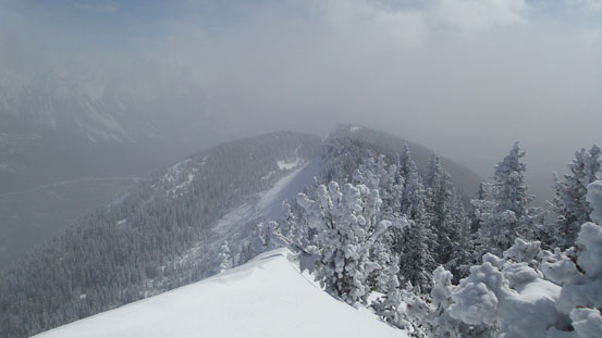
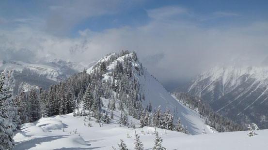
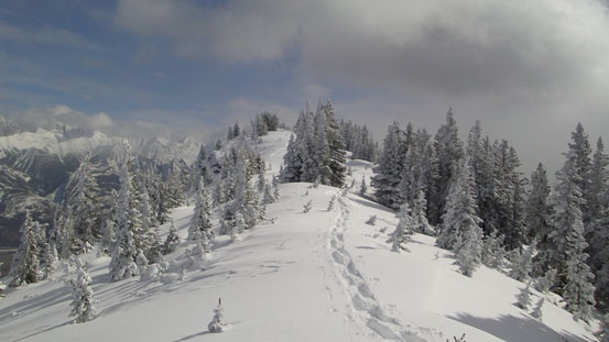
Though strenuous, the last 2 km’s ridge traverse was definitely the highlight of the entire trip. Firstly I contoured around the obvious rock face and found a break to re-ascend back to ridge crest. After that the rest would be simply following the ridge up, but getting to the true summit involved a fair amount of bushwhacking and post-holing. The ridge also narrowed down quite a bit higher up and on each side there were steep loaded slopes waiting to slide. I was forced to stay on the ridge crest overcoming tight and bushy sections, and higher up, big cornices here and there. And there were numerous false summits. Every time I thought the next one must be the true summit it turned out to be another false one… But on the other hand, weather held up nicely and I was awarded with some awesome views with the Colin Range stealing the show. Storms were hovering around Maligne and Parkway area throughout the entire day but blue sky and sunshine were above me and towards east. Pyramid Mountain marked the boundary between the two systems and I was happy to be just a couple km’s east of the boundary..
Near one of the many false summits

Snow, clouds, and blue sky.

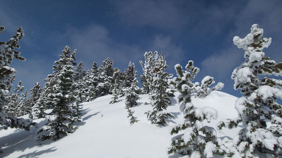
Trees look way better with fresh snow
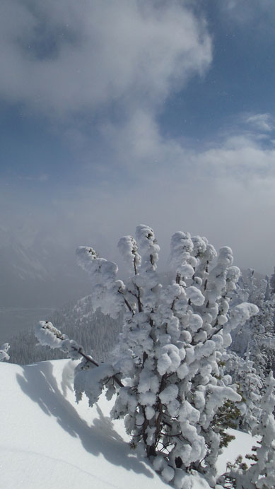
Another tree on the ridge
Looking back from the ridge
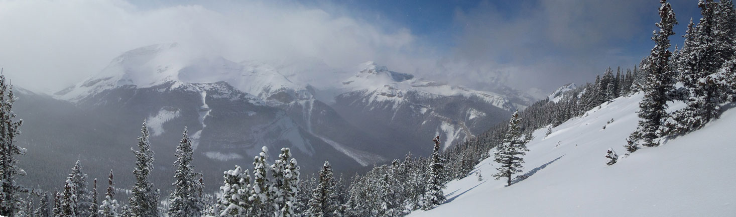
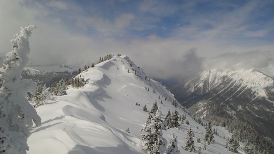
Panorama view of V. C. Range. Zengel and Buttress on left. Summit of Palisade on right

Cornices look cool
Another cornice
Another false summit ahead

Buttress Mountain (in clouds) and false summit

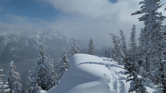
What a view point here..
Looking back at another false summit

Can’t believe I solo’d Hawk Mountain in February without snowshoes…
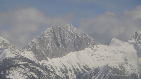
Mt. Colin looks cool. Someday..
Ahead is the true summit.

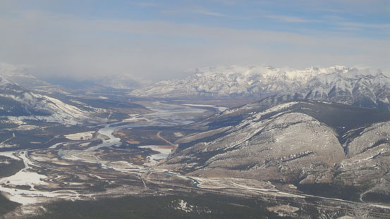
Panorama of Athabasca River Valley from the summit. Click to view large size.

Chetamon Mountain was shy to show up on this day.
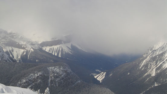
Snaring River Valley was soaked pretty badly
Morro Peak and Roche Miette are another two that I did in winter
Roche Jasques would be interesting to explore. Like many Jasper peaks there’s no beta.
After a short energy break on the summit I started down. As usual going down was much easier and faster and in no time I was back to the road. Now it was time to turn iPod on again. I wasn’t looking forward to the return but at least it went by pretty fast. Once joining the groomed section I put the snowshoes away and walked down the rest. Near the end I re-entered the storm and Jasper was soaked pretty badly… My round trip time was 8.5 hours on a fast pace.

View from the descent
Mount Colin
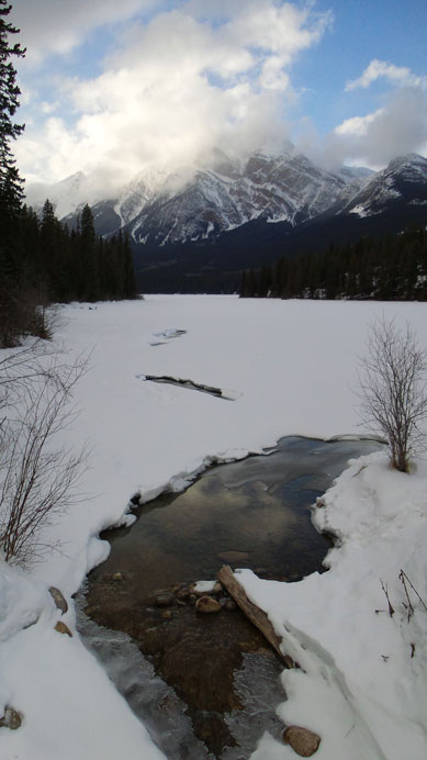
Back to Pyramid Lake, weather was still good
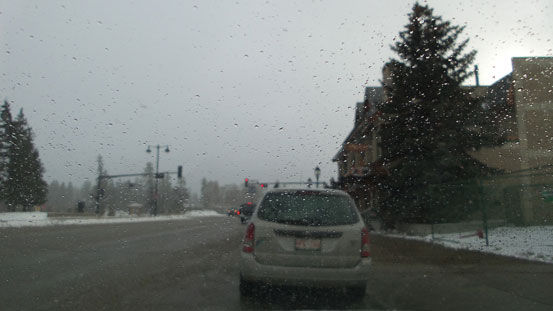
And, this was the weather in Jasper….
For fit parties this is a worthy objective in high avalanche period. After slogging 3-4 hours up a boring fire road you’d be rewarded with a scenic ridge traverse for 2 km horizontally. I’d also recommend skiing it if you can negotiate some tight, narrow and bushy sections. Skiing down the fire road would be a blast!
