Mount Saskatchewan Junior
April 21, 2013
2850m
Icefield Parkway (North), AB
The unofficially named “Mt. Saskatchewan Junior” is one of the many highpoints near Terrace Creek valley. It’s a slightly higher point than the nearby Big Bend Peak and offers slightly better views. Both objectives are well documented in Andrew Nugara’s Snowshoeing in the Canadian Rockies book. There’re many ways to ascend these two peaks and the route we took differs from Nugara’s direction.
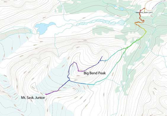
Big Bend Peak and Mt. Saskatchewan Junior snowshoe ascent route. GPX DL
After summitting Big Bend Peak, our group decided to descend the back side (west side) instead of retracing our steps down the avalanche slopes we just went up. Note that the west side where we went down also involves big avalanche slopes so there isn’t a absolutely safe way up Big Bend Peak under snowy condition. Initially we decided to go down via north ridge and then cut west into the slope below, but after a quick check, it involves a drop-off right away. However, the NW slope looked to be doable but the initial part was steep and rocky. We packed snowshoes and went down on foot. It was slippery but manageable. Lower down we encountered snow that offered good plunging-step. After fun run we encountered icy parts and since not everyone brought crampons up we were forced to traverse skier’s right into rocky terrain. Some fun winter scrambling brought us back to the North ridge. Following it down for another hundred meters or so I picked a line and dropped down the west slope. The other three took a line further down the ridge.
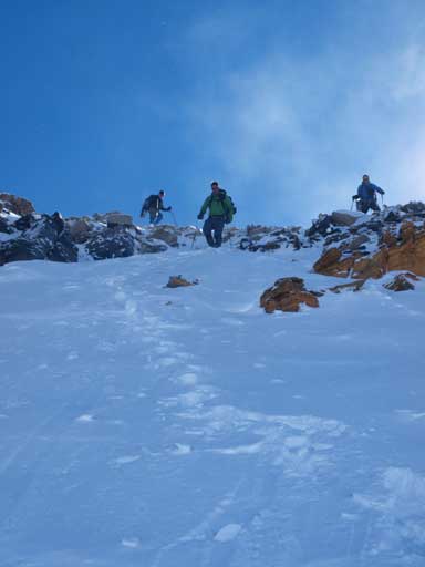
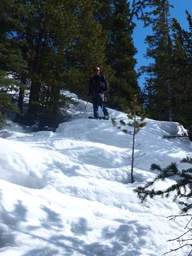
Boys ready to descend some fun snow. Had to take-off snowshoes to descent this part.
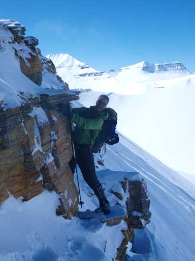
Vern traversing a corner. Fun scrambling!

Vern and Eric traversing slippery terrain to re-gain the North ridge
Ben traversed earlier and he would be following the ridge down.
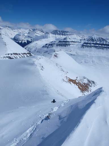
My line wasn’t fun since the snow wasn’t deep enough for snowshoes, and the ground beneath was still frozen and slippery. But I was the one finishing this part the first though. I had the concern that the “ramp” that leads down to the lower glacier could be a drop-off. I was getting nervous while approaching it since I still couldn’t see a “ramp” thing going down and the glacier just appeared to be much lower. Once I got there, I found it wasn’t a drop-off, but definitely steep enough to cause concerns, and if the snow was icy then we definitely would need crampons. It was frustrating so I waited for the other guys to show up. We searched further towards skier’s left, and Vern soon spotted a line down the steep band. Nice! By going left we also avoided some elevation loss and regain. This line was not as steep as the previous one I saw, but still very steep. We went down one at a time, and up the other side, we were on the glacier now.
Looking back to my descent line, and Big Bend Peak

Vern searching for a possible line down the steep lower part

An impressive cornice/scoop
We found a (still steep) line down to Big Bend/Sask Junior col. Lots of big terrains, and there is no easy way up the two.
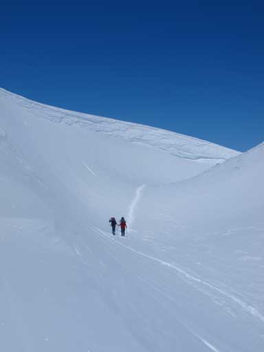
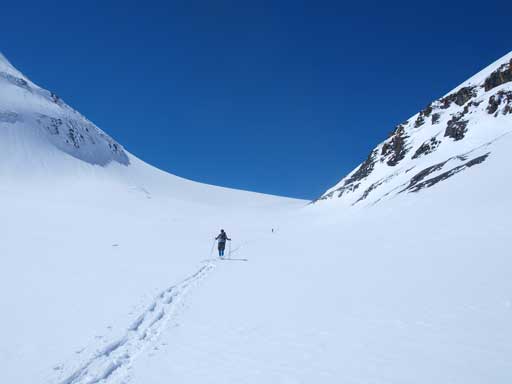
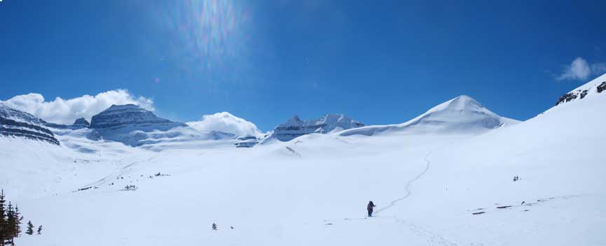
Now We’d done the elevation loss. What we had to do was to gain the left side and follow the glacier up
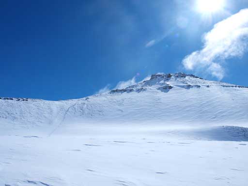
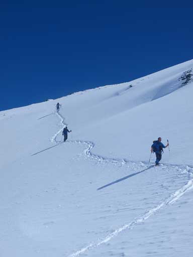
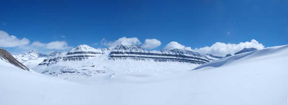
This glacier provides a short-cut way up Mt. Saskatchewan Junior compared to the route described in Nugara’s snowshoeing book. According to Eric’s photos taken in summer, this glacier, though small, does have some small crevasses and a big bergschund. Given the thick snowpack we thought it would be pretty safe to travel. One fact that applies to all glaciers is the foreshortened view. I knew Mt. Sask. Junior is higher in elevation than Big Bend Peak, so my strategy was to look back. Ben was apparently in a better shape than I did and he broke trail for most of the way up, and as we got closer we turned climber’s left and gained its east ridge, and then the view suddenly opened up. Despite the fact we just summitted Big Bend Peak a couple hours ago, we still got a “wow” moment here. Mt. Saskatchewan was just beyond impressive. I’d be happy to climb it someday and according to Eric it’s not overly difficult neither.
Looking back towards Big Bend Peak. It’s a good looking peak from both direction!
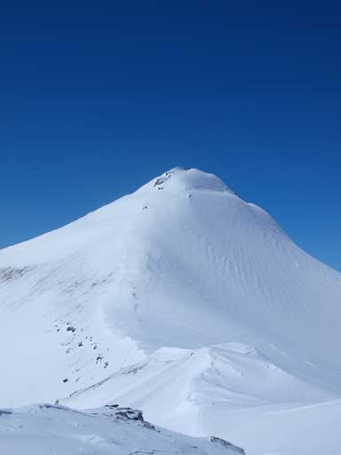
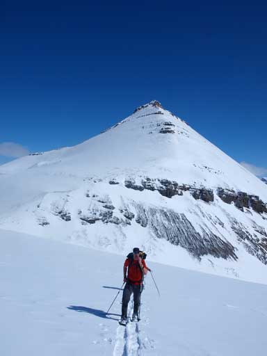
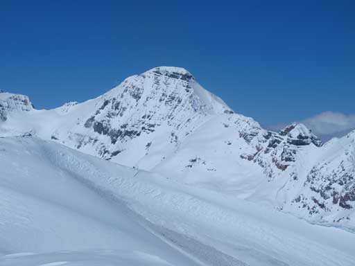
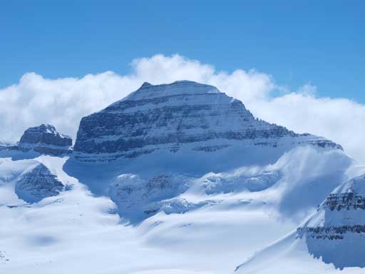
And this would be Sask Junior. We would follow the ridge crest up
Our objective appeared to be quite impressive from the East ridge, and the final summit block appeared to be quite steep, with a big schund on right side waiting to eat us if we slipped. The ridge also goes over a couple small bumps. It was indeed steep near the summit, but I didn’t feel it being that exposed. We managed to snowshoe all the way up. The view towards the other side was just amazing, with part of Columbia Icefield spreading out in front of us. We discussed about tagging the other peak, but since it’s not the official summit we didn’t bother. The main reason was to save energy for the next day. We already increased ambition today and if we kept going further we wouldn’t have enough energy for a 2000 vertical meter ascent tomorrow.
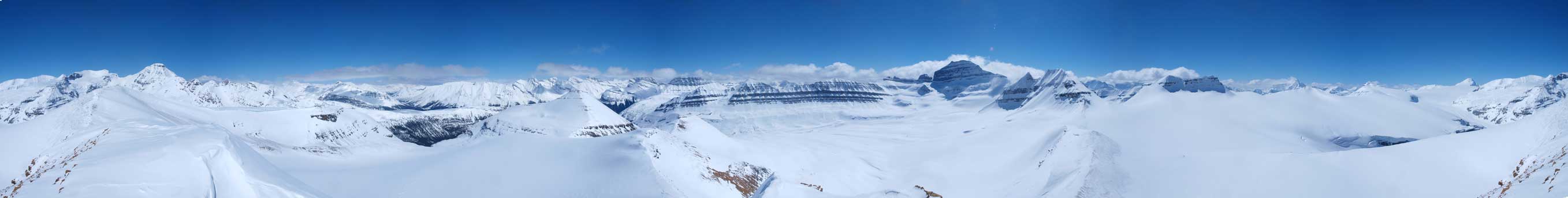
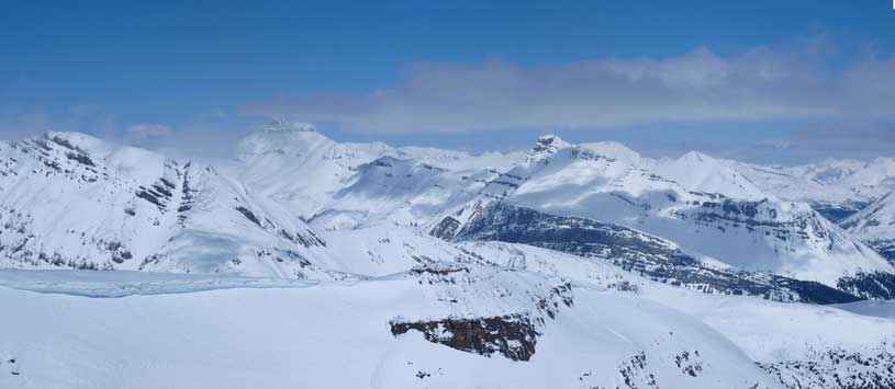
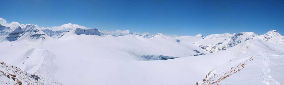
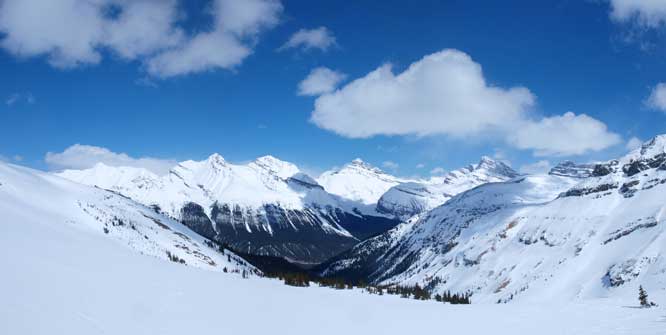
Summit Panorama. Click to view large size. It’s one of my favourites!
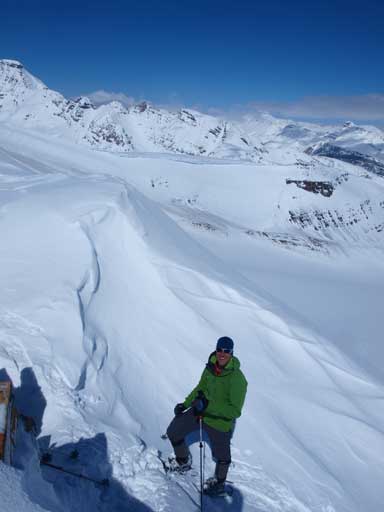
Vern approaching the summit, with big views behind

The North Towers of Mt. Saskatchewan
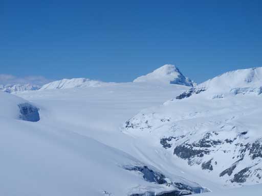
Mount Columbia
Mount Athabasca
Nigel Peak on left, an unnamed on right
More unnamed peaks on the East side of parkway
Looking over the summit of Big Bend, towards Cirrus Mountain
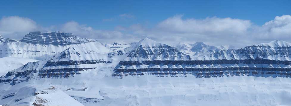
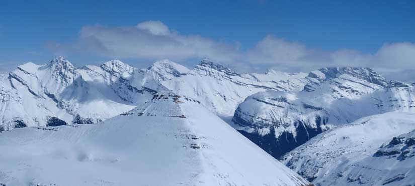
I like the rock bands in this area. Spine Peak at center
Mount Saskatchewan
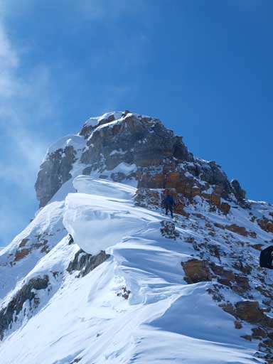
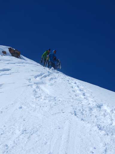
Eric climbing up the steep slope just before the summit

Guys taking pictures of the sexy ladies!
Another panorama, using snow/beach mode
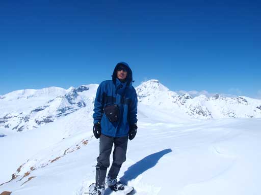
Me on the summit
We eventually retraced our steps down. The initial part felt a bit awkward, and I suggest you taking off snowshoes and plunge-step down the ridge. Since the terrain below was on the glacier we didn’t do any fancy thing to short-cut our route. We just simply went down our up-tracks, and followed the glacier all the way to its exit, contouring around Big Bend Peak on its SW side. We were constantly being distracted by the big views. The descent was soft and fast, but would have been even faster on skis. Oh well..
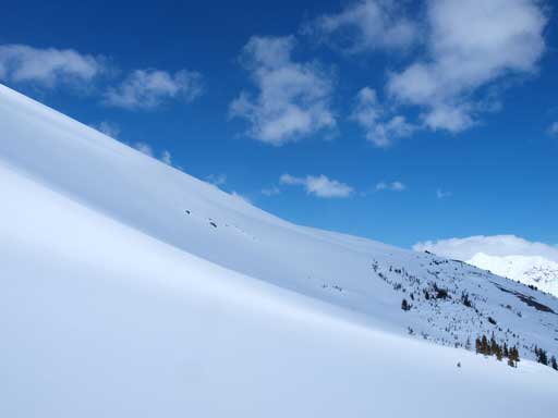
Ben and Vern descending the upper slope, ‘shoes off

Big Bend Peak from the descent

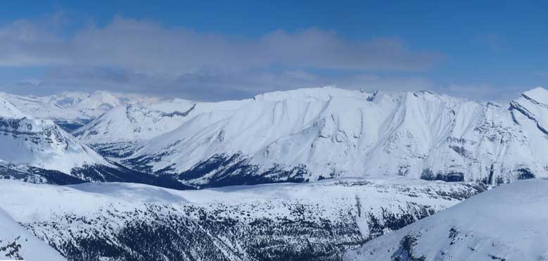
We would be following this valley out to join the main exit valley. Spine Peak at center
Another view from this valley
Looking back

Interesting peak, but I don’t think it has a name
Can’t get rid of the views!
Another look towards East, before going down to treeline
We contouring around these slopes at treeline. This slope comes down from Big Bend’s false summit
Once we reached treeline we cut sharply left resisting to lose elevation. There were a couple of avalanche slopes to cross in the trees, and the snow in the trees was very hard that side-hilling on snowshoes was very painful. I even turned facing uphill and moved sideways to reduce the stress to my foot. Anyway it worked and we contoured around Big Bend Peak and eventually rejoined our uptracks in the trees. The rest of the day was straightforward from here, and we simply enjoyed the day. I was worrying about the possible isothermal snow, and thankfully it never happened on this day. The snow was still rock hard even at parking lot level once we got down. The bridge over Saskatchewan River could still hold our weight on the way back.
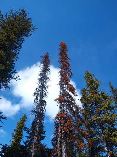
A view from the trees
Ben descending in the trees. Snow was still rock hard
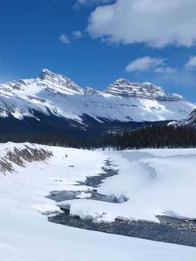
Back to the Sask River. Looking towards Cirrus Mountain. What a beautiful day!
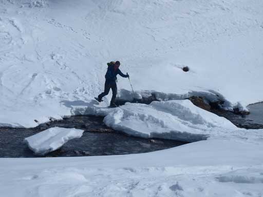
Vern just about to cross the thinning bridge
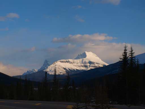
Mount Sarbach seen from Rampart Creek Hostel! We were ready for the next day
Our round trip time was 9.5 hours which was much faster than what Nugara suggested in his book. We got both peaks in the most efficient way, that was, traversing over the summit of Big Bend, ascending Sask. Junior via the glacier, going down Sask. Junior by the glacier again and contouring around Big Bend on its south side resisting elevation loss and regain. And we got the perfect snow condition that we never encountered significant post-holing the entire day. However, the route we took, or Nugara’s route, does involve lots of big terrains exposed to avalanches, and our route involves glacier travel. These two peaks are far from being straightfoward, and they should be treated as mountaineering objectives. We still had lots of time but we were tired. So after driving back to Rampart Creek Hostel, it didn’t take us that long to go to bed. A quick weather check revealed good news, and we were all hoping for the best. And the next day would be my biggest ascent to date!
