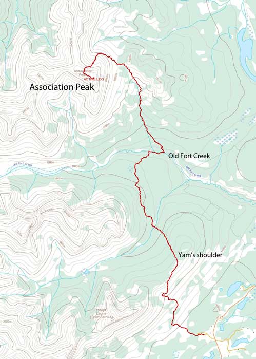
Association Peak
October 20, 2013
2320m
Bow Valley / Ghost River, AB
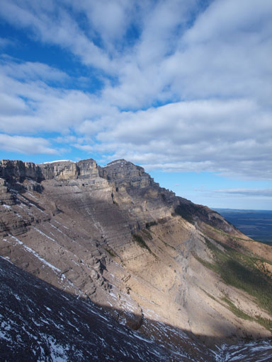
Association Peak is not a popular objective by any means, but it’s a peak visible when driving into the Rockies via Highway 1. It isn’t a particularly prominent peak by elevation, nor a difficult objective speaking technically, the reason why most people don’t even bother to think about it is the approach. There’re two approach routes. One goes up and over Yamuska’s shoulder followed by going up and over East Wendell’s shoulder, while the other route has considerably less amount of elevation change, but goes into First Nation’s private land. Not liking to obtain a permit, nor to risk getting a trespassing fine, Ben and I would use the former route which essentially follows Bob Spirko’s route. Since most of the approach is not on an official trail and we had no clue how easy to find those trails, we opted to load up Spirko’s GPS track just in case.
Association Peak scramble route. GPX DL
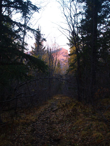
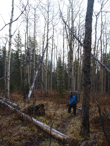
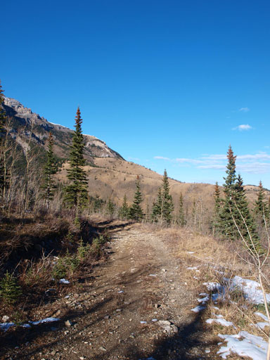
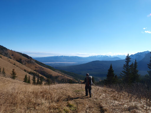
Having a long day ahead, we started at 7am with headlamps on. The initial 3.5km was following a heavily travelled Yamuska’s east shoulder trail. Near the crest of Yam’s shoulder we got great lighting on the horizon. Apparently we were a bit too early for alpenglow or sunrise, but instead of waiting for morning photos we pressed on. The next critical point was aiming for the cutline that joins the shoulder. We somehow missed the excellent trail on the shoulder and ended up doing some light bushwhacking, and the cutline was a bit further east than we thought. But anyway, the bush was short lived and we were soon on the cutline working our way down towards CMC valley.

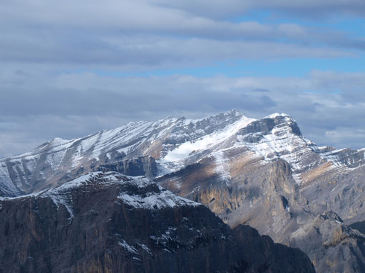
Morning light from Yam’s shoulder
A view from the cutline
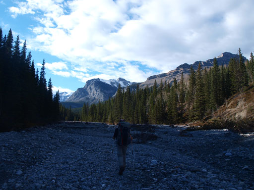
The cutline was in a much worse shape than expected. It’s super muddy thank to the horses and the warm weather. But it did lead us quickly down towards CMC valley. Near the end we got surprised by a couple barbed wires. Without paying much attention I thought they were bush… But thankfully my pants didn’t get much of a damage from that. Once we crossed the creek we automatically picked up the excellent trail on the other side.
The trail up and over Wendell’s shoulder was in a good shape. There’s no distracting branches nor indistinct section and we followed it easily to Old Fort Creek. We met a solo hunter at this section. After crossing Old Fort Creek, it came the next critical point of this approach. According to Bob Spirko, we had to look closely for a horse trail on the north side at a couple hundred meters downstream. It’s a bit further than expected but once there it’s hard to miss. This trail was also in a good shape (with the exception of a couple muddy spots near the start). This trail led us all the way to the “high col” on Association’s east shoulder.
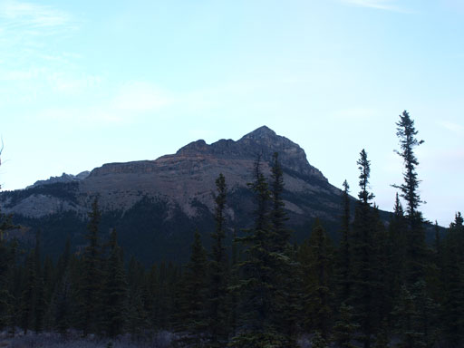
Association Peak is getting closer
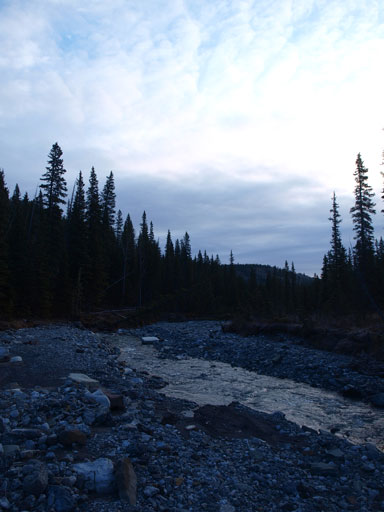
Crossed Old Fort Creek now
Following the horse trail up towards “Association col”
Higher up on the horse trail
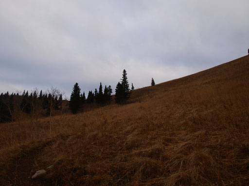
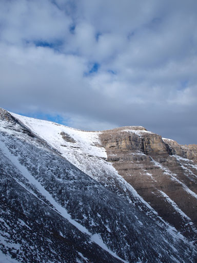
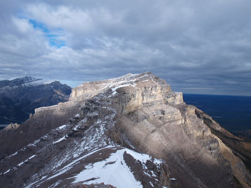
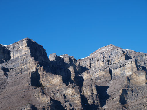
At the crest of this col, the trail joins an old road. Here we left the trail and began the long diagonal traverse. We firstly went up to treeline, and then traversed sideways towards climber’s right. After seeing more of the other side we started to gain elevation directly over a short rock band, but after that we came to a realization that the “main band” was not breakable on the near side and we must use Spirko’s route. So we started side-hilling again. It’s not very pleasant on the sideways terrain on frozen rubble. Near the break we weren’t very patient and came through a hard line that required two axes and crampons. We wasted at least half an hour here but fun scramble! An easy walk-up exists further down the traverse that we discovered on the way back. After this bit of excitement we were not far from the top. Great views despite the cloudy weather. Checking the register, we were the first party up here since June 2012.
Moose Mountain
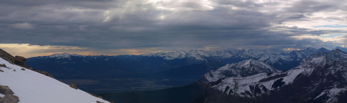
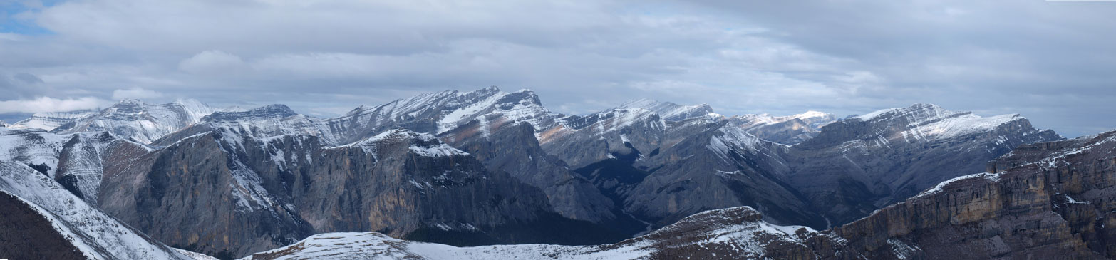
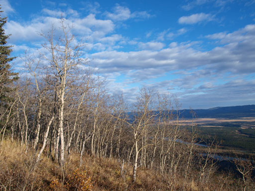
Panorama of the prairie

End Mountain is slowly showing up
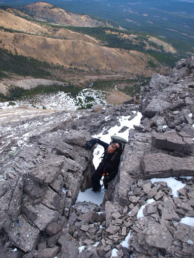
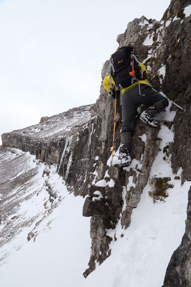
Scrambling through an optional rock band

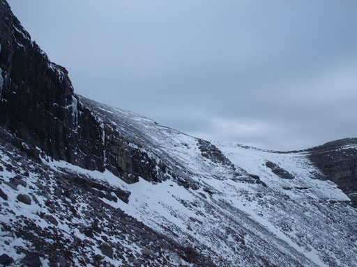
Now comes the tedious side-hilling
The high shoulder above
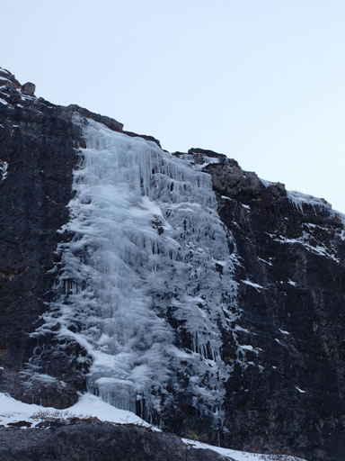
Ice climbers??
It’s pretty obvious where to go. The farther you traverse, the easier the terrain is.

Post-holing was tedious at times
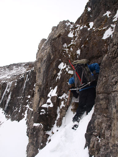
We tried a harder route but it’s too difficult without ice tools and technical cramps
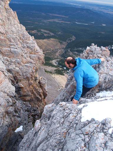
Me trying hard to get up this band, but it’s too slippery
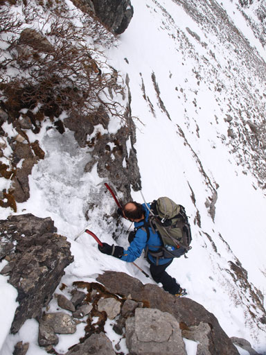
Here we found another route. It worked but we had to give each other an extra ice axe.
Zooming-in towards Kananaskis
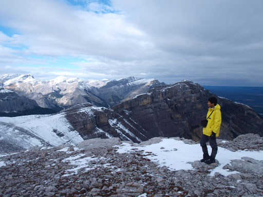
Me on the summit soaking in the views
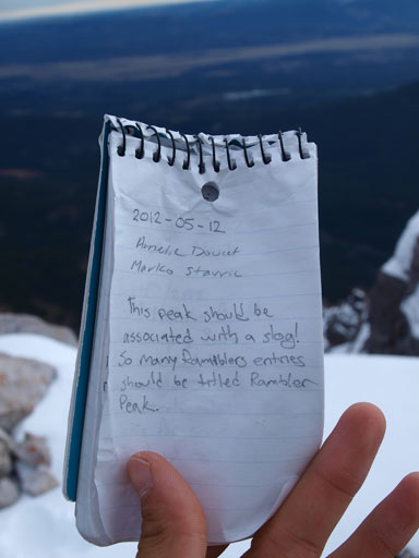
Familiar names from last year’s entries

The new register was placed by Rick Collier
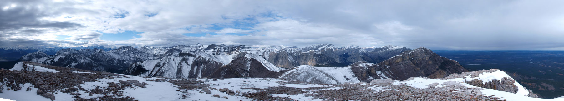
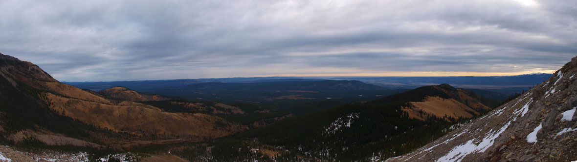
Summit Panorama. Click to view large size.
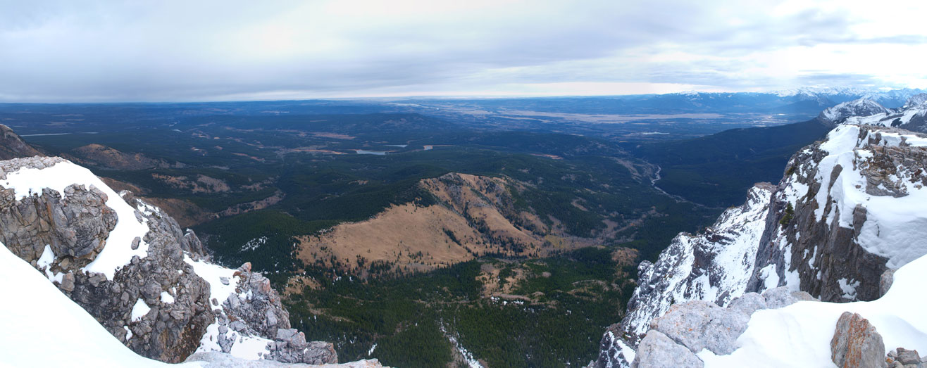
Panorama of the prairie

Familiar peaks in Kananaskis including Mount Lougheed
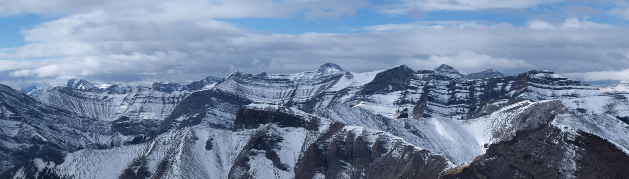
The biggest peak is Mount Townsend, highest in the group east of Canmore.
Panorama of the Ghost Area
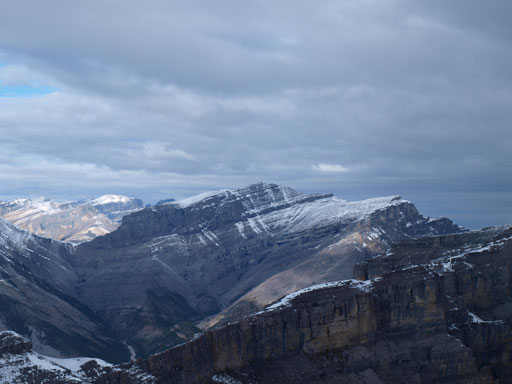
Orient Point is calling my name now.
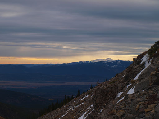
Mount Costigan in the far distance
Saddle Peak looks impressive.
Many people have comment the possibility to traverse to End Mountain and the consensus is, it’s impossible due to a big notch presenting in between. Well, since we had a lot of time to kill we decided to check it out. We weren’t count on summitting End Mountain but it’s good to gather more route beta. The connecting ridge went easily initially but soon it narrowed down. This part really reminded me the southwest ridge of Mount Cline. Up and over a couple short rocky steps we came to a notch that looked awfully like Cline’s notches. We tried, but it’s definitely 5th class to just get into it (more difficult than Cline’s 1st notch). So we concluded that it’s not gonna work without even reaching the “infamous” big notch.
(According to the summit register entries, some people like Bill Corbett had done the traverse from End to Association. Well, from my observation and from Rick Collier’s trip reports, both mountains can be done from the drainage west of End Mountain. I think they initially started the trip from South Ghost River and between the two peaks they must have lost a ton of elevation.)
Traversing towards End Mountain. Ahead reminds me Mount Cline
Here we go. Cline’s notches again? Less exposed but more difficult, so we called it a day here.

Me trying to downclimb into the notch, but the last few moves were too sketchy without rock shoes.

Looking back towards Association from the farthest we went on the connecting ridge.
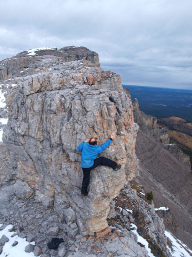
Ben found another bouldering opportunity on this jagged ridge.
Time to go home. Descending and side-hilling the frozen rubble slope was painful but thankfully it’s not “that” long. Near the end we decided to go straight down to avoid more side-hilling. This brought us to the quad road below and then we followed it easily back to the col. Picking up the trail, the rest of the day was pretty much simply putting one foot in front of the other, under the hot sun though. Up and over two hills, we were back. Our round trip time was 10.5 hours including everything.

Looking back from our descent
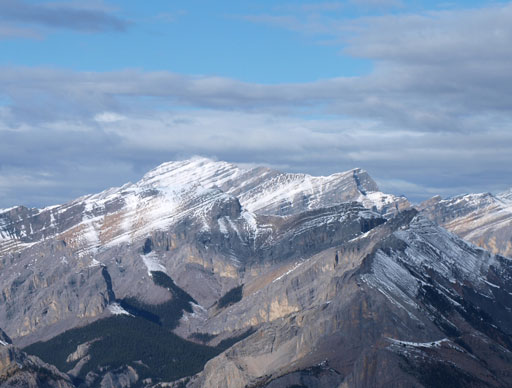
End Mountain

Sky is clearing up!
The connecting ridge with the “big notch”. We didn’t even get that point.
Down to the quad road
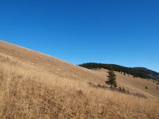
Pretty grassy slope in late season condition
Time to hike back. Note Yam’s shoulder in the distance…
Down to Old Fort Creek now
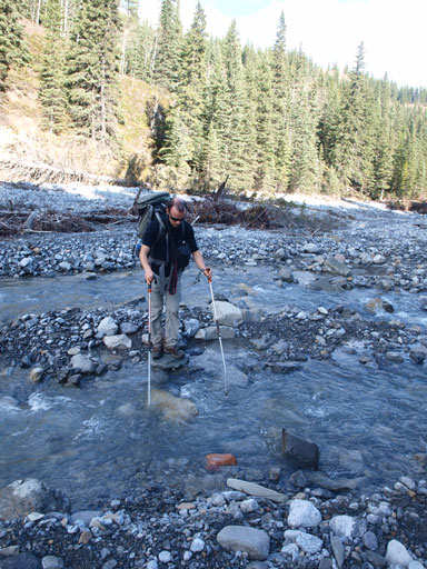
Hopping the creek
Back to Yam’s shoulder.
Association is a good shoulder season objective. Surprisingly I really enjoyed this “slog” and it’s really not as lengthy as described by other sources. Well, having just done Drummond and Wapiti I certainly would appreciate the “short” approach of this one so don’t take my voice. It’s still a long way up there.

Nice trip report. I think I was the solo hunter you met, I was quite surprised to see you guys, it’s really quiet back there and it was pretty early.
Your reports are well done!! Enjoyed reading a few of them. Will become part of my research list prior to hitting a peak. Too bad you left Edmonton , would’ve loved to have a beer with you and hear about your story. Climb safe!!!
[…] Other great Association Peak Scramble resources are Explor8ion by Vern Dewit and Steven Song’s Peak Bagging Site […]
Greatt blog I enjoyed reading