Rugged Mountain
September 4-6, 2020
1861m
Vancouver Island, BC
Rugged Mountain is the highest peak in Haihte Range of the far north-western reach of Vancouver Island. It’s one of the four “ultra prominent peaks” on Vancouver Island and is also listed as one of the nine “Island Qualifiers”. Needless to say, Rugged Mountain is considered as one of the more significant summits on the island in either local or broader scope. The access to Haihte Range used to be extremely challenging that required taking a boat ride, but logging had significantly reduced the pain in recent years. In the past two years the newish logging on N20 spur had made the access of Rugged Mountain probably the easiest time in history, that peak-baggers and alpine climbers had been rushing here for their missions. This peak offers a dozen routes including the newish multi-pitch rock route “Thunderbird” on SW Face, that had soon become a local classic, but for peak-baggers like myself the “WFH Route” is probably the only one that makes sense. The East Ridge also offers a less-technical route to the summit but I do not like the added complication with moats and bergschrunds. The WFH route is mostly just a scramble on dry rock albeit with fair amount of route-finding on loose rocks, but such has never been a problem for me.
The original plan was for Winnie and I teaming up with my friends from the island – Phil Jackson and Rick, but after completing Victoria Peak we changed our mind due to concern of a small incoming weather system. Phil and Rick were not flexible and must climb Rugged Mountain on Sunday. Winnie and I spent at least one hour in the McDonald’s in Campbell River browsing all kinds of forecasts and the conclusion was to bail Phil’s trip and go on our own, aiming to summit it on Saturday with at least one add-on peak. The downside for not having my local friends in this trip was that we had to figure out the approach direction at the very last minute using solely our cell phones. It seemed like one could drive farther up the spur road based on a few posts on Facebook and we must find out what exactly did that mean. I was very confused for a while but eventually came to a conclusion there must have a new logging spur made, so I went onto the Sentinel Hub up-to-date satellite images website and figured everything out. Once the decision was made I texted Phil explaining the situation. We might still see each other as Winnie and I might not hike out until Sunday morning. We then spent the next hour or two driving northwards past Woss to Zeballos turn-off before starting the logging roads. The condition of logging roads on Vancouver Island had always been amazing and this one was no exception. The condition deteriorated slightly once turning onto Nomash Main but nothing worth noting, until the start of N20 spur.
A full sized truck had parked at the start of N20 spur which was certainly not a good sign. The initial stretch seemed extremely rough with lots and lots of boulders but with all-terrain tires I decided to power it up nonetheless. This stretch surely put my Taco in test but it did pass the test. The wash-out at one or two switchbacks higher up (warned by others) was literally nothing comparing with the starting 200 m. At around 600 m I correctly located the start of the new spur road and turned left onto some very steep grades. The new spur road wasn’t super rough, but narrow and steep with quite a few deep water bars. My long bed Taco was clearly not the best vehicle in handling deep water bars and got scrapped several times. I made to 875 m elevation and parked just before what seemed like a huge ditch with a running creek in it. At the time I didn’t even bother to invest what’s beyond that spot, but in retrospect we did park at the most logical spot for this snow-free conditions. In early season one should drive (or hike) all the way to the end and boot-pack up a snow gully but in September it’s easier to bushwhack up to the ridge from where exactly I parked.
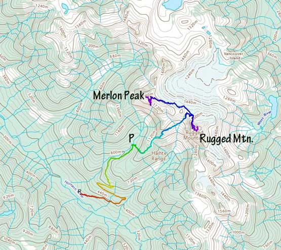
Ascents of Rugged Mountain and Merlon Peak. GPX DL
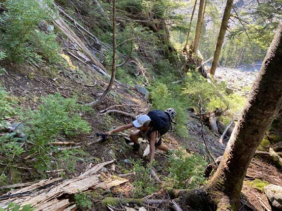
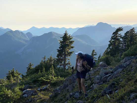
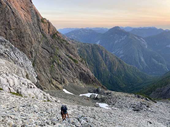
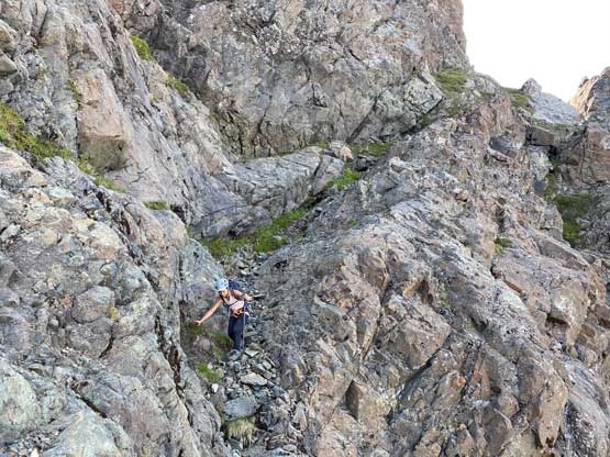
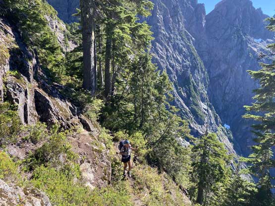
Winnie and I spent almost an hour relaxing and repacking and didn’t commit to the hike-in until almost 3 pm. In retrospect we should have hurried up a bit as the approach was a lot longer and rougher than what the Facebook posts suggested, but we did get to Nathan Col and set up camp before dark, so all good. We started by ascending the mature forest on the climber’s left side but soon encountered a rock city full of bus-sized boulders. This forced us to face the cut-block. Traversing into the cut-block was shit but once in it, the going wasn’t too terrible by BC standard. The uppermost section above the cut-block had some slow and dense bushwhacking (BW3) to get onto the ridge, and once onto the ridge we picked up the climber’s trail that was easy to follow and well flagged.

The bushwhack started right off the bat…
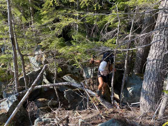
We were forced to traverse into the cutblock. The going was shit here
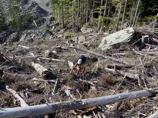
The typical ascent for 200 vertical meters up the cutblock.
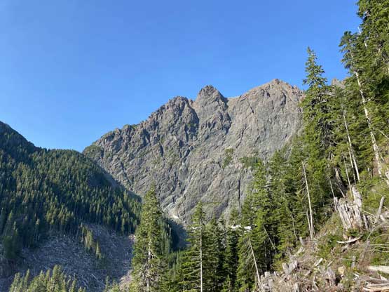
A view of the SW Face of Merlon Peak
Winnie struggling on the very steep and slippery forest above the cutblock

BC “BW3” bushwhack to gain the ridge.
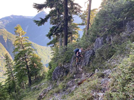
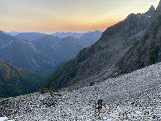
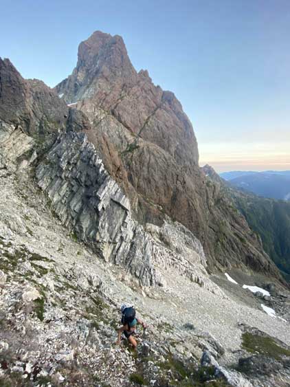
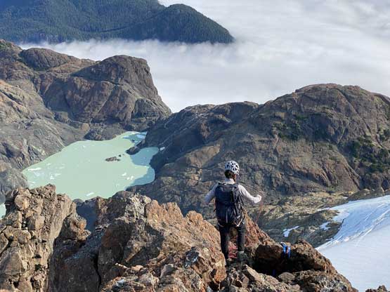
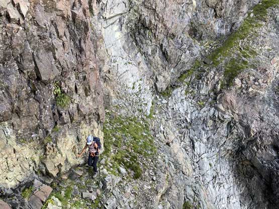
The terrain on this approach was quite rugged. We did some steep and exposed traverses and zig-zags through bluffs while following the trail, past the “Balcony Camp” to just under 1400 m elevation. Once the view towards Nathan Col completely opened up we somehow lost the trail and flags but I also had Matthew Lettington’s GPS tracks to follow. We then just followed their GPS track descending/traversing a series of exposed and slippery ramps for about 50 vertical meters into the basin below, hopped across a few streams and ascended the tedious treadmill scree for about 200 vertical meters under Nathan Col. Looking back I wasn’t sure whether or not this was the most efficient line, but it worked for us and we would use it on the return as well. The last 50 m to Nathan Col required some scrambling moves and that whole zone had some high rockfall hazard. It was also not very obvious where exactly to set up our tent at the col. I didn’t want to pitch the tent on snow but thankfully we did find a neat spot about 20 m higher than the col on Rugged Mountain side. The approach had taken us 3.5 hours that we barely managed to erect the tent before dark. I went down to the glacier on the east side to fill up the water bottles while Winnie did the cooking job, and then we settled for the night.

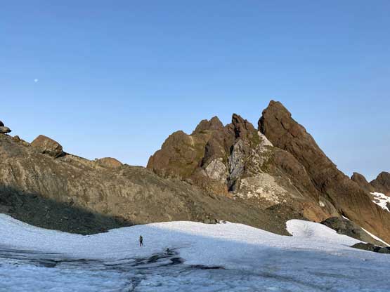
Our first view of Rugged Mountain
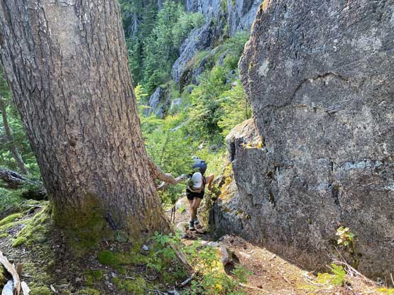
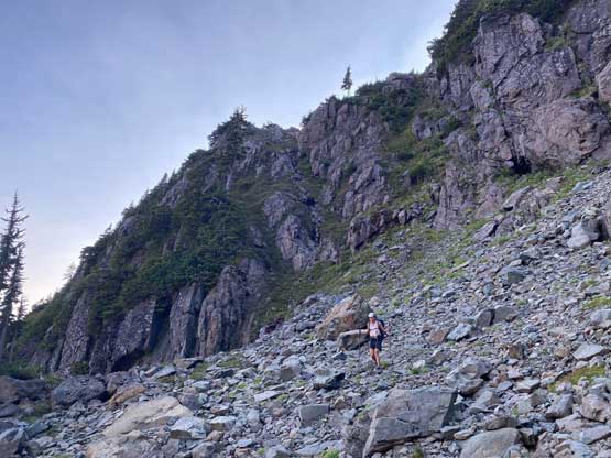
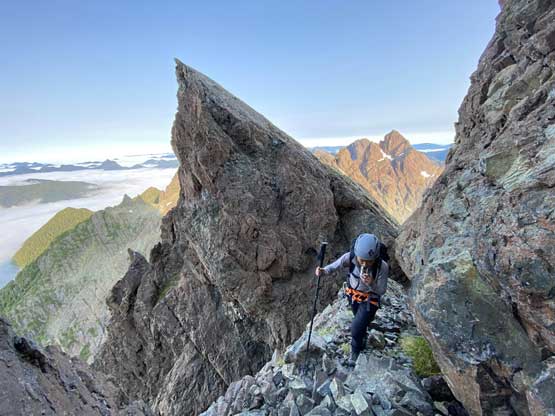
Believe or not we were on the climber’s “trail” here
The climber’s “trail” was not difficult to follow, but very rough
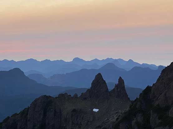
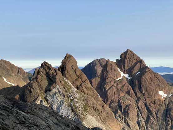
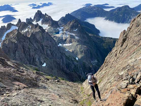
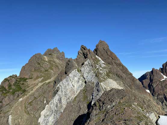
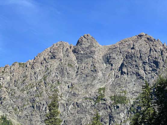
“The Blades” on the southern Haihte Range

Winnie with SW Face of Rugged Mountain ahead

Me posing on the same spot. Photo by Winnie M.
Winnie still seemed enjoying the approach

This section of descending/traversing was very slippery
About 50 m of drop later we were down to the rocky basin
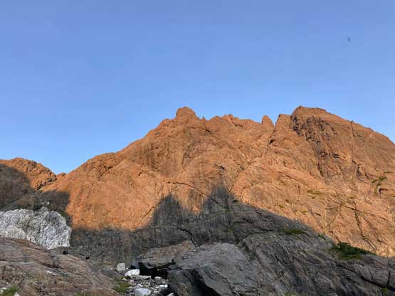
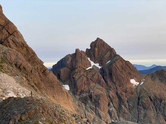
SW Face of Rugged Mountain
Winnie now plodding up the rocky basin
It’s a long haul from here to Nathan Col
Winnie with Rugged Mtn. behind
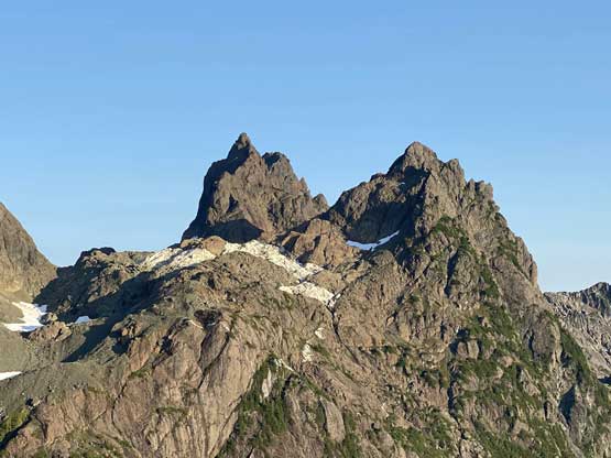
An iconic “twin spires” that doesn’t even have a name

Winnie and our tent at Nathan Col
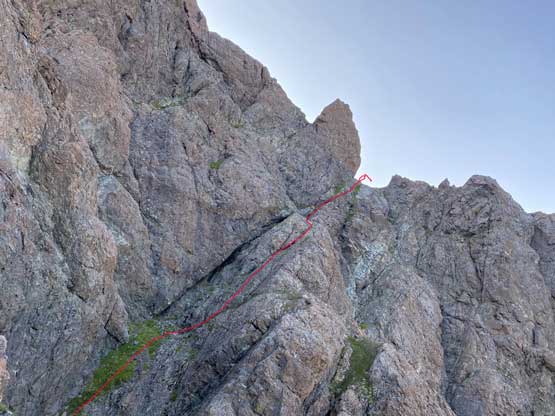
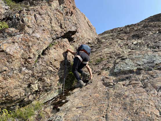
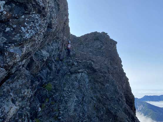
We did not rush in the next morning and instead, we watched sunrise and leisurely cooked our breakfast before starting the ascent. We anticipated the ascent to take several hours but it turned out to be a lot easier. The plod up the glacier towards an obvious col/notch on the NW side of the peak required us to strap crampons on, but I did not feel the need to use an ice axe. We ditched all of our snow gears at the notch. The “WFH Route” essentially wraps around the peak in a corkscrew way, from NW, W, S, SE and finally the uppermost east aspect. For the section around NW and W aspects there’s literally only one way to go, that was to traverse the obvious ledge. The ledge was reasonably wide enough that we didn’t really feel the exposure, and the scrambling never exceeded “3rd class”. Once around the obvious gendarme on the west side we traversed an easy and wide ledge out towards the south ridge.
Ya’ai Peak in the morning
Winnie in front of “Nathan Needles”

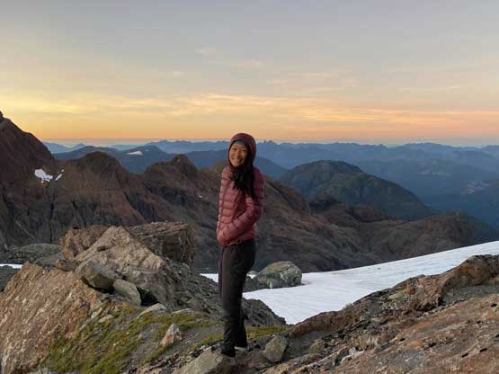
Winnie and the smoky sunrise
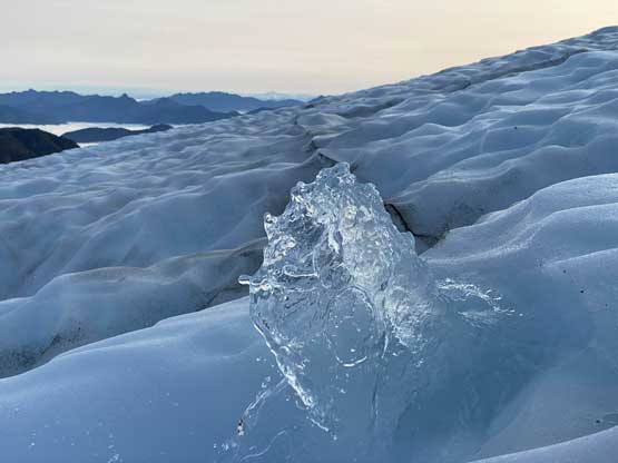
We found a natural fountain on the glacier
Another view of Nathan Needles

Ascending low-angled dry ice

Aiming for that obvious notch
“Nathan Needles” and “Ya’ai Peak”
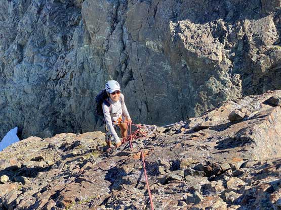
Winnie traversing an exposed ledge eating Gu
The next stage of ledge traverse

As you can see, the ledge’s quite wide..

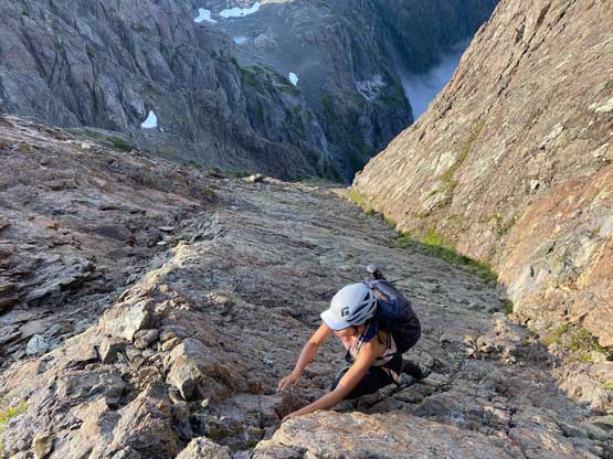
Winnie carefully ascending slabs covered in scree here.

Around the corner towards the south side now.
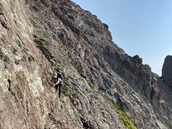
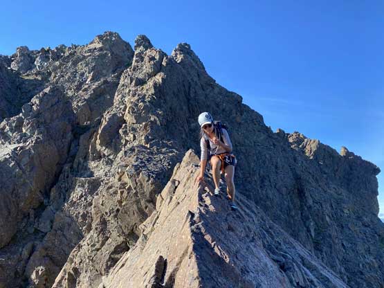
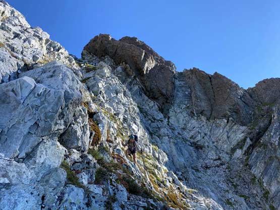
The “real” scrambling didn’t start until wrapping around the corner of south ridge where we had to ascend a series of shallow chimneys that was definitely 3rd class with considerable exposure. After that we had a long stretch of low-angled 3rd class slabs (covered in pebbles) with moderate exposure. This stretch of slabs brought us to the uppermost east ridge. Instead of turning directly towards the summit we kept the corkscrew bearing aiming for the far NE Corner, and ascended one steep spot (one or two chimney moves of 4th or low 5th class) to the summit. The ascent turned out to be much easier than anticipated so that we earned ourselves about an hour’s stay.

Starting the 3rd class scrambling on the S/SE Face

The typical scrambling on the long stretch of 3rd class slabs
Winnie topping out on the uppermost East Ridge
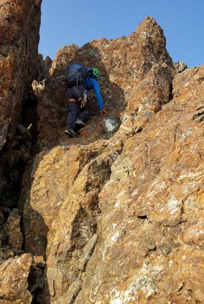
Me climbing the crux. Photo by Winnie M.

Winnie scrambling the crux moves just below the summit.

The last few moves
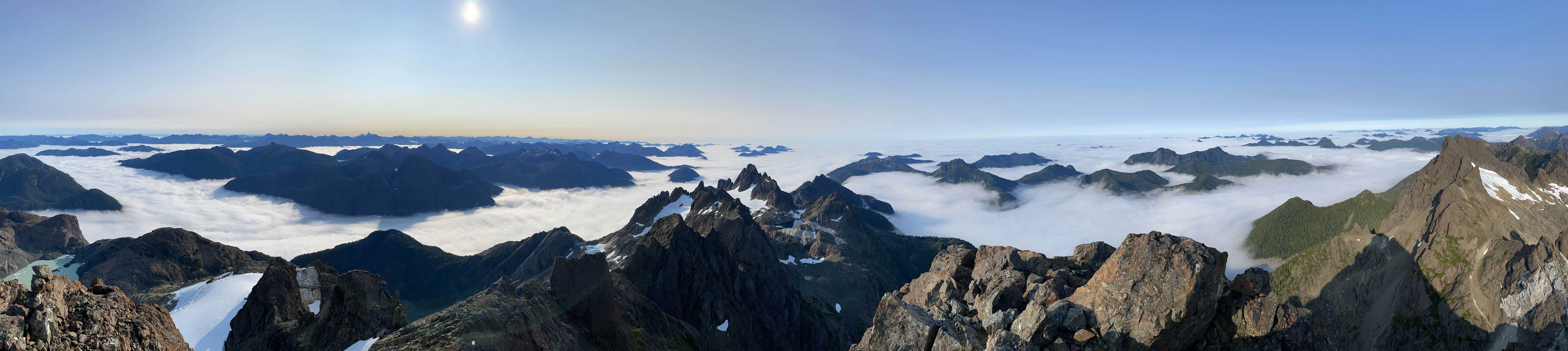
Partial Summit Panorama from Rugged Mountain. Click to view large size.
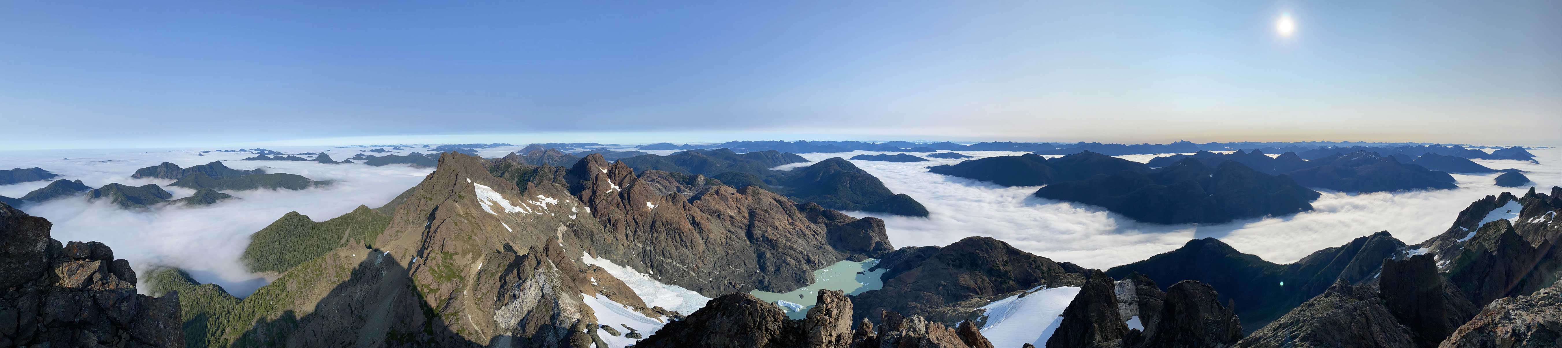
Partial Summit Panorama from Rugged Mountain. Click to view large size.
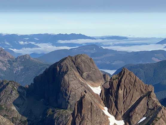
“Haihte Spire” at center shot

“The Blades” in foreground
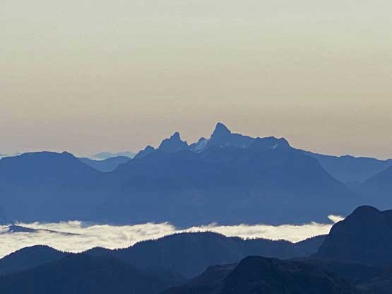
Victoria Peak and Warden Peak to the east

Golden Hinde and Mt. Colonel Foster on the skyline
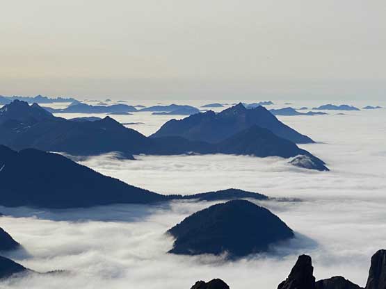
These are some very remote peaks towards south
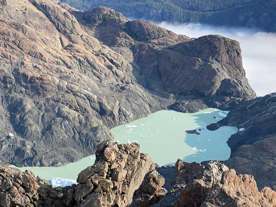
This glacial lake has some icebergs in it. Better view from Merlon Peak
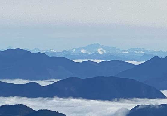
Mt. Waddington dominates the northeastern horizon
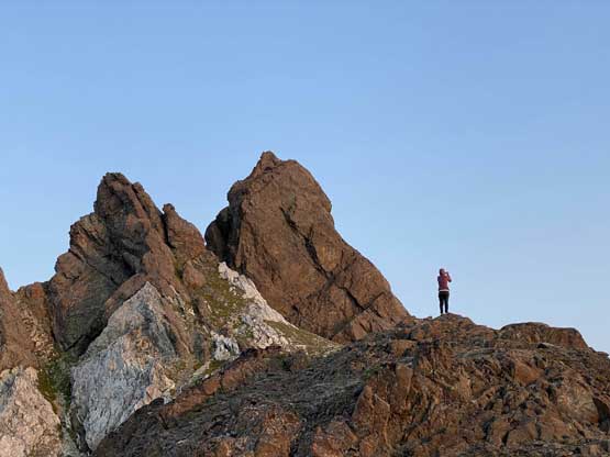
Winnie on the summit of Rugged Mountain

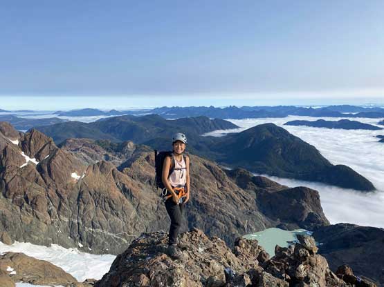
Me on the summit of Rugged Mountain.
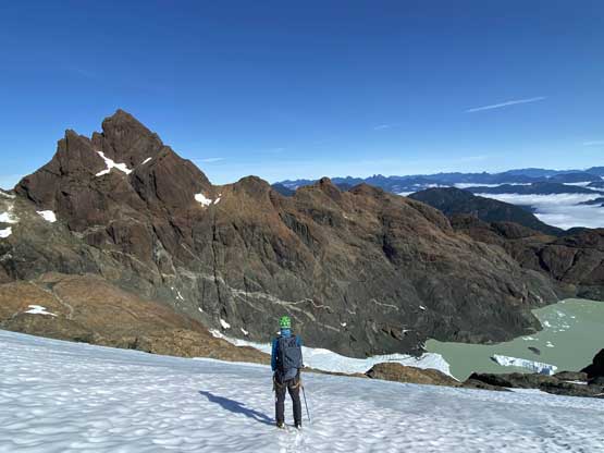
There were two established rappel stations so we took advantage of them. The first (short) rappel brought us down the summit block to the top of the 3rd class slabs. We then tied together the two 30m ropes and made a long rappel skipping the upper section of those slabs. Down-climbing the lower part of the SE/S Face required caution and once back to the ledges the descent was quite easy. To make use of the rest of this day we decided to explore Merlon Peak, which turned out to be much harder than Rugged Mountain itself.
Winnie preparing for our first rappel

Winnie on the first rappel off the summit block

Winnie still on the first rappel.
The second rappel brought us down onto the 3rd class slabs
The typical down-climbing on those slabs
Exposed traverses under the slabs to join the ledges

This particular move was tricky.

Back onto the wide ledge under the south ridge
The typical ledge traverses back across the SW and W Faces
Winnie on the ledge.
The last section of the ledge wrapping around the NW side

Winnie taking a break to put crampons on

Descending the glacier
Me with Ya’ai Peak and the glacial lake ahead. Photo by Winnie M.
A few selected photos from our ascent of Merlon Peak
Merlon Peak was much harder than Rugged Mountain itself

Back to camp in early evening hours

The unnamed “twin spires” again.
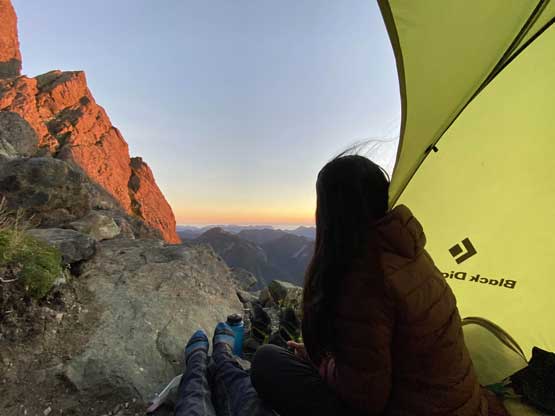
Winnie in our tent soaking in the sunset scenery

Rugged Mountain catching the evening glow
Winnie and the evening horizon.
We didn’t get back from Merlon Peak until evening so we definitely would stay at Nathan Col for another night. The forecasted weather system didn’t really arrive but the wind did pick up to be at least 40 km/h. My BD Hilight was built to withstand strong wind but I could see why this camp is notorious for ripping people’s tents off. On the 3rd day we woke up leisurely and sure enough, Phil and Rick showed up. They ended up car camping at the same spot where I parked. We chatted for a bit and then resumed our respective ways. Winnie and I again, took our time packing up the gears and leisurely went down following our own route. The initial 50 m descent down below Nathan Col was quite shitty and so was re-ascending those wet and exposed ledges. Once rejoining the trail we had a bit of cruise sail, until it’s time to bail off the trail back into the bush. The downhill direction helped us on the descent, but bushwhacking was never a fun game no matter what. Lower down we opted to stay entirely in the cut-block instead of dealing with that rock garden, which turned out to be a better choice, though still far from “pleasant”.
“Nathan Needles” in the morning of Day 3

One last photo of Ya’ai Peak.
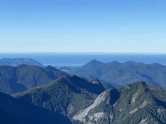
The Pacific Ocean finally showed up…
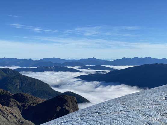
The east side valleys still held lots of fogs

Our tent after surviving a relentlessly windy night

Winnie cooking our breakfast

Phil and Rick passed us on their way up Rugged Mountain
Winnie descending the terrain immediately under Nathan Col
Back to the “climber’s trail”

One photo to illustrate the bushwhack part above the cut-block
Merlon Peak’s SW Face
My truck and Phil’s XTerra

Winnie still smiling. No idea how she did this bushwhack in shorts.
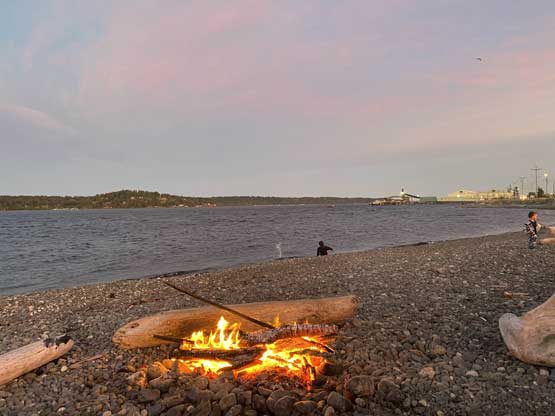
I had a bit of concern about a few deep water bars and sure enough, I scrapped the bottom of my Tacoma at least two or three times but the rest of the drive down N20 spur wasn’t too bad. For the last 200m of boulders I just crawled down at a snail’s pace. The rest of the drive back to Campbell River was uneventful but very boring. We weren’t quite sure what exactly to do on the next day but eventually decided on H’kusam Mountain to finish off my island’s ultras. To celebrate our success on Victoria and Rugged we ordered a luxurious sushi dinner and brought it to a nearby beach for sunset, where some locals kindly offered us fish for added calories. We got to learn a bit of what the Campbell River locals do in a daily basis. I was not expecting much from this evening but it surely turned out to be quite memorable.

We showed up in a random beach for sunset and got our freshly cooked fish
That was quite a memorable evening to finish off a trip in the Haihte Range
