Mount Rideout
September 15, 2017
2445m
Hope / Skagit Valley, BC
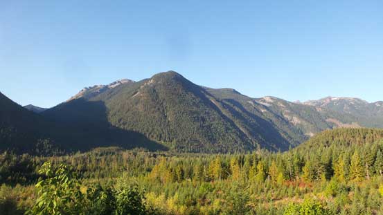
Mt. Rideout is a fairly impressive peak with a steep profile especially when viewing from north, but itself isn’t very prominent thank to the close proximity to Silvertip Mountain. A few impressive routes had been established on its near-vertical north face although the easiest route does not exceed “4th class”, attacking from Rideout/Silvertip col. For peak-baggers like myself the main interest is always Silvertip Mountain but Mt. Rideout makes a great add-on.
This was about a week after my successful ascent of Mt. Alberta so despite the perfect weather I wasn’t super stoked about anything outrageously difficult. That being said the weather was really good such that both Vlad and Al (Spectrum) were game for something interesting. In the end I threw out this Rideout/Silvertip day-trip and everybody agreed. The only beta we had was from our friend, Jeff Han that the same trip took them almost 17 hours but he did say that we should have no problem finishing within 12 hours. We took that with a grain of salt although by simply looking at the topographic map I actually thought 12 hours would be bang on. The alarm was set at 4:30 am but I slept through. An hour later the other guys showed up at my house and I soon woke up, realizing I had just missed something.. I said let’s keep the plan as long as we could make the summit at sunset. We could always navigate back down by my GPS so not a huge deal. Remember that there’s no “turn-around time” for my trips…
The drive out to Hope down Highway 1 went by without event and then we turned onto Silver-Skagit Road. This was my first time ever driving that way so Vlad and Al had to instruct me as where to exit the highway. The secondary road was in a decent shape and pretty much free of pot-holes or any other forms of obstacles. Every minute counted including the driving section so I pretty much cruised down as fast as possible, generally around 60-80 km/h. To get to the “trail-head” or precisely speaking, the “start point” we had to locate a small spur road and follow it for about 100 meters to a clear-cut. This spur road is next to impossible to locate without a pre-drawn GPS coordinates but did not impose much of a problem to us, and soon enough the Tacoma was parked, much sooner than anticipated.
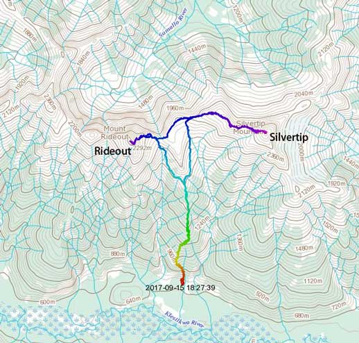
Mt. Rideout and Silvertip Mountain ascent routes. GPX DL
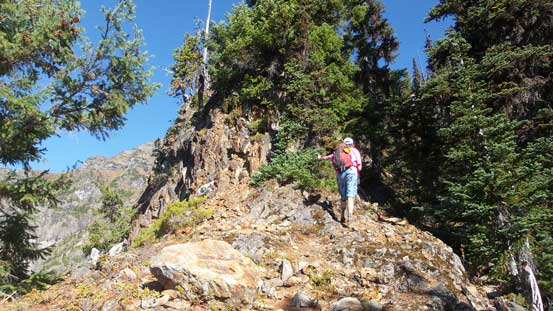
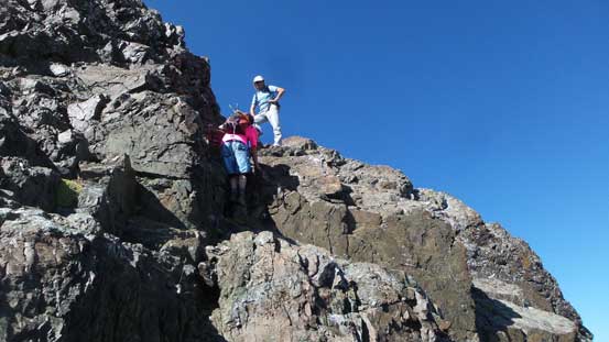
Wasting no time we soon geared up and started the game with me using the mere 20L Black Diamond backpack. There’s no need to haul snow equipment nor anything fancy and the heaviest “gear” was actually the water (there’s no water source whatsoever). The first section was shooting straight up a cut-block which narrows into a loose gully feature. There’s some game paths but generally speaking the lower reach was confusing. After a while we found the main “trail” which directed us upwards into the confinement. It’s important to locate the key point to exit this gully. The terrain’s very steep and one particular step was even aided by a fixed batman rope.

This is the start.
Pretty good views from this early into the trip. This is part of Mt. Lockwood
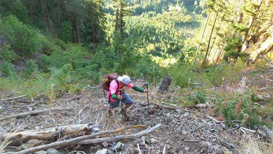
Alan grunting up the loose lower gully
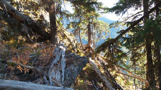
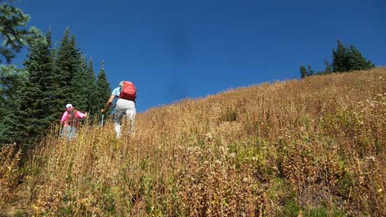
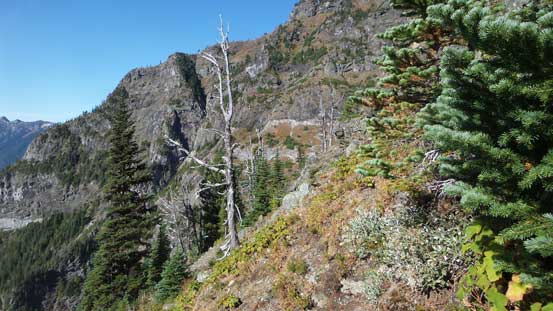
After the rope the terrain levels out a bit and for the next long while we would be grunting more-or-less straight up a forested rib at a pretty sustained grade. Back in the days when Jeff et al. did this trip there wasn’t any form of a trail but luckily for us this was no longer the case. Actually for most of the time except for a couple spots we were following a pretty decent path with lots of flagging to help keeping on track. And of course I was armed with Jeff’s GPS track so there’s no excuse to not find the path with the least amount of resistance. For about 1000 vertical meters of gain there’s little worth noting and then the forest starts to thin out. There’s one narrow spot that we opted to scramble head-on for some fun and then we weren’t far away from treeline. Not bad, not bad…
The typical forested travel for a long while

There are some dead-falls but the path was easy to follow
Al continuing up
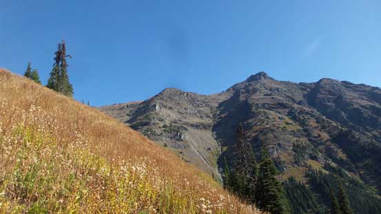
Breaking out of the trees at last.. Silvertip Mtn. behind
Al and Vlad marching up.
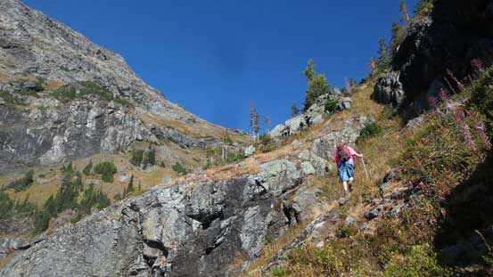
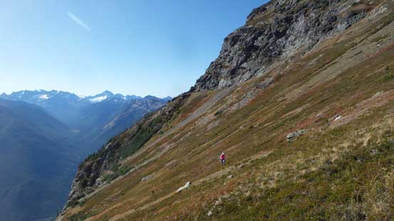
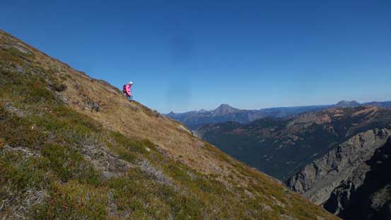
It’s pretty obvious where we had to turn left. The spot where Rideout and Silvertip’s standard routes split is right underneath a bluff. Going for Mt. Rideout first we took the left side valley and that involves a lot of side-hilling on increasingly steep grassy slopes. A fall would not be very pleasant at some certain spots so some care had to be taken. Wearing a pair of Trango Ice Cube mountaineering boots helped a lot as a simple technique of “edging” made things a whole lot easier. That technique did not work very well for Al and Vlad wearing hiking shoes, but we all made through without an incidence. And then there’s a long, foreshortened grunt to Silvertip/Rideout col.

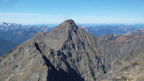
Mt. Rideout looks pretty impressive from this angle
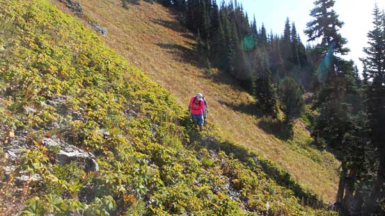
This is the first section of the unpleasant side-hill traverse
As typical as this side-hill bash goes..
Al leading the second stage of side-hilling
Vlad traversing around a corner
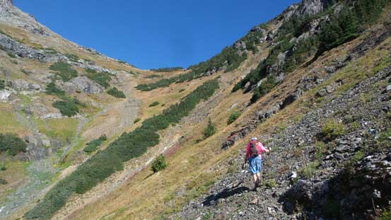
Aiming to cut into this bowl somewhere
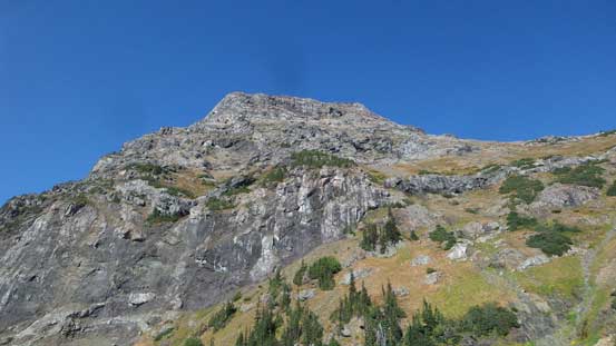
Another view of the east face of Mt. Rideout
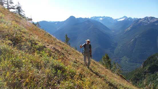
This is a very good-looking meadow area

It’s a very long slog to the col. The views were deceiving
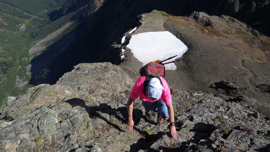
The col’s where we took the second break of this day and it’s also at this point that I actually thought we could finish the mission without even having to use head-lamps. The new mission was set to get back down to truck before dark and to complete that we had to maintain the pace, so after a quick bite of eat we ditched most gears and started up Mt. Rideout. There’s still more than 300 vertical meters of gain to reach the summit and much of the terrain looked pretty scrambly although the lower half was still a mere grunt on steep grassy slopes. There seems to have quite a few route options with the easiest trending far to the left, but that’s also the least interesting and would involve considerable amount of side-hilling. After such a side-hilly approach we just wanted to go straight up. So we trended pretty far to the right on the edge of a “ridge” feature next to a deep gully. Once the first step (awkward 3rd class) started we were pretty much committed. The terrain ahead looked kinda involved but let the adventure unfold itself.
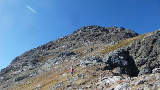
Starting up the east face of Mt. Rideout

Let the scrambling begin…
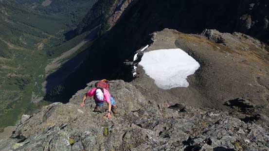
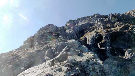
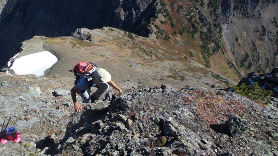
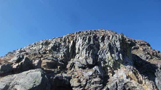
It’s also worth noting that we came here without any form of detailed beta. After the trip we did more digging. Most parties did go up this way as it’s the direction that this terrain forces you to go, but some parties including Jeff’s group descended the far climber’s left and that’s indeed reported to be much easier. Resuming on our “ridge route” there came a series of 3rd class steps, most of which was fun but there’s one particularly exposed au-cheval which felt “class 4” to me. The scrambling was also fairly sustained although it did not last very long. Before realizing we had already topped out and then a short traverse later we arrived at the summit.
Alan negotiating a tricky move.
Pretty enjoyable scrambling with a good position
The typical terrain we had to deal with

Looking sideways into the immense areas to the north.

This is looking down the north face.. You don’t want to fall into that…
Vlad having fun
Almost there!

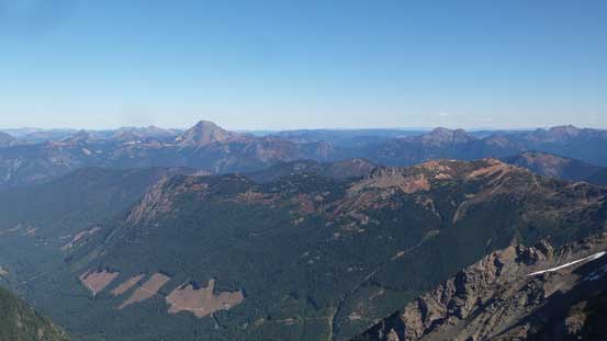
Summit Panorama from Mt. Rideout. Click to view large size.
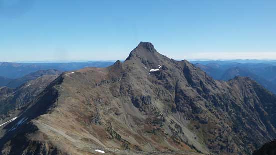
Silvertip Mountain
Mt. Outram dominates the northern skyline
Mt. Payne is actually the most impressive looking one nearby
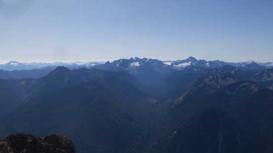
Mt. Spickard and Mt. Redoubt dominate the southern horizon
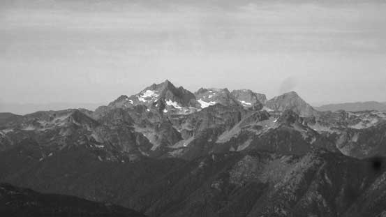
Welch Peak in Cheam Range

Isollilock Peak and Silver Peak left of center in foreground
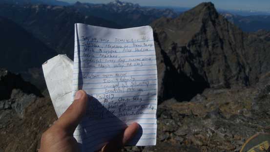
This summit register doesn’t get signed often
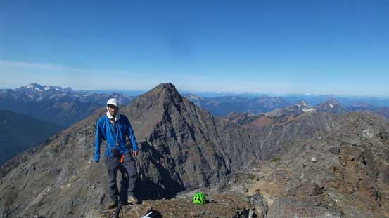
Me on the summit of Mt. Rideout
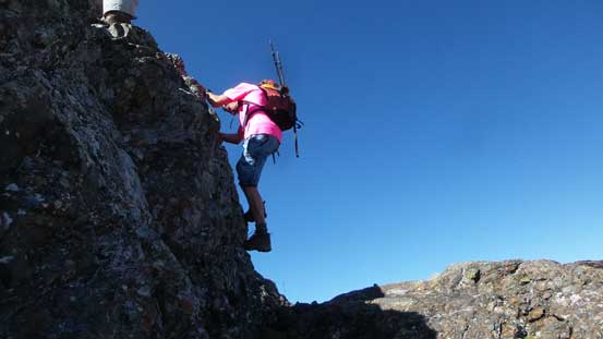
We briefly discussed the strategy of descent but decided to just reverse what we had just done. It’s kinda exposed but we really liked the fact there’s lots of 3rd class scrambling. In other words, it’s pretty damn fun and much more aesthetic than the scree route on far skier’s right, so down we went. Down-climbing that au-cheval required great care and triple-checking all holds as a fall would almost definitely be fatal, but elsewhere was quite enjoyable. Before long we were off the tricky terrain and then it’s a steep grassy descent back to Rideout/Silvertip col.

Me down-climbing the crux au-cheval. Photo by Alan Blair
Al down-climbing another tricky step
More careful down-climbing
Back onto the grass slope now

Silvertip Mountain would be our next objective.
Not doing a lot of lingering this trip continues with an ascent of Silvertip Mountain.
