Mount Sir Richard
July 3-4, 2017
2681m
Whistler / Garibaldi Provincial Park, BC
Buried deeply behind the front-country Spearhead peaks in the far eastern reach of McBride Range sits a massive glaciated peak named Mt. Sir Richard – in the true middle of nowhere and yet visible from everywhere. While the ascent of this iconic objective is technically nothing harder than a plod on snow, the approach is what eludes most. The traditional method used by the earlier explorers starts from Whistler and goes either up and over the Spearhead Range or by a bush bash up Cheakamus River. This has since become part of the classic week-long McBride Range ski traverse that most parties would opt for a short detour to check off Mt. Sir Richard’s summit. It’s hard to pass.
However, the ski traverse was not the method I was interested in. There exists a third option, a summer ascent from Lillooet River aided by the logging road system which Alex had pointed out. The more I looked into this area and more I intended to actually give it a try. It still requires a long day just to get into but from the base camp we could easily ascend half a dozen summits and that also includes the nearby Nivalis Mountain.
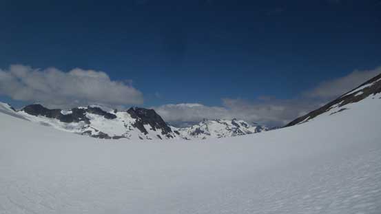
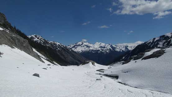
For me myself the main objectives would be Nivalis Mountain and Mt. Sir Richard but the others eventually decided to opt out and save them for a spring trip on skis. No big deal as we just had to split up on Day 3. I set my alarm at 4 am and after a long, arduous approach I made the summit of Nivalis Mountain. Now coming down its south ridge I turned my attention to Mt. Sir Richard. This peak still looked terribly far away and a check on my GPS revealed at least 3 kilometers away. There also appeared to have a massive drop and the Google Earth images I studied before suggests some heavily crevassed terrain. Fair amount of work still required but let’s face one step at a time.

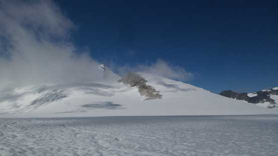
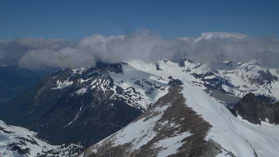
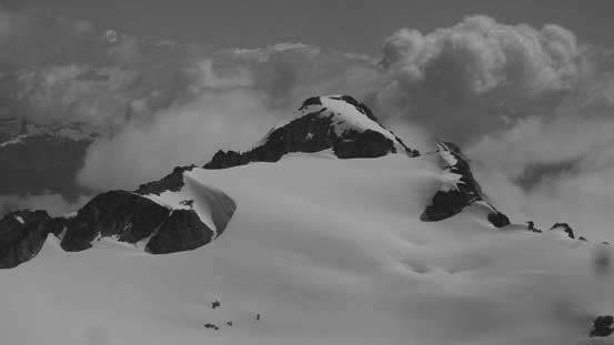
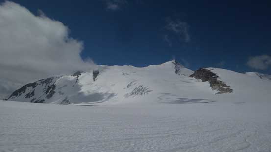
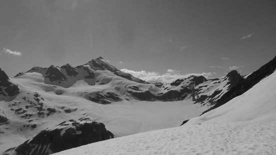
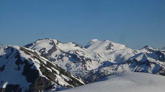
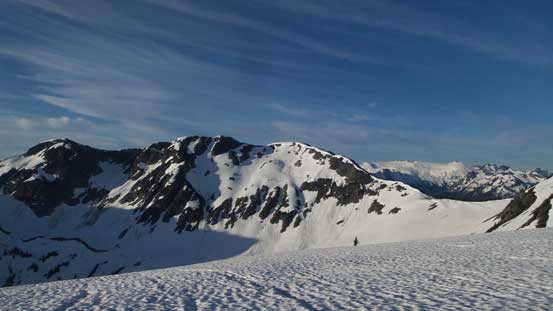
Ascent routes for peaks around Nivalis Mountain
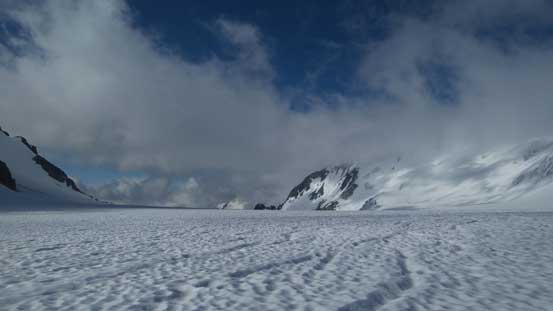
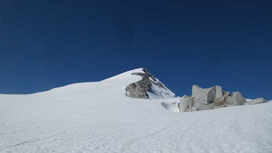
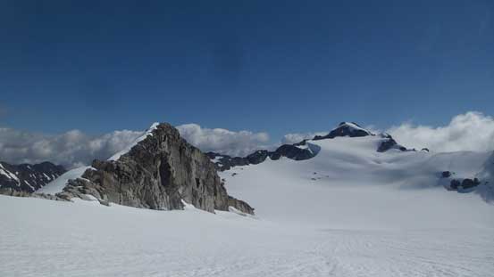
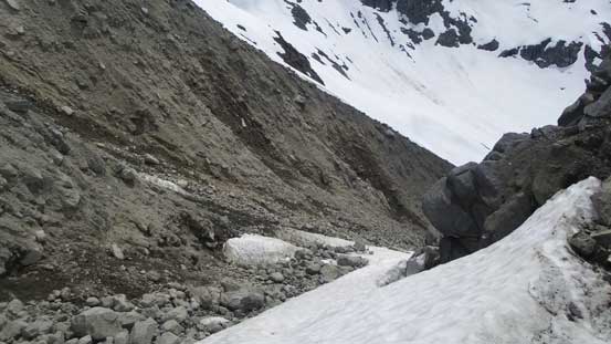
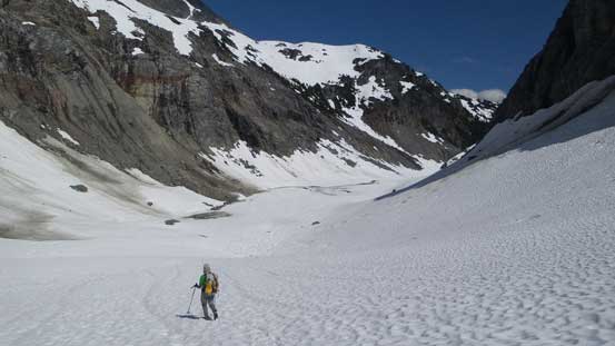
My first business was to descend to Nivalis/Sir Richard pass without falling into a crevasse. The firm snow did make things easy although the saggings nearby suggested I’d have to probe carefully on the return when things started to soften up. The pass between the two peaks was more like a glacial plateau. Lots of flat grounds had to be covered but eventually I started up the Sir Richard side. I stuck closer to a rocky ridge on the left side and the route-finding was pretty basic. The only problem was the foreshortened views but with the GPS handy I had clear image how far I still had to plod across. Looking back at Nivalis Mtn. gave a good idea about the height too.
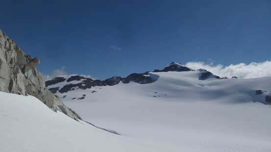
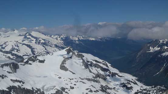
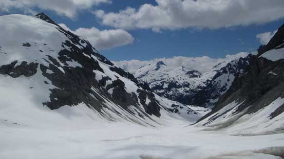
My main objective – Mt. Sir Richard finally in the cards
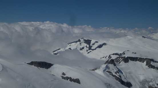
Down to the broad glaciated saddle/pass now after losing more than 200 m height
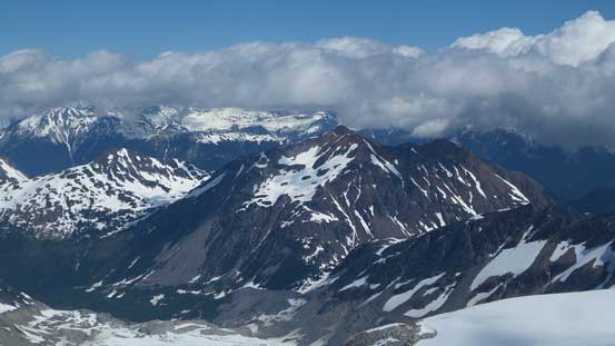
Looking back at Nivalis Mountain, my previous objective
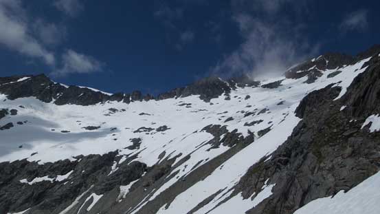
Ascending easy terrain paralleling this rock ridge
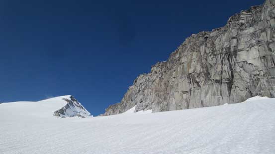
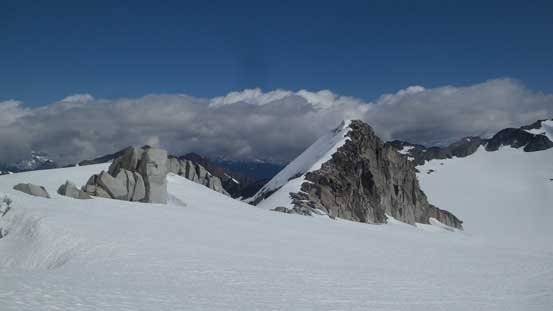
The summit block of Mt. Sir Richard
Another shot looking back at Nivalis Mountain shows my progress
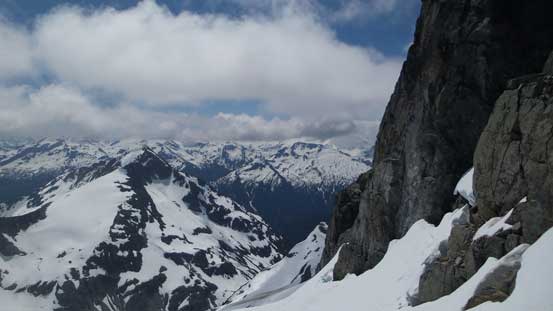
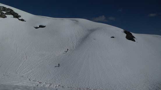
Towards the summit the slope angle increased significantly and then I trended climber’s left onto the face. I picked a line ascending straight up the snow face paying close attention to the now-filled bergschrund and had no issue making to the summit ridge. There’s another crevasse/moat to be aware of near the rocky ridge but once crossing over it’s just a simple plod to the highest point. The boulder-holing was pretty tedious near the top though but the views were great. I spent a long time taking in the scenery before figuring it’s time to head back to rejoin the others.
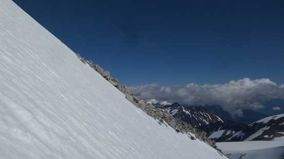
The summit push was pretty steep despite its look
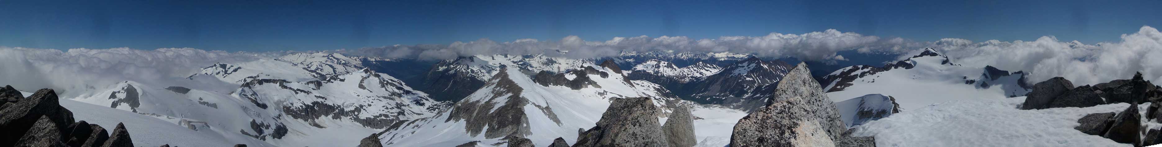
Summit Panorama from Mt. Sir Richard. Click to view large size.
The Wedge Group still engulfed in clouds
This is looking down Cheakamus River valley towards Whistler
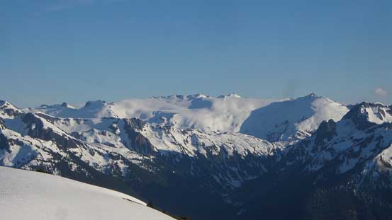
The rest of the high divide on McBride Range Traverse

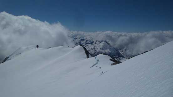
Looking down the glacier I just plodded across.

The Lecture Cutters in foreground
This is Outlier Peak
Zooming-in towards Nivalis Mountain
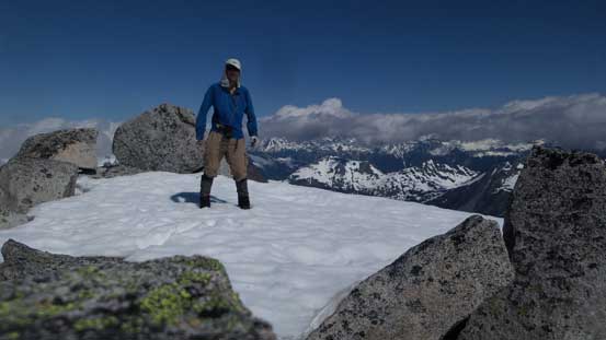
Me on the summit of Mt. Sir Richard
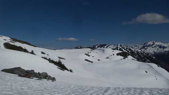
I quickly plunged down the immense east-side glacier back to Nivalis/Sir Richard saddle and then had no problem picking a line back up to the “high col” on Nivalis’s south ridge. The snow was still firm even with the sunbeam beating down, but once crossing over to the east side it had become a total slush. Again, quick work plunging following closely to my uptracks I made to the top of that moraine strip. Picking a different line seemed foolish at this point so I dropped all the way to its bottom again. Rather than re-ascending directly beside the moraine I opted for a long, gradual traversing line across the lower bowl, followed by a whole 300 vertical meters of grunt back to Talon/Nivalis col.
Time to go down..
Descending skier’s right paralleling this rocky section
Looking back at Mt. Sir Richard
Down to the broad Nivalis/Sir Richard saddle now
The other side of Nivalis high col
Terrain is pretty steep near this col
Made to this strip of moraine

Almost down to the bottom now, time to slog all the way back up
This valley heading south into some pretty much untraveled country
Looking back at the high south bowl traverse on Nivalis Mtn.
I was totally beat as this point but I had to carry on, plunging down another stretch of glacier and then slogging back up to our campsite. The other guys had been waiting patiently, and since the day was still young we decided to move camp to a closer place to our vehicle, so to shorten our 4th day. It made no sense to waste a whole afternoon sitting around at this place doing nothing. I needed a long break but soon enough we got going. This time Daniel volunteered to lead and he surely did a great job picking up some snow traverses with waterfalls rushing underneath. It was sketchy as hell but we all made it without falling into the creek, and then more upwards traverses we were back at Gauguin/Flood col. There’s still a couple hours to kill but this was just perfect for setting a new camp spot and relax.
Daniel leading down from camp
We descended this valley for a while before spotting a treed ramp
Above the treed ramp now looking back at Nivalis Mountain
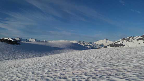
Lots of undulating terrain yet to be covered
Keep marching on
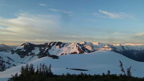
Graymantal and Greenmantle Mountains
Snowcap Peak
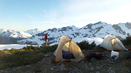
Our camp for the 3rd night with million-dollar front door views
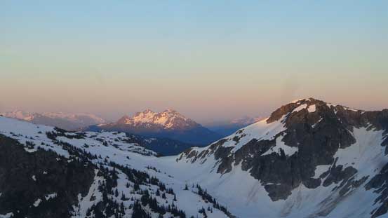
Evening horizon over Fire Mountain in Harrison Lake area
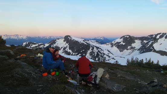
Relaxing
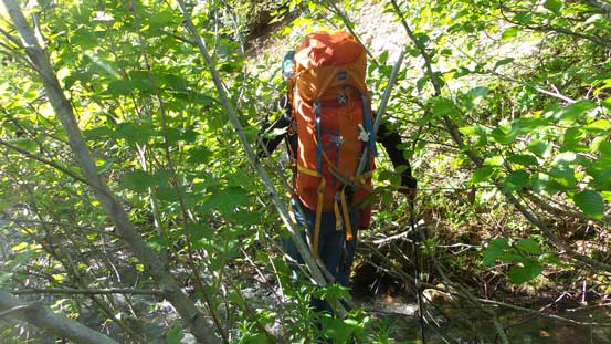
The 4th day we woke up under clear sky again and in short time we packed up and started the descent. The snow was pretty firm thank to a freeze but not icy enough to require crampons which was good. The first section was an undulating business traversing on top of the forested ridge. It was difficult to follow the exact tracks of ours as they were no longer visible. Lots of GPS work was required to not get off-route but with Ben setting up a blistering pace we just kept going. Eventually we ascended up and over the last bump and then dropped down into the forest, initially aiming skier’s left but then straight down the slope. It was steep, bushy and slippery with just enough snow to make things interesting but again, we just ran down the thing. Eventually I gave up the game and went at my own pace but near the final cut-block I had a pretty close encounter with a big black bear, thank for not paying attention. The rest of the descent back to car was uneventful but boring and tedious with some bushwhacking in alders.
The morning of Day 4

Mt. Pitt
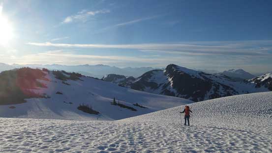
Alex heading out
It’s just another gorgeous morning. The snow was more frozen than we thought
The north face of Gauguin Peak looks amazing from this angle
Aiming at that undulating ridge
Lots of rolls like this
No snow now
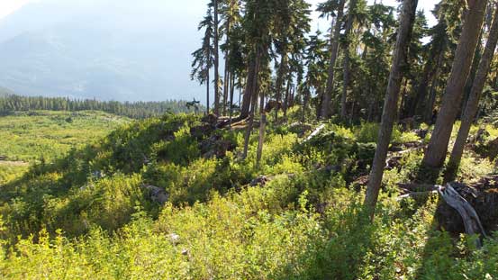
Down to the edge of this broad cut-block. Soon I had a bear encounter…
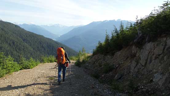
Walking down the road
Where’s the road now?!
The adventure was not over yet as we were literally in the middle of nowhere. Thankfully Daniel’s jeep was still there, healthy and sound. Driving down this stretch of Flood Creek FSR was sketchy to watch with lots of “car bushwhacking” and a few very rough spots. It’s more of an ATV trail than a logging road but we made it down nonetheless. Then onto Lillooet West, crossing the Tenas Narrows and then onto the Lillooet Lake Main. There’s about 15 km of super bumpy section. The rest was tolerable, but certainly far from “good” for such a major logging road.
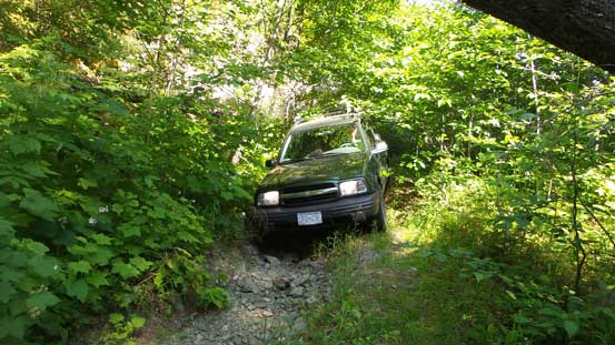
Pretty sure not many cars can make this access road…
The rest of the drive back home was not bad and thank to the early timing we managed to avoid this long weekend gong show thing. Actually we were off the long weekend by just one day so maybe that’s why the traffic wasn’t bad.. To sum it up this was another super successful trip exploring a remote area. From the planning stage to putting the peaks down everything was next to unknown which kept things exciting all the time, and as usual everything went out pretty much next to planned. A big thank to Alex suggesting this area and Daniel for driving. Believe or not I’d say pulling Mt. Sir Richard off as a summer ascent on my first try is one of this incredible year’s highlights.
