Windtower
June 17, 2012
2686m
Kananaskis – Smith Dorrien Valley, AB
Neil (Travelin’ Jones), Andrea and I finalized our objective on the lowly Windtower and Rimwall, two unofficially named summits near Canmore. The standard ascent routes for both are nothing more than a tedious slog from their “back side”, but they do look particularly impressive from Bow Valley, and in fact, their NE sides do boast a few alpine climbing routes. Due to the forecasted thunderstorm in afternoon, we did a somewhat early start at 7:30 am. The unsigned trail-head is just before reaching the Spurling Creek. There is a pull off on the right side of highway which can fit about 5 cars. Seeing how much snow left on the upper slope, we left ice axes in the car.
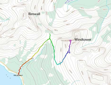
The standard ascent route for Windtower
Neil is extremely fit and he set up a blistering pace on the initial West Wind Pass trail. I felt a bit short of energy due to the 1800 m elevation gain on Saturday, and I had to push myself hard to catch up his speed. Apart from stopping at several viewpoints to take pictures of Spray Lake, we reached West Wind Pass in no time. The wind speed was about 30-40 kph, and we continued a bit further towards the pass to take in the view of the other side. The most eye-catching feature is the lowly greenish “Wind Ridge”.
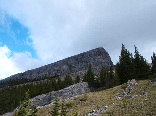
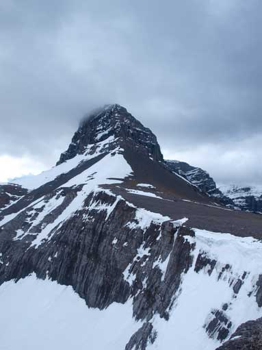
Rimwall seen from West Wind Pass trail

Neil checking out from the pass
There are several ways to get to Windtower. The hardcore route will be directly approaching from the Pass, which involves overcoming cliff bands (at least according to So Nakagawa’s winter ascent). Their route looked particularly sketchy. In June, the normal trail was clearly visible, and we decided to do the normal way. The trail initially contoured around treeline for about 1 km due south, while overcoming several short rock bands. After the last band, the trail turned sharply left and the rest was just a numbing slog up scree slope. The weather was still cloudy as we got to the summit, but the views were still fine. This is my first time seeing the melted Spray Lake.
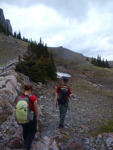
Contouring around
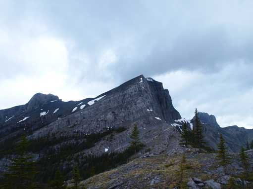
Looking back towards Rimwall
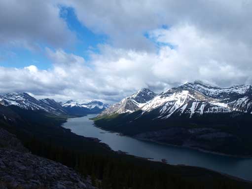
A view of Spray Lake
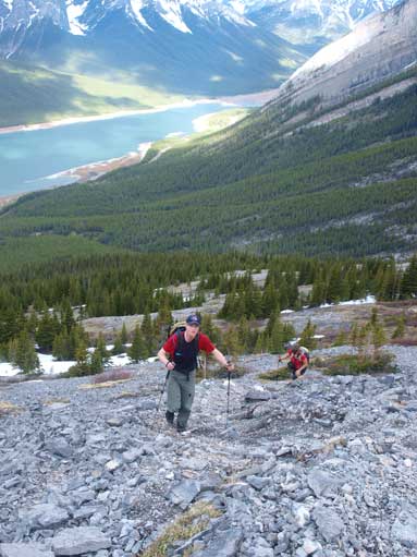
Neil and Andrea slogging up scree
Impressive Mount Lougheed
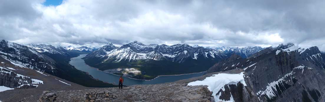
Partial summit view: towards West
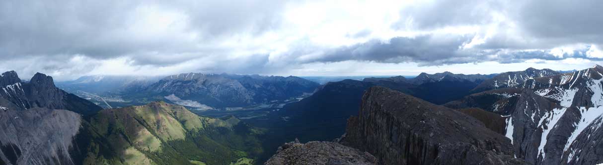
Partial summit view: towards NE
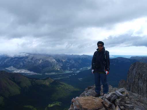
Me on the summit

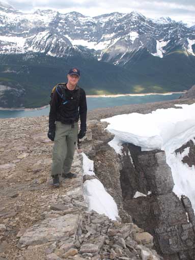
Neil on the summit
Neil trying to stand right next to the edge
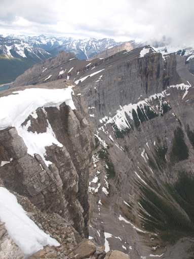
The drop-off is huge…
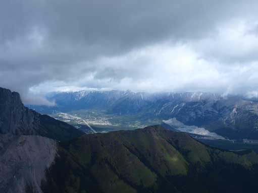
Zooming-in towards Canmore. You can see the clouds moving in.
We didn’t stay too long and soon started the descent. The scree was generally comfortable to descent and we soon got back to West Wind Pass. On the way down, we studied the route up Rimwall.
