Mount Custer
July 11, 2018
2630m
Depot Creek / Chilliwack Lake Road, WA
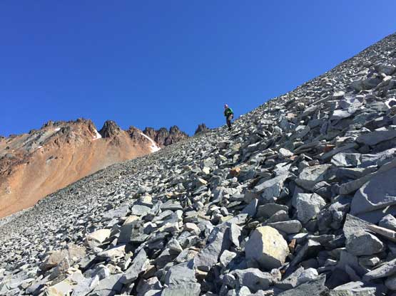
Mt. Custer is the king of choss and the worst peak to climb in North Cascades unless you have an exceptional tolerance on loose rocks. The “red rocks’ here are oxidized volcanic garbage that’s comparable to some of the shittiest terrain in Canadian Rockies although the slopes on Mt. Custer is neither exposed nor frustratingly long. After completing the ascent via the easiest SW slopes route (but also the chossest) I can say that this can be a prerequisite climb to the Rockies adventures. It’s not that bad, not at all, but I can see how it’s becoming a nightmare for those locals British Columbian or Washingtonian climbers… The worst is some scree-on-slabs but you’ll practise that in Rockies anyway…
This is the last of the 6-pack slam in Chilliwack ranges between Eric G. and myself and earlier in this trip we had already grabbed Easy Mox, Redoubt, Hard Mox, Spickard and Rahm over three uber burly days. We had five days of food but figured there’s no need to use the last day so we ate two dinners in the previous night. The plan of 4th day was tagging Mt. Custer and hiking out, as lazy as it seems. Oh well..
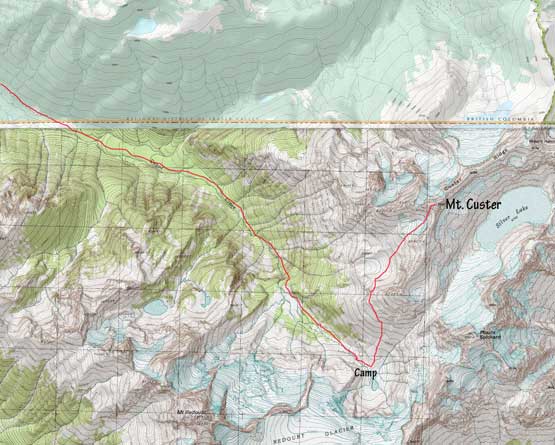
Mt. Custer via SW Slopes.
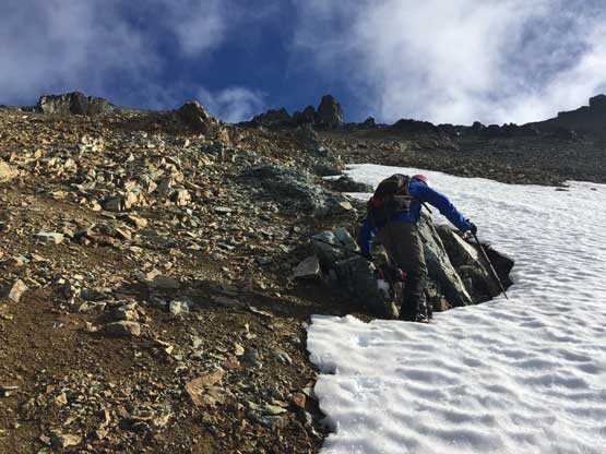
We woke up at around 5:30 am and got going in about half an hour. The plan was to not repeat any of the Silver Pass slog because then why not combing Rahm and Custer together. We wanted to justify our decision, so we spotted a “green gully” far on climber’s left of Pt. 8205 that seems to offer a direct access. None of us had put a lot of effort in researching Mt. Custer so we somehow missed that this is actually a fairly “standard” route and has trip reports on NWHikers.net. To Eric and I this was an exploratory mission based on our earlier observations and the examination of the topographic maps. The green gully was very easy to ascend and then we picked up a rubble bench traversing northwards at around 2200 m elevation across two bowls. Patchy snow was encountered and too bad the snow had undergone an overnight freeze. The snow was still soft enough to gain a little bit of purchase without crampons so we skipped the gear transitions, but crossing one particular slope was scary to say the least without any specilized gear.

Eric crossing any icy patch of snow that we should have donned crampons
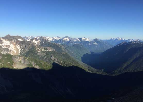
Morning view down Depot Creek into the Chilliwack Valley
Around the second bowl we were surprised at a massive elevation drop must be done. At least 50 m hard won elevation must be dropped if not 100 m and that was frustrating. Thankfully much of the next stage could be done on snow and the snow was soft enough to just walk across. There’s one patch of talus field to ascend and we found a small trickle of running water which turned out to be the only source of water on this entire mountain. Time flee by fast and in no time we were already at the base of the orange/red scree bashing towards a high notch on west ridge. The lower 1/3 was still snow covered so that’s good but then we had to handle the worst of it. The lower patch of scree was just treadmill, easy peasy but then we started to encounter hardpacked, down-sloping slabs underneath the thin scree cover. I did not particularly like this stretch but at least it’s short-lived. Eric spotted a better line on climber’s left so I followed his lead getting onto some grey rocks and the rest of the plod to the west ridge was pretty straightforward.
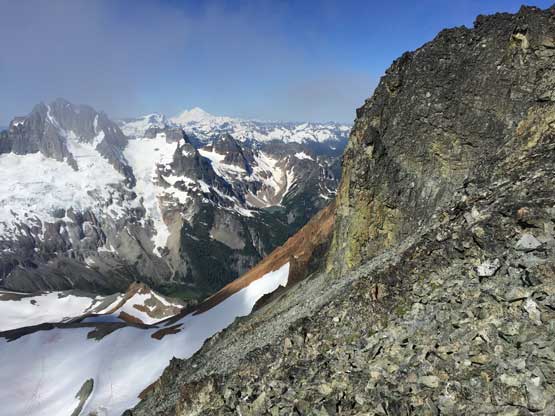
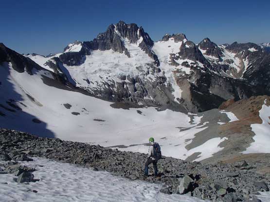
Into the SW basin now and could see part of Custer Ridge
Looking back at the castle of Mt. Redoubt

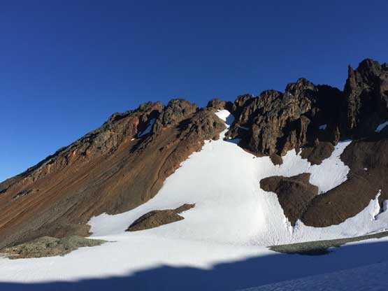
In early July we could still use snow on the lower slopes. Photo by Eric G.
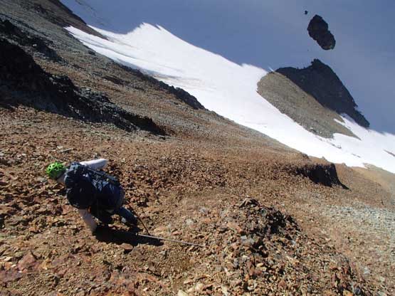
Almost time to test out the choss. Been looking forward to this the whole trip
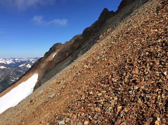
Oh the choss fest..

Eric scrambling up the scree-on-slabs the worst type of combination
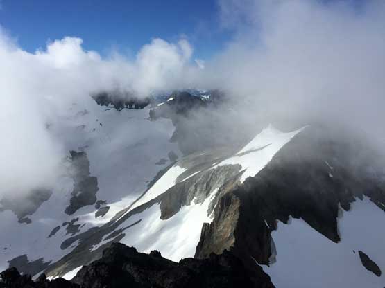
Unfortunately some clouds rolled in and we were sucked in another white-out. The ascent on west ridge wasn’t as trivial as I thought because we had to bypass several gendarmes on the south side and much of the bypassing process was done by side-hilling on rubbles. The side-hilling sucks, but again there’s no exposure. Before realizing we were already on the summit and we waited there for a while but the clouds just didn’t want to dissipate.

Topping out on the west ridge now with good views

This is a glimpse into the north side over a sub-summit
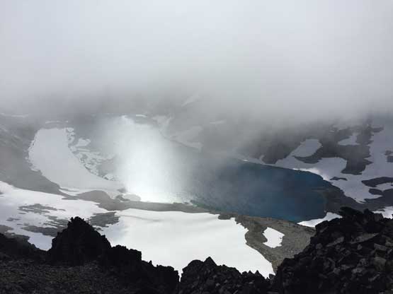
Silver Lake and the layer of mist. The sun’s behind the lake
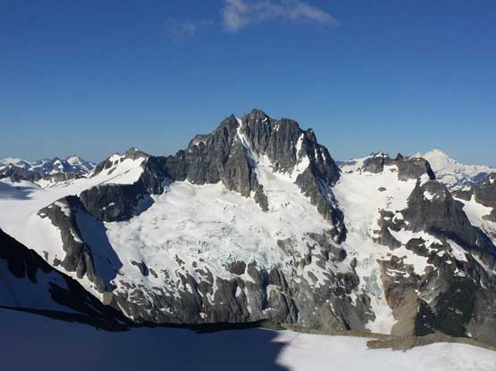
Upon a brief clearing we could see the south ridge and part of Mt. Spickard

As much as the panoramic view from the summit of Mt. Custer. Click to view large size.
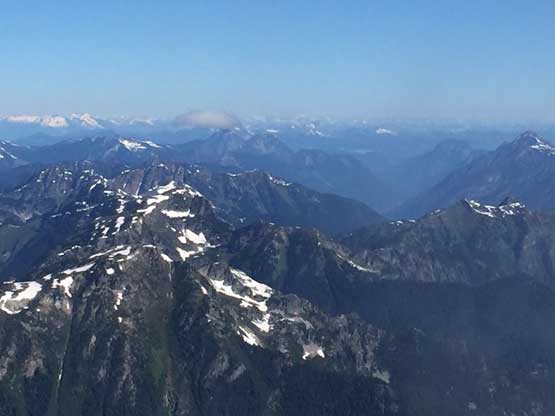
The sea of peaks in B.C. Cascades are all small

Me on the summit of Mt. Custer
As soon as we started the descent the clouds dissipated and it’s a bluebird day as forecasted. We were just not as lucky with views as our peak-bagging mission. I carefully picked a better traversing line on the return to bypass those gendarmes staying away from “real shit terrain” and then it’s time to descend the scree-on-slabs. For about 30 vertical meters we had to be 120% careful not taking a tumble but lower down the angle eased and I just surfed on the scree slabs. It went a bit fast but I never took a fall and there’s always deeper patches of scree to break the speed. The lower 1/3 was treadmill pebbles followed by boot-skiing on snow, as fun as Mt. Custer ever offers.
Time to descend but first of all we had to traverse underneath gendarmes

The grey choss wasn’t too bad

Now it’s time for the red choss…
We had to be extremely careful here. Photo by Eric G.
Now it’s time to surf the red scree. It’s actually pretty fun
The descent on lower mountain was more of a numbing plod with lots of traversing, some elevation regain and of course, lots of choss. The key is to be patient. Before long we were back to the top of that “green gully” and another 20 minutes later we were back to camp, surprised to see another party-of-four arriving. These mountains are getting too busy and I’m not used to see that many people in such a remote area. I guess that’s the America for you…… Half an hour later our boots were dry and the tent’s packed. We followed cairns boulder-hopping down the north/east side of Depot Creek and the route’s mostly easy to follow. Picking up our ditched trail-runners is the highlight of this day.

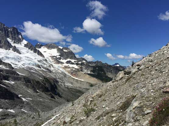
A zoomed-in view of Mt. Redoubt’s NE Face
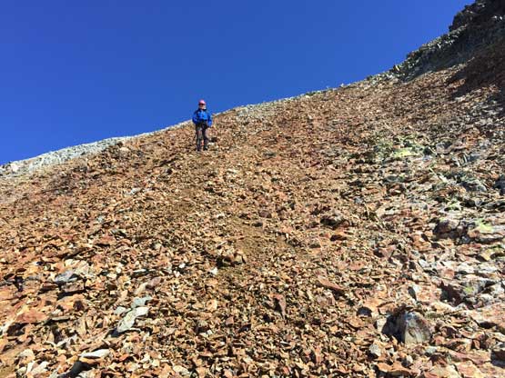
The talus field is just as loose as anywhere near Mt. Custer
Me soaking in the views. Photo by Eric G.

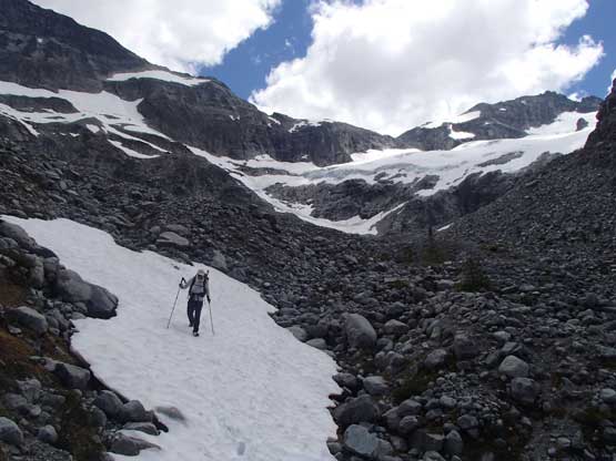
Into the lowest point of the basin and now we had to re-ascend

Traversing the high bench due south with Lake Ouzel in sight now

Descending the steep green gully
As chossy as this peak is the view’s really good
Me plunging down the last bit of snow finger above camp. Photo by Eric G.

Descending from camp on the north side of Depot Creek. Photo by Eric G.

The stream’s really beautiful but boulder-hopping sucks…
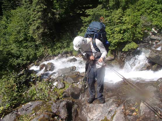
Another highlight was getting into the shades of forest as the sun’s beating down mercilessly and the temperature must have gone over 30 degrees Celcius. It was ridiculous. Descending the headwall by Depot Falls was such a pain in the ass with lots of wet boulders and steep, rooty terrain. There’s always a trail and the trail is easy to follow, but the grade’s simply too steep for the heavy packs and our tired legs. It took me forever to get down that stretch, but the batman ropes were fun to climb down. The rest of the hike-out was very long, but without any further difficulty. I think we took a couple breaks along the way but otherwise we maintained a decent pace. The drive-out was another story though with a hell lot of crawling on big rocks. It never fails to amaze me what a Tacoma can do. We were the only party parked at the “advanced trail-head” as those Washingtonians had to park their Subaru way back on the road. There were 5 cars parked at the low point and at least 2 more cars driving in on various stage of Chilliwack Lake Road with Washington plate. I’m really glad to not participate in the gong show. Too many parties. Period..

Descending the steep headwall now. It’s very painful

This sums up the descent off the headwall. Lots of lichen on boulders
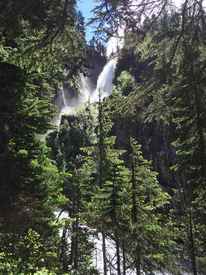
At least Depot Falls is very pretty

Me checking my phone to see how far still have to go…
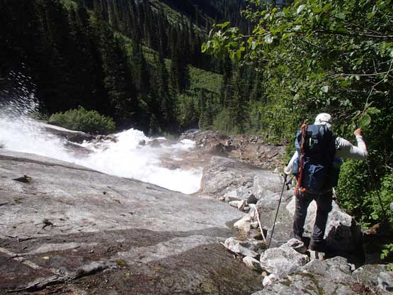
Me dropping beside the waterfall slabs now. Photo by Eric G.
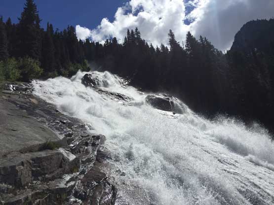
The water’s running very high.

Me down-climbing the first batman rope. The ropes are really necessary here
Me down-climbing the second batman rope. Photo by Eric G.

Eric down-climbing the batman rope
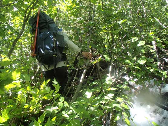
Crossing this stream was very interesting. Photo by Eric G.

As typical as Depot Creek Trail is but only on the good part
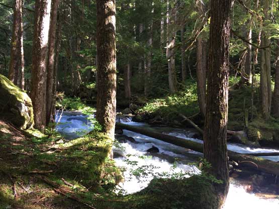
Depot Creek

This is the bad part of this trail. You don’t want to lose the trail…

It’s border swath time now. Almost done

No doubt this is the north face of Nodoubt Peak
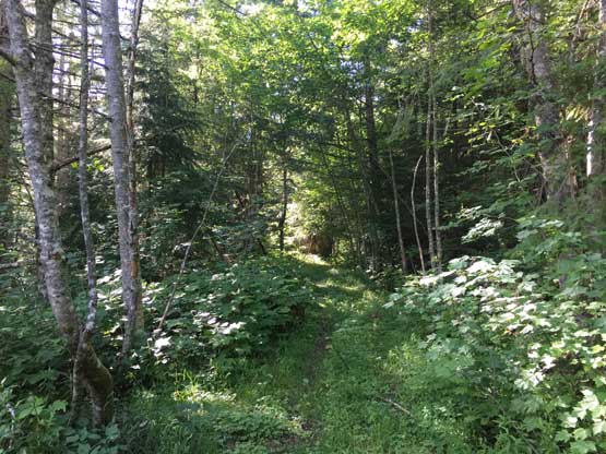
Into the Canadian side now onto the overgrown logging roads
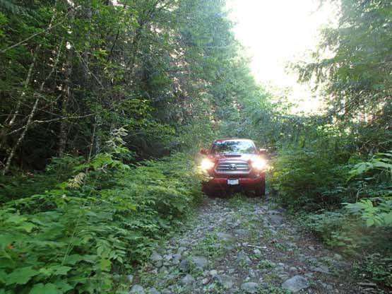
It’s Taco time. No way to get up there without the truck…
As for the six Bulgers we climbed in this trip I would say Hard Mox deserves its reputation of being the toughest Bulger, and Easy Mox isn’t “easy” and will rank pretty high on the Bulger’s difficulty list as well. Mt. Redoubt has everything thrown in and is very enjoyable while Mt. Spickard is just a long slog on snow and talus. Mt. Rahm is another long slog but has good views of Silver Lake and Mt. Custer is a don’t-bother unless you go after the list.
