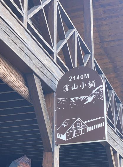
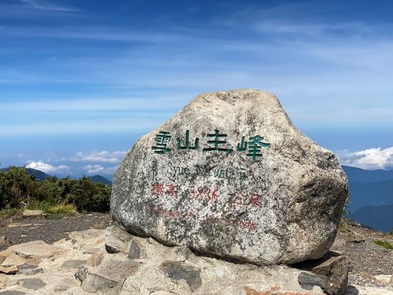
Xueshan / 雪山
September 13, 2023
3886m
Yilan, Taiwan
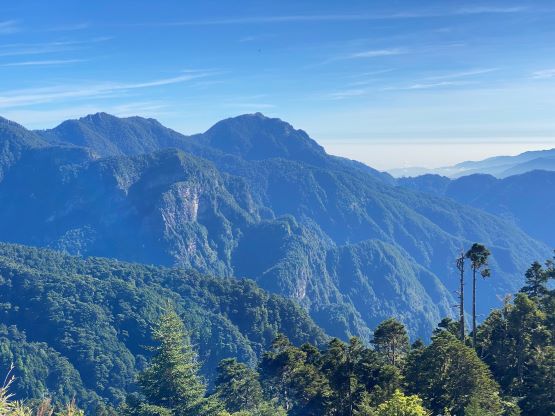
Xueshan, also spelled as Sjue Shan, is the second highest and the second most prominent peak in Taiwan. It’s rare that the second highest peak of an area is also the second most prominent. This suggests that the mountains in Taiwan do spread out. In English the name means “snow mountain” which is quite lame. I think the second highest peak in Taiwan deserves a better name than 雪山. To be fair the name is indeed descriptive but definitely not distinct, as this can be any mountain that has snow. Ironically, the peak is completely free of snow most of a year except for in winter. Like the highest peak (Yushan), this one is also more commonly done over 2-3 days, but can be done in a day for fit parties. Most of the day-trippers would prefer to spend a night near the trail-head (Wuling Farmlands) for better acclimatization, but Adam and I had already done a few tall peaks in the past week so we decided to do it in a day from Taipei. The drive from Taipei would take 3-4 hours but I could sleep in the vehicle. It’s more convenient to book the same hotel for 3 nights and do day-trips from one place, and our driver also preferred this fashion as he lives in Taipei.
The ascent of Yushan gave us was a good experiment and we learnt that it would not be wise to start late. We had no other choice on Yushan as we didn’t want to walk the 3 km access road so our starting time was limited by the shuttle van. By comparison there’s no shuttle van service on Xueshan and we could start as early as we wanted. I made the call to leave Taipei at 1 am and I slept through most of the drive. We arrived at the trail-head at 4:40 am and started 10 minutes later after forcing in some breakfast. There’s a lodge/hut about 2/3 of the way up so we did not need to bring too much contingency for food and water. We did end up bringing enough for the entire day, but without any leftover in the end. We could see a lot of stars in the sky so our stoke was high. There wasn’t much of a view from Yushan so we really hoped to see something from this peak. By the way the “red tape” to enter Xueshan is significantly easier than Yushan’s permit bullshits as there isn’t a lottery system, but one still needs to fill in a complicated form including detailed personal information, a fixed trip date with a fixed route itinerary and an emergency contact. My initial submission was rejected as they required the contact to be Taiwanese. At the time of application I did not have any local contact but my best high school friend (Jenny C.) was from Taiwan. I submitted her contact even though she isn’t currently living in Taiwan, and got the permit. I did make sure to make several Taiwanese friends DURING this trip. There are a shit ton load of peaks in Taiwan, some very iconic and difficult, that I’m sure I’ll be back for another trip.

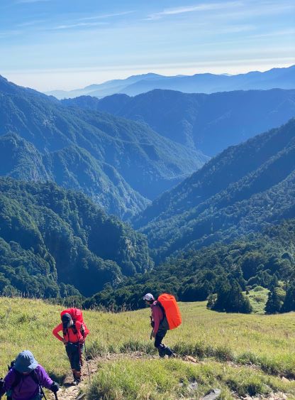
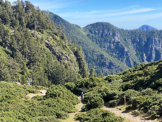
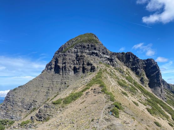
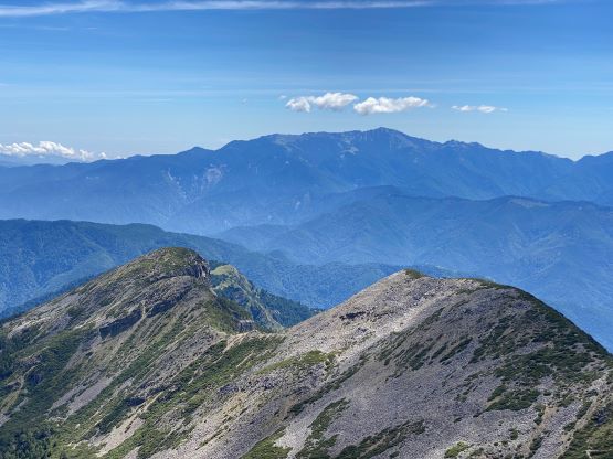
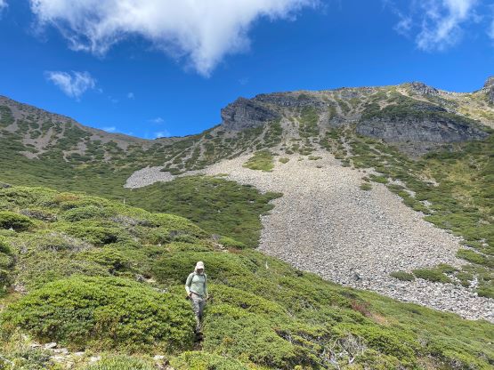
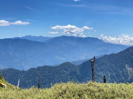
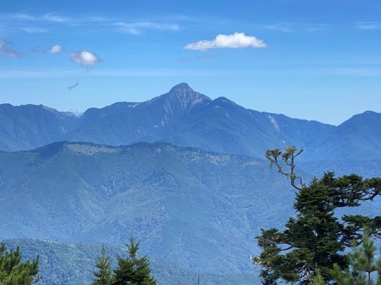
We only needed to use head-lamps for about half an hour and the sky was already bright by the time we got to Qika Lodge (七卡山庄). I was surprised there’s a lodge this close to the trail-head but given the speed of the averaged Taiwanese I was then not surprised. The steepest and the roughest section of this trail was from Qika Lodge to the east peak. The steepness was sustained and the trail bed was covered by a lot of irregular rocks. I did not notice much during the ascent, but did feel the pain on the descent. Nearing the east peak we could see the view eastwards towards two of the more remote peaks in Taiwan – Nanhudashan / 南湖大山 and Zhongyangjianshan / 中央尖山. Both are P600m objectives so I will have to come back for those. The east peak itself is a joke with hardly any notable prominence, but they somehow decided to put it into the fabled 百岳 (100 highest) list. Despite the lack of topographic significance this peak is important in the local culture, so we nonetheless took a “summit” shot before moving on. By this point we had gained over 1000 m elevation but covered only 1/3 of the distance.

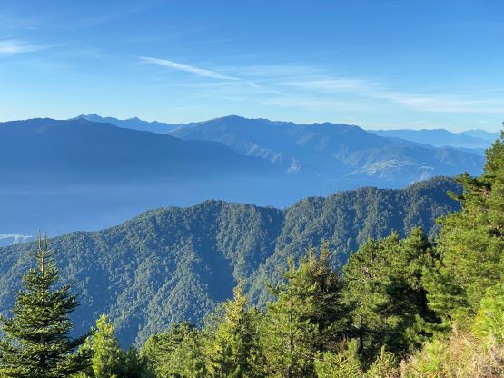


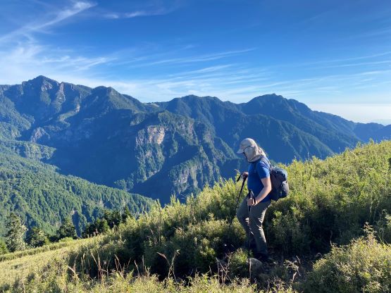
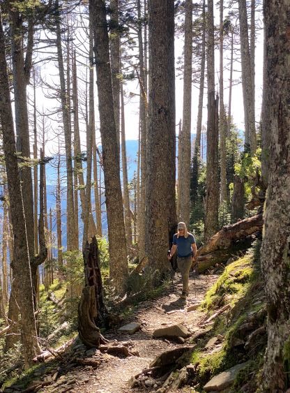
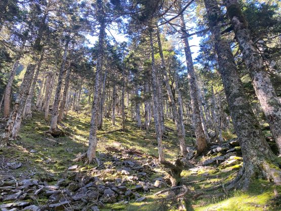
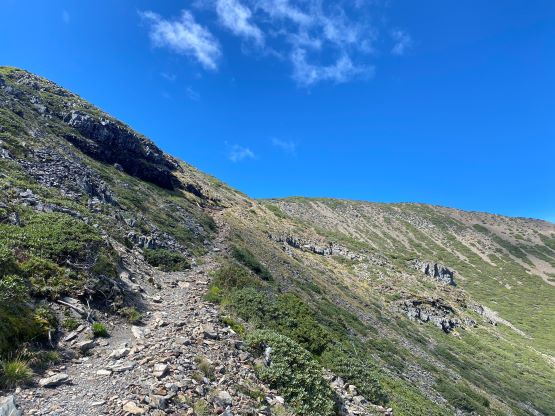
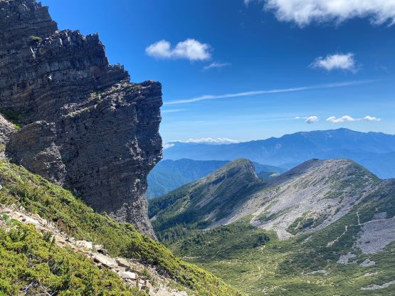
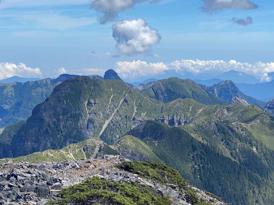
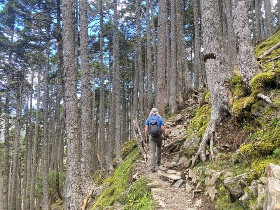
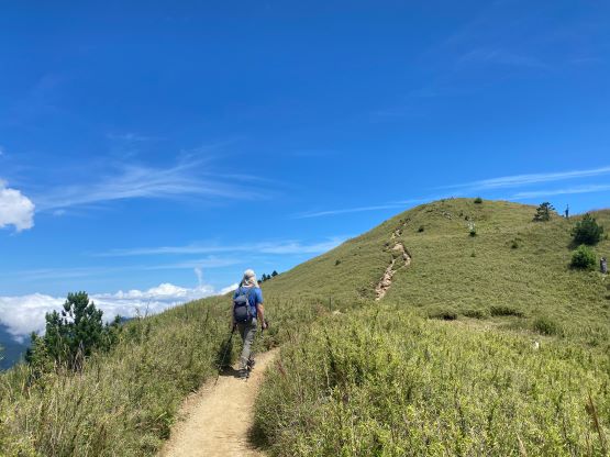
The next stage of the route involves mostly traversing on flat and undulating terrain, for several kilometers to Sanliujiu (396) Lodge / 三六九山庄, the main lodge on Xueshan’s routes. To spend a night in this lodge one does need to make a reservation and the reservation can be difficult, if not impossible in summer. Thankfully Adam and I were fit enough to do this peak in one day. The trail actually traverses high above the lodge such that we did not have to actually pay a visit inside. We passed several groups of Taiwanese on the steep section above 369 Lodge before entering the “black forest”. This piece of forest is the typical type that we have in Washington and B.C. with mostly tall trees and hardly any underbrush and I do think there has snow coverage in winter. I did not find it to be spectacular at all, but apparently it’s quite a thing for the Taiwanese. After exiting the “black forest” we came to the treeline zone in the valley NE of the main summit. The ascent onto the NE Ridge of the main summit was long and foreshortened, but I made quick work and got there in a timely manner before the clouds came.


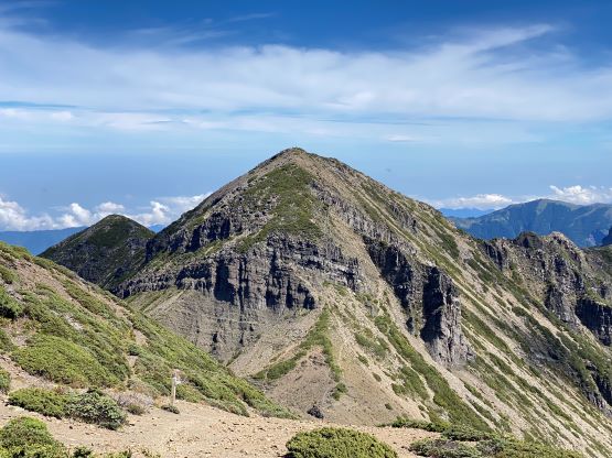


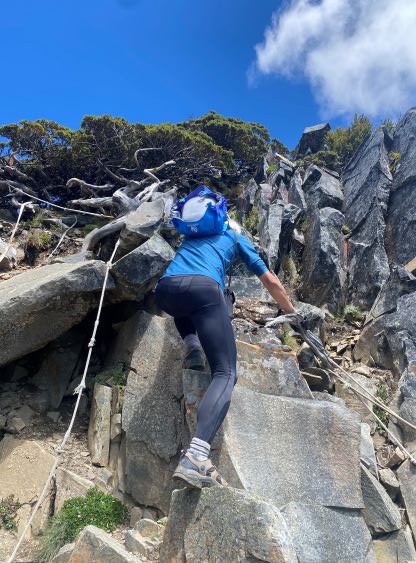
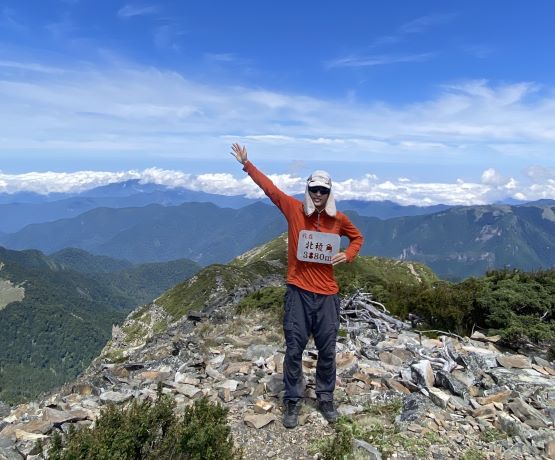
As I was ascending I kept looking towards the northern sub-summit known as Beilengjiao / 北棱角, that it sure seemed to be higher. From the main summit it still looked to be higher, so I checked the peakbagger app. The official height difference is only 4 m and who knows who actually did the surveys and how accurate those surveys were. Once Adam showed up I immediately told him that I had to go for that secondary summit even though we were tired and we knew the rain’s coming later in the day. Adam had the same feeling, so we immediately dashed down the north ridge of the main peak. There was already a group on Beilengjiao by taking a short-cut trail from the valley straight up to Main/Beilengjiao col. I assumed those were seasoned peak-baggers as who else would skip the main peak to go for the secondary one. I caught up to them at the scrambling section. The scrambling was 3rd class at the most, and was aided by multiple fixed ropes. I made sure to not use any of those ropes as I usually preferred some challenges and never took the rope’s safety for granted, but everyone else was heavily relying on them. One of them pulled a rope, it came loose and he almost fell, and I had the whole thing recorded on video. In any case I passed the group and made the summit. There’s no way to tell the height difference of these two peaks by visual inspection, and I did not have any surveying equipment. The guy from that group actually claimed that Beilengjiao is higher as there’s a new survey or some sort, but later in the hotel I could not find any reference of the surveys, even by searching in Chinese. If this peak does end up being higher than I have no sympathy towards those who missed it. The height difference is only a few meters (within the error range of recreational GPS devices), and the traverse is non-technical and adds minimal amount of effort, so you just have to do both. It’s kind of an obligation to do both to be thorough.


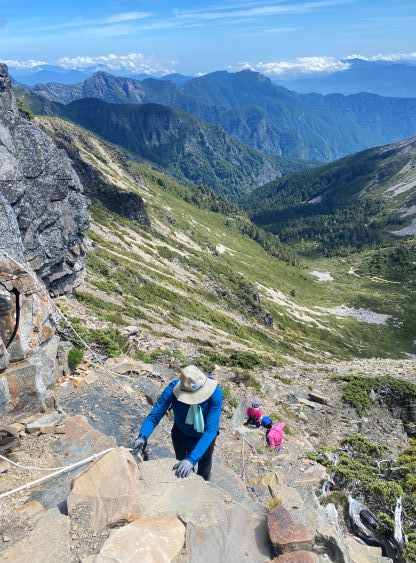

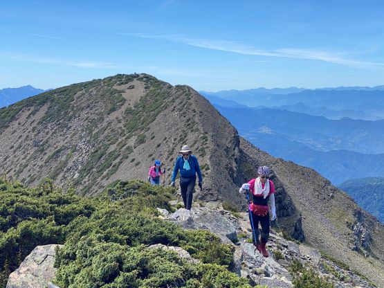

Despite that we weren’t doing particularly great on time I still lingered on this summit for 20 minutes to socialize, and then made my way back down to the col to rejoin Adam. We then descended that short-cut trail (overgrown with thorny plants) back into the valley. There isn’t much worth documenting about the descent as it’s mostly a long and boring ass slog, with many up-and-downs. The trail was mostly rocky and rooty until near Qika Lodge so the hike-out was slow and tedious. We had to pay attention and stay focused. I stopped regularly to socialize with the Taiwanese as I speak their language. I usually do not bother doing that in other countries but here is a bit more special for me. I ended up being 20 minutes behind Adam but still finished the round trip in 9.5 hours.


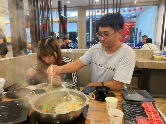
I had to go into the trail-head office to check us out as we did not do the check-in, and they gave us no hassle. The driver was already there waiting for us after watching a full day of movie. He did manage to catch some sleep and that was good. I slept through most of the drive back towards Yilan / 宜兰. The driver knew some places in that city so we stopped for some bread and tarts, before driving back to Taipei for a deserved hotpot dinner. We picked up the driver’s girlfriend and then went for their go-to restaurant. Adam opted for a 32-once steak meal, whereas the three of us had our hotpot meal. This is a buffet styled restaurant so we took as much as possible. I was particularly hungry and at a shit ton load of their meat. We eventually got back to the hotel past 9 pm. I was too exhausted to work on the trip reports.