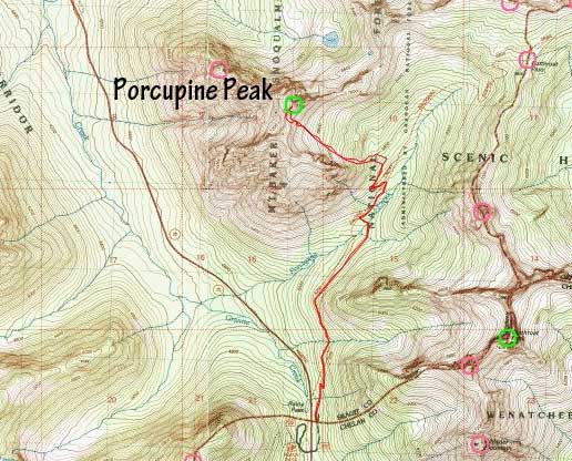
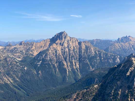
Porcupine Peak (WA)
September 18, 2022
2366m
North Cascades Highway, WA
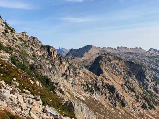
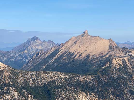
There are quite a few “Porcupine Peak” out there in the vicinity of SW BC but this is the one in Washington’s North Cascades and is relatively obscured. This peak is not included in any peak-bagging list but to reach the summit one has to deal with some exposed 3rd class scrambling, so very few actually bothered to attempt. My first time coming across this peak was bluntly seeing it while driving westbound from Rainy Pass. It was actually the passenger at the time who pointed out this cool-looking summit and then I checked the maps. I researched at home and determined this to be a decent scramble when time and/or energy was lacking.
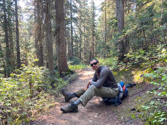
Vlad wanted to get out on Sunday but I had the Nesakwatch Spires planned for Monday so I threw out the suggestion of Mt. Pilchuck. Of course Vlad wouldn’t sign up for that, so I changed to Porcupine Peak. The elevation and distance stats weren’t actually much higher, but this would be a semi-exploratory type of trip without any GPX to follow. I told Vlad that I would not be up for 8 hours of driving on top of the hiking so the only solution was to car-camp at the trail-head. We left White Rock at around 9 pm and made to Rainy Pass 4 hours later after over an hour’s delay at the border. I simply slept on the front seat while Vlad pitched his tent outside. The night was cold and the morning was cloudy.
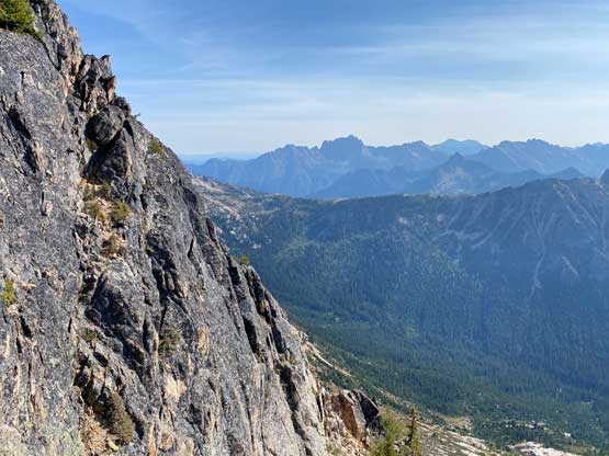
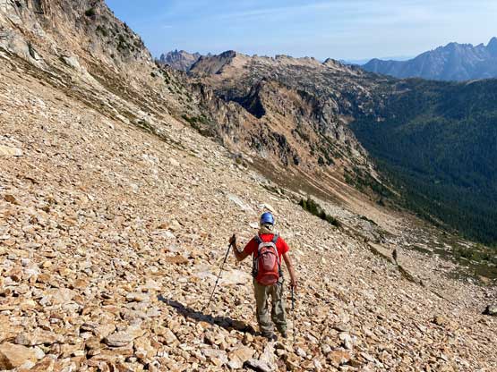
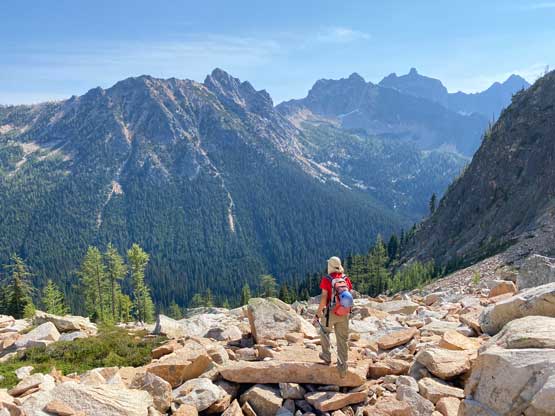
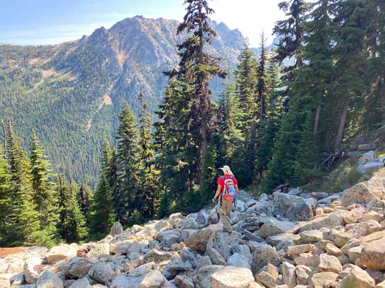
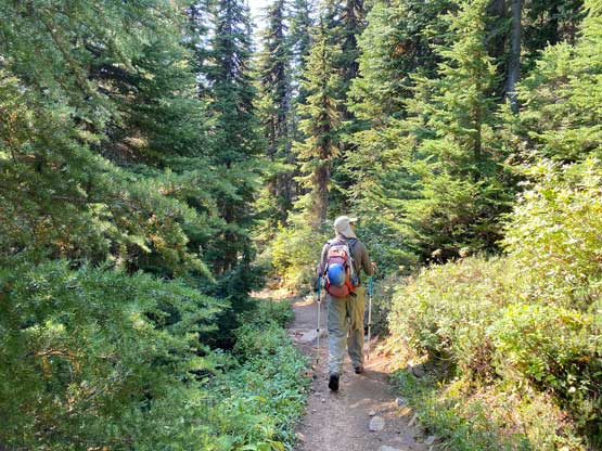
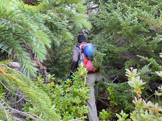
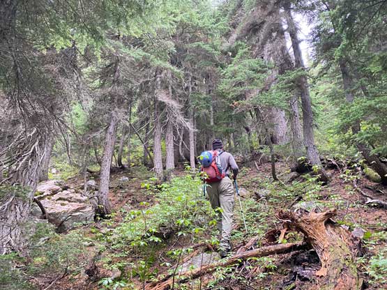
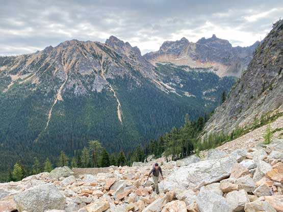
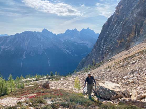
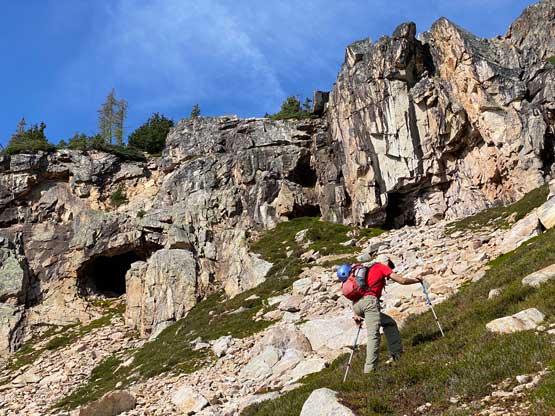
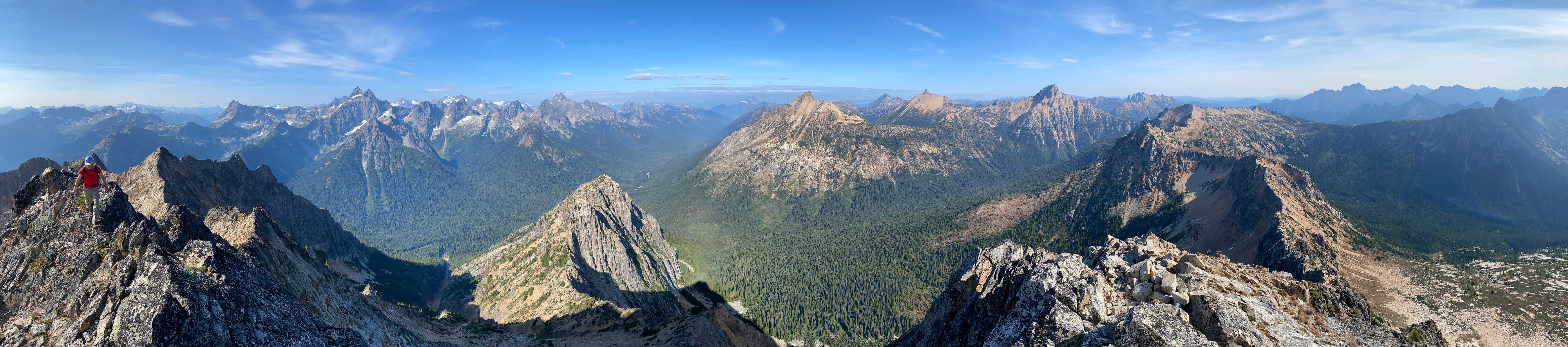
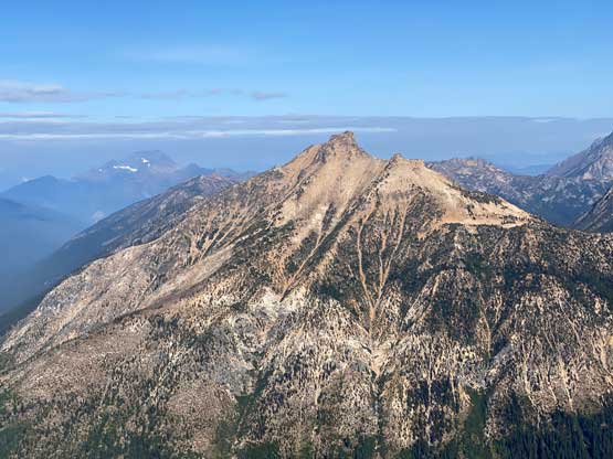
The approach was facilitated with the top-quality PCT trail for a few kilometers northwards to under the gigantic SE basin of Porcupine Peak, but the coldness and the clouds had significantly diminished my motivation such that I felt completely lack of energy on this day. Thankfully Vlad wasn’t much faster neither. I had no idea where exactly to bail into the bushes so just picked a random spot, and that punished us with some level-3 thrashing and wet at times. We followed our sense and traversed leftwards into the mature forest and that was much better. Higher up we traversed climber’s right to emerge out of the trees onto some boulder fields. The boulder-hopping would last for a long while. Eventually the clouds dissipated and with the warm sun beams we took the first break of the day.

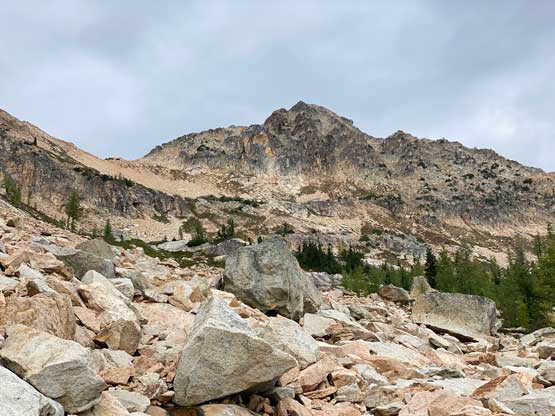


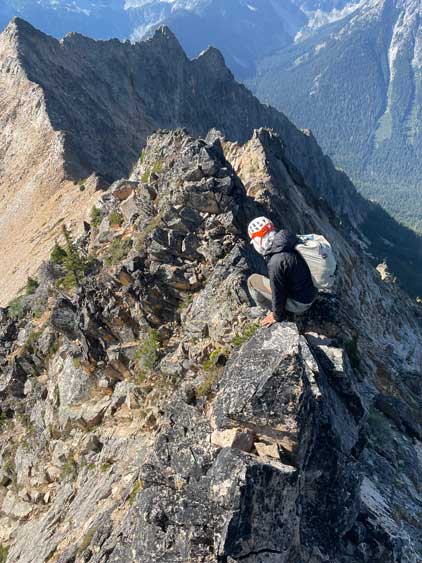
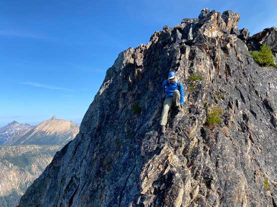
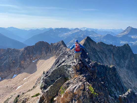
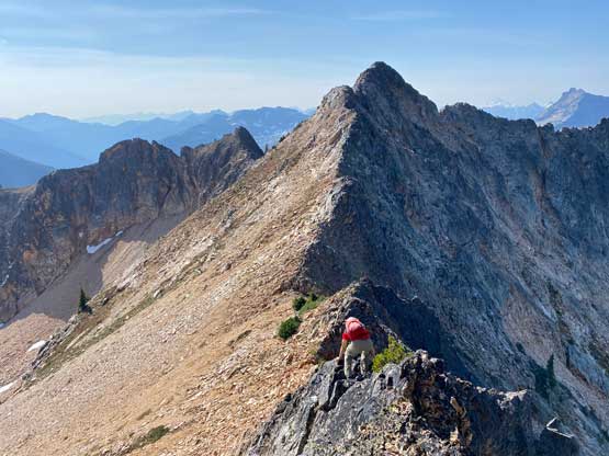
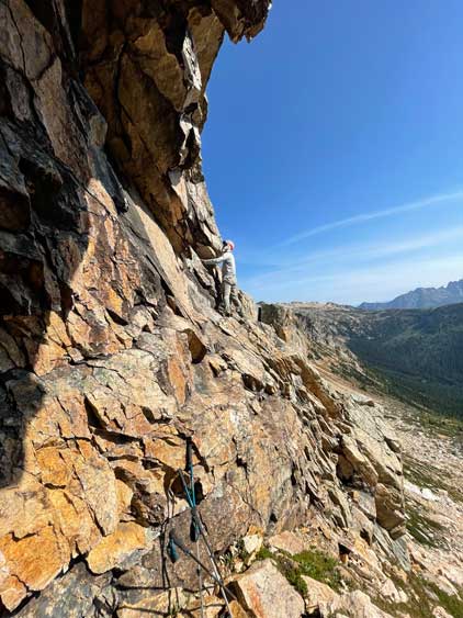
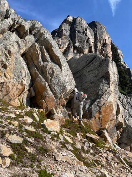
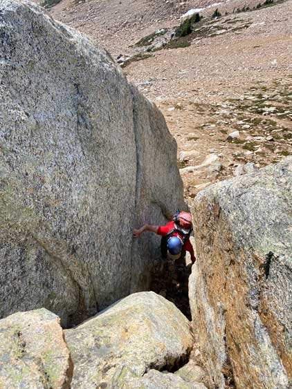
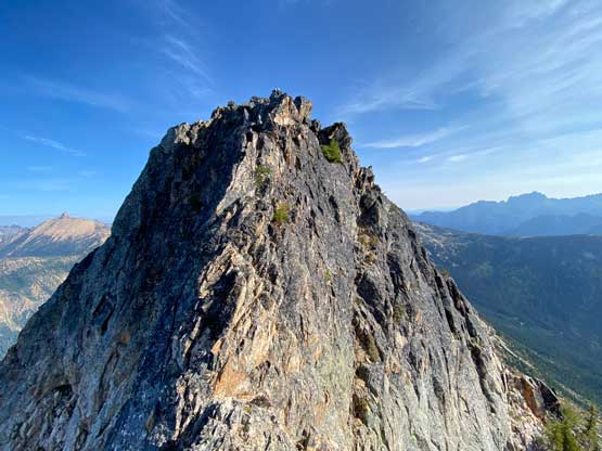
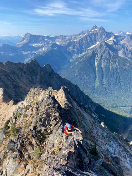
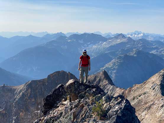
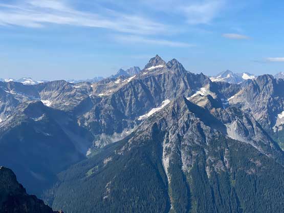
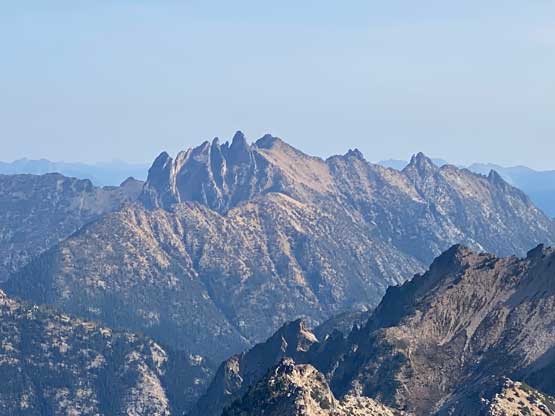
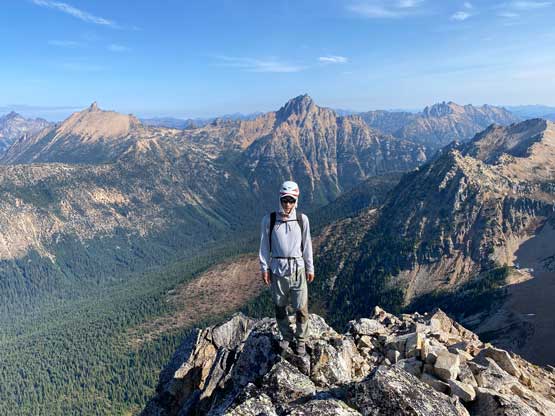
We aimed at the most obvious spot to gain the SW Ridge of Porcupine Peak but Vlad suggested that we should aim to do more fun scrambling instead. I agreed, so led us more climber’s right than needed into some chimneys. Of course the chimneys turned out harder than expected with some stiff moves. I was wearing approach shoes so did it just fine, but Vlad had to turn around to find an easier path. I continued climbing the south face instead of the SW Ridge and did not intersect the ridge until much higher up nearing the summit. Vlad went up the ridge instead. Before long we were staring at the infamous summit block challenges. With all the hypes on the internet I expected this to be difficult and even brought a rope and harnesses but it turned out to be trivial. We didn’t even bother to take the ledge as suggested by others, but rather scrambled the ridge crest. There were some 3rd class moves on questionable blocks with huge exposures but that’s not problematic for me. After watching me scrambling to the top Vlad followed and announced that it’s easier than his expectation as well.
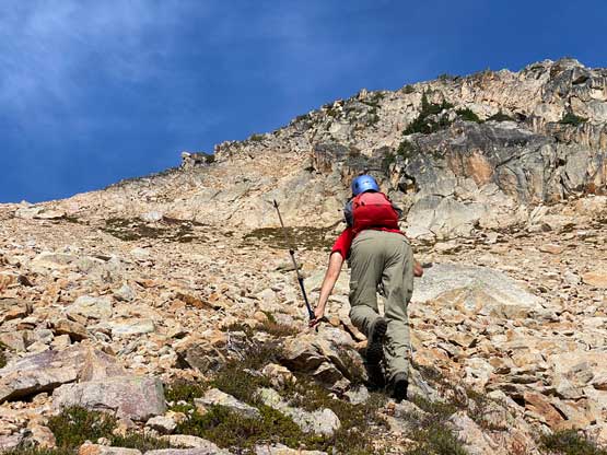
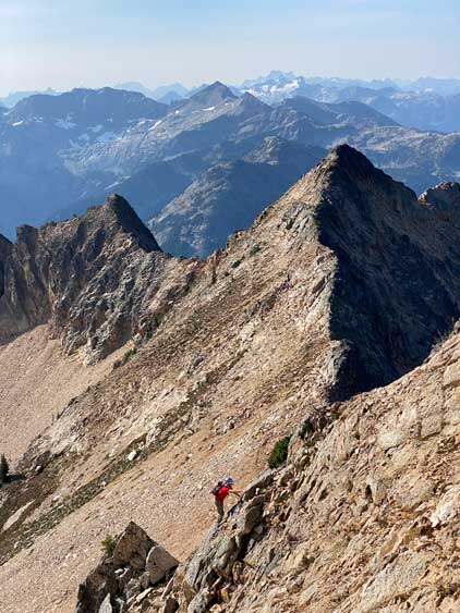

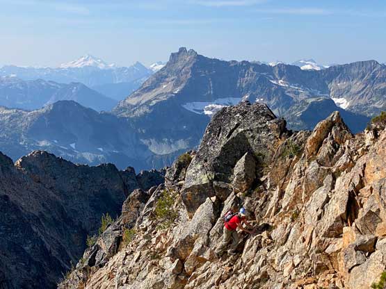

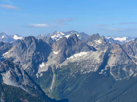

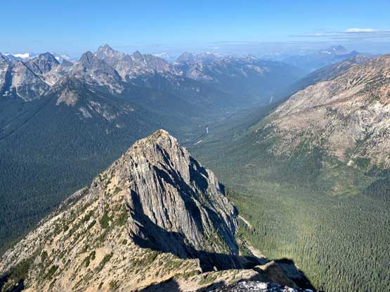
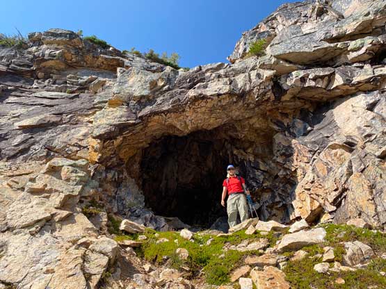
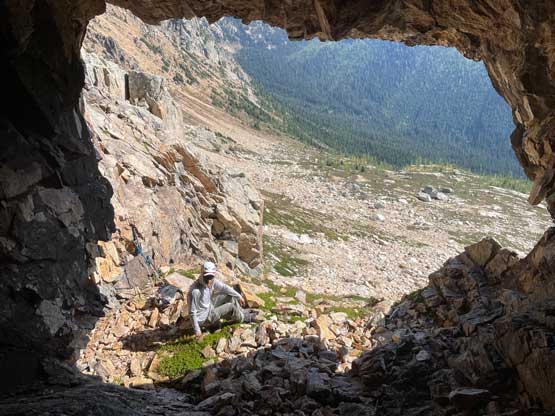
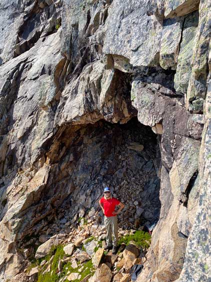
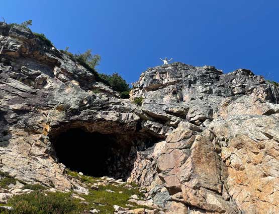
We didn’t linger too long on the summit as I needed to get home as early as possible to prepare for the Nesakwatch Spires. We took Vlad’s route on the descent and continued scrambling down the SW Ridge staying as close to the ridge crest as possible. I found the rocks to be quite loose for this area’s standard. We did have to descend the south side of the ridge at one point and then plunged onto the scree zone. The scree and the boulder-hopping was not pleasant. We found a neat cave and decided to check that out. I spontaneously decided to free solo a pitch of 4th and low 5th class rocks on climber’s right side of that cave. The rock quality was again, not very great so I climbed with extreme caution. The original idea was to traverse above the cave and down-climb the other side, but I decided to just take the walk-off. Into the forest we stayed entirely on skier’s right in the mature forest, and the bushwhacking was never bothering. The rest of the descent was uneventful and we took our time. Vlad then did the drive for me bringing us back to Sedro-Woolley and I did the rest of the drive myself. I got home at around dinner time which was enough for me to do all the things that needed to be done before driving out eastwards for the night.