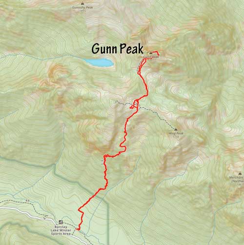
Gunn Peak
August 21, 2022
1902m
Index / US-2 Corridor, WA
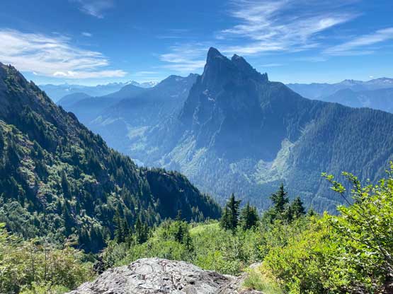
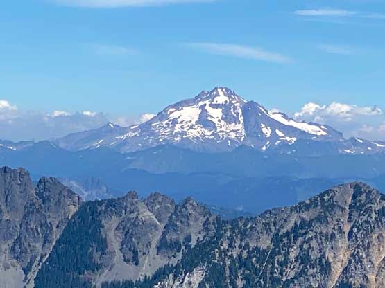
Gunn Peak is the highest summit in Wild Sky Wilderness and hence boasts over 1000 m prominence. This peak locates not far away from Index and the area is very rugged with several known hard summits. The standard route on Gunn Peak is however, not difficult but it still takes most of a day for most parties and the terrain is decently steep and rugged. There’s a climber’s trail to facilitate the access but this isn’t the typical Washington’s hiking trail. Vlad, Silvana and I came from BC and found this trail to be rather pleasant but that’s because we had very low expectation about the trail quality. We also anticipated some tricky and exposed scrambling on the upper mountain but other than a few moves at the beginning of the “hidden ramp” we found the ascent to be rather trivial.
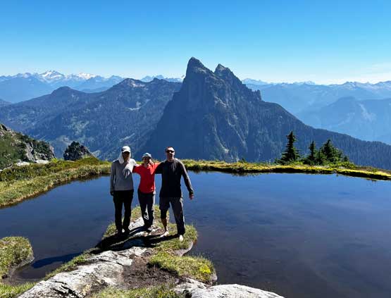
I made a spontaneous decision to scramble Gunn Peak simply because I had no better idea. I just came back from an exhausting Rockies trip but I needed a day-trip on Sunday to take advantage of the local weather. Vlad and Silvana decided to come along even though both of them were on some other hikes on Saturday and this would be my first trip with Silvana so I was looking forward to it. Vlad and I made the decision to leave White Rock at 5:30 am in favour for a more fluent border crossing. Silvana simply decided to just sleep in my place and wake up together with me, mostly to get at least an extra hour of sleep as she lives much farther to the north in Coquitlam. The drive down to US-2 took about 2 hours. I had previously driven the logging roads to Barclay Lake trail-head in 2017 for Baring Mountain but I couldn’t remember much. The recent trip reports indicated a passenger car being fine for the access so we contemplated taking Vlad’s car, but opted not. The road turned out not terrible, but also not as smooth as I was hoping for such that we were glad to have taken my Tacome all the way down instead of Vlad’s electric car. The fuel costs would be enormous but I always plan trips with lots and lots of contingency in case things turn out harder than expected. For Gunn Peak’s scramble we turned onto a deactivated spur road just before Barclay Lake trail-head and parked right at the start of the climber’s trail. Most scramblers would simply park at the main FSR and walk some extra distance.
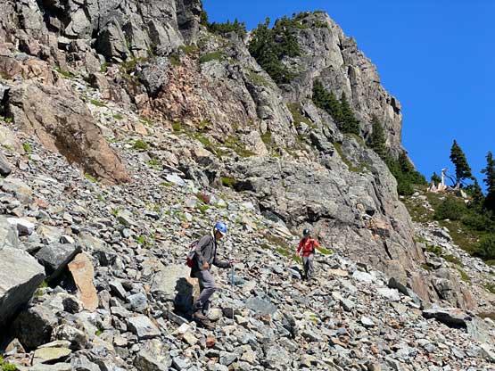
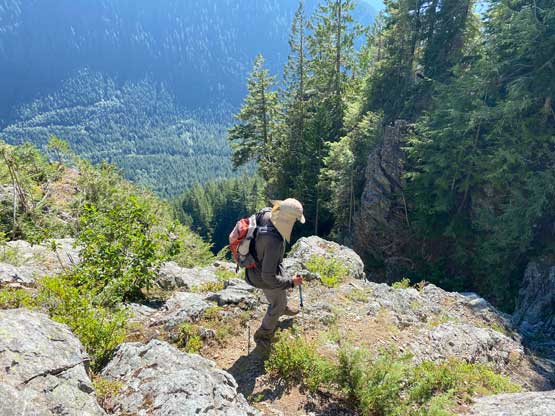
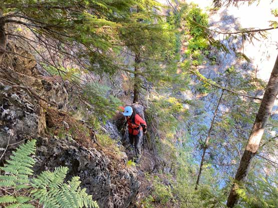
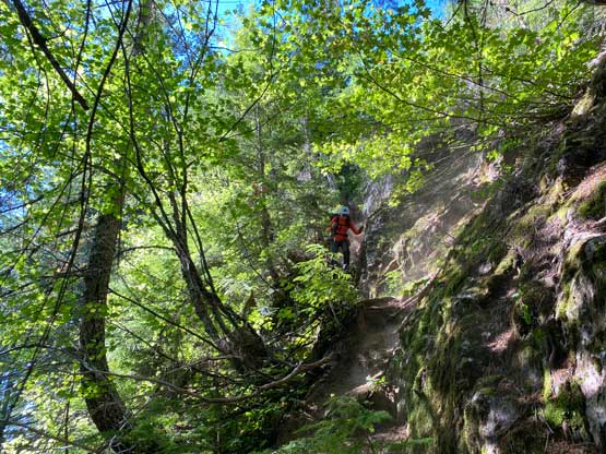
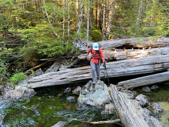
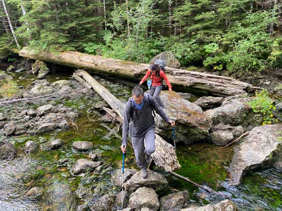
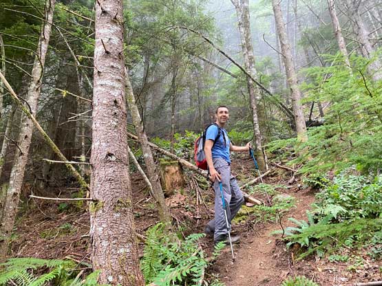
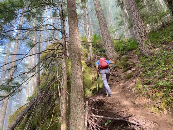
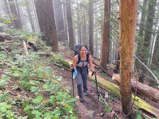
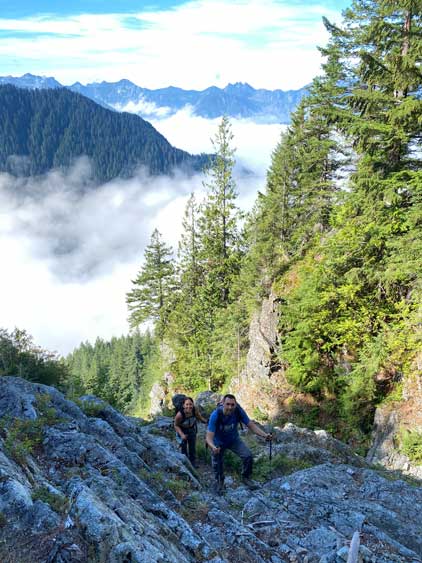
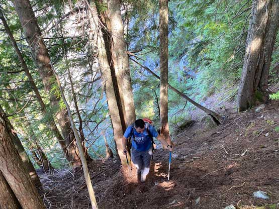
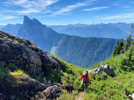
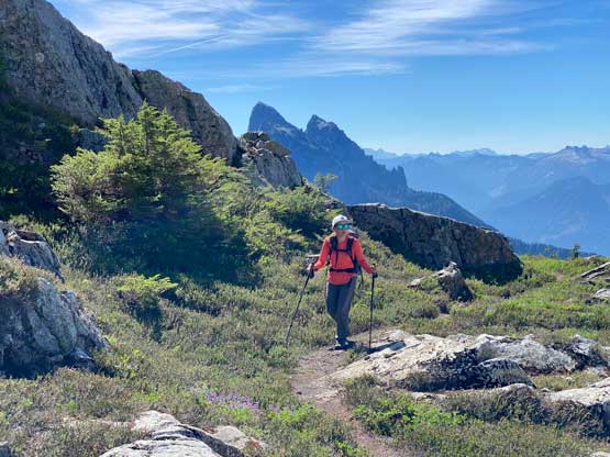
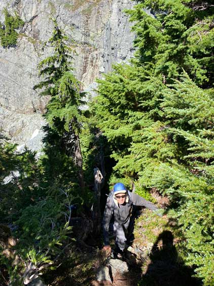
The “beta” of this peak is overwhelmingly detailed on the internet such that I decided to just download a few sets of GPS tracks and use our own navigation sense. In this modern era with GPS technology one really does not need to provide information like “200 yards in then turn left”. It’s much more useful to just provide a track log for the public to download. After crossing two streams on slippery rocks and navigating a few confusing junctions we came to the lower part of the climber’s trail which was more like something in the North Shore Mountains of Vancouver. It was steep but the trail-bed was clear. Higher up we traversed rightwards across a rocky section with minor down-climbing and scrambling. We accidently down-climbed a 3rd class and exposed chute but we quickly regained the trail and made a mental note for the return. The trail beyond that was overgrown but still mostly easy to follow. Many people commented on how bad the bushwhacking was, but I wouldn’t even call this “bushwhacking” as we were entirely on a trail with very clear foot bed. We also did a few optional scrambling steps to the left or right of the path, mostly to add some fun time into the otherwise monotonous slog fest.


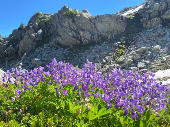
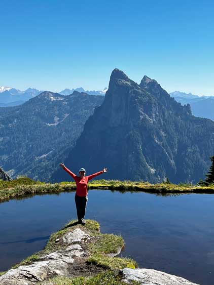
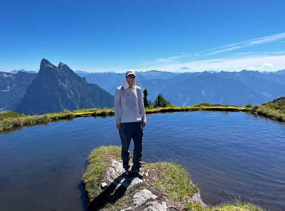
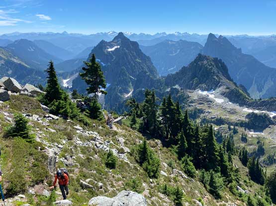
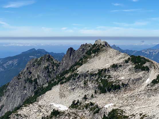
We followed the path bypassing Infinity Tarn without even realizing that but we made a note to check that out on the descent, which turned out to be very worthwhile. There’s then a minor gully to descend into. The trail takes a more roundabout route but we said to just down-climb straight into it for more fun (class 4 and slippery). We then worked our way around the east slopes of “Tailgunner” and made another annoying long descent and traverse to the base of Gunn Peak’s upper mountain. We finally decided to take a needed break before committing to the scramble.


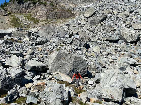
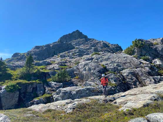
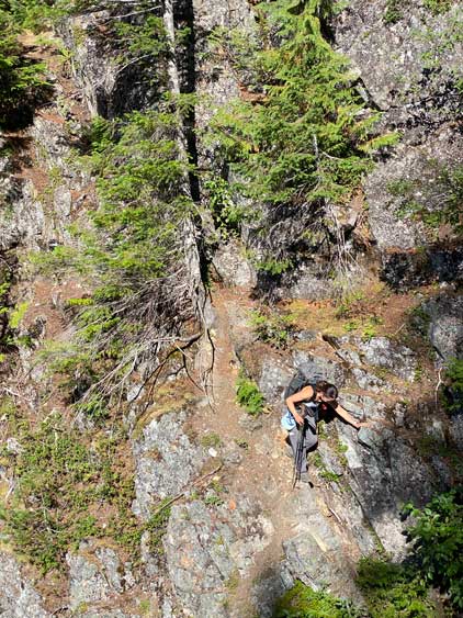
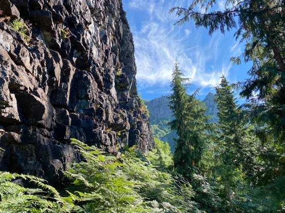
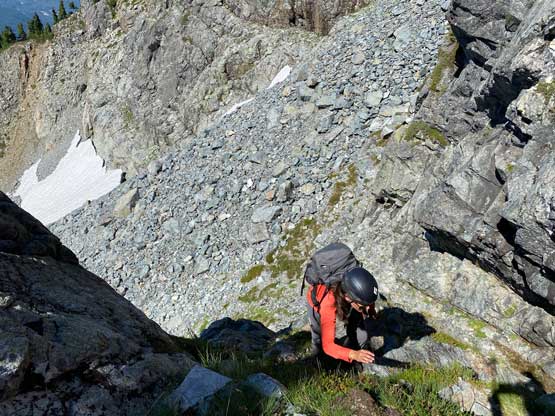
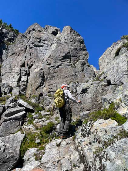
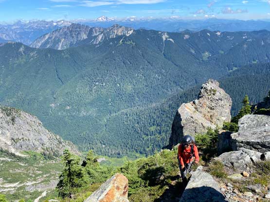
There’s an unavoidable boulder field to ascend which took a while. We then located the correct “hidden ramp”. I’m not sure what’s the standard way to get into the ramp but we opted for a route climber’s right of the fall line. The terrain appeared drier on that side but the scrambling was class 3 with moderate exposure and some loose rocks. The rest of the scrambling to exit this ramp was straightforward and we could even follow a path here through the vegetation. We then easily traversed/ascended to the high notch on the east ridge. The ledge traverse on the north side of the east ridge was rather trivial (in fact, just a walk) and we were soon standing on the summit soaking in excellent views.


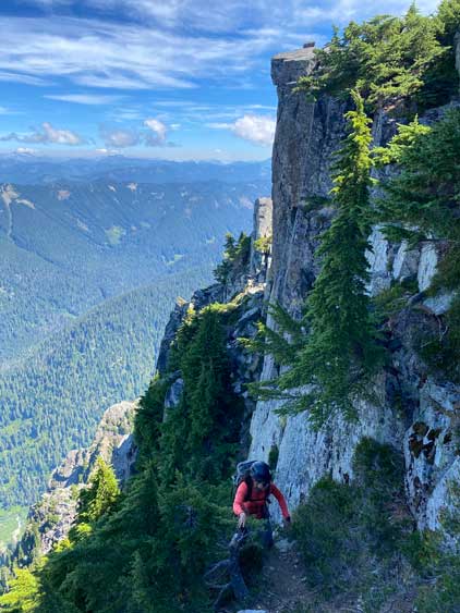

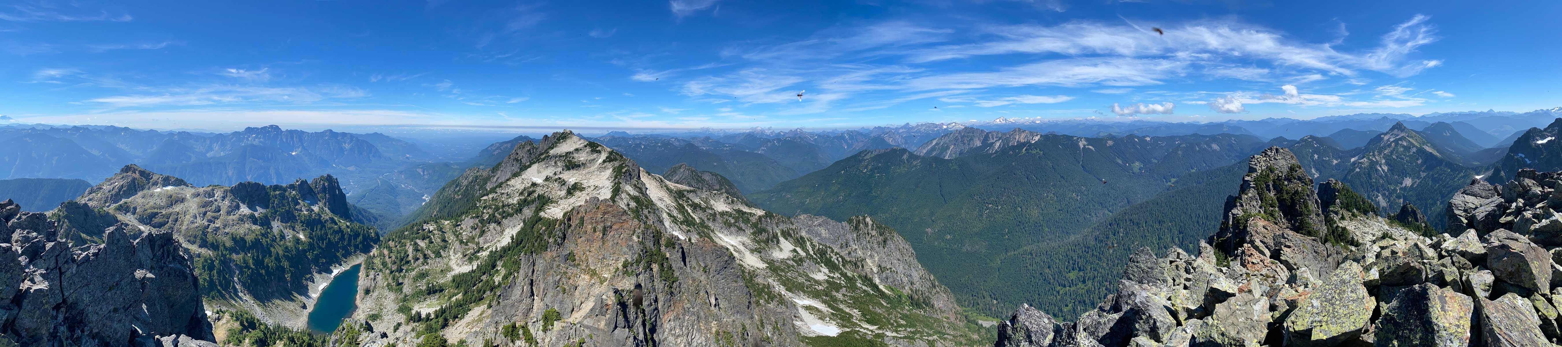


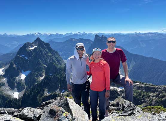


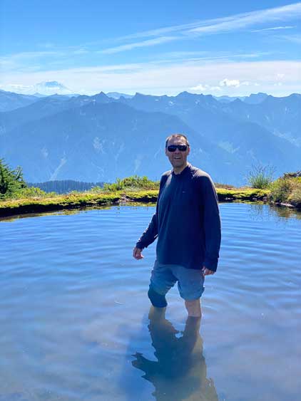
We stayed on the summit for about an hour. The descent off the upper mountain was not a problem by following our own line but we did have to check the GPS several times to make sure we took the correct ledge or gully. That down-climb at the bottom of the hidden ramp required a few moves facing into the slopes. After traversing around “Tailgunner” we followed the GPS to the Infinity Tarn and spent another half an hour there taking pictures. Vlad even went in for a dip but it was too shallow for a swim. The rest of the descent was very tedious but relatively uneventful and our round trip time was just over 8 hours including everything. We eventually got back to White Rock at 10 pm.