Cline Fire Lookout
March 15, 2014
2050m
David Thompson Country, AB
With high avalanche danger persisting throughout most parts of the Rockies but not-so-bad weather forecast, Ben and I were looking at another smaller ascent somewhere in the front ranges. After the howling wind and warming temperature in the past week, I’m sure we could have done something slightly more aggressive than just Cline Fire Lookout. But given the fact it’s already mid March, we figured it’s better to squeeze in a trip that requires lake crossing. For low elevation lakes like Abraham Lake, mid March is probably the latest I want to cross.
Cline Fire Lookout is merely a bump (that’s barely above treeline) on the southwest corner of Mount Michener massive. (It has nothing to do with Mount Cline). In old days (before Abraham Lake was formed) people had gone up there often, but nowadays the trails had already degraded. To get there involves bushwhacking pretty much from bottom to top. I was not super keen on this but I knew I’d do it someday due to the fact it’s well documented in The David Thompson Highway – A Hiking Guide book and the name being official. Despite the lack of technical difficulty, this is not a easy summit to get to mainly due to the short climbing season. It’s doable in summer but you have to travel a long ways through bush from Siffleur Falls trail-head (this is what’s described in the guidebook as a 3-day trip).

Cline Fire Lookout ascent route in winter. GPX DL
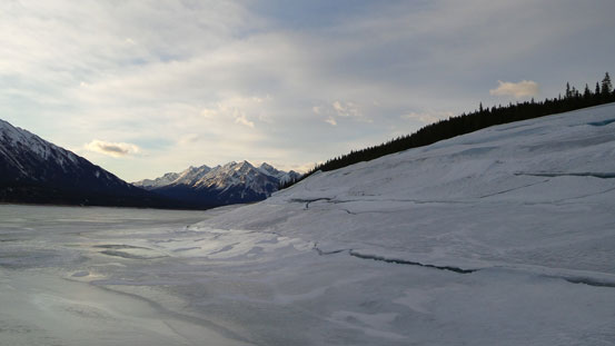
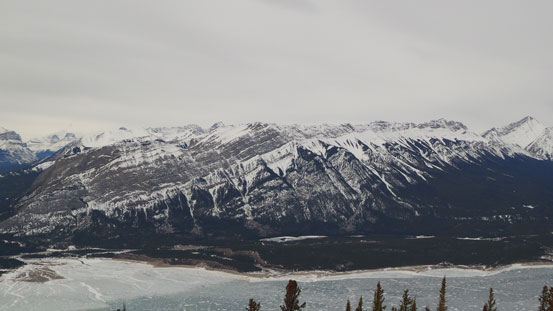
So on Friday evening, we found ourselves driving westwards on Highway 11. It was a bit confusing where to park but we managed to locate an old road leading down towards the lake from the highway. It was a bit colder than expected and we slept in till alpenglow time. The first thing to do was losing a ton of elevation down to Abraham Lake. The snow was deep and unsupportive and we had to strap snowshoes on right away. Down to the lake, ropes on, crampons on, we soon started the crossing. It was trickier than expected due to open water and some questionable areas. The ice looked to be very thick and I think it’s just a pool of water on the surface of ice, but that did look pretty scary. We picked the narrowest section of the lake to cross so in short time we were on the other side, where the tedious bushwhacking officially started.

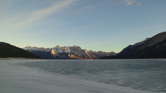
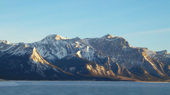
Morning view towards Ex Coelis
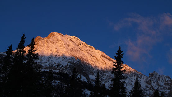
Alpenglow on Elliot Peak
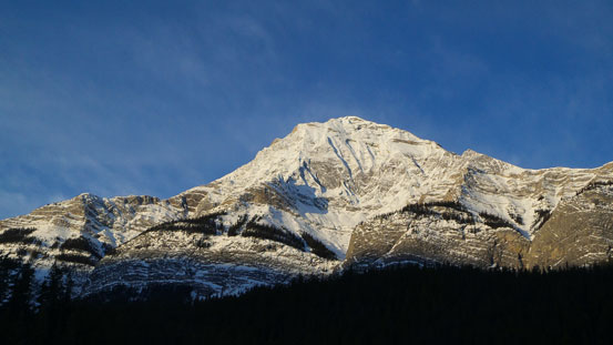
Elliot Peak
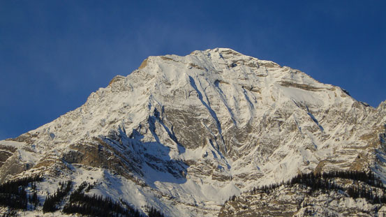
A zoomed-in view of Elliot Peak
Down to Abraham Lake now
Allstones Peak and Abraham Mountain

Crossing the “lake schrund”
Lake shore view
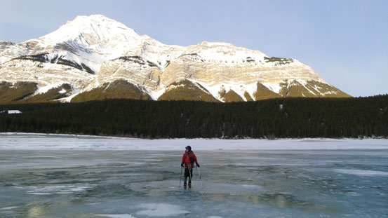
Crossing Abraham Lake
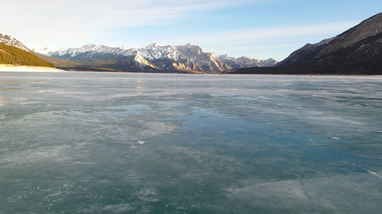
The lake
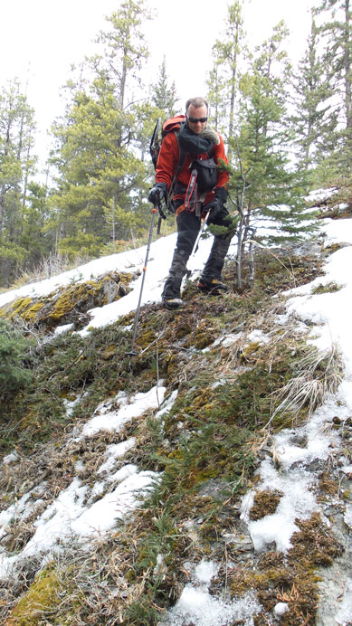
The worst bush was the initial flat section of about 1.5 km long. Timbers were pretty dense and there were many dead falls to negotiate. Patches of snow were pretty deep as well and we were struggling whether to keep the snowshoes on or not. We managed to keep ’em on for a long time until a steeper hill. Some steep rock steps forced us to remove them. (I think it’s easier to remove the snowshoes earlier as we discovered on the way back, but it’s all about personal preference). Once we hit the first ridge we trended sharply climber’s left following this ridge up. Snow forced us to strap ‘shoes on, and not far after that, the theme shifted from bushwhacking to post-holing. The snow was horrible. A thin crust (that couldn’t support our weight) on top of pure sugar. For every step we not only sunk to the bottom, but also slid backwards, and our progress was slow. Thankfully this is not a high mountain so in any case, we were getting there.
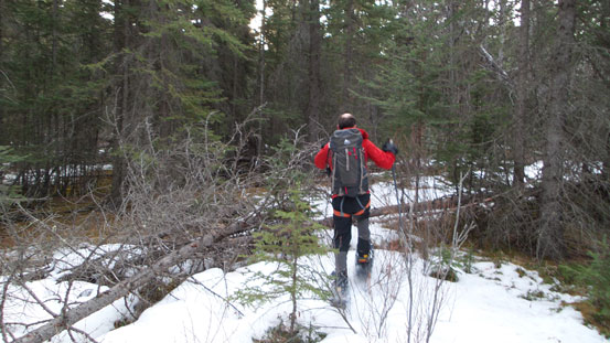
Started bushwhacking

Typical bush

Steep terrain in the forest

Some occasional views
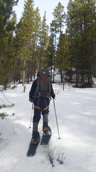
Strap snowshoes on again
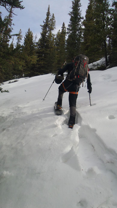
Now the post-holing started…

Gained the main ridge, looking up
This ridge eventually led us diagonally towards the main ascending ridge. There were still a couple hills to go over after cresting the main ridge, and there was definitely more elevation gain than appeared. And once on the final summit ridge, we were not done yet. It appeared we’d start losing elevation into the bush but according to my GPS, the actual summit lies somewhere 400 m down the ridge so we kept going. And yes, we eventually started going uphill again, and there was a big fire lookout structure and a helicopter pad on the summit. The view was good but weather had already turned overcast.

There’s quite a “Lookout” on the summit…

Some information about this Lookout

Ben wondering around on the summit
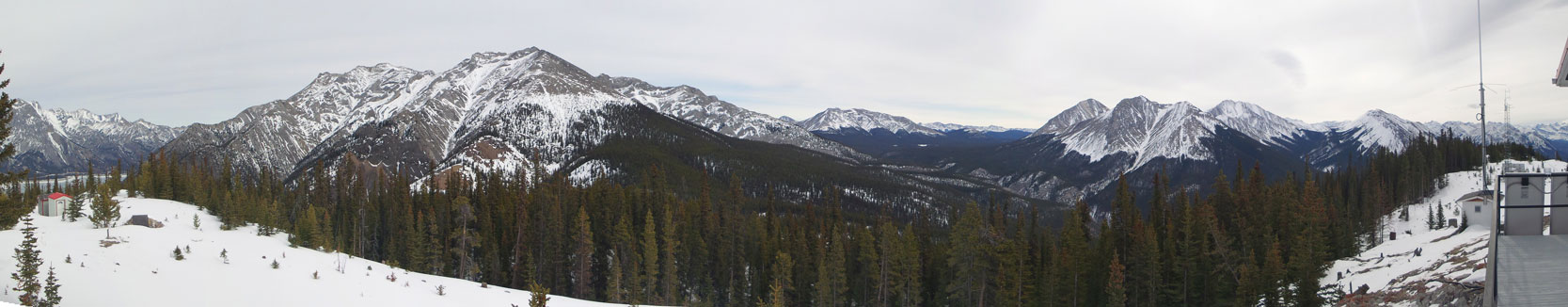
Summit panorama towards east. Click to view large size.
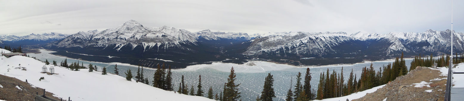
Summit panorama towards west. Click to view large size.

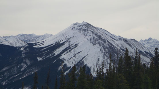
Mt. Michener

Some rarely seen (unnamed) peaks in David Thompson Country
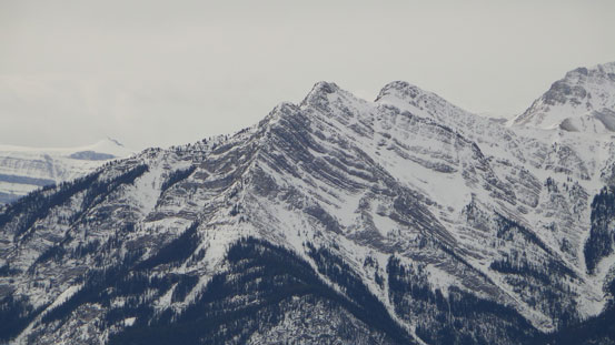
This ridge is part of Mt. William Booth
The twin summits of Mt. Ernest Ross

Peaks buried deeply in Siffleur Wilderness
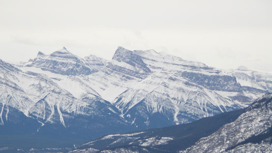
Mt. Loudon and Mt. Peskett

Whitegoat Peaks
The long ridge of Mt. Stelfox
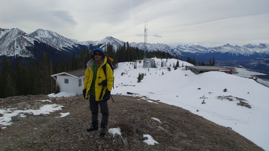
Me on the summit
We didn’t linger long since wind had picked up too. Coming back we managed to retrace our steps most of the way until the last bit. We kept the snowshoes on our backpacks for the final dead-fall field and turned out to be way faster than on the way in. Back across the lake, the last uphill walk on that old road felt like endless. It took us a good 30 min just to get up that road… Our round trip time was slightly more than 6 hours. Considering my round trip time on Mt. Michener was 7 hours, this was not an impressive pace. Even though it’s much lower than Michener, the bush and snow slowed us down significantly.
Descending
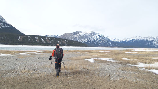
Down to the lake
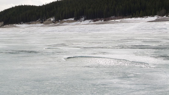
Pools of open water on the lake…
Cline Fire Lookout turned out to be a nice objective in bad condition. Not sure how much I’d recommend it due to the bushwhacking, but if you look for some variety in David Thompson Country then it’s a good one to think about. I’m sure not many people had gone up there.
