Volcán Acatenango
March 21, 2024
3975m
Antigua, Guatemala
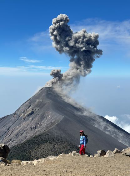
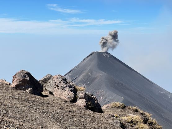
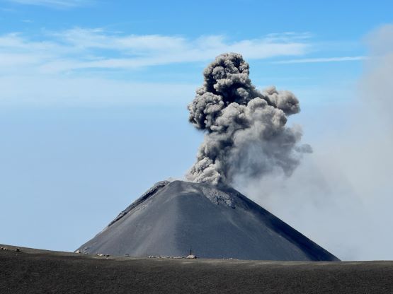
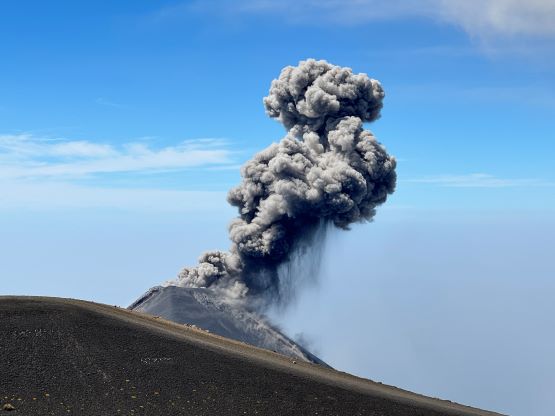
Watching Volcán de Fuego erupting (every few minutes) from the slopes or the summit of Volcán Acatenango is the most iconic and popular adventurous activity in all of Guatemala, but that’s not the primary reason why I did this peak. To me the statistical significance is much more important, as this is the 3rd highest as well as one of the 6 “ultra prominent peaks” in Guatemala. The nice views and watching the other volcano letting go would then be the “bonus” for me. Most hikers do this over 2 days to catch the sunset and sunrise views, but I preferred the day-trip option and I do not care that much about the sunrises. Fortunately despite the popularities (hundreds of people going up on any given day) the authorities hadn’t put up a mandatory requirement of hiring a guide, so Kate and I were again free on this objective. We would still use Oswaldo as the private driver for the day, but would do the peak on our own. Unlike most of the other people we would leave Antigua at 5 am to start hiking at the first light. We again, spent the previous evening walking a little bit around the city but I did not want to walk too much due to our exhausting day-after-day itinerary. I also thought the food were too expensive (worse than in Canada or U.S.) and I eventually opted to try some cheap-ass street food, which turned out to be rather excellent. I wished we tried more of those street food, but I was also concerning about catching some stomach bugs (which could then ruin the hike). It was a difficult balance between going cheap versus having the highest chance of success.


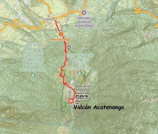
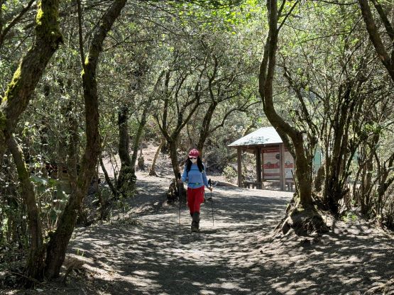
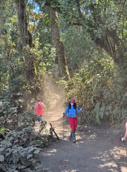
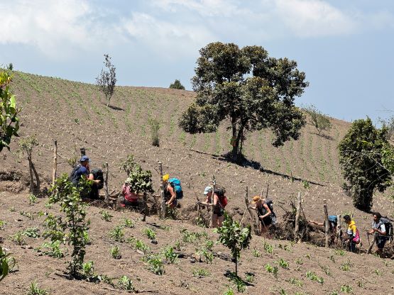
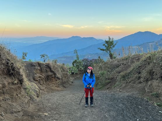
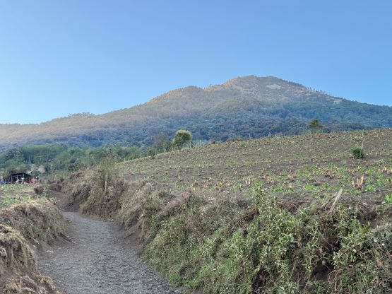
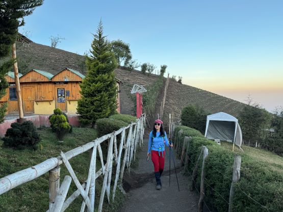
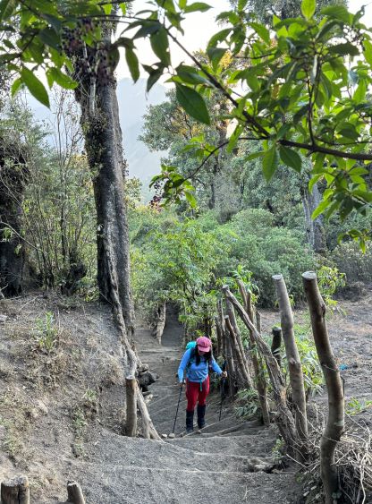
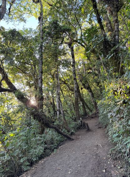
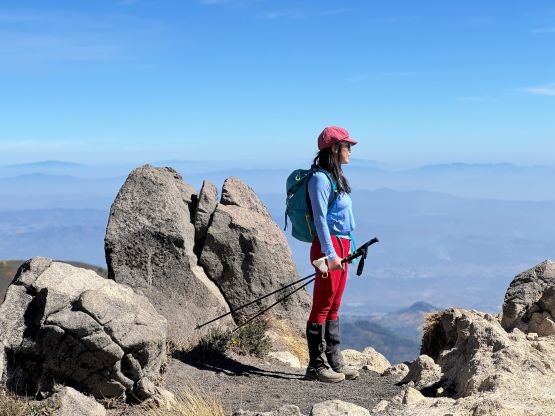
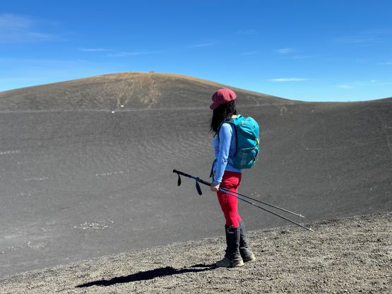
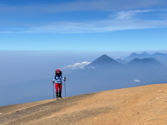
Oswaldo showed up at 5 am and we got to the trail-head in La Soledad at 2450 m elevation an hour later. The horizon was bright enough such that I ditched the head-lamp in the vehicle (no need to carry extra weight). I did carry a lightweight jacket as this peak is rather high, but that did turn out to be training weight as the day’s just as hot as this past week. The initial few hundred meters of gain was in some farm lands and the trail was very sandy and tiring to walk on. A few zig-zags later following the narrow farm trails we came to the registration office, which was fortunately closed. Kate and I were running extremely low on the local currency and I learnt in the previous evening that the entrance fee would be 110Q per person. I was quite angry as I absolutely do not support this kind of money grabbing. We borrowed 200Q from the driver, but we timed ourselves well enough that we had no one asking us to pay anything. I was sure that an hour or two later we would have to pay once the overnight hordes started to show up. The trail was well-defined above the registration, that we were able to make quick progress without realizing. There were multiple trails and we picked what seemed like the “standard way” up until an important junction at 3650 m. We met multiple extremely large groups descending, and were forced to take out the Covid masks as the dusts were insane.


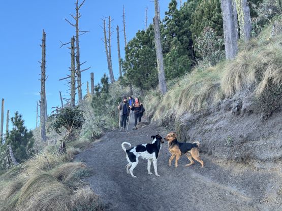
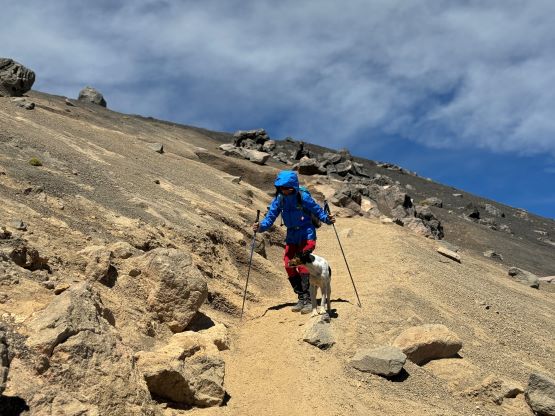
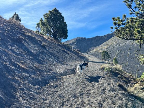
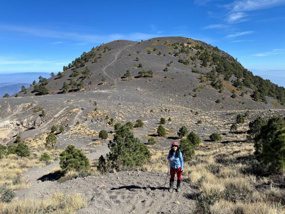
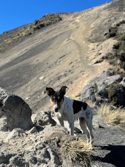
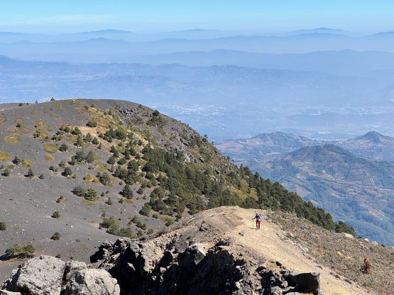
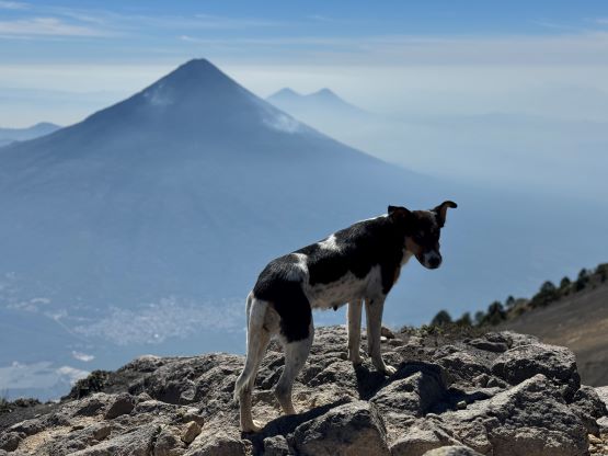
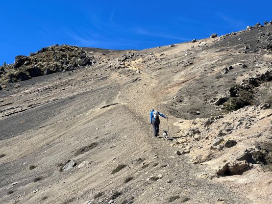
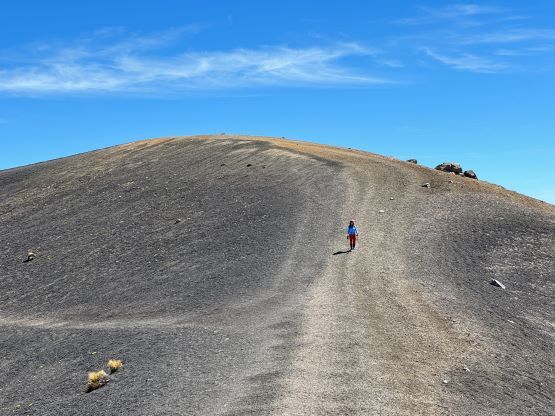
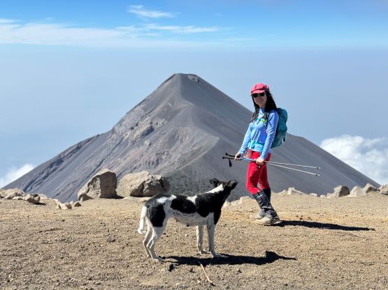
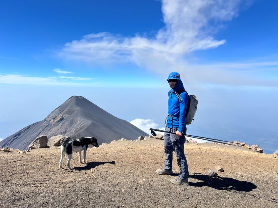
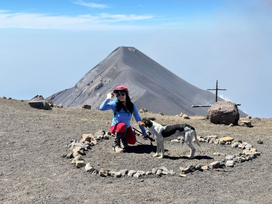
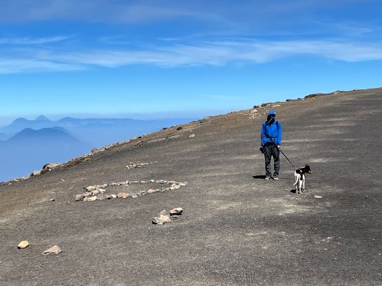
I think most of the groups continued southwards from this junction towards the broad pass between Acatenango and Fuego, but I led us turning climber’s left towards the other saddle between Acatenango and its north peak. This option definitely saved us from breathing in more dusts as the route was kind of quiet. We did meet one group (of locals) camping at this saddle but that’s it. There was no one else on route until the descent. The push up the summit “cone” was on some loose scree and Kate really disliked that kind of terrain. I thought she should go scrambling in the Rockies for a few months because if you come from a Rockies background you’d consider this as rather “solid”. Nevertheless I made quick work up the choss and had to wait for Kate to catch up a few times. We eventually dragged our tired selves onto the crater rim, and opted to do a clockwise loop mostly to give ourselves enough time to watch Volcán de Fuego erupting. I think that volcano cummed every few minutes. By doing the clockwise loop we would hit the true summit last, so once there we took a long break. A dog had been following us all the way up from somewhere above the registration office and I gave her 1 L water along with some redundant food. This dog had changed my perception about the Guatemalan dogs as all of the previous ones we met were extremely aggressive and unfriendly.


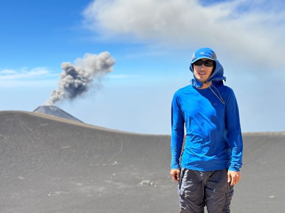
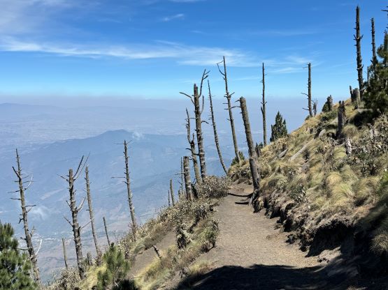
It was eventually the time to descend. Kate did don her hardshell jacket as the summit was quite windy, but I was able to manage in just t-shirt while lingering around for at least an hour on the summit and the crater rim. I made a single dash down the loose “cone” and had to dump a shit ton of rocks out of the shoes at the main/north peak saddle. We then met a large group of Mayans on their way up, and saw no international tourist until joining the main trail. I think most of the tourists are not aware of this north side route. The second half of the descent reminded me Fuji in Japan thank to at least 200 tourists huffing and puffing, mostly in extremely large guided groups and some significantly overweight and clearly not going to make it. I’m sure most of them went straight from cities at sea level to this hike (camping at 3700 m) and that seemed like a dumb idea if you ask me. The way most of them struggling suggested very improper (or basically none) acclimatization. Kate and I nevertheless, put on our Covid masks and jogged most of the way down. The loose and sandy trail made for an ideal trail-running descent, and we finished the round trip in 6 hours just as expected. I had told Oswaldo to come back and pick us up in 6 hours and he was already there. We then drove to our final hotel within walking distance to the airport in Guatemala City. I assured him that after serving me well he would get unlimited clients in the following years as I’m sure many follow-up parties would copy and paste our itinerary as I believe this was the most efficient way in getting these peaks done (at least 1 peak per day for 10 days with no rest), at a reasonably low cost. It could be cheaper had we rented a truck and driven it ourselves, but I have no ability to drive manual transmission, am not into mechanics and do not have the skills to handle the traffics in large cities in the 3rd world countries. When it comes to driving I simply have to pay more to cover up my inabilities.