Cassiope Peak
January 8, 2023
2284m
Pemberton, BC
Cassiope Peak on the very southern edge of Place Glacier Group is often scrambled together with Saxifrage Peak in summer as described in Matt Gunn’s Scrambles in SW British Columbia, but I prefer to do the peaks in Pemberton area in winter, if possible. The main reason has been to save the precious summer days for peaks that can solely be done in summer. The standard summer route of Cassiope/Saxifrage isn’t practical in winter due to the higher-elevation logging roads access, but John Baldwin had illustrated a winter route originated from North Joffre Creek off the Duffey Lake Road, as per his Exploring the Coast Mountains on Skis. To do this route on snowshoes is considerably more involved than the scrambles in summer so that’s why I had been debating the options for years. I eventually pulled the trigger only because of Elise’s suggestion, but I went back to the maps and proposed an exploratory route that seems to have tamer terrain than the one in John Baldwin’s book, even though it’s likely a few kilometers longer.
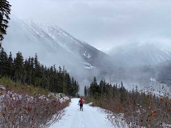
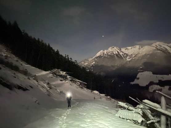
Elise suggested Cassiope Peak even though she needed to be back in Vancouver no later than 7 pm for nightshift work. Given the various unknown factors of this route I said we should plan to summit at 8-9 am and that further meant we had to leave Vancouver just after midnight. In the previous day I worked till 9 pm and didn’t finish packing and the other evening routine things until 11 pm. The alarm was set at 11:45 pm so needless to say, I got zero minute of sleep. I picked Elise up from Burnaby at 12:30 am and drove us up the familiar Sea to Sky Corridor in the trusty Tacoma. A construction at Porteau Cove costed half an hour’s delay and I had to drive considerably slower than the speed limit as I was feeling extremely exhausted. Elise had to eventually take over the drive to get us to the small parking area at North Joffre Creek and we didn’t start walking until 4:20 am, more than an hour later than planned.
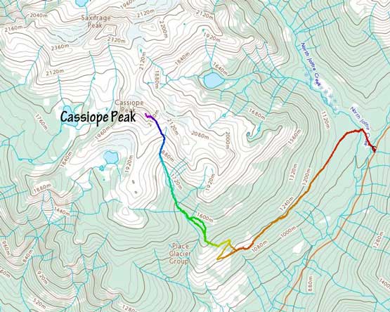
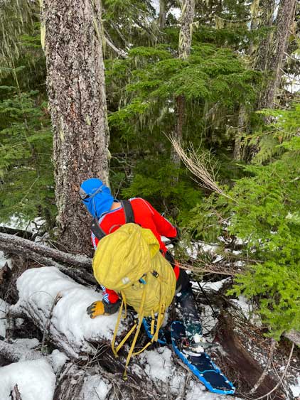
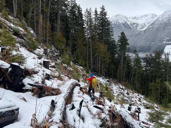
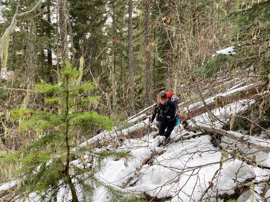
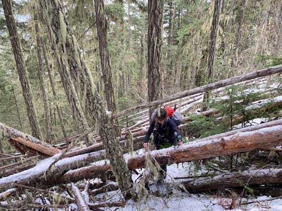
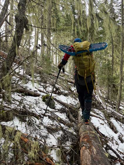
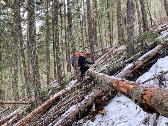
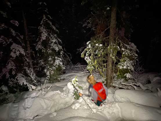
The start of my proposed route is the same as the ski route but a few junctions later we took the narrower southern branch of the logging roads which essentially traversed across the SE flanks of Cassiope Peak at 1100-1200 m elevation for 4-5 km distance. There was no skin track anywhere to be seen so we were on our own trail-breaking for the entire ascent. That’s as expected though as I do not think this route gets done often and in fact, there had been no “beta” whatsoever on the internet and I found it solely because of Gaia maps and Google’s satellite images. The first key connection in this route was a 300-m stretch of forested traverse to link up two sets of logging roads system. I thought we’d be simply snowshoeing across but the reality was cruel. There wasn’t enough snow coverage at this elevation in the dense forest and the pick-up sticks were beyond imagination. After frustratingly taking the snowshoes off it took us over half an hour to cover this 300 m horizontal distance while crawling over hundreds of dead-falls. The other option was to ascend more than 50 m of extra elevation to bypass this forested traverse on cut-blocks. Honestly it could be the better option but without any “beta” it’s purely a pick-your-poison type of adventure for us.


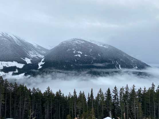
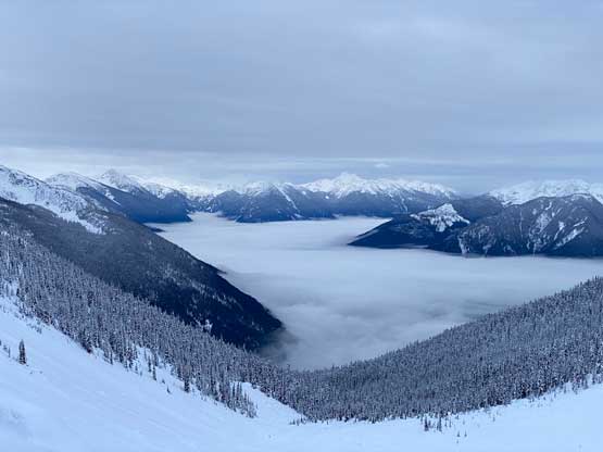
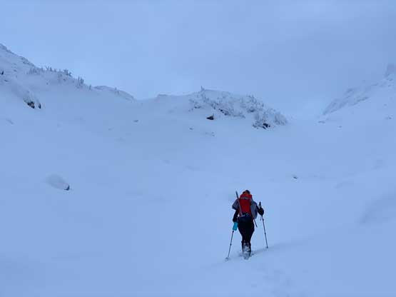
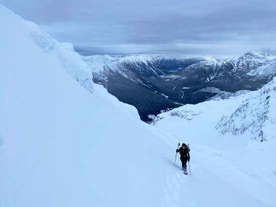
After linking to the other set of logging roads we had to frustratingly lose 50 m of precious elevation before starting to ascend again. A few more switchbacks later we finally arrived at the road’s end but now we had to deal with more forests. Based on the pick-up sticks situation we just encountered I wasn’t even positive about the feasibility of this route but thankfully the snowpack depth increased drastically from 1300 m to 1600 m. The start of the bushwhacking was indeed bad, but didn’t last long. At one point we made a minor route-finding error by ascending too far up on climber’s right but we quickly corrected the error by doing some descending traverses. Eventually we dropped into the main Cassiope Peak’s south side valley at 1500 m elevation. The pick-up sticks were nowhere to be seen but the post-holing took over. Even with 30′ snowshoes I was sinking knee deep on average and that was an exhausting show to break trail to treeline. I was hoping to catch some sunrise colours but we were late by about 20 minutes.


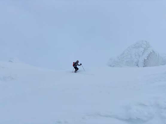
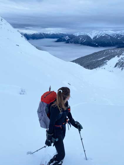
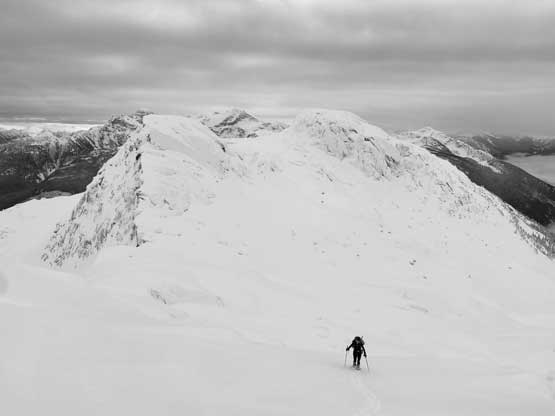
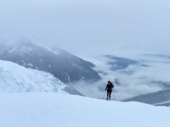
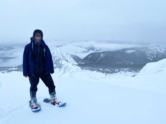
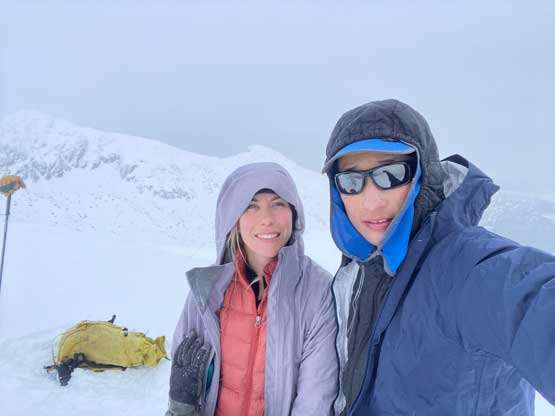
We then traversed across more open slopes in flat light conditions into the alpine zone and ascended the middle of this valley for 300 more meters of elevation. The snow conditions were slightly better than lower down in the trees but the trail-breaking effort was still massive. Thankfully the inversion views behind us was motivating. We trended climber’s left eventually and aimed straight towards Cassiope Peak’s SE Face where the final ascent would take place on. This is the least steep aspect of the peak based on the topo maps and I was still surprised by how actually steep it was. I pretty much led a line staying in the middle of the face but trending climber’s left on the upper half, and at times the steepness of the slope was putting my Lightning Ascents snowshoes in test. There was no sign of instability to be seen but we did read about the deep, persistent problems about this year’s snowpack that could wake up and trigger large avalanches. We decided to take the risks and hoped that nothing would move and in a short while we were standing on the summit. A snow squall was approaching and in no time we lost all of the views.


In no time we started the descent. Instead of glissading we walked down our own tracks until 2/3 of the way down, where we finally sat on our butts for some faster rides. After clearing the steep zones of the SE Face we leisurely plunged down the south valley all the way back to treeline where we took an energy break. Further down we bypassed that route-finding error by staying closer to the creek and that avoided any unnecessary elevation regain and the next stop was back onto the logging roads. We then subsequently took a massive short-cut through a cut-block and some dense forest chocked with pick-up sticks, as both of us were tired of plodding on FSRs. While plodding back I kept thinking to regain that 50 extra meters of elevation to bypass the horrendous pick-up sticks field, but decided to just embrace the known. Following our own foot prints back through the dead-fall fields wouldn’t be that terrible after all. The rest of the descent was uneventful but extremely boring. Our round trip time was 9 hours and I was completely spent by the time I plodded back to the truck. I barely had enough energy to drive us back to Pemberton and then Elise took over the drive to Whistler. We stopped for food in Splitz Grill but then got sucked into the homewards skier’s traffics. We eventually got back to Elise’s place at 5:30 pm earning only enough time for a shower and some food before her exhausting nightshift work, and I did not get back to my own home in White Rock until another hour later.