Picacho Peak (AZ)
March 16, 2017
1027m
Tuscon / Picacho Peak State Park, AZ
Picacho Peak is a formidable spire sticking out of nowhere in the middle of Sonoran Desert in southern Arizona. Those who travelled either direction, especially from north to south along I-10 corridor between Phoenix and Tucson are likely inspired by the look of it. At first glance it appears technical from all sides but in fact, there’s a well constructed trail bringing thousands of hikers to the summit each year. The ascent is assisted by ladders, chains, handrails and concrete steps so suitable to anyone with some hands-on scrambling experience.
The appear of this peak makes is a major lure to peak-baggers like myself but the lack of elevation gain (less than 500 m gain) meant I did not have to treat it seriously. I figured a couple hours should be more than enough and the location of Picacho Peak suggested I could easily squeeze it in along with the drive from Phoenix to El Paso, Texas. On the 8th day of this spring break vacation trip I did not even bother with an early start. I leisurely woke up at around 8 am in Casa Grande, had some breakfast and then 30 minutes later I was parked inside Picacho State Park. This park is patrolled very frequently so it’s necessary to obtain a day pass which was 7 dollars per vehicle.

Picacho Peak via Hunter Trail. GPX DL
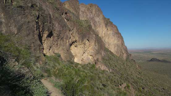
The summit is reached via Hunter Trail and as expected, this trail was very well defined. The trail bed was a bit rocky and loose at places but what else you would expect considering the steepness of this objective. In short time the trail brought me to the base of the cliffs and then did a long traverse towards climber’s left. The trail then took a sharp turn upon reaching a corner, followed by a long rising traverse back over climber’s right to hit a high saddle. Much of this stage was done together with Morgan, a local hiker that I met on the trail.

The start of this Hunter Trail
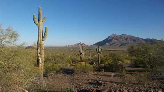
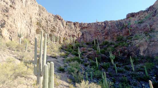
This was my first time seeing the Saguaros – the signature species of Sonoran Desert

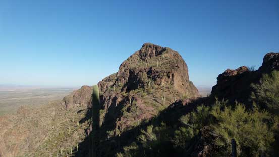
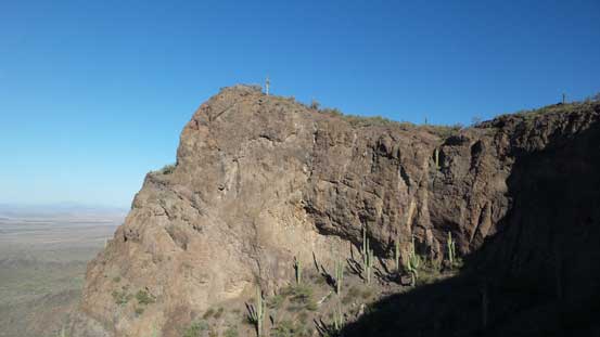
This is the summit of Picacho Peak. Looks pretty daunting
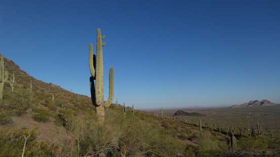
Another picture to show the saguaro
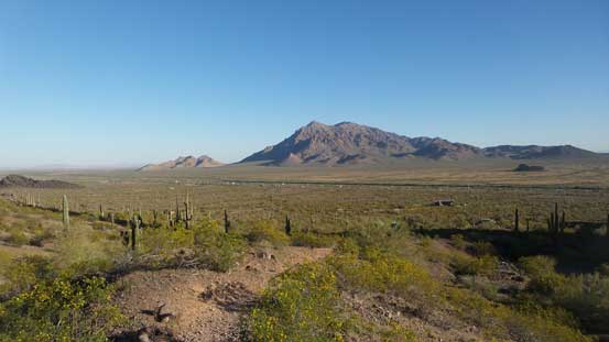
Newman Peak in the distance
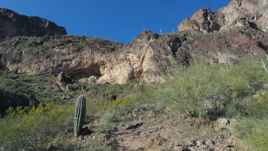
Approaching the first set of cliffs

Morgan and his friend going up underneath the cliffs

Looking back at the desert floor

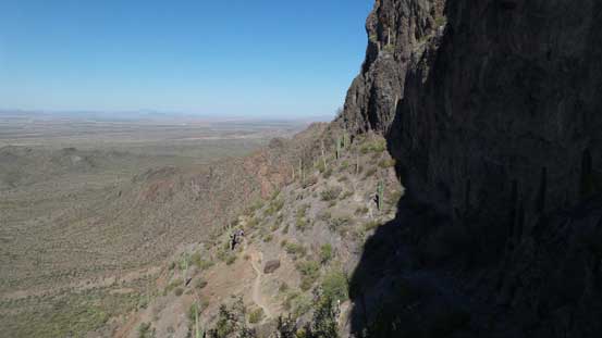
A sideways view across the shear cliffs
Another look at the lower cliffs

Following the trail to the first major corner

Cutting back now, another sideways view

Traversing directly underneath the second set of cliffs

Can’t get rid of the views.
Beyond this high saddle the route became a bit technical for those without scrambling experience. Firstly it went down directly underneath the overhanging cliffs. This descending section was fairly long and the ground was slabby and polished (thank to the amount of traffic), but assisted by handrails and chains so it’s pretty secure. Then this Hunter Trail joined the other trail coming up from the “backside” and the combined route then took a traverse towards down-climber’s left (east). Along this stage I passed at least 2 or 3 groups of hikers and it took me no time to arrive at the first scrambling step – a 3rd class step assisted by chains to gain a “hanging bowl” which was super fun.
Crossing over to the “backside” of the high shoulder now.
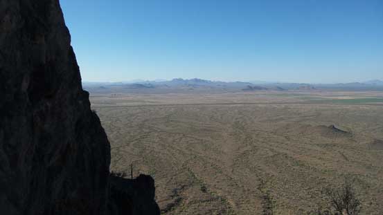
The southwest side opens up. It’s nothing but just the vast desert.

Steep descent to join the other trail

Traversing the backside now.
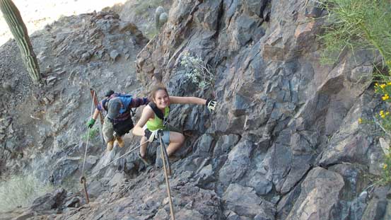
Another group having fun on the lower scramble step.

Topping out on this lower step.
The traverse across this bowl was not so much fun but there’s more hands-on stuffs coming. The next challenging step was a very steep wall and again, assisted by chains and handrails. Pulling myself up those was quite different than what I normally do in the Canadian mountains but I like different things. Traversing back climber’s left the trail brought me to the final summit ridge and then there’s still fair a bit of plodding to reach the highest point. I managed to beat all others and got the summit to myself for about 10 minutes before everyone else showed up.
This is the bowl that I had to ascend and traverse across

The girl from the other group topping out on a small rise.
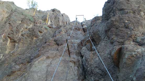
This is the upper scrambling step.
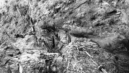
The same step, but looking down from above
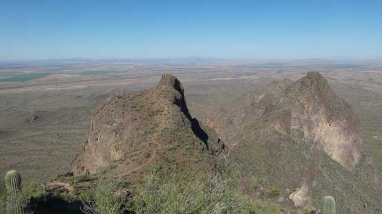
The sub-peaks of this massif are equally impressive.
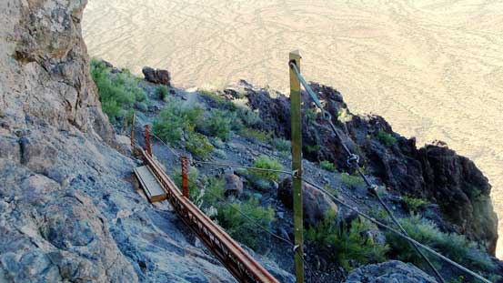
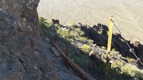
The final traverse to join the summit ridge. Note that tiny piece of bridge.

Onto the summit ridge now.

Summit Panorama from Picacho Peak. Click to view large size.

Looking down at the lower sub-summits.

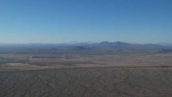
Looking north at where I-10 travels through.
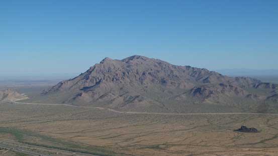
Newman Peak

More about the I-10 corridor and the vast Sonoran Desert
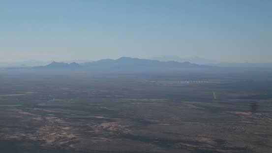
A zoomed-in view towards Tucson Mountains
Another picture to show the desert and the distant mountains

Me on the summit of Picacho Peak

Another picture of me on the summit.
Eventually the summit got too crowded for my like plus there’s virtually no sheltered place to hide from the brutal Sonoran Desert sun so I leisurely started the descent. I teamed up with Morgan and we had some pretty good time exchanging stories. I also got some neat beta about the surrounding areas which surely could come handy a few days later when I get back from Texas. There’s not much to document about this descent other than reversing the ascent route. And yeah, near the end you want to be careful with loose pebbles so not to take too many spills.
Time to head down.

Looking back towards the summit.
Back to that bridge section.

Morgan carefully descending this step.
The traverse across the “backside” now catching some sunlight.

Grunting back up towards the “high shoulder” now.

Another group slowly making their way down this slabby section

Back to the “front side” now

The typical conditions on this trail. Steep, loose and rocky

Saguaros

Almost done.
It was only 10:30 when I got back to the parking lot which meant I’d still have plenty of time to kill. The final destination of this day was Pine Springs, TX but I’d be happy to make just to El Paso which is about 110 miles short. I was still debating which peak to bag next but first of all I’d have to resume the southwards driving to the city of Tucson, AZ. And then the decision was made to drive up Kitt Peak for some views.
