Slhanay (“Stawamus Squaw”)
July 15, 2020
665m
Squamish, BC
“Stawamus Squaw” is one of the two unofficial names of the summit immediately to the north of Stawamus Chief next to the city of Squamish. The alternative name of this peak is “Slhanay” as the word “squaw” is politically incorrect, offensive to indigenous women and should not appear in the name of a mountain. A few years ago I came across knowing this peak as the “Squaw” as most friends of mine, as well as sites such as peakbagger.com and bivouac.com all use this name, but over the last few years I’ve seen a process that quite a few peaks with the name “squaw” in them get renamed including “Squaw’s Tit” in the Canadian Rockies. It’s unclear whether the name “Slhanay” was the original name of this peak, or was created by the Squamish locals in recent years just to replace the offensive name but regardless the origin, maybe we all should start calling this peak “Slhanay” from now on. But in any case, this is rather just a sub-summit of the chief but for those seeking some lesser known hikes, this does provide a good alternative of the uber-busy Chief’s trail. The summit offers some views of the Squamish area but is not nearly as open as the Chief.
I knew this objective would be a good “plan B” for the area as there simply aren’t many easy summits near Squamish, but it could also serve as a decent “plan A” objective for someone new to hiking. I had been talking to Wendy Li recently about going for for a hike, as she’s just graduated from university and is now stuck in home in White Rock doing literally nothing for a couple months. I needed a day with guaranteed sunshine, which happened to be this past Wednesday. I also needed to find a peak that I hadn’t done, but yet easy enough for her. I searched in my memory data base for a good while and eventually decided on this one. There are a few trails and a few different starting points for this peak. We would not do the full length hike from the sea level and instead, we would drive up the backside access road in Shannon Creek basin, and from there we only needed to gain 160 m elevation on what seemed like a well-defined trail on my Gaia app. This then seemed like a perfect introductory hike.
There was no need to rush for this hike. At 8 am I picked her up from her home and in less than two hours we were driving up the increasingly rough access roads. I had driven Shannon Creek FSR two times in the past, and the condition was just as bad as I remembered. There wasn’t any deep water bar, but the road’s bed was steep and rough with lots of rocks. Thankfully my Taco is now equipped with all terrain tires and I just needed to keep the speed low. There seemed to have a spur road leading further towards our objective but not knowing the status of that road we opted to park at the junction with Shannon Creek FSR. This added a couple hundred meter’s walking but whatever.

Stawamus Squaw (Slhanay) hike from the backside. GPX DL
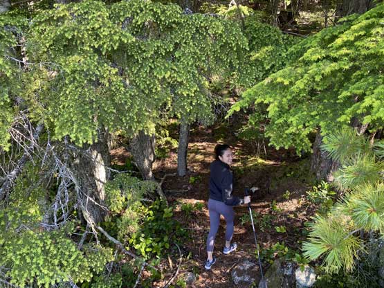
From the truck we then easily walked to the end of the logging road and picked up a well defined trail heading southwards. The junction with the Stawamus Squaw’s trail was unsigned but I came prepared with Gaia’s map so navigation was easy. The trail heading for the summit was a bit steep and slippery at places but Wendy did really well. We passed a nice viewpoint along the way. The summit was semi-open with partial views of the Squamish area and the final 10 meter or so involved some minor scrambling on granite slabs. We stayed on the summit for a long while doing some photo shooting.

Wendy starting the hike.

Our objective – Stawamus Squaw ahead

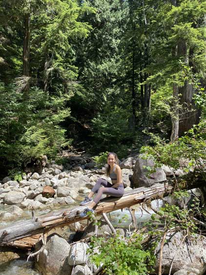
One of the bigger deadfall that we had to hop across

The view of Stawamus Chief from the lookout
Continuing the hike beyond the lookout point

Wendy seemed to have lots of fun so far.

Wendy posing on the summit of Stawamus Squaw
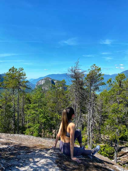
Another angle of Wendy on the summit

Wendy with Mt. Garibaldi/Atwell Peak behind
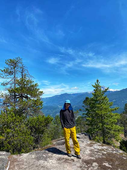
Me on the summit of Stawamus Squaw

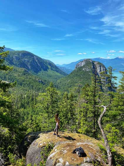
We found a cliff to do more Instagram shooting.
On the descent we briefly went off route but soon realized the mistake and backtracked. We also made a stop at that aforementioned viewpoint for more photos and then leisurely walked back to the truck.

Wendy posing at the lookout
Wendy with Stawamus Chief behind

Wendy and I at the lookout.
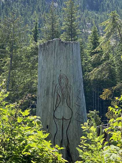
Someone’s doing some art work near where we parked…
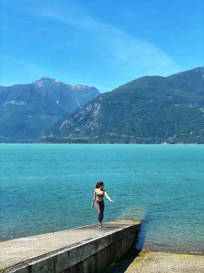
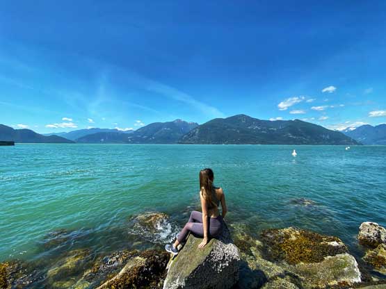
On the drive back home we were again, not in a hurry so did two tourist’s stops in Shannon Falls and Porteau Cove. I normally wouldn’t do that but Wendy had never been to these places so it seemed logical. The scene at Porteau Cove was partially good for taking more photos, so that was awesome. The rest of the drive back home was uneventful and I got back at 4 pm, just in time for my afternoon/evening work.
We stopped at Shannon Falls to play around a bit
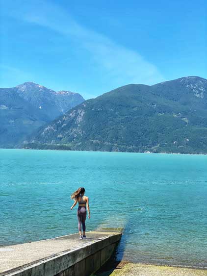
Then we made a stop at Porteau Cove
Wendy being an excellent model today!
One last photo of Wendy in front of the Howe Sound
