Quartz Hill
May 3, 2013
2580m
Banff – Sunshine to Assiniboine, AB/BC
With a high pressure system dominating for at least 4-5 days it was the time to plan big mountains. However, when the date came closer the temperature started to get nuclear. A special avalanche warning was issued predicting for a large spring avalanche cycle, and danger would rise to high/high/considerable by Saturday. The big Columbia Icefield plan was bailed, and it was left to Ben and I figuring out what we could do. Eventually we decided to give Quartz Hill a shot. Despite the fact it is a “hill”, it’s not an easy day. 26 km round trip distance on skis would be the longest I’ve done in one day. (And, since it’s Ben’s first time backcountry skiing, 26km is probably a bit too long).
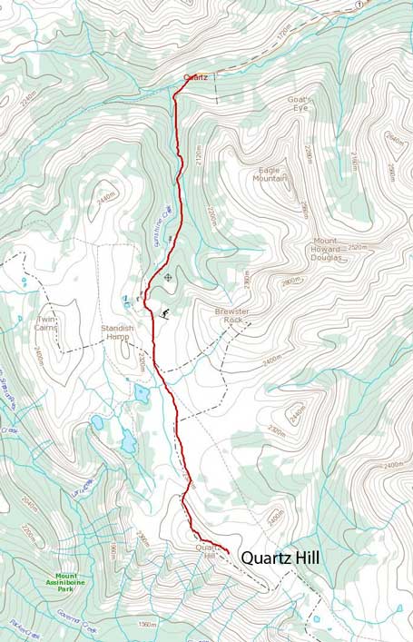
Quartz Hill ski ascent route from Sunshine Village
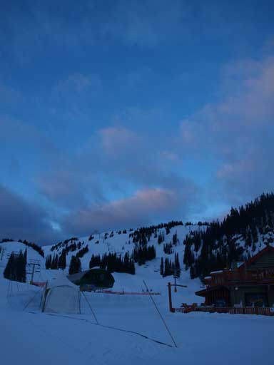
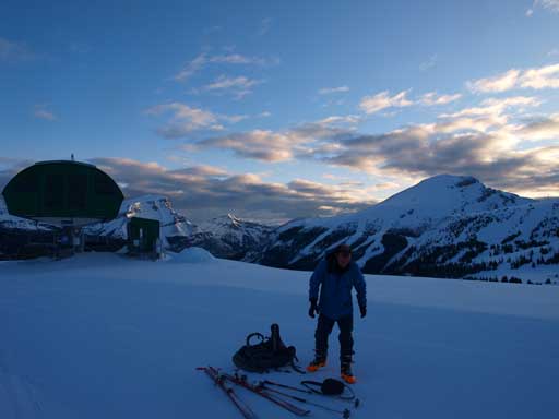
Due to the concern of afternoon heat, we had to start early. As tradition goes, I made the call of car bivying at trail-head, and woke up at 3:30 am, and started shortly after 4 am. I’d already figured out the best way to avoid blisters by ascending Brewster Rock last weekend, but this day I decided to use ski socks instead of the thin socks I used last time. I also packed that pair of thin socks just in case. It worked fine initially but once passing Goat’s Eye chairlift, my right foot started to feel pain, and I had to change back to the thin socks (only right foot though). And since then I didn’t get a problem with my boots for the rest of the day. Ben was okay with his boots at this stage as well. It’s already May so sunrise time was ridiculously early after getting used to the everlasting Alberta’s winter. It was partly cloudy instead of overcast, and the clouds provided some best view during morning hours once we got to the Village.
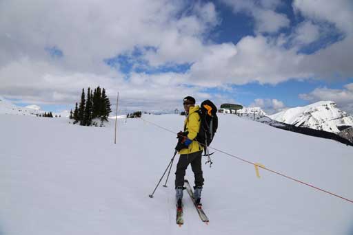
Arrived at Sunshine Village. Looking towards Standish Ridge

Gorgeous morning views!

Mount Howard Douglas. It’ll be my last peak in this area.
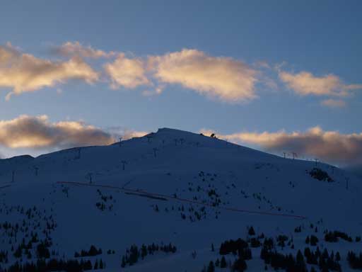
Brewster Rock. I need to go back up there for the views that I’d missed one week ago.
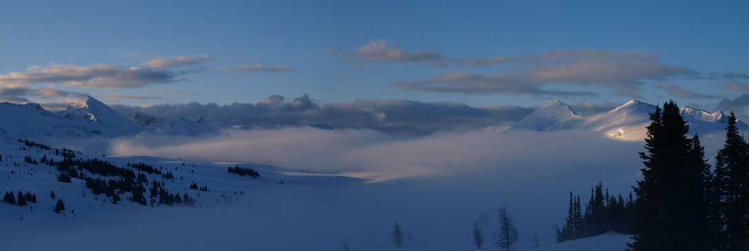
We aimed for the Strawberry chairlift. It wasn’t open yet, so we had to skin up beneath it. More morning colours started to show up as the views opened up. It was gonna be a gorgeous day instead of the forecasted miserable day. We got the first view of our objective as well as the massive Sunshine Meadows that we had to travel through. The Meadows were covered by a thin layer of fog just like the typical Icefield morning view. We were psyched for a white-out condition once we started to descend the other side. But it was hard to get disoriented since we would be aiming for a general direction. And it was our lucky day that we soon found a set of snowshoe tracks going the same direction. So we essentially followed that tracks through the no-view field.
At the top of Strawberry chairlift. Ben decided to take off skin for a short descent. I didn’t bother with that for this part.
What view down to Sunshine Meadows@

Unnamed on left. Fatigue Mountain right of center.
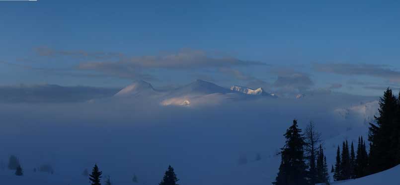
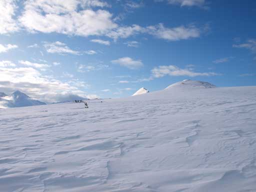
Our objective, Quartz Hill, poking through the morning mist

Almost into the mist now.

And, in the mist now…
Ben started to feel really uncomfortable with his right foot, and the pain could only accelerate even though we slowed down the pace. It was a pressure point rather than blister problem so I didn’t know how to deal with that. We took a couple breaks but it didn’t help at all. He kept following me for a long distance but eventually he had to call it a day. That’s too bad since he’d already made this far. But I knew exactly how it feels if the boots do not fit. I suffered the entire trip on Onion and Vulture, and I couldn’t even walk for one week after that. I’d made this far so I wouldn’t turn around unless the condition becomes unsafe (which I couldn’t tell from where I was standing). The temperature would shoot straight up once sun started baking the snow, so I speeded up for a bit towards false summit. View opened up once I hit the ridge. It was just beyond gorgeous. Not far up I encountered scree so I ditched skis there and boot-packed up. It was a bad call because I would soon start knee deep post-holing. I should have used the snow on climber’s right to gain false summit entirely on skis, but oh well.

The fog lifted up. Objective was getting closer

Too bad Ben had to stop shortly after this photo.
Prime ski terrain. I was psyched for that!
Looking back at Mount Bourgeau
Sloggin’ up towards false summit (right).

What a view of The Monarch!

Mount Ball

Zooming-in. Brewster Rock on left
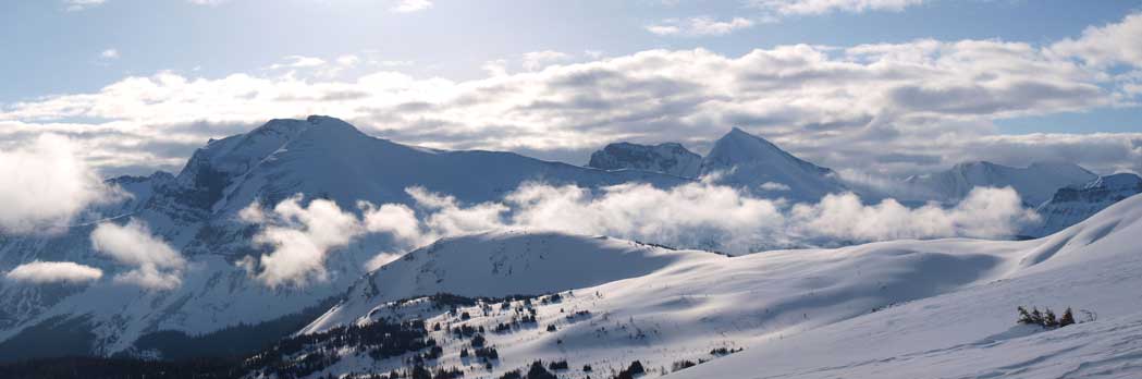
Zooming-in towards Fatigue Mountain (right of center). Note the layered clouds.
The intimidating summit ridge doesn’t look to be that bad once I made to the false peak, and I decided to give it a go. The first thing to do was to lose elevation to the col though, which was obviously, frustrating. Once I got closer I decided to just give it a shot with poles and boots. The snow wasn’t icy so I didn’t need traction gears. It was a bit foreshortened (has a couple steeper sections), but overall easier than expected, but still, it’s a steep, heavily corniced ridge. Breaking through a cornice and fall on climber’s right will likely to be fatal, while, an avalanche down climber’s left will send you down quite a long distance (and you’ll be buried), so it should not be treated lightly. The variable cloudiness weather provided dramatic scenery throughout the day, and the views were constantly changing even towards the same direction. Sitting on the famous Sunshine to Assiniboine route, this summit guarantees great views. However, since I was soloin’ at this point, I had to get down quick to rejoin Ben, so I didn’t stay any longer. I did have my eyes setting on Citadel Peak and Fatigue Mountain which I will probably do on skis.
The true summit seen from partway up false summit
Now I’m at the false summit, looking towards the true summit

The mighty Mount Assiniboine

Looking into BC side. The valleys are deeper this side.

Me on the summit ridge. Photo by Ben Nearingburg

I couldn’t get a better perspective of the ridge since I was soloing. But it is steep.
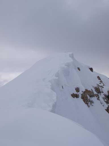
And, it is heavily corniced
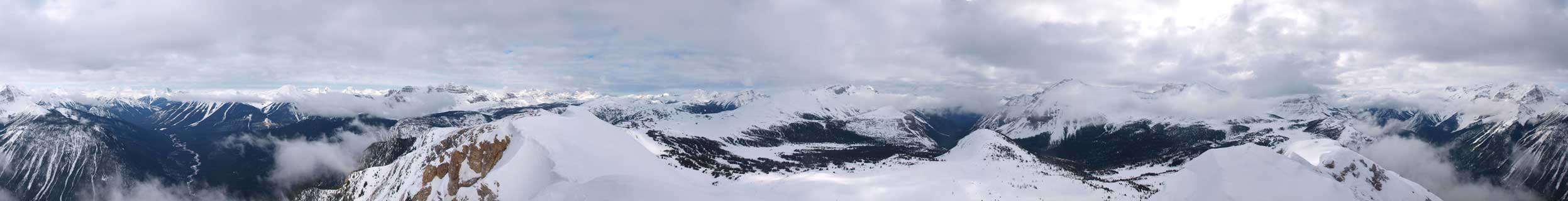
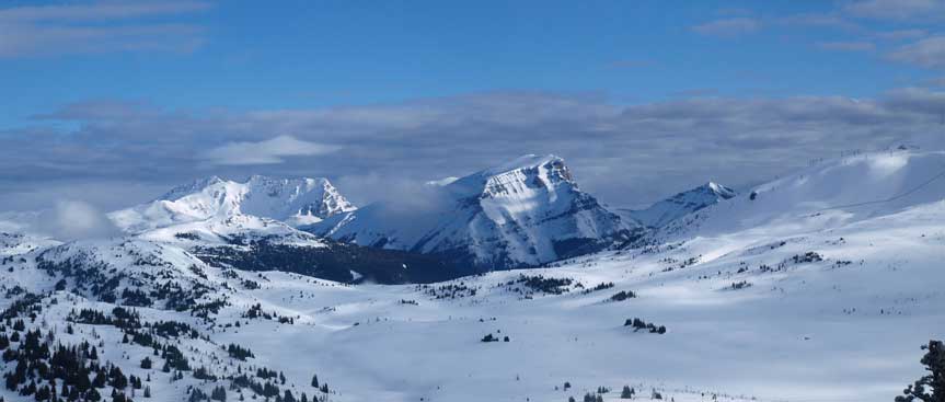
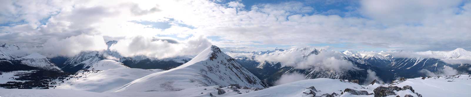
Summit Panorama. Click to view large size
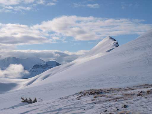
Citadel Peak will bump up my to-do list

Interesting piece of cloud

Time to go down. I would simply retracing my steps/holes

One last panorama of BC side (Mt. Assiniboine Provincial Park)
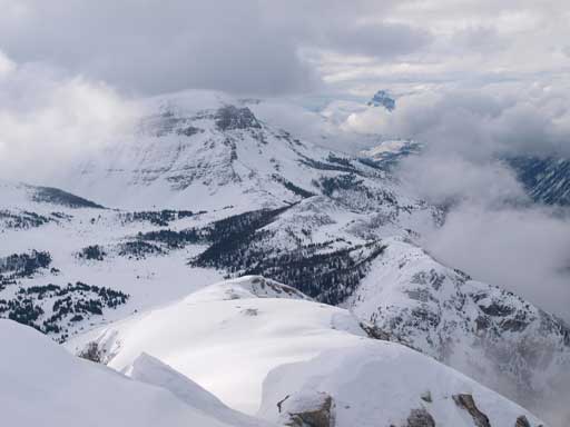
Once having the holes/footprints, travelling became much easier. I simply walked down the ridge using my steps, and then slogged back up to false summit. The weather was improving at this stage, and I took a short break on false summit taking numerous panoramas. This viewpoint is one of my favourites, and in my opinion, the false summit has better view than the true summit! I was already getting excited for the ski descent!

Panorama from false summit. Click to view large size

The clouds were really making things dramatic
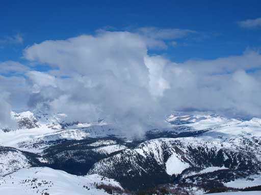
More clouds

And, layered clouds

True summit with my tracks.

Cool clouds

Looking back towards the true summit

Citadel Peak on right. Interesting clouds above it.

Looking back at Quartz Hill.
There was no sign of any instability and I skied down a slightly steeper and more open slope, rather than retracing my up-tracks. I almost lost Ben since we didn’t see each other when I passed his resting area. I thought he might had already gone down and after shouting I didn’t get any response. Just about when I was starting to retrace out tracks down, Ben showed up from behind, thankfully. His feet were getting better and he was still keen on getting something done, namely Standish Ridge. It’s not really a mountain by any mean, but since it has an official name (that’s marked on Gov’n map), we have to count it as a summit. I had already done it back in December 2011 on snowshoes, and I’d love to repeat it on skis. The elevation regain was longer than expected though, and it took us a while to slog up its summit, where the chairlift upper station sits.
Ben still had problems with his boots so that would be the day. There would be no ascent on Brewster Rock, nor Twin Cairns. We chose blue/green lines down the mountain, mainly focusing on doing turns rather than speeding. Skiing in a world-class resort is always probably the best thing one can wish to in the mountains, not to say we were skiing there without paying even one buck. The ski-out was long, and snow got slushy, but that also provided us experience of dealing with different conditions.
Me approaching the summit of Standish Ridge. Photo by Ben Nearingburg

Back to Sunshine Village
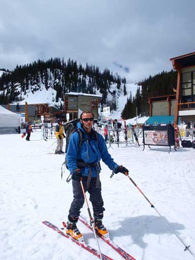
Ben enjoys skiing. Ready for the ski-out?
We finished the day too early. It was only lunch time when we got back to car, but we were both short on motivation to do something else, so we drove back home. If the temperature stays that high I might wanna go Okanagan to start summer earlier! We will see.
