Mount Howard
December 13-14, 2017
2551m
Cerise Creek / Duffey Lake Road, BC
The rugged Joffre Group is by any mean the “mountaineering central” of the Duffey area past Pemberton. Over the last couple years I’ve been slowly, but steadily ticking off these summits one after another and mostly in winter conditions. Eventually there came Mt. Howard. This isn’t nearly the biggest peak and in fact it’s significantly overshadowed by Mt. Matier, but surely is the most mysterious one thank to the lack of route information. The summit block looks steep enough from all sides that some degree of climbing is involved no matter what, and the approach isn’t obvious neither. The only published route with a detailed trip report goes up the heavily crevassed Twin One Glacier followed by a troublesome 4th class step on the west ridge. I decided to challenge that. The terrain on the south side looks gentler and the NE Ridge appears to offer an all-snow route in the right timing window.
The south side valley is more obvious to access from logging roads in Twin One Creek drainage but having already done the Snowspider’s approach over Vantage col I figured it’s probably just as efficient to go that way instead. There’s over 300 m elevation loss on the south side of Vantage col but then I would also start from the high pass on Duffey Lake Road with the Cerise Creek approach often packed down by all forms of traffic. The third, also the shortest approach is by a cross country trek over Snowspider Pass from Van Horlick FSR but it’s not an option this year as the logging company no longer maintains that road in winter. The decision? A two-day, solo snowshoe ascent via Vantage col and that’s it. The timing was at the tailing end of this unseasonably stable block. The weather had been good for two weeks and conditions had been “L/L/L” for at least a full week such that I felt safe to charge up any steep slope I wanted without worrying about the snowpack stability. It would be a shame had I stayed home and wasted these few days.
The task of Day 1 was simply getting into that “south side valley” which seemed like a short day on paper. Driving out of Vancouver at 7:30 am was a horrible decision though. It took me almost two full hours to get out of the rush hour gong show from Surrey to North Vancouver, although once the show’s over the rest was a cruise sailing to Pemberton. The drive up Duffey Lake Road’s switchbacks was uneventful in my LC 2WD without chains nor fancy stuffs. The road was just as bare as expected. I eventually parked at Cerise approach’s pull-out by around 11 am.
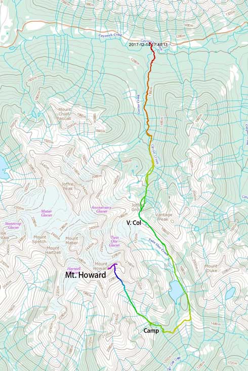
Mt. Howard via Vantage col and south slopes. GPX DL
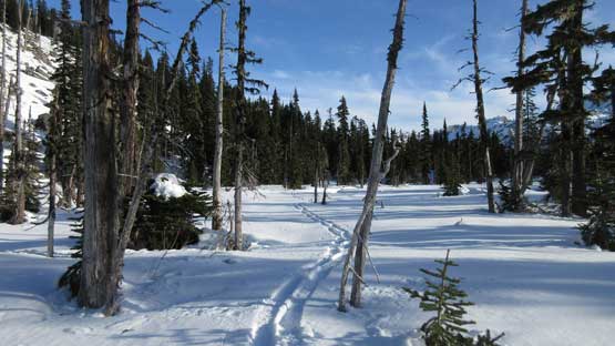
This was my 4th time sloggin’ this Cerise approach. It was such a mind-numbing plod that I did not want to document in depth. About 2 hours later I reached the flats below Anniversary Glacier. After an obligatory food break I picked up a narrower branch of skin tracks and resumed on towards Vantage col. This section of the grunt was done in two major stages. And again nothing’s overly fancy and I did make to Vantage col in a timely manner.

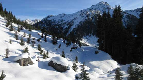
As boring as Cerise approach goes…

This is someone in the upper drainage. I should have stayed on the left side…

More about the Cerise Creek approach.

Just an obligatory shot of the Anniversary Glacier from the flats.

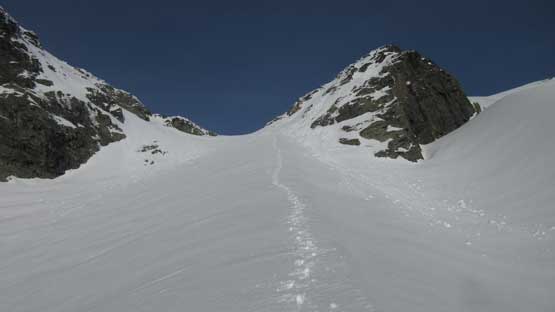
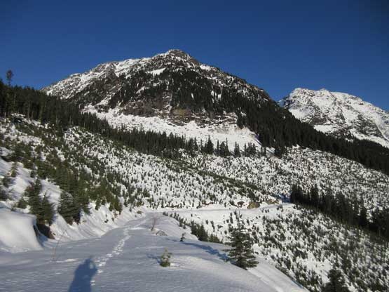
Ahead is Vantage col. A bit of grunt still awaits.
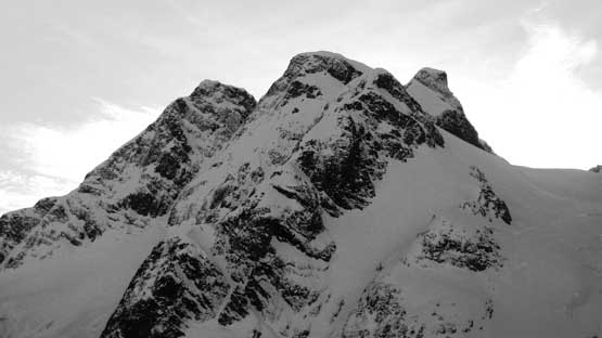
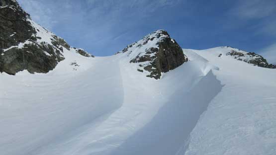
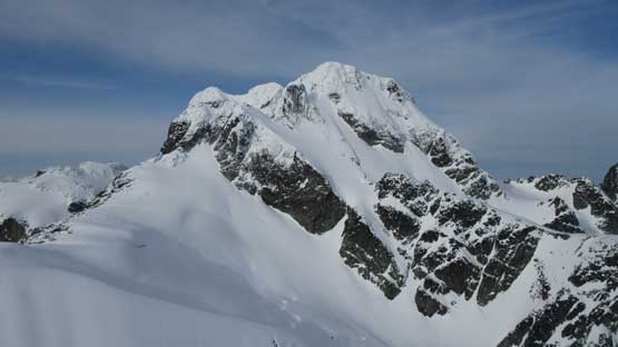
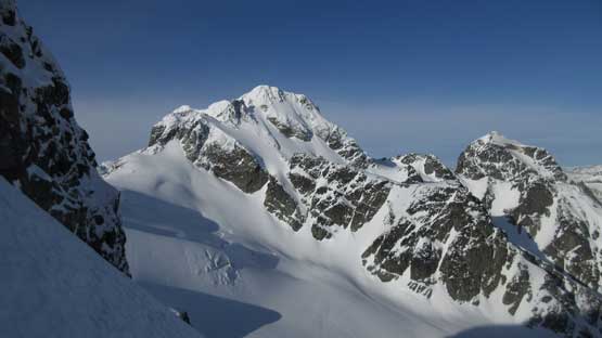
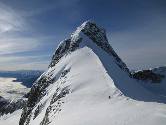
Mt. Howard looks really badass from the col.
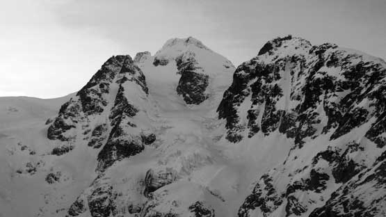
Mt. Matier looks pretty badass too… This is a good col for views.
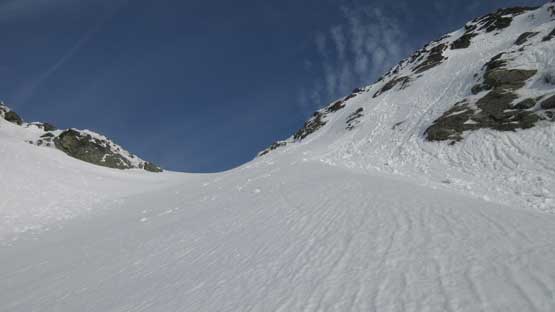
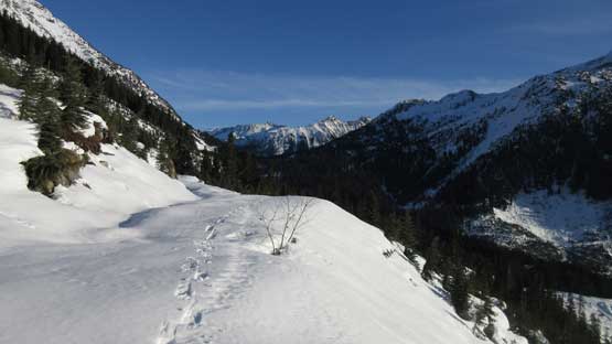
The views were inspiring but not completely new to me, so instead of lingering I resumed on immediately. This time I picked a slightly different route than my Snowspider’s trip. There’s a strip of moraine on skier’s left and I stayed on the depression zone just to the left (east) side of that moraine crest. This became steep near the bottom but nonetheless it worked well. Once down to the valley floor it’s a flat walk towards, and then across Twin One Lake. I picked up a set of skin tracks again probably from skier’s approaching Snowspider Hut. And then up and over a small rise I got to lose another 50 meters of hard won elevation into the Twin One Creek drainage. By far I’ve been following the same route as Snowspider Hut’s but now instead of turning left I would aim right (west).
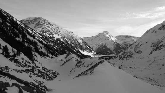
Looking down the valley I’d soon descend. I stayed on left side this time.

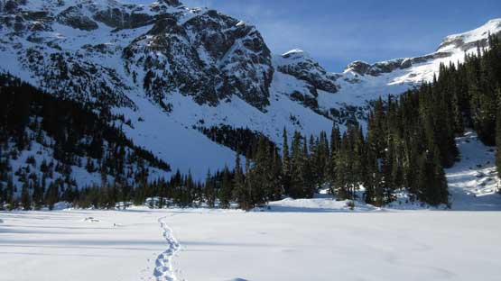
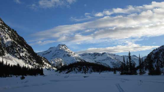
After a while I made down to Twin One Lake.
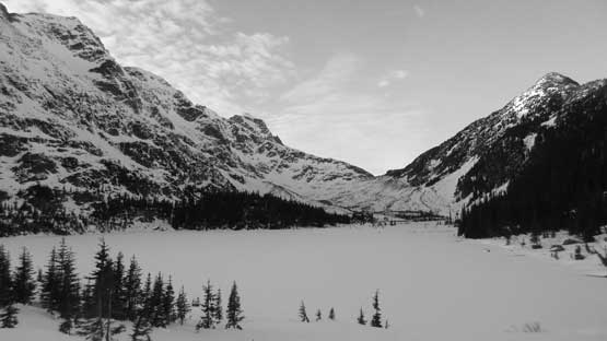
Finished the lake crossing, looking back.

I picked up a set of skin tracks ascending up and over a small rise.

Another 50m elevation drop later I made down to Twin One FSR
This is the south side entrance into Twin One Lake drainage.
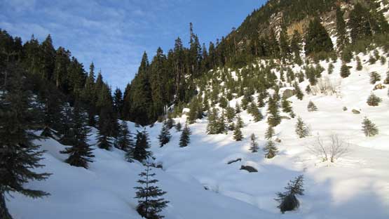
The short stretch of plod on the uppermost Twin One FSR lasted for about 500 meters and then I reached the road’s end. Into the forest I soon had to cross the Twin One Lake’s outflow creek. I did manage to cross without taking the snowshoes off but not without some yoga moves. There’s also one piece of ice bridge that I had to put my fate on. Had it collapsed I would at least end the trip there, if not anything worse. Of course the bridge did hold nicely… But the game’s still on as the forest’s becoming steep in no time. Keeping the snowshoes on seemed silly so I spent a couple minutes swapping gears for crampons. There’s one band of very steep forest to traverse across. After that the grade mellowed out sooner than expected and now with the aid of my GPS unit I took a traversing beeline towards the next creek. Upon hearing the creek’s sound I strapped the snowshoes on and started shooting straight up the slope. This got me directly into the entrance of that “south side valley” with plenty of perfect camp spots.

This is where I reached the Twin One FSR

Instead of turning left I turned the opposite direction

Immediately after the road’s end I had to cross this tricky creek.
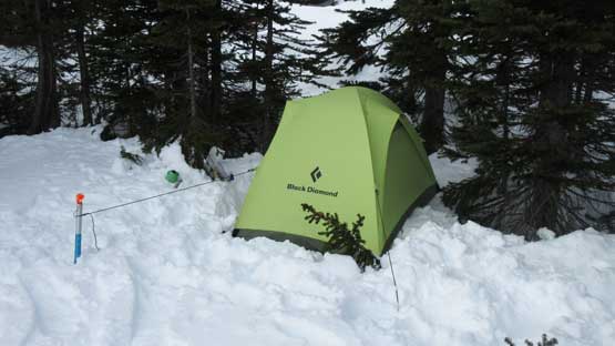
I kept plodding until I was able to see the upper valley ahead and then called a day. The daylight was fading rapidly plus I just found a really good spot. There are trees on three sides offering protection as well as anchors for pitching a tent. The next half an hour was spent resorting gears and erecting tent but with the number of days I’ve spent in the backcountry this was a fluent process. It was still too early for dinner so I opted for a nap. A couple hours later I woke up and did the whole lot of evening routine thing and then went to bed again. No desire of making a fire on my own. Pretty sure I slept at least 12 solid hours that night but I wouldn’t complain about that.

Home sweet home…
The next morning I woke up around sunrise time. Again there seemed no need to rush. From where I camped it’s about 800 vertical meters of steep grunt to a “high col” on the NE Ridge. Even just the sight of it made me tired but I had to face it. The snow condition was excellent with virtually no snowshoe penetration and in fact it was almost too icy. The snowshoes were kept on only for its added grips and the heel lifts. It’s overall much easier than bootpacking on crampons. The grade was sustained but turned out to be not as bad as appeared. About 30-35 degrees the whole way up and this again, was pretty much “designed” for my MSR Lightning Ascents. The uppermost slope merges onto the south glacier although other than one crevasse I did not observe other sign of “being on a glacier”…
Grunting up. Slowly but steadily…

This is just one of the many sub-summits of Mt. Howard
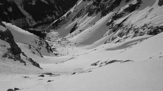
About 2/3 of the way up, looking down. It’s a steep ascent up the south slopes.
Merging onto the last strip of the plod.
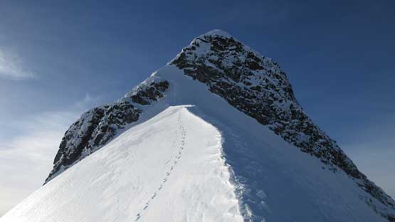
Almost at the “high col” now
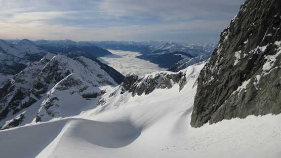
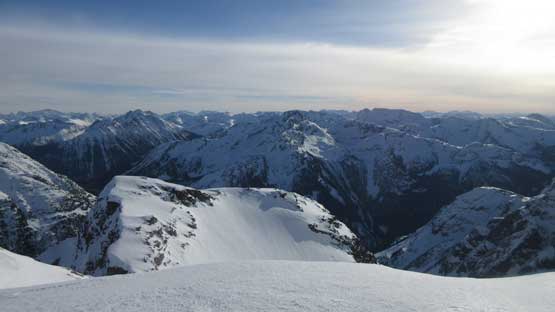
Looking back reveals unbelievable scenery
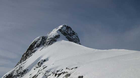
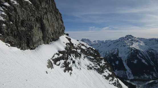
The summit block and the upper NE Ridge.

Another shot looking sideways across the south face.

This is a sub-summit that I went up later in the day.
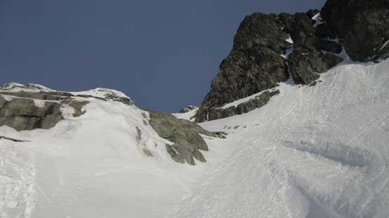
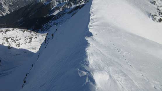
The route on this upper NE Ridge was completely experimental but once there I really liked the appearance. It did seem that I could have stayed entirely on snow without the need of mixed climbing although the steep grade on the upper face did make me glad to have hauled two ice axes this far. The first stage was charging up a snow arete and this was easy peasy. And then the arete turns onto a short face climb on the north side. This piece of slope is unsupported. It looked innocent from my vantage point but I knew there’s at least a hundred meter of shear cliff below had it slid. Not something to worry about one this particular day, so easy peasy again.

Charging up the arete now.
And then there came the third stage of this climb – the upper face. The grade was like some sustained 45 degrees but the challenge came from the combined exposure and the rotten, thin snow coverage. The exposure was severe that a fall would almost definitely be fatal and the snow was so rotten that the ice axes were mostly for show. Thankfully I did have plenty of experience with all kinds of snow climbing so it wasn’t too terribly bad. The climbing was pretty short and the next thing I topped out on the summit plateau.
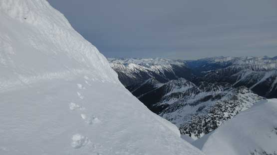
This is already after the sketchiest stretch
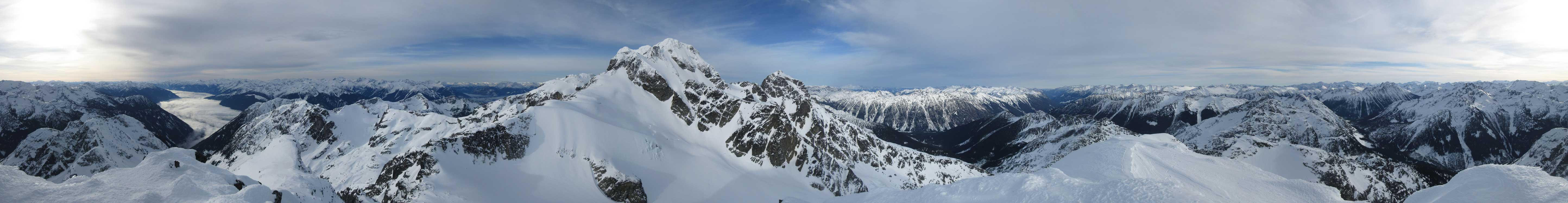
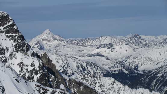
Summit Panorama from Mt. Howard. Click to view large size.
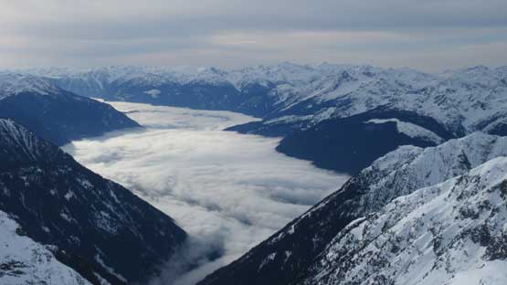
Valley inversion above Lillooet Lake
Looking towards Mt. Currie area behind Duffey Peak

Gideon Peak et al. in the Bible Group
A zoomed-in view of the summit block of Mt. Matier
Petlushkwohap and Skihist Mtn. on the horizon.
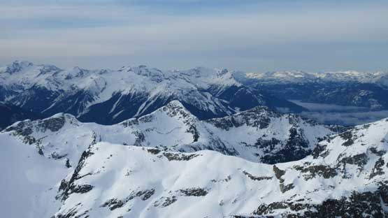
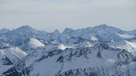
This is looking at the sea of peaks in the “East Duffey” area
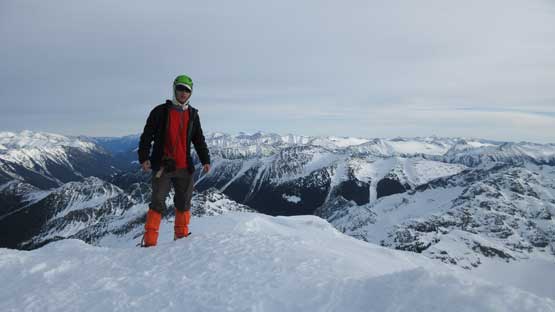
Me on the summit of Mt. Howard
The short down-climb was very committing. As mentioned earlier the two axes were mostly for show so it’s all about gingerly placing my footwork. The previous foot steps were then used as “hand holds” as I dug down as much as I could to at least get a bit of a “grip”. Meanwhile I had to mentally handle the fatal exposure so that wasn’t easy even with the extensive experience I had on snow… Thankfully it wasn’t long. Kicking-in while down-climbing the short north side face was fast and fun and then I enjoyed the plunge down the lower arete to the “high col”. I decided to check out the lower sub-summit too, figuring there might have a better view. It surely didn’t disappoint me.

This shows my tracks across the very upper face.

Just about to down-climb the steepest stretch.
Finished the sketchiest part now. Mt. Matier is back under sunshine

This is the sub-summit that I would soon ascend

The fine art of snow arete.
Joffre Peak is such a rocky fang

Twin One Glacier isn’t fully filled in, obviously…
On the descent I plunged down on the crest of this arete. Very fun.
Looking back at the snow arete leading to the short north face slopes.
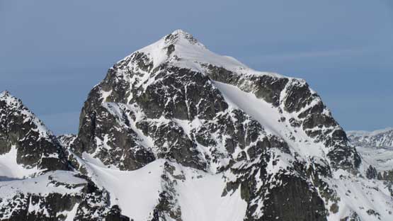
A full review shot of the summit block from the sub-summit.

A zoomed-in shot of the block. The route is obvious.
A southern view from the sub-summit. Too lazy to label these peaks.
Mt. Marriott stands out looking north.
The snow had softened a bit by now but I decided to keep the crampons on while plunging down the south face. This turned out to be a good call as there were certainly a few icy stretches that required crampons. Much of the other places I had to deal with sticky snow balling under my crampons. On a few steeper rolls I opted for inwards down-climbing the entire way. This might be slower, but at least I wouldn’t have to constantly concern about the balling problem. It sure was slow… This long descent seemed to drag on forever that once I got back to camp I had to take another long break to regather some strength. Too bad I couldn’t stay another night so get up, and move on…
Plunging down from the “high col”
The only crevasse I observed on this small south glacier

Steep. Steep. Steep…
About halfway down the south slopes looking across sideways

Almost back down to the valley. Snowspider Mtn. behind

A review shot showing the route I ascended out of this valley.
Too bad I didn’t plan another night stay at this lovely location…
The pack’s getting heavy again but let’s face it. My tracks down and traversing across the lower forest was still highly visible which helped my navigation. For that steep roll I had to take the snowshoes off again but I didn’t bother with crampons this time. With the tracks already made it seemed pretty easy. The next crux was crossing that creek. Too lazy to don any gear I just went for it on boots. I almost slipped into the creek but thankfully I reached the bush on the other side which saved me from getting wet. After hauling myself up using vege belays I donned snowshoes again. The next stage of plodding down Twin One FSR and then back into Twin One Lake’s valley was scenic, but not pleasant. I had to take another long food break to get ready for that grunt back up to Vantage col. And of course the game wasn’t over yet. Darkness fell in another half an hour and I did the last hour of depproach with headlamp on.
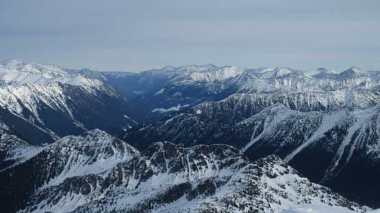
More about this valley. So much exploration potential.
Beautiful snowshoe tracks.

It felt like May instead of December…

Into the steep forest now.
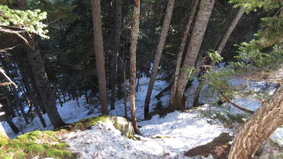
Traversing this short stretch requires no mistake..

Back to the creek crossing
Back to the uppermost Twin One FSR. Mt. Duke behind
Another shot of this short walk on Twin One FSR
Let the grunt begin… Back into Twin One Lake drainage

Twin One Lake
Snowspider Mountain

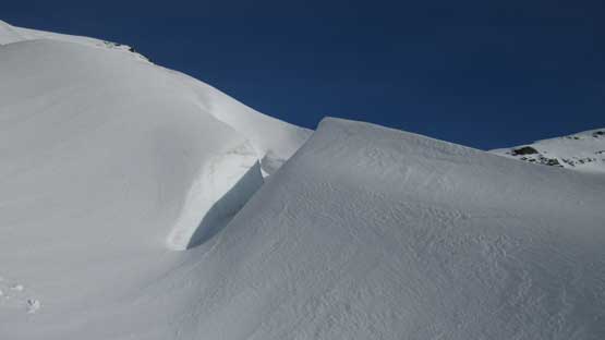
The east side of Mt. Howard is very steep and impressive. You have to see it yourself.
Engine’s on I was not home free yet. Firstly the road surface was starting to freeze that I had to drive under 40 kph the whole way down Duffey Lake Road. And then guess what? I entered a thick layer of fog with visibility less than 20 meters. It was mentally draining to say the least but I did mange to get back to Pemberton. I took a long, long break in the McDonald’s before committing to the Sea to Sky Highway. Thankfully this last part wasn’t bad.
