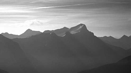
Mount Prince George
August 10, 2014
2879m
Height of the Rockies Provincial Park, BC
In this past weekend, Eric, Vern, Ben and I planed to visit the southern Royal Group just to the west of the more popular Peter Lougheed Provincial Park, with Mt. King George being our primary objective. We bagged it together with the nearby Mt. Princess Mary on the first try so that left us an extra day to explore the surroundings. On the third day we were hoping to make an ascent of the bigger Mt. Prince Albert but due to various reasons we ended up doing the smallest one. Getting up Prince George was easy scrambling only but the views were all worth the effort and we all thoroughly enjoyed exploring the glacier and the hanging valley just to the east of King George.

Ascent route of Mt. Prince George. GPX DL
We woke up by about 4:15 am and quickly got started. The approach up this hanging valley was longer and more complicated than we thought especially with head lamps on. There was some micro terrain requiring route-finding and neither of us had done a lot of research about Prince Albert. Near the toe of the glacier we voted to head left since that would give us a more direct line towards Prince Albert. All started well but we’d soon enter a huge crevasse field. With the glacier being dry we managed to step or jump across many of those but eventually we ran out of luck. A couple really huge ones blocked our direct route and we were forced to head climber’s left onto the snow.
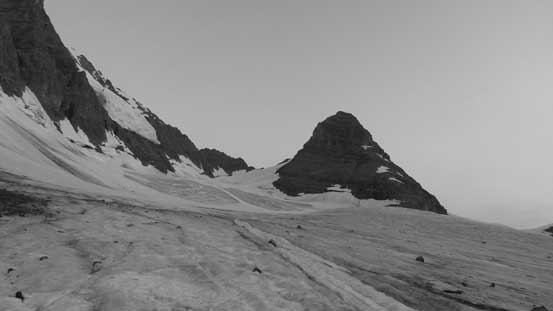
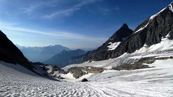
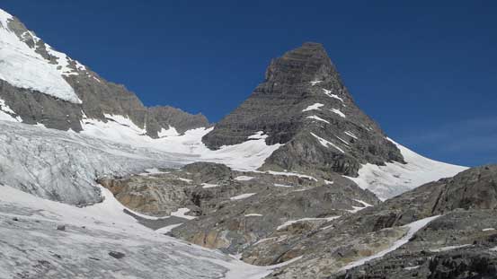
Looking ahead towards Prince Albert
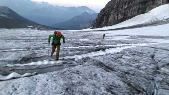
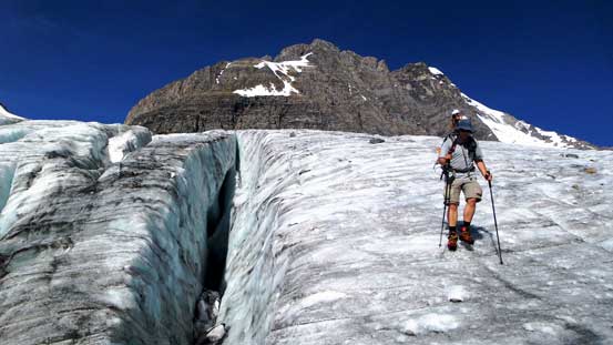
Negotiating the maze of crevasses
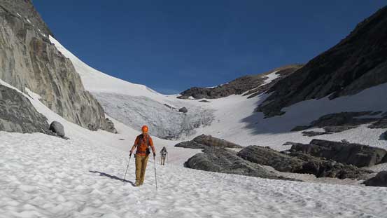
It’s roughly at this point things really started to get a bit more involved than we thought. There’s no way we could just walk on the snow given how big the nearby holes were so we roped up, thus slowed down significantly. We opted to ascend a snow ramp which seemed to be the only reasonable way to get up the serac/icefalls ahead. That led us to more crevasses just above the ramp with one particular being monster sized. We also had to go underneath an area subjected to serac falls from high on the east face of King George if continuing. I, being on the lead had to even step onto some of the debris. At the meantime there wasn’t much of a freeze and the snow was soft. Looking ahead there seemed to be a big bergschrund spanning most of the way across the steep slope up on Prince Albert. And we were going slow so if continuing we wouldn’t be back home until very late (2 am ish) which wouldn’t be great for the following working day. So all factors added up, together with our motivation issue as Prince Albert was merely a bonus objective on top of the successful ascent of King George. Nobody was in the mood to risk too much for an optional ascent so we redirected our attention to the nearby Mt. Prince George.

Prince Albert ahead. Note more crevasses in the foreground

Looking back at some morning colours over the horizon.
I think our day worked perfectly as this part of the glacier travel was very fun and scenic. We didn’t have to lose much elevation neither as we could pick a more direct line towards Prince George over more glaciated terrain rather than retracing. There was more crevasses to navigate and also one scrambling section (which worked awkwardly with ropes on). It took us quite a while to reach Prince Albert/Prince George col. We ditched glacier gears at the col and proceeded up the snow slope. It wasn’t as steep as appeared but was a bit foreshortening. Once exiting snow we had to do some scree bashing and boulder hoping, and then we were on the summit. Looking back Mt. King George was massive and I was very impressed we’d already had it bagged.
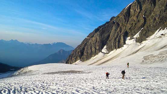
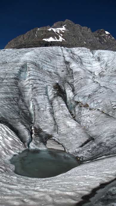
Still have field of crevasses to negotiate towards Prince George
Our team on the glacier
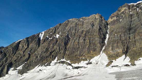
Right of center is Congdon/McNab Couloir – I admire guys like Kevin Barton, Jason Wilcox and Blair Piggot being able to climb something like this!
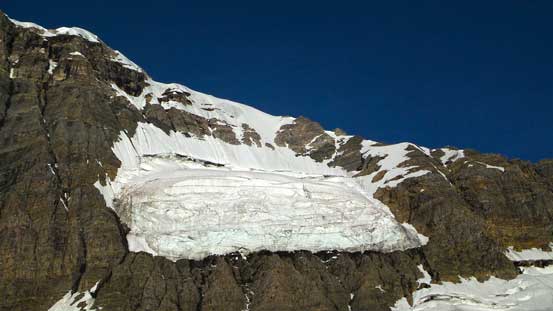
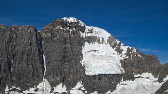
Hanging glacier on the East Face of KG – pretty much ready to fall off at any time!
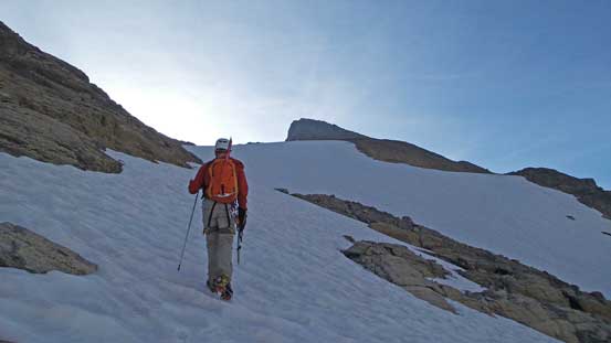
Ben ascending Prince George
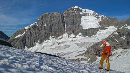
Vern with King George in the background
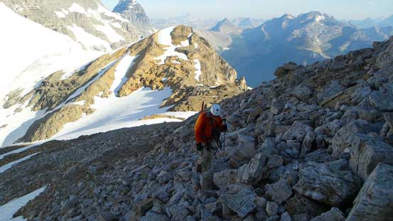
Easy scrambling near the summit

Ben ascending onto the summit plateau

Vern and I identifying peaks from the summit. Photo by Ben
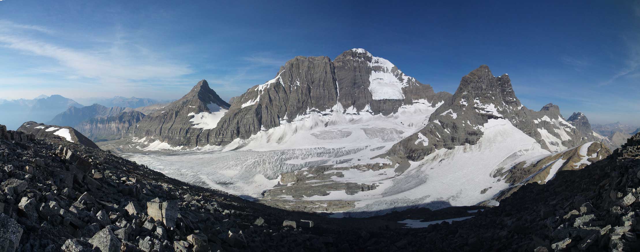
Panorama from the summit. King George dominates the Royal Group. Click to view large size.

Another panorama view from the summit. Click to view large size.
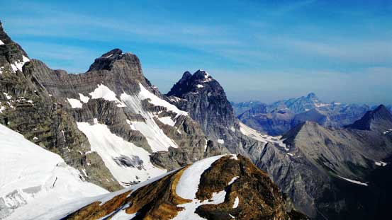
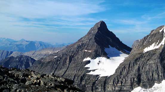
Prince Henry and Prince John in the Royal Group – even them are impressive peaks
Mt. Birdwood from a unusual angle – It’s definitely on my to-do list
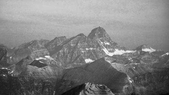
The mighty Mt. Assiniboine

A closer view of Mt. Prince John
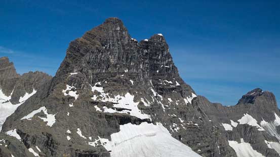
Mt. Prince Albert
East Face of King George. Congdon/McNab Couloir left of center. Again, my thought goes to Barton, Blair and JW… That looks insane to me now, but maybe my perspective will change once I start ice climbing…
Mt. Princess Mary which we bagged the day before
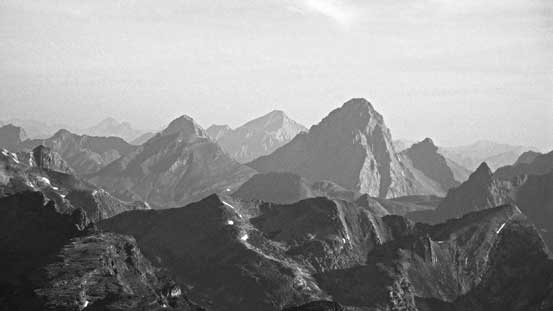
Smoky view of Mt. Joffre

A sea of peaks looking south

The east side was a huge drop-off.. Prince George might actually be an impressive looking mountain from Palliser River way down below

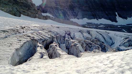
The heavily crevassed glacier we just ascended in the morning

Me on the summit
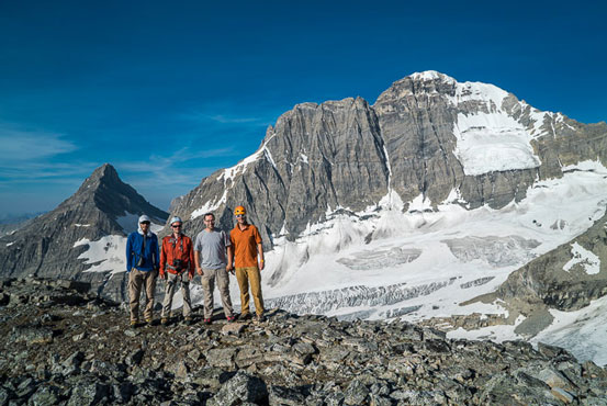
Group shot on the summit. Photo by Vern
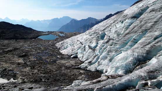
The descent went uneventful and we soon got back to Prince Albert/Prince George col. From here instead of going back via the same route we’d use a more direct line down the skier’s left side of this hanging valley. Obviously nobody had done any research about it. I remember seeing it being quite rocky from Princess Mary on the previous day but everything looked different from below. We walked down a gentle glacier staying way on the left side to avoid suspicious area, and then took the lower branch upon reaching the first junction. This brought us to the edge of the big glacier. We had to a bit more route-finding on the edge of this glacier but on the other hand, we were treated with some exceptional view of spectacular ice formation. I hadn’t done many trips on dry glaciers and I was very impressed. Lower down there’s even an alpine tarn adding to the scenery – would be a even better bivy spot for parties ascending Prince George.

Back onto the glacier
Looking down the long but very scenic valley

Vern decending the glacier

Here we’d take the right branch
Looking back
Mt. Prince Albert – too bad we couldn’t get it on this day, but on the other hand that gives me an excuse to come back to this beautiful area someday, someday when I don’t remember how miserable this approach was…
Hiking down some dry glacier, really cool for photos

The fractured glacier
A pool of water. Swimming? – only if it’s a hot spring…

Deep holes that we couldn’t even see the bottom
Almost finished the glacier walk
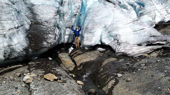
Me posing beside some cool ice formation
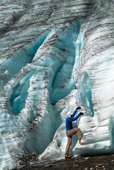
Me and the glacier again. Very cool area for photos. Photo by Vern

Leaving the glacier behind
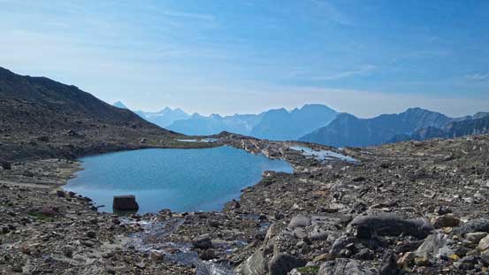
This alpine tarn would be a three star bivy spot. If you objective is only Prince George then I’d suggest going all the way to here.
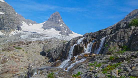
Neat waterfalls with Prince Albert behind
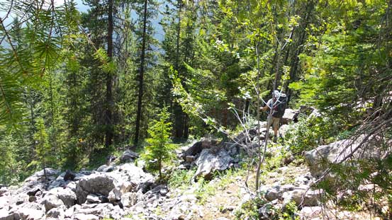
From here on the fun parts were over and I was not looking forward to the lengthy return. Hiking down the moraine back to camp was already tiring and hard on my knees… From camp downwards, the trail was extremely difficult to follow. The key was looking for flags. If you don’t see flags for 2 minutes you’re likely off route. There’re many paths leading the wrong way and some are even bigger than the correct trail. I think many climbers had struggled here just like us. We had to constantly check the GPS to make sure we were not off route. Descending the steep headwall was exceptionally miserable given the heat and the fact I was wearing full shank mountaineering boots… The hike out via Fynn Creek was even worse as we had to constantly backtrack or regain elevation due to washouts, hop over endless deadfalls and bushwhack through brushes. This is one of the parts I’d rather have rain than full on sunshine with 30 degree temperature. And towards the end we had to negotiate the last obstacle – arguably the crux of the trip – shaffling across the log…
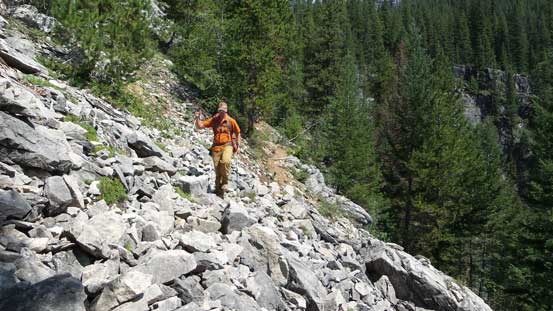
Crossing a boulder path on the return
The long, steep and hot descent
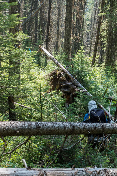
Back through the mess. Photo by Vern
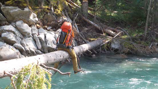
The sketchy log cross near the end of this trip..
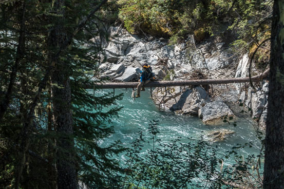
Me crossing the log. Photo by Vern
In the end we all made back, exhausted. For Eric, Ben and I what was left was a 7.5-hour road trip back home… Oh well, we made back by midnight so not too bad. Overall, this was a very satisfying trip. Having Mt. King George bagged on our first trip was already very successful and we even managed to squeeze in 2 optional objectives, and in only 2.5 days considering most climbers would typically plan 3 days for King George only. Speaking Mt. King George, I think it’s one of the 11,000ers that’s more about spending a few days in a remote setting rather than classic mountaineering (unless you do Congdon/McNab Couloir on the East Face). It’s a huge slog from parking lot all the way to the start of the upper south glacier, mostly on unpleasant terrain.
