Guardian Peak (South Face)
October 2, 2021
1790m
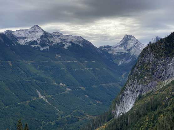
Chilliwack, BC
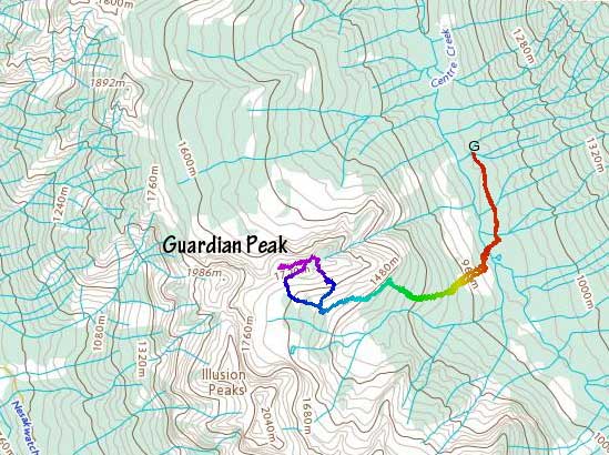
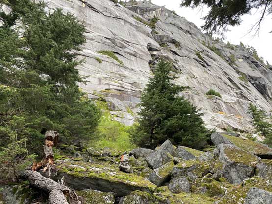
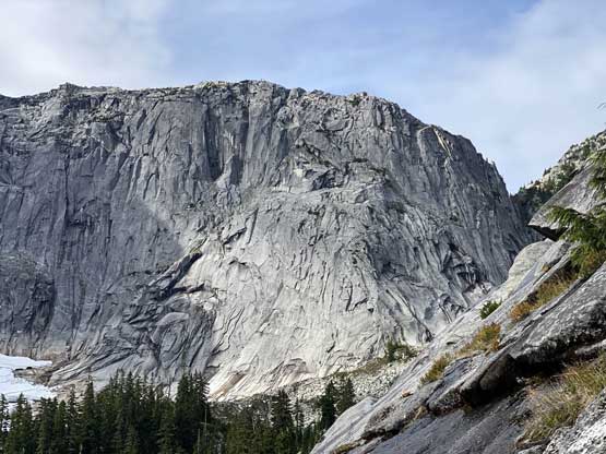
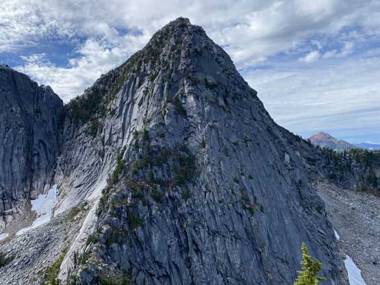
“Guardian Peak” is the unofficial name of a small summit in the “Illusion Group” immediately to the north of the more fabled Mt. Rexford. This peak does not boast much prominence above Guardian/Disillusion saddle but is guarded by slabs and cliffs on all sides such that all the “published routes” are at least somewhat technical. I do believe that this peak can be entirely scrambled but somebody has to come here for some exploratory missions. The “standard route” these days seems to be the south face that involves a few pitches up to mid-5th class. The approach is unpleasant with bushwhacking and the route-finding on the face is tricky and ambiguous. After the climb I would say there are many ways to make it work with variable degree of slab climbing.
The overview of this peak and some brief route descriptions can be found on Fred Beckey’s Cascades Climbing Guide. Initially Lily and I were planning a scramble objective but she made this suggestion after flipping her Beckey’s guide. There’s even one (decently detailed) trip report on bivouac.com from Lily’s friend. I had some concerns about the recent full week’s of rain making the slabs wet but on the other hand we really didn’t have other “interesting” options. I spent a few hours on the computer and dug out some beta photos. From those photos I estimated that we should have multiple options in each stage with more than a few possible lines to take. If that was the case then one way or another we should be able to make the summit. For gears we decided to bring two 60 m half ropes, a rack of cams to size 2 and a lot of rappelling cords. This selection proved to be overkill as we only ended up using one rope along with a few small pieces of pros. To maximize the use of daylight we left Abbotsford at 5:30 am and made to the driveable end of Center Creek FSR at daybreak and started the approach just when it’s bright enough to not need head-lamps.
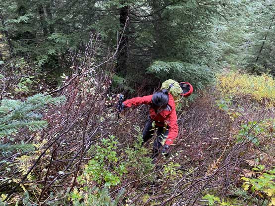
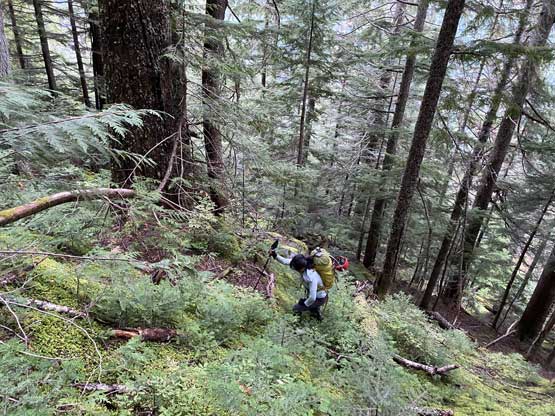
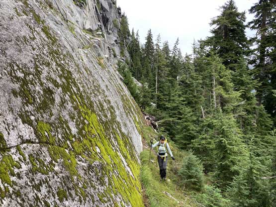
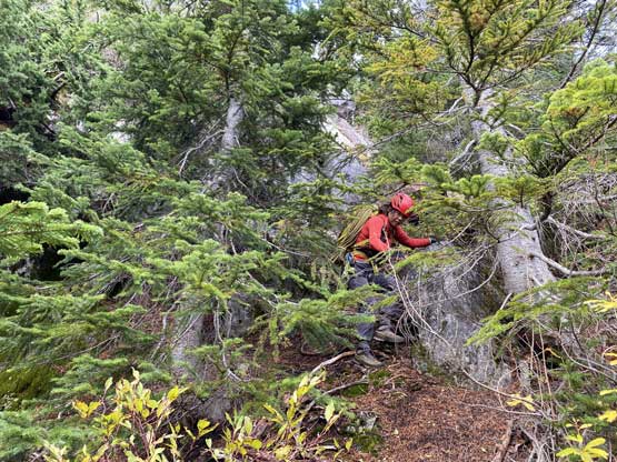
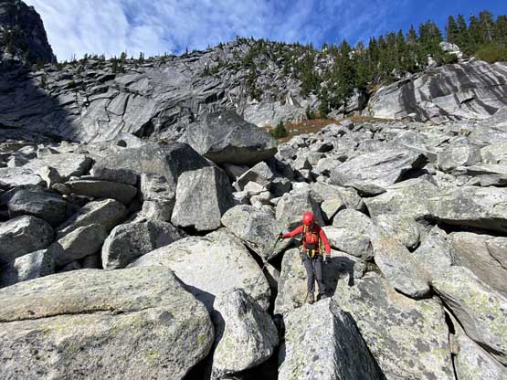
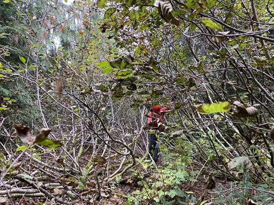
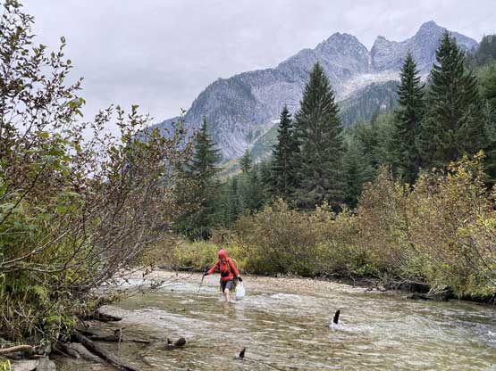
The driveable end of Center Creek was at a washout more than 1 km closer than where I parked for Mt. Lindeman 4 years ago. That washout can be driven over in an ATV but not in my Tacoma. For the approach we decided to ignore the beta in that reference trip report. On the satellite images we spotted some intermittent boulder fields to break through the secondary growth mess near Center Creek and that’s roughly halfway between their ascent route and descent route (they had taken different ways in and out). The bushwhack from the road down to Center Creek was pretty straightforward but then we had to wade the creek. There would have been no way to just rock-hop across this creek so I was glad we decided to bring river crossing shoes. We then dived right into the bush aiming for that aforementioned boulder field. We soon came across an extremely overgrown logging road, crossed it and found the line we planned. We also found orange flagging in this zone and the flags also directed us roughly towards the direction we wanted to go. The boulder field was however, much worse than expected with mosses covering the holes and literally a ton of thorny plants thrown in. There was occasional smooth-sailing but most of the time we had to be extremely careful about where we stepped and what we could grab. Needless to say the progress was slow and I started to wonder about taking a different route down by staying more into the (thick) forest, climber’s left of us.


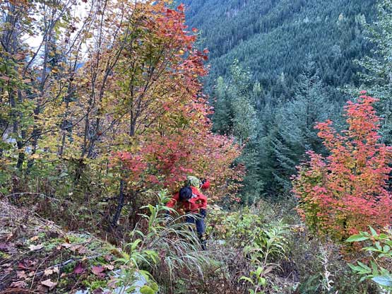


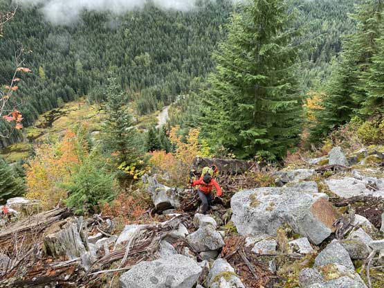
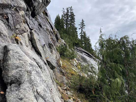
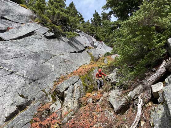
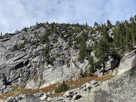
After what seemed like a long while we finally gained 200 m in this mess and after bashing through another band of thick, secondary growth bush we finally found the old growth. We soon encountered some slabs and traversed climber’s left under the slabs and found more orange flags. The flags were hard to miss from this point onwards and led us ascending a more direct line, straight up for another few hundred meters of elevation gain to the base of the big slab walls under Guardian Peak’s east and south faces. The going was mostly free of bushwhacking in this stretch and was actually decently pleasant. Lily noticed a lot of mushrooms in this zone and made some mental notes to collect them on the descent, if we would have enough time. We then traversed underneath the impressive slab walls due left (west) for a long zone on mostly easy terrain with some intermittent scrambling steps.
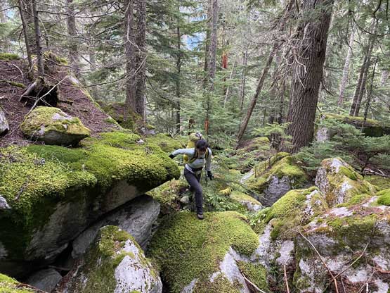
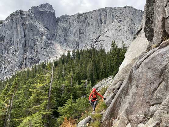
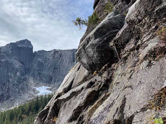
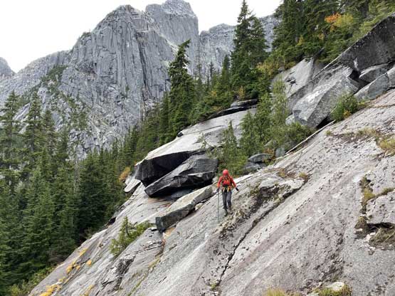
At one point we found a natural staircases type of terrain on the slabs immediately to the right of us (class 3). I made the call to scramble straight up and left from this spot and found more orange flags higher up. Lily took a slightly different route and ours merged soon. The next stretch was a long zone of traverse on slabs, mostly class 2/3 but with two tricky spots. Upon trying a few moves on that first step I backtracked and we opted to don hardness and rock shoes. With rock shoes I was able to solo across this step, but the second step looked too blank to attempt without a rope. I found a cluster of small trees, built an anchor and belayed Lily across this slab crux. Lily was able to put in one 0.3 sized cam to protect the few crux 5th class moves for me to follow. I did not find the ascent being too difficult but the down-climb a few hours later felt much harder, probably because of the increased exposure.
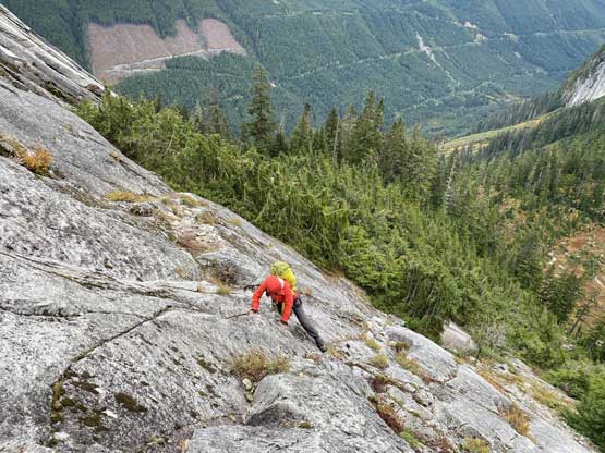


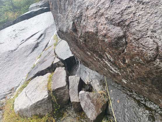
After this short but fun technical step we resumed the westwards traverse along the base of the slabs until directly beneath where the other group went up. The other group had climbed a long pitch of low-angled slab to reach the next treed ledge but that was not an option for us as the slabs were wet in this area. We kept traversing until the slab face became shorter, scrambled some wet but easy rock to a “waterfall corner”. The orange flags indicated we were on-route but to commit to that corner we again had to pitch it out. The climbing would be only 4th class if dry, but we had to climb directly up the fall line where water was running, which wasn’t difficult but felt weird. We then scrambled up and out towards climber’s right to access the next treed ledge and traversed a ways due north-east along that ledge. The scrambling here wasn’t difficult but involved some bush-thrashing.


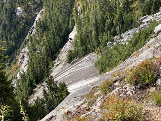
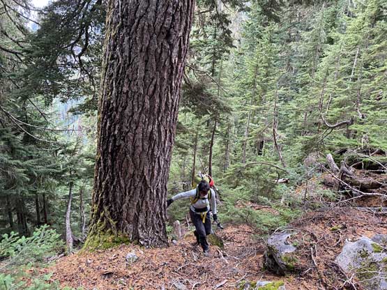
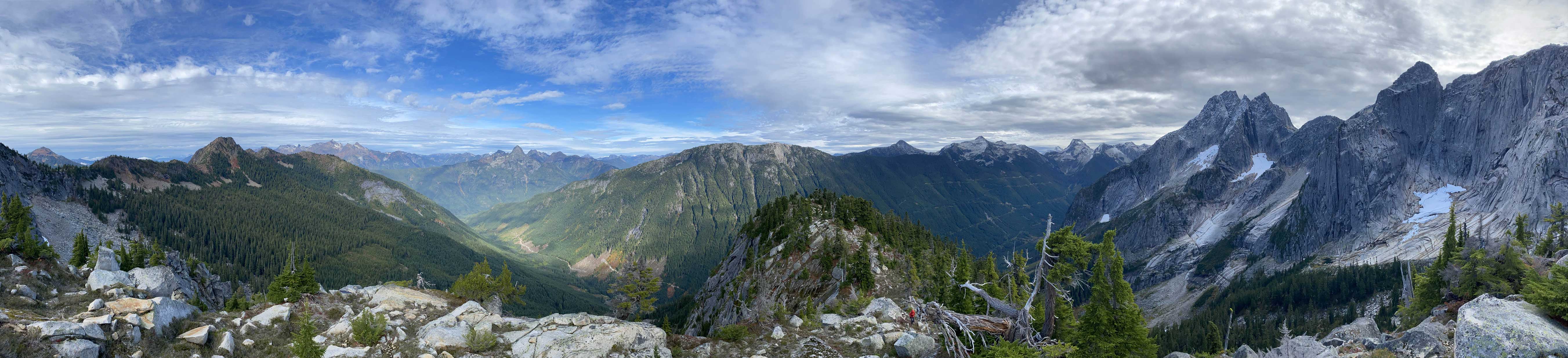
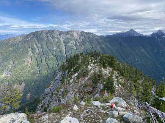
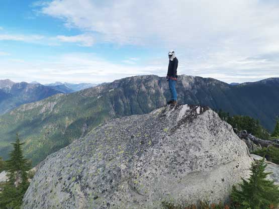
For the upper slabs I figured out where the other group went up but again, the dihedrals looked wet so we traversed further and found another feasible route. Our route involved another “4th class waterfall step” at the start but the terrain soon transitioned back to “3rd class”. I led this pitch, running about 50 m length to a cluster tree belay. The next pitch we must traverse some wet and blank slabs but we found a creative solution such that none of us felt too exposed. From the end of this pitch we weren’t sure what’s exactly above us, so Lily led a 3rd pitch into the forest. The climbing had a few stiff steps at the start but soon tapered off. The rest of the ascent to the summit was straightforward but fair amount of bushwhacking. The views were surprisingly good from this small summit.


We evaluated a few descent options and in the end we decided to explore a possible scramble route down the “SW ledge”. There had been zero beta about this route but I had spent time zooming-in on my own photos and was somewhat confident we could descend that way. There was more bushwhacking to traverse towards that direction and the forest had become increasingly steep near the bottom. I thought we for sure needed to do one or two rappels but the forest kept delivering, and in the end we indeed found a scramble route and avoided all the rappels to get off the “upper slabs”. This didn’t mean the entire route was a scramble because we still had to rappel that “waterfall corner”, and belay each other to cross the lower slab crux. Lily led back across that slab crux placing the same cam into the same crack, but this time the follower (me) was the more exposed because I had to down-climb the few 5.6 ish slab moves with some exposure. Had I slipped the consequence would be a 10-meter whip. I tried a few times to eventually commit to the few moves. I kept the rock shoes on until all the scrambling was over and then swapped for mountaineering boots.


For the rest of the descent we reversed the exact route we took, following the orange flags back to the edge of the secondary growth zone. We spent an extra hour in this stage to collect mushroom and my pack’s weight had increased by a few kilograms. At the edge of the secondary growth we stayed in the forest to avoid the bramble type of plants in that boulder field. The bush was thick (BW4-) but not thorny. About halfway down we somehow got ourselves too close to the edge of the boulder field so decided to just dive back into the field embracing the brambles. It was actually not as bad as I thought. Lower down we also stayed a bit longer on that alder-chocked logging road and dashed directly down to where we ditched the shoes. The crossing of Center Creek was uneventful and so was the final stretch of road-walking. Our round trip time was almost 11 hours on a very leisurely pace.


I still had to pay attention to the drive-out as there were a few water bars on this Center Creek FSR. Once back to the Chilliwack River Road we saw the usual weekend camping hordes and the rest of the drive back home was pretty fluent. Overall I would actually recommend this route as it offers some typical SW BC challenges. This trip also opens up the other peaks in this “Illusion Group” for me. I had been aware of these peaks but never put in thoughts to actually climb them, mostly because of the lack of beta.
