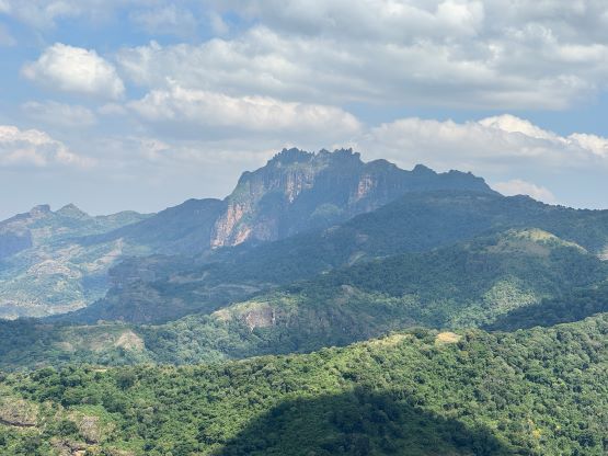
Mount Kadam
January 5-6, 2024
3063m
Uganda
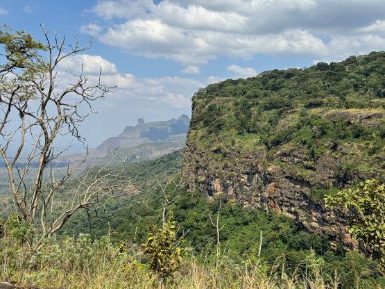
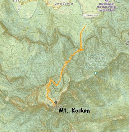
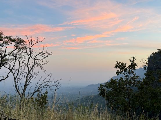
Mt. Kadam in eastern Uganda has gradually gained some popularities in the recent years but it’s still far from being popular. This is a beautiful mountain with some rugged landscape, but the route is rough and difficult. Most parties would need at least 2 days to complete the ascent and most do not actually visit the true summit, which requires another hour of off-trail plodding across the upper plateau. Our friends Adam and Petter however managed to snag the true summit in one day (without camping) and without much “beta” back in Feb. 2020. Rob, Alastair and I hired Julian W. from African Ascents to organize the trip and our plan was to spend one night on the mountain. We could have also day-tripped Mt. Kadam but there wasn’t any hotel or campsite near the trail-head that Julian felt safe about. It made sense to camp even just for the sake reason of saving a few hours of back-and-forth driving.
Our itinerary was ambitious that we had to make the long drive from Mt. Elgon’s east side gate across the Kenya-Uganda border, meet up with the local supporting team of guides, porters and cooks and make the trek-in all in the same day. Comparing with the itinerary of Julian’s previous clients (Deividas, Dave and Rokinstraw) ours was short by one day, so there were a lot of things to be squeezed in. The border crossing itself was not without event. I was mostly busy with the phone trying to post on the social media so I wasn’t paying that much attention, but apparently we needed to officially exit Kenya first before entering Uganda. The Uganda side of the border took a while and the entire border crossing infrastructure system was under construction. It was quite chaotic but that was to be expected in Africa. The next difficulty was to obtain fuel as none of the gas stations in this part of Uganda accepted payments by credit card. We were forced to make another stop to exchange some cash. The third difficulty was the roughness of a short-cut that we took from the north slopes of Mt. Elgon down to the desert plain. I’m not sure about the name of this road but it could not be recommended. This road had surely put our Landcruiser in test. For more than once I questioned our sanity of taking this unknown way, but again the capability of the vehicle combined with Julian’s driving made this possible.
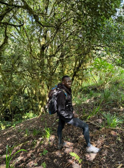
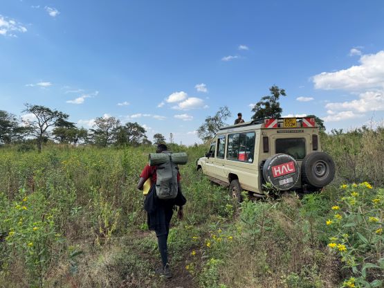
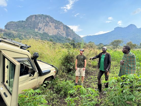
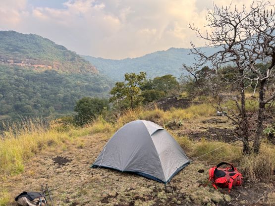
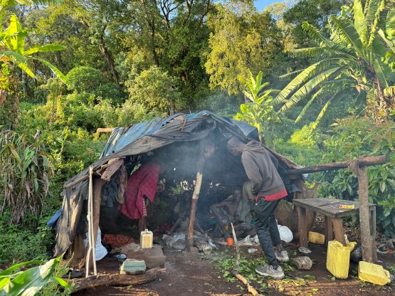
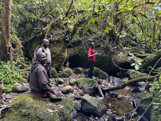
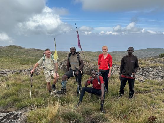
We met our local team in the small village north of Mt. Kadam. There was apparently a shortage of carrying capacity but that’s not the end of the world as we could carry our own overnight gears if needed. The only problem was not bringing a backpack that’s large enough to stuff those gears in, but I was sure we could figure a way out. The “short” drive to the trail-head was again a major adventure thank to the recent rain. It was very difficult to push through the mud and I was impressed by Julian’s ability to drive in this kind of conditions. We did eventually get ourselves stuck in the mud, but by this point we had already driven “far enough” to start walking. The in situ decision was then made for Julian to stay behind to sort out the vehicular problems. Elijah would accompany us together with the 4 local guides/cooks. The carrying capacity ended up not being a problem so I did not have to carry much stuffs, after all. Meanwhile Julian managed to somehow get the vehicle turned around so he did not have to reverse all the way out.


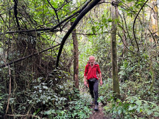
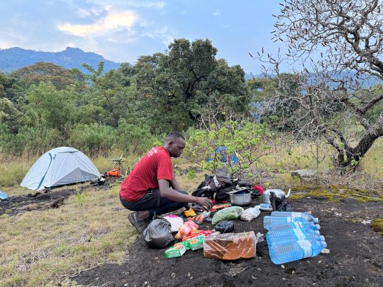
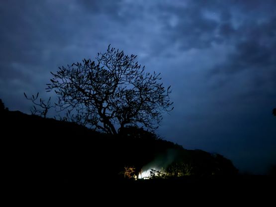
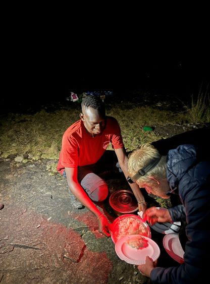
There was still about 1 km of the remaining road that we walked across on foot. The road was more or less a “trail” anyway, but a day later Julian managed to drive all the way to the road’s end, albeit in better (drier) conditions. We then followed the local guides entering the forest. It was very hot and humid that we all went shirtless in no time. The trail in the forest was easy to follow, but there were a few scrambling sections that a few of the cooks were struggling with. Installing some fixed ropes could definitely make things simpler, but this mountain isn’t popular enough for that yet. About an hour later we made to the “lower camp” and the guides insisted for us to stop there. Rob and I were not particularly happy about this decision as we still had more than an hour of daylight, but we would soon learn about the reasons. First of all our guides and cooks did not use the modern stove/fuel system to cook and instead, they needed to start up a bonfire and cook from that. This meant our dinner was not served until more than 2 hours later. We were all very hungry and desperate, but at least the food was great. The plan was to wake up at 5 am on the next day to start hiking no later than 6 am at the “first light”, but we all woke up by some continuous gun shots at around 4:30 am a few kilometers from us somewhere up on the mountain. The guides were preparing for the breakfast but they had put down the fires and gone hiding. They knew what exactly was going on, but did not tell us anything about it beforehand. Apparently the soldiers were up there to arrest someone with guns and they were fighting. We all turned off the head-lamps. There was at least one bomb explosion in addition to more gun shots within the next hour. By around 6 am we could finally see some head-lamps moving downhill so the guides assumed that the officials had already arrested that guy, so our breakfast was ready in about an hour and we could still climb this mountain.


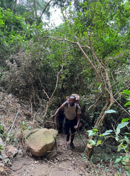
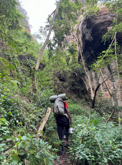
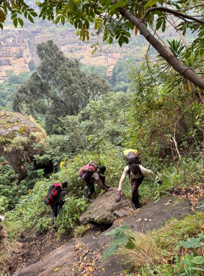


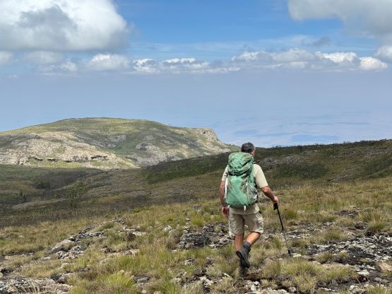
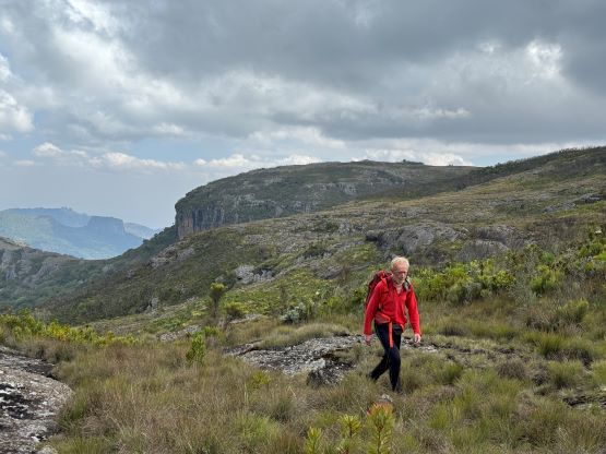
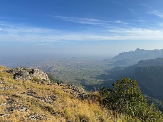
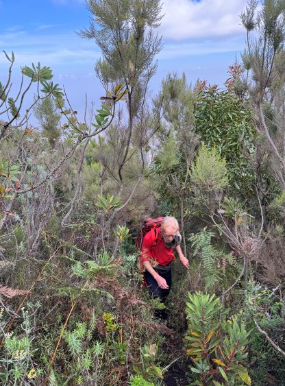
There was about 500 m elevation gain between the lower camp and the upper camp and we covered that section reasonably fast. We passed several locals living on this part of the mountain and we were all excited to talk about the machine gun fighting. The trail, though reasonably clear and easy to follow, was quite overgrown at places. The plants were thankfully mostly dry, as otherwise we would be soaked to the bone within 10 minutes. There’s one exciting traverse on a sloping ramp to reach the upper camp, but this kind of terrain would soon become the “norm” on the upper route. The next stage involved about 50 m of descending followed by a long and gradual traverse across the “northern amphitheatre” of this peak. This section has no sketchy terrain, but the trail was still overgrown. There’s one running stream in the middle of this amphitheatre, so we could have left some of the water bottles behind.
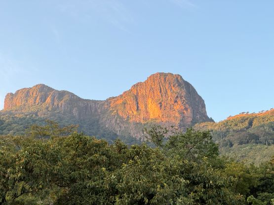


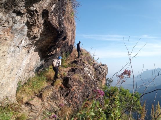

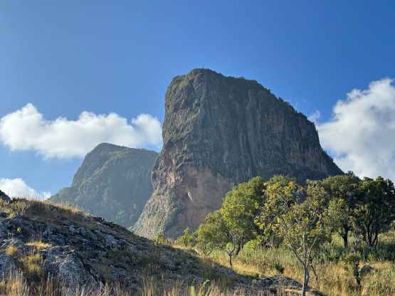
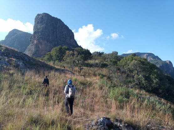

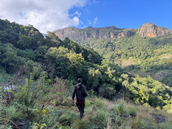


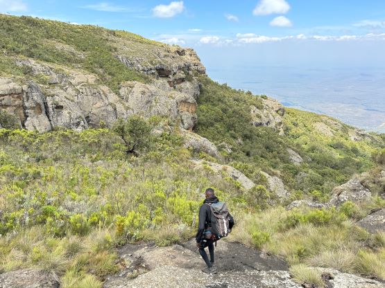
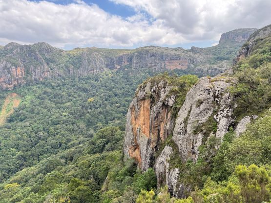
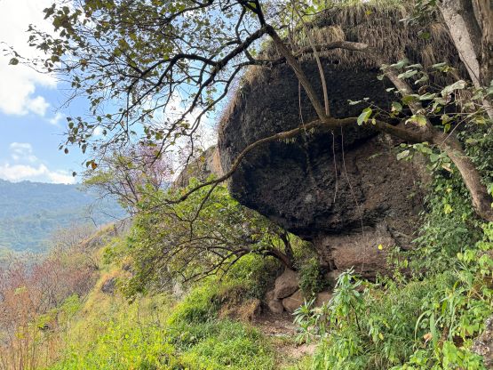
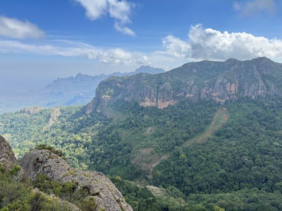
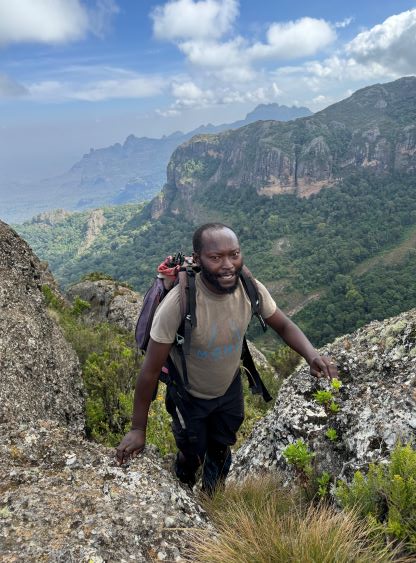
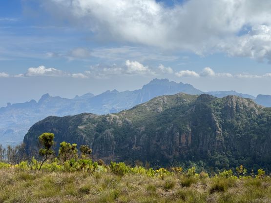
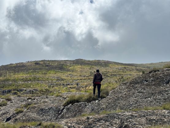
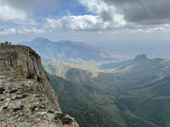
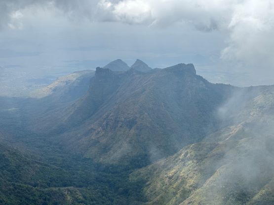
The hardest part of this route was to gain the upper plateau and for about 200 m elevation gain we were constantly dealing with class 2/3 scrambling and overgrown trails. The trail was so thick that we felt like bushwhacking. The route-finding was also not obvious but the guides knew the route really well. I just blindly followed the lead guide and had no issue whatsoever. There is apparently an alternative route that bypasses some of the exposed scrambling but adds some bushwhacking. The younger guide took us down that route on the return, but it’s hard to say which one I would prefer. The traverse across the entire upper plateau to reach the highest point was also not as straightforward as I thought, with more undulating terrain and route-finding. The older guide took a different way than Deividas’ GPX track, with more up-and-downs but probably less bushwhacking. It was a bit annoying, but all we needed was perseverance at this point. The other side of the true summit is a shear drop and apparently the Gaia topo knows nothing about the location of this summit. According to the Gaia map we had already jumped off the cliff. The peak to the east, Nabato caught our attention. Rob used his hand level and determined that peak to be about 10 m lower than where we were standing. The spot height on Gaia map is clearly too low to be true.
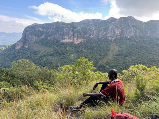


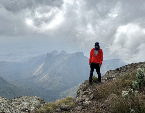
About 20 minutes were spent on the summit and then it’s time to get off the mountain. Rob and I took a more direct route back across the plateau and were punished by some thick bushwhacking. Thankfully we corrected this mistake without losing too much time. After traversing back to the north (lower) end of the plateau the lead (older) guide realized that he had forgotten his phone on the summit. We would then descend with this younger guide. Don’t worry, the lead guide would eventually catch up to us. As mentioned earlier we took a variation route to bypass some of the steeper scrambling but this route involves more traversing and thrashing. The lead guide caught up to us somewhere near that running stream in the middle of the amphitheatre, and Rob and I took off together with the younger guide (Felix) afterwards. I maxed out my descending pace to try to keep up with Felix. Rob was thankfully not on my heels so I did not have to run the entire way. We nevertheless got back to the camp and took a long break. The cooks had prepared some pasta for us. The pasta was not great, but I still ate as much as I could. Alastair and Elijah eventually showed up about 40 minutes later and in about half an hour we were ready for the final stage of this descent. Meanwhile three locals showed up and ate all of our pasta. I was sure that they enjoyed it more than I did. Julian had pushed the vehicle about 1 km farther than in the previous day to save us some energy. We then spent the rest of the day driving northwards to the town of Moroto to position ourselves for the next objective.