Cheam Peak
August 17, 2016
2104m
Chilliwack / Chilliwack Lake Road, BC
Towering a shear 2000 m above the adjacent river flats, Cheam Peak dominates the skyline of Fraser Valley. This tall peak appears ultra prominent when viewing from the Trans-Canada Highway, grabbing attention from all those drivers cruising along that section of the road. Given the shear volume of the traffic nowadays there’s no wonder why Cheam Peak is one of the most famous in its vicinity. From mountaineering perspective, the steep north face rarely gets done, while an easy trail leads hordes and hordes of hikers to the summit from the south flank.
A narrow, steep and rough logging road brings those with high clearance 4×4 to a trail-head at elevation of 1400 m and from there it’s a mere 600-m elevation gain to the summit, and judging by others’ pictures on the Internet this peak offers one of the finest panoramas of the Fraser Valley. Technically I could have bagged it in the off-season as an overnighter but that 10+ km road-walk didn’t sound very appealing. All these facts combined would make a perfect idea for me to wait for a dry summer day, and take either family or friends up. Fortunately, I didn’t have to wait for too long before this day came. After a rough 3-month absence from any “real hiking” I figured it’s time to get back into the action. With some good weather thrown in the forecast I locked my objectives on the Chilliwack classics – Cheam/Lady combo. My parents would take Wednesday off work and accompany me up the easier Cheam Peak.
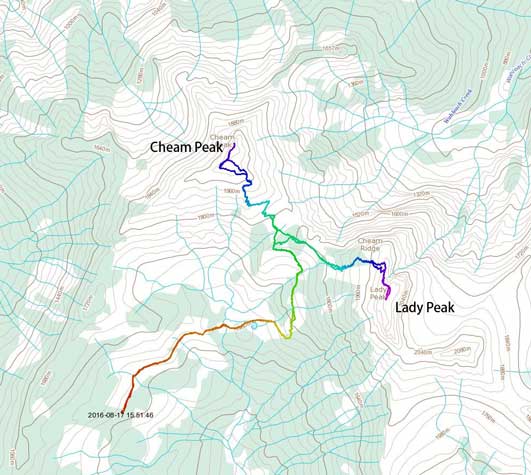
Cheam Peak and Lady Peak scramble route. GPX DL
After a not-so-alpine wake-up call at 6 am we were on the road within an hour. Another hour later we correctly turned on the Chilliwack Lake Road, and then thank to my previously plotted GPS track from scribblemaps.com we didn’t miss the logging road turn-off. About 2 km down we turned left, and then at the next major intersection we’d turn right up the much rougher Chipmunk Creek FSR. For the next 9 km or so this road would bring us up 1000+ vertical meters – appealing but on the other hand, this was easily one of the worst roads I’ve ever driven onto. At least 15 major waterbars were involved along with some very rough, rocky and steep sections. My Jeep Grand Cherokee had no problem handling it, although the entire logging road section took us a rough 1 hour, if not longer.
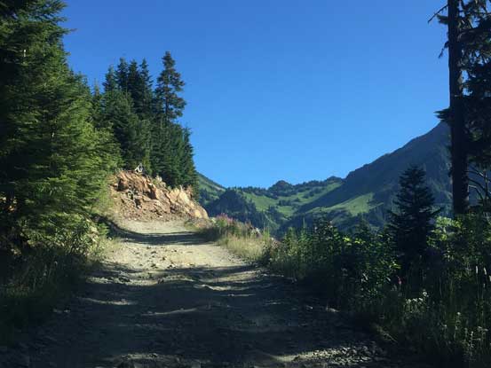
Almost done the logging road drive. It was mentally tiring…
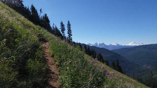
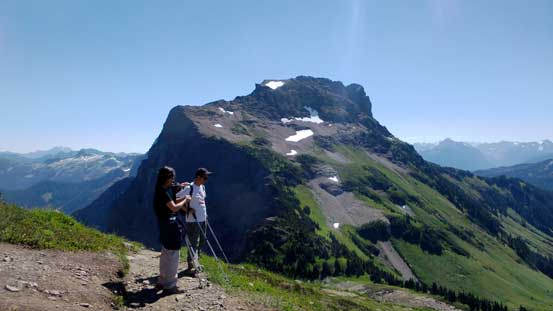
There were already 3 trucks parked there and 2 more coming up from behind. It’s going to be a busy show on this day, but with the good weather I wouldn’t going into complain. There’s not much involved to gear up so we were off onto the trail in no time. The initial plod was along the deactivated road, passing a stream and a small tarn, and then the trail took a steep switchback up the lower flanks of Lady Peak. There were some neat meadows around as we slowly gaining height, traversing towards the distant Cheam/Lady col.

Hiking out from the parking lot.
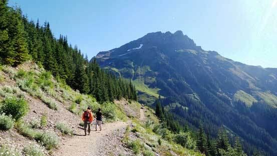
Hiking the trail, with Lady Peak in front
Looking back from the first section. Mt. Archibald is that forested bump at center
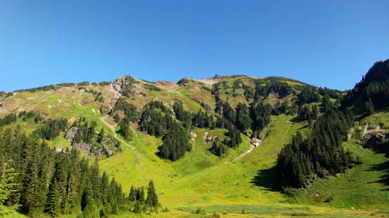
The bowl/cirque on the south flanks of Cheam Peak
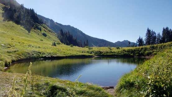
A small but beautiful tarn
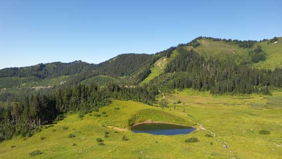
The same tarn, from above
The trail switchbacks steeply up.
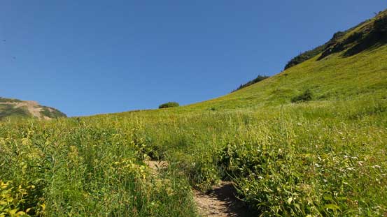
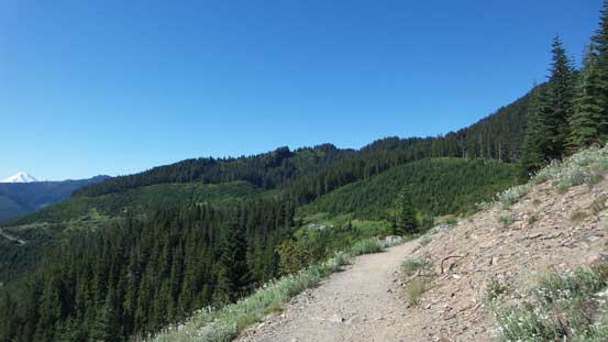
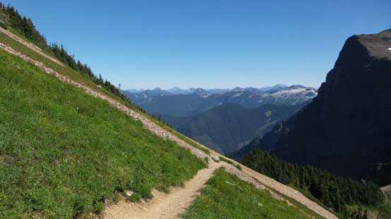
The trail traverses some neat alpine meadows

An obligatory shot of Mt. Baker

Looking back at the trail traversing the lower slopes of Lady Peak before cutting back
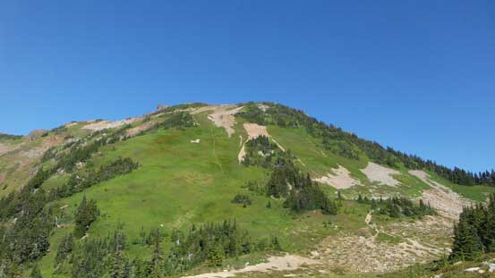
The south-east slopes of Cheam Peak. Almost to the col now
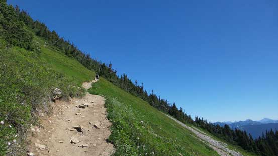
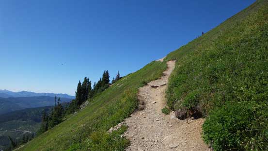
From the col we took the narrow trail switchbacking up Cheam Peak’s SE Slopes. It was steep at places but my parents were doing good. A while later the grade eased. The ground had slowly become rocky and the next thing, we had crested the summit ridge. The drop-off down the N. Face was impressive and intimidating at the same time.
Following the trail up.
Lots of switchbacks. Nothing too steep
Looking back at Lady Peak
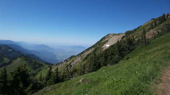
Finally able to see at least some of the Fraser Valley.
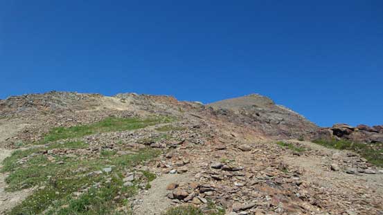
The terrain starts to get rockier
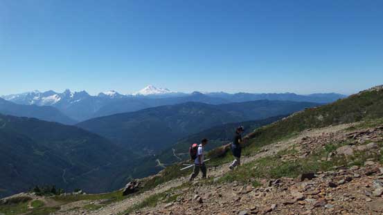
Marching up…
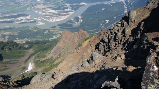
Hitting the SW Ridge, looking steeply down the N. Face
Harrison Lake to the north. The bump in front is Bear Mountain, now looking tiny.
Fraser Valley at 2000 vertical meters below
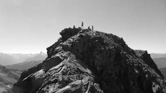
Another group checking out the views. The summit behind

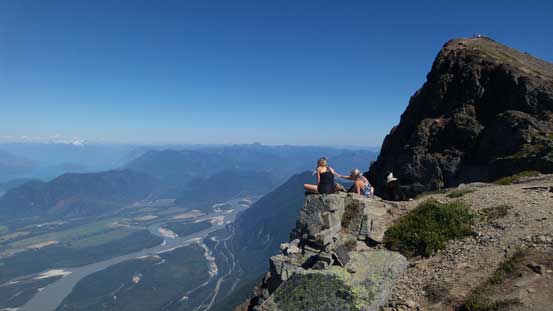
This is indeed a very nice viewpoint. Worth lingering around.
We then followed a loose, but well trodden path to the summit (only about 5 minutes away). The views were outstanding especially looking down at the Fraser River. Eventually everyone else headed down and we decided to linger a bit longer just so to have the entire summit to ourselves.

The final push to the summit
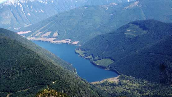
Jones Lake (aka. Wahleach Lake). I was there in this past November while doing Conway Peak
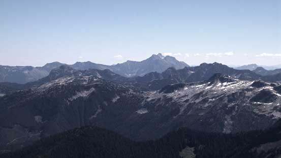
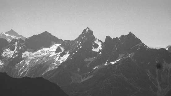
Mt. Outram right of center in the far background; Mt. Grant and Eaton Peak in front
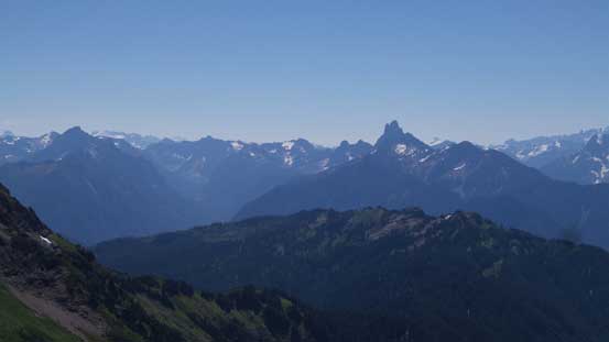
Silvertip Mountain in the background; the tiny Conway Peak in foreground on right
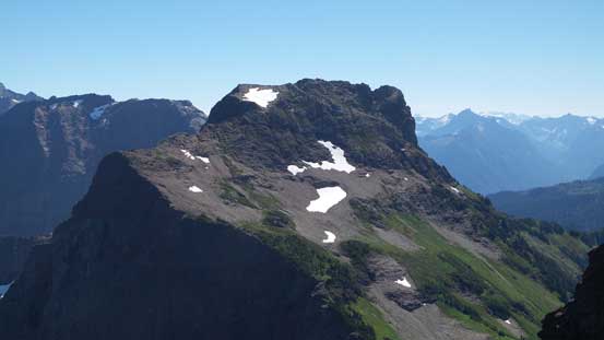
A zoomed-in view of Lady Peak, my next objective

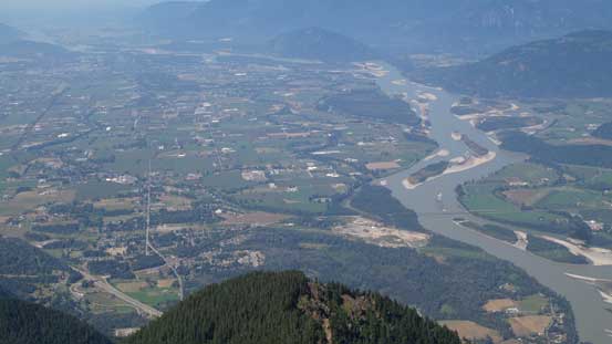
Fraser River and some braided sections
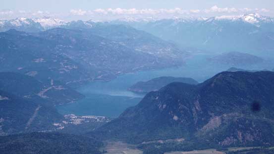
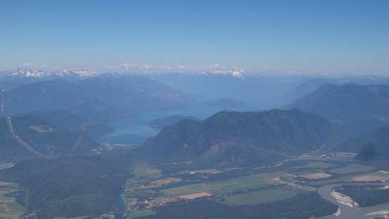
Harrison Lake

Looking down at Sumas Mountain and the city of Abbotsford. It was a bit hazy.

This is looking towards Cultus Lake and area
Slesse Mountain is that striking peak right of center; Mt. Rexford on the far left

The volcano Mt. Baker
Mt. Larabee, American Border Peak, Canadian Border Peak; with Mt. Shuksan on the far left
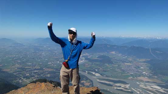
Me on the summit of Cheam Peak
I wondered around a bit. This is looking back towards the summit
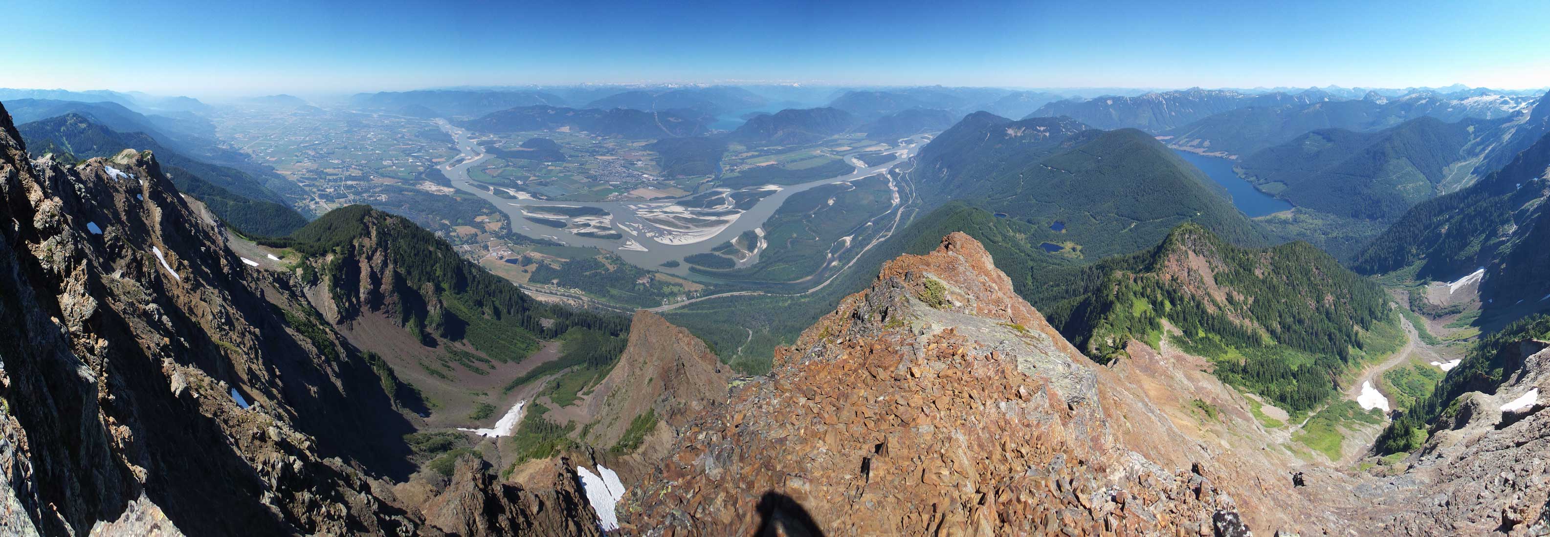
Partial summit panorama. Click to view large size.
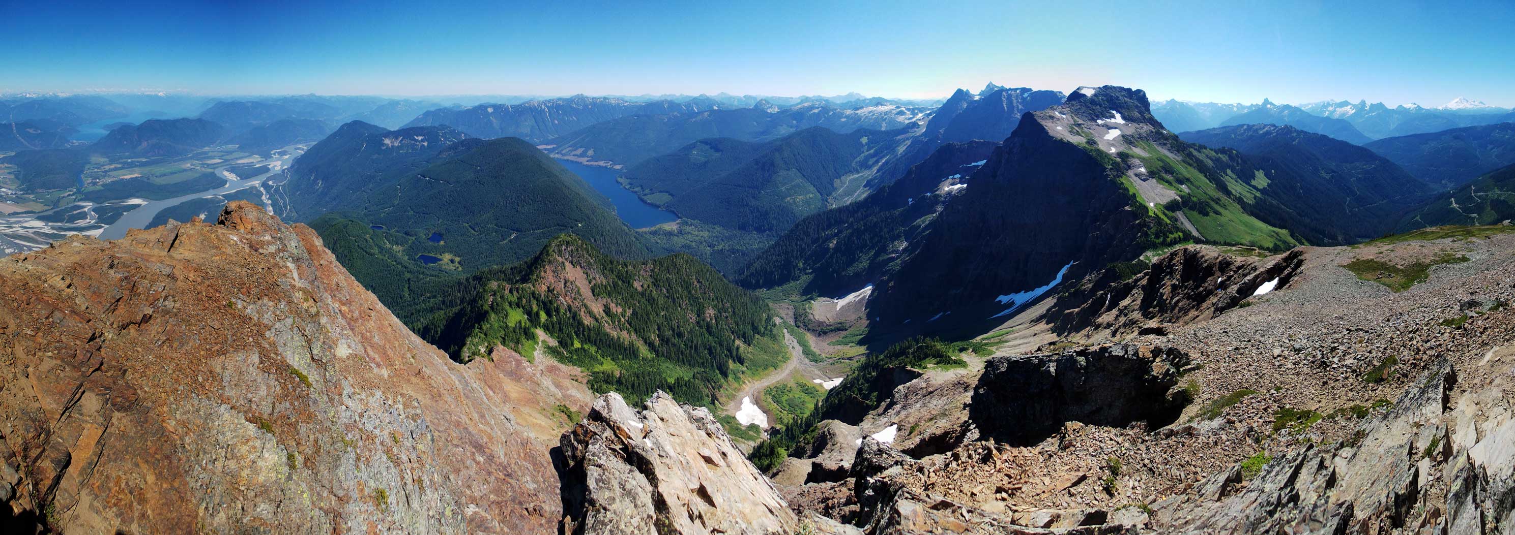
Partial summit panorama. Click to view large size.
On the descent we checked out an optional spot along SW Ridge before bailing down the trails on SE Slopes. A bit tiring on our knees but nothing else worth nothing.

Me checking out that viewpoint along SW Ridge
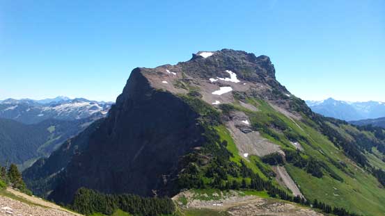
Lady Peak
Going down..
Down to Cheam/Lady col. The summit of Lady Peak was right there, so why not… While my parents taking a well-deserved break on a bump with some alpine meadows around, I would go for a solo ascent up Lady Peak.
