Uto Peak
September 11, 2020
2927m
Rogers Pass, BC
Uto Peak is one of the classic climbs in the immediate Rogers Pass area of Glacier National Park. It’s somewhat overlooked thank to the close proximity to Mt. Sir Donald, but the climbing quality is equally good. The SW Ridge of Uto Peak is rather just a shorter version of the NW Ridge of Mt. Sir Donald. It’s not as sustained nor exposed, but offers a few harder technical cruxes. The north ridge of Uto Peak offers an easier route (3rd or 4th class) albeit with looser rocks. The most common way to climb Uto Peak is by ascending the classic SW Ridge and descending the easier N. Ridge making a loop, while ambitious parties would probably prefer a traverse from Uto Peak to Avalanche Mountain.
Winnie and I had been talking about to give Rogers Pass area a visit for a few weeks. I knew how much she wanted to come here, but she also needed to gain some experience in scrambling and mountaineering. Earlier in the summer we had done Welch Peak and Foley Peak in the Chilliwack area that involved route-finding on exposed and loose terrain, and then spent 5 days on Vancouver Island dealing with more loose rocks. A weather window formed immediately after coming back from the Vancouver Island trip so we pulled the trigger spontaneously. It was tempting to try Uto to Avalanche traverse but I figured it’s probably safer to just do Uto Peak (up and down SW Ridge) as a introductory climb. Winnie didn’t expressed interest in just scrambling Avalanche Mountain so after the climb of Uto Peak we would move to the Bugaboos to aim for Lions Way and Brenta Spire to finish off this mini road-trip.
The objective for the first day was simply driving to the trail-head and sleep in our vehicle so we didn’t need to rush. Winnie had an important appointment at home and couldn’t leave until 5 pm anyway. The drive out of Vancouver was a bit slow but once the darkness kicked in, the drive into the interior was quite a smooth sail. The drive over Coquihalla Highway to Kamloops, then eastwards down Highway 1 corridor to Revelstoke was something that I had done probably 20 times in the past 5 years. We eventually made to the trail-head at around 2 am. We were too tired to set up our tent at this time of a day, so just opted to sleep in the truck. There were two other vehicles with climbers or hikers sleeping inside, so we weren’t alone. We also determined the risk of getting ticketed by a ranger was minimal.

Uto Peak via SW Ridge. GPX DL
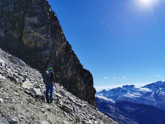
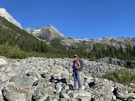
The alarm went off at around 6 am. Based on the various trip reports as well as my own Mt. Sir Donald trip 6 years ago we figured that a true alpine start wasn’t required to day-trip Uto Peak. We only used head-lamps for the first half an hour. The approach trail was a bit rougher than I remembered with some long stretches of hopping on rocks, but it’s very well marked and easy to follow. The trail gains just over 1000 meters to the official campsite under Uto/Sir Donald. We took our one and only break filling up water bottles at the only (easy) stream hopping before reaching the campsite. The terrain was bouldary and confusing near the campsite but the general bearing was to just turn right aiming for the cliff faces of Mt. Sir Donald. After a few minutes of boulder hopping we came across some sets of paths and cairns and ascended steeply to the climber’s path under Mt. Sir Donald’s rappel route, then traversed horizontally across some ledges to Uto/Sir Donald col without having to step onto any snow patch (2.5 h from truck).

Morning view of the SW Face of Mt. Sir Donald

The south aspect of Eagle Peak
Mt. Bonney and Mt. Swanzy behind “Asulkan Ridge”
The ledge traverse to Uto/Sir Donald col

We were able to squeeze beside the rock and avoid this permanent snowpatch

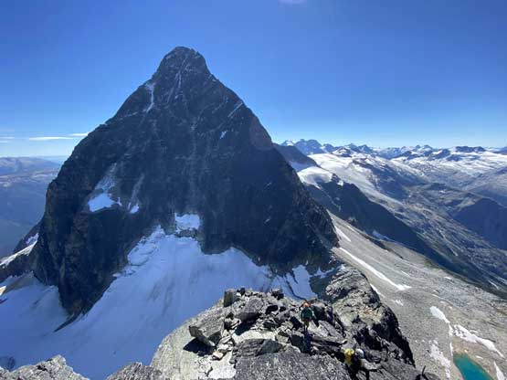
The start of NW Ridge of Mt. Sir Donald from the col
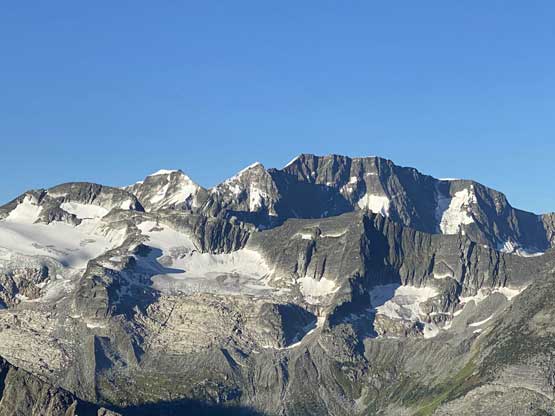
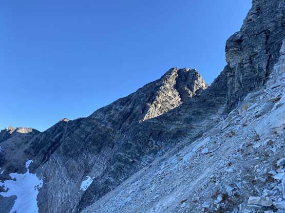
Uto Peak’s SW Face from Uto/Sir Donald col

This is looking down the east side Uto Glacier from the col
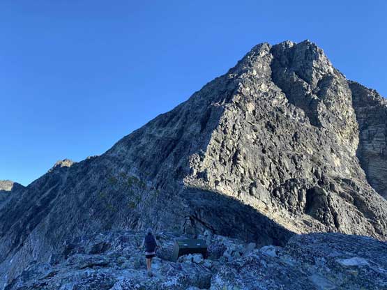
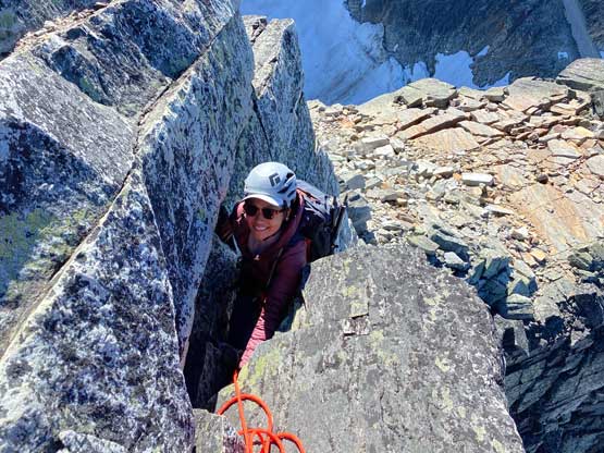
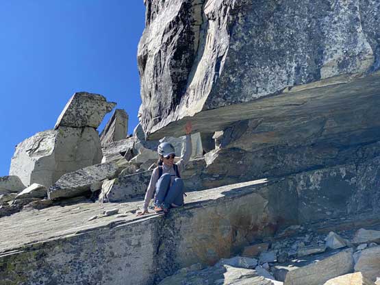
Winnie and I took a long break swapping footwear for rock shoes. We opted to carry our hiking shoes and trekking poles because we weren’t 100% sure whether or not we would come back down the same way. The exposure kicked in right off the bat with an awkward traverse out climber’s left, which was then followed by a long stretch of 4th class climbing on small ledges. The lower ridge can be broken down into several steps separated by a few platforms. The attacks of the difficult sections were usually on climber’s left side of the crest. The crux came at about halfway up. We opted to pitch out one short stretch with me leading the sharp end. The climbing was definitely 5th class there and I agreed that this short pitch felt harder than anything I did on Mt. Sir Donald. Beyond that we both soloed the next short section – an uber exposed corner on climber’s left side of the crest.
Winnie starting the SW Ridge of Uto Peak
Winnie tackling a fun crack on the lower ridge

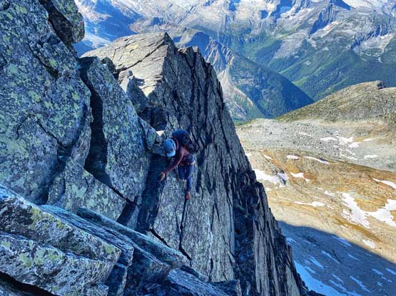
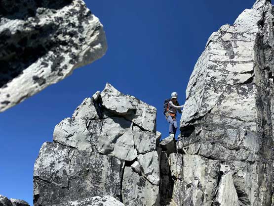
The typical exposure and climbing on the ridge
Coming up onto a platform. Mt. Sir Donald behind
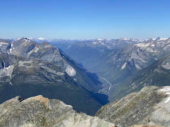
This is looking down at Rogers Pass and Highway 1 corridor

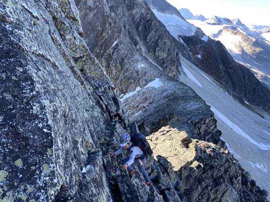
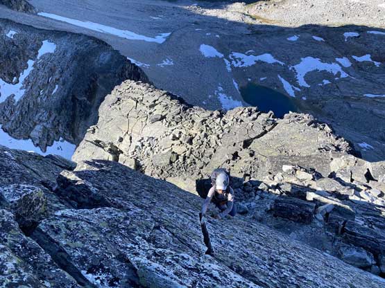
Me scrambling up the typical terrain. Photo by Winnie M.
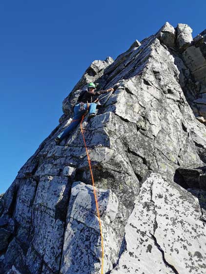
Me leading the crux pitch. Photo by Winnie M.
Winnie coming up to the belay station
Winnie soloing the exposed corner pitch

Winnie finishing the corner pitch.
The terrain eased a bit above this stretch of technical climbing but depends on the micro-terrain route-finding we still encountered a few climbing steps. Nearing the top we deviated from the SW Ridge and ventured onto what seemed like the west face. We ascended the last 50-100 vertical meters on the west face dealing with mostly 3rd class terrain albeit with loose rocks. We made the summit in 4 hours 40 minutes since leaving the vehicle. Despite the earliness we decided against the traverse towards Avalanche Mountain and instead, spent at least an hour and half on the summit. It had been 6 years since I climbed Mt. Sir Donald so I felt a bit emotional to look back at that giant.

Me continuing up the ridge. Photo by Winnie M.

Winnie plodding across another flat platform

The exposure kicked in again

Winnie taking the lead for a while

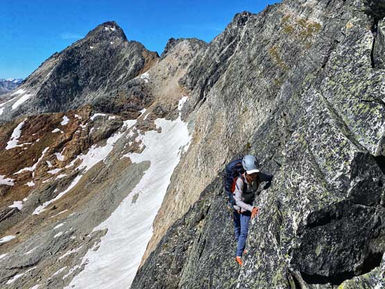
On the upper mountain we traversed climber’s left onto the SW Face

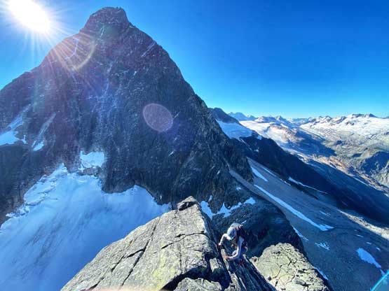
Winnie with Mt. Sir Donald behind

The last stretch to the summit was mostly just 3rd class

Partial Summit Panorama from Uto Peak. Click to view large size.

Partial Summit Panorama from Uto Peak. Click to view large size.
Avalanche Glacier in the foreground with Mt. Rogers behind

The Dogtooth Range in the northern Purcells across Beaver River valley
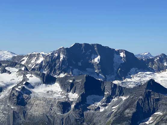
A closer look at the north face of Mt. Bonney
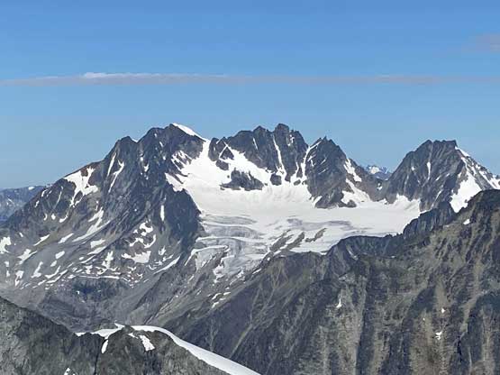
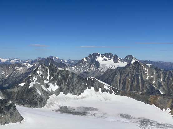
Mt. Rogers massif (Rogers Peak and Swiss Peaks), and Hermit Mountain

Carnes Group in the northern Selkirks dominates the skyline
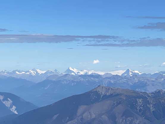
Mt. Columbia and Columbia Icefield in the Canadian Rockies

The towers of Mt. Goodsir in the background

Findhorn Peak, Mt. McBean and Tomatin Peak in the distance

Mt. Jupiter (Leda, Pollux, Castor) with Hope and Charity Peaks behind on right

Me on the summit of Uto Peak
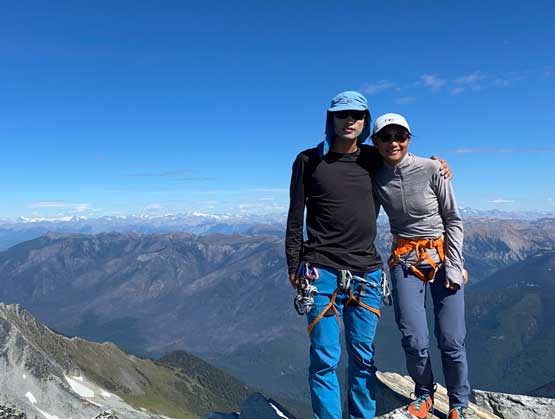
Winnie and I on the summit of Uto Peak
The descent off N. Ridge would be easier but we both wanted more challenges, so decided to return the same way. For the upper route we reversed our route down the west face and then made a few short and exposed down-climbs. There weren’t many existing rappel stations so we either had to down-climb, or to leave cords behind. We ended up only doing one rappel to get down the crux zone, and down-climbed everywhere else. The lower ridge had a few long stretches of committing down-climb but we thought those were actually quite fun.

Winnie descending the upper SW/W Face

More about the typical terrain on the upper route on the face
Back onto the SW Ridge now. Mt. Sir Donald ahead

Me posing for a shot in front of Mt. Sir Donald. Photo by Winnie M.

Winnie down-climbing the typical ledgy terrain
The rock steps seemed too huge for her lol..
Lots of blocky terrain

Me leading down the rappel. Photo by Winnie M.

Winnie finishing the rappel.

Cool corner to traverse. Photo by Winnie M.

Me looking small in this terrain. Photo by Winnie M.

Back onto the ridge crest and briefly back onto easier terrain

One of the harder pitches to down-climb

Winnie finishing down-climbing that crack

What a typical shot of the lower ridge. We down-climbed all of it
Just one of the many exposed ledges

Not sure what she’s trying to display here… Seems too casual lol…

Winnie seems happy to be back at Uto/Sir Donald col
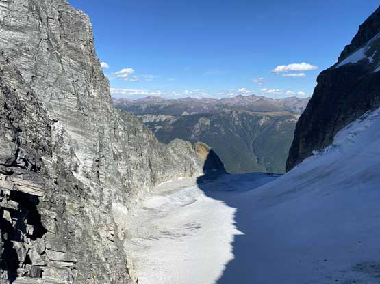
Uto Glacier from Uto/Sir Donald col
Wearing rock shoes the whole way up and down was quite hurting so we both looked forward to take a long break at Uto/Sir Donald col resting our feet. The climb of Uto Peak via SW Ridge was honestly a bit disappointingly easy for both of us but for sure “type 1 fun” that I’d recommend to anybody. The return hike was boring and tedious but didn’t take us too long. By coincidence we bumped into Kris Mutafov and his friends heading for Mt. Sir Donald on the following day. We had bumped into his group on Victoria Peak on Vancouver Island a week or so ago and now they recognized us out here in Rogers Pass… How small the climbing world is…

Traversing the ledges down below Uto/Sir Donald col

Eagle Peak behind a cool little tarn
Me picking the path. Photo by Winnie M.

Ahead is that squeeze to avoid stepping onto snow

Winnie with Uto Peak’s SW Ridge behind

Back to that rock city with lots of boulders

Mt. Sir Donald and Vaux Glacier

There’s a really fat marmot

One of the handful hiker’s foot bridges
Winnie’s still smiling after a long and tiring descent
After the climb we wasted no time and drove straight to Golden for a well-deserved dinner. We unfortunately arrived there too late so that most restaurants were already closed. None of us wanted to eat fast food so we settled on a restaurant beside the Subway on Highway 1, which turned out to be disappointingly expensive but oh well.. We then resumed the drive southwards down Columbia Valley aiming for the Bugaboos…
