Maple Mountain
February 5, 2022
504m
Vancouver Island, BC
Maple Mountain in North Cowichan of southern Vancouver Island is another forested hill ridded with logging roads and mountain biking trails. One would think this peak is a dumpster drive-up objective as the Mt. Maple Mainline goes all the way to a communication structure near the summit, but it is gated at the very bottom. My plan was to park at the gate and pedal the 5km+ road to the top on bike. There are also numerous hiking routes to the summit but I did not investigate. Earlier in the day I had just bagged Mt. Prevost and Big Sicker Mountain with the bike.
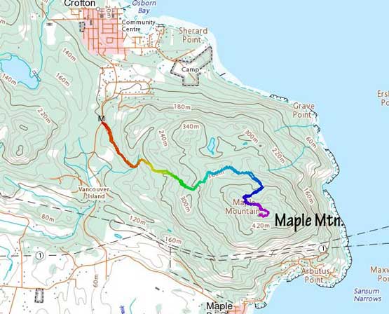
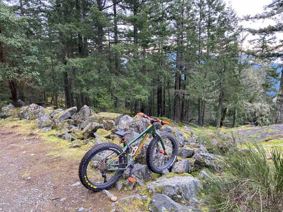
The drive from Mt. Prevost to Maple Mountain seemed short on the map but felt a bit roundabout but I just followed Google’s direction without thinking too much. The parking lot was extremely busy that I barely found a spot to park the truck. Numerous bikers were there as well, but it seemed like most weren’t using this mainline access road. I later learned there’s a better way to pedal up but with only the Gaia’s map at the time I had no way to know. The road started off fairly tame with a few long stretches of flats passing some replanted zones. After a 90-degree left-turn bend the road started to climb steeply such that I had to get off the bike to push it up, but wherever I could pedal I opted to pedal. For the upper 1/3 the grade was still as steep, but I felt like 100% warmed up so I pushed myself to pedal the whole way to the top mostly in the lowest gear. I was very beat by that, but one purpose of this trip was to train my biking muscles, so I had to push myself. The true summit was slightly to the west of the road’s end so I made sure to check that out. There was no view from the highest point, but the road’s end had a little bit of views, though nothing magic.


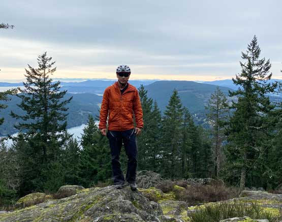
Two hikers helped me to take some pictures. I tempted to stay longer on the summit but with at least one more peak on the agenda I had to move on. One of the hikers casually mentioned a downhill route called “Maple Syrup” but I checked the map and couldn’t find it. I decided to not fancy with the unknowns and just ride the road down, which was quite furious as well. I basically rode as fast as I felt comfortable with and in no time I was back at the truck. I immediately turned on the engine and drove to the next objective, Mt. Tzouhalem.

