Leitrim Peak
July 7, 2015
2934m
Invermere, BC
Leitrim Peak and its lower neighbour, Antrim Peak are two of the easier ascents in the Irish Peaks group near the famous Welsh Lakes. For folks wishing to make an ascent of one, it makes perfect sense to traverse to the other as well, and that’s exactly what I did on the Day 2 of this trip, after successfully ascended Mt. Alpha Centauri on Day 1 and then Antrim Peak earlier this day.

Ascent routes for Antrim and Leitrim Peaks. GPX DL
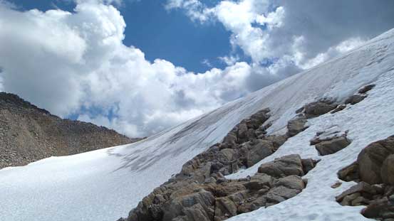
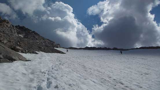
The traverse from Antrim to Leitrim actually surprised me quite a bit as it’s not nearly as easy as expected. Immediately I could no longer stay on the ridge crest and had to bail down skier’s right side on some down-sloping and loose terrain. I tried to regain the ridge crest at least twice (and did gain the crest), but the terrain immediately ahead forced me to bail down skier’s right every time. Eventually I got frustrated enough so went down for quite a ways until I could spot a reasonable line cutting back. This line, though worked, involved traversing some very ugly and loose ground, and brought me down to the low col between Antrim and Leitrim. Due to a glacier on Leitrim Peak I couldn’t go straight towards the summit, but picked the right hand side ridge.
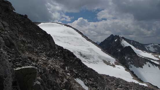
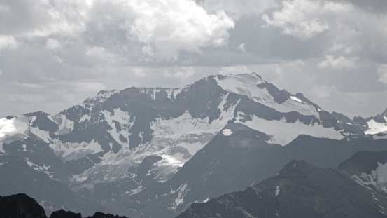
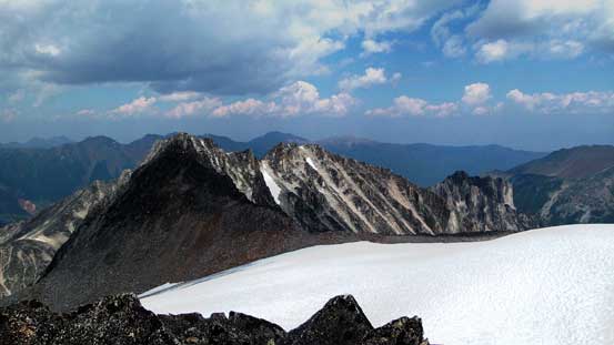
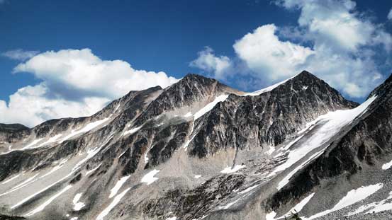
A view of the glaciated Leitrim Peak from partway down from Antrim
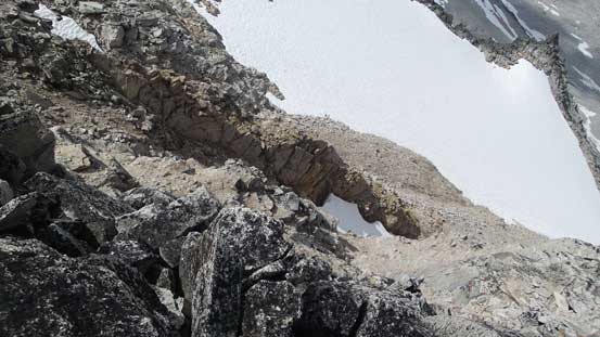
This is the ugly loose terrain I had to traverse/descend
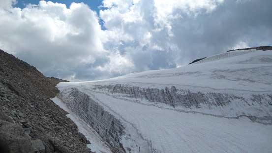
Finally got through those crap and on the edge of Leitrim’s glacier

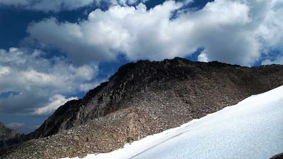
I decided to keep descending to the low col and then ascend the other ridge
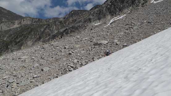
The snow was still reasonable so I basically stayed on the edge of that glacier (snow was always easier than boulders), but near the summit I did have to go back on the rocky ridge proper. The summit was also a bit farther than expected and offered slightly better view than the nearby Antrim Peak. I also noticed that Ben and Eric just traversed up and over Antrim Peak and were on their way down towards the col. There wasn’t much space to relax on the top so I went back down to the low col (below the glacier) and waited for them tagging the summit.
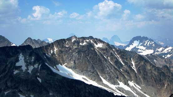
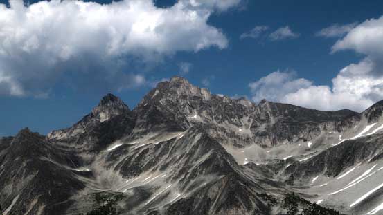
Looking back towards Antrim Peak from partway up Leitrim
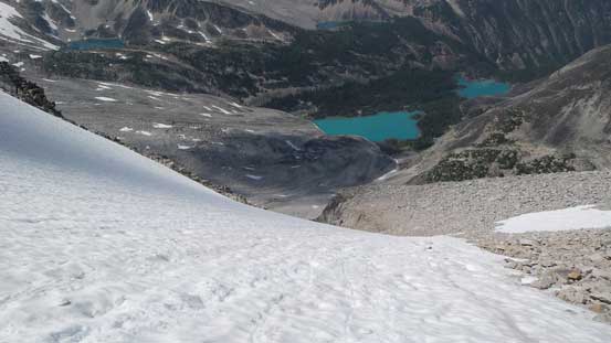
Leitrim’s glacier
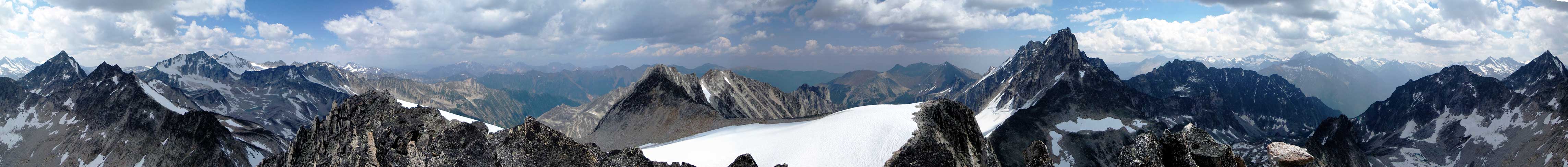
Summit Panorama from Leitrim Peak. Click to view large size.
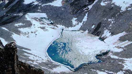
This is a rarely-seen lake on the south side of Leitrim Peak
Gelway Peak

Mt. Stockdale and Tricorn Peaks

Jumbo and Karnak with Commander in front – 3 of the Purcell 11,000ers
Mt. Delphine – another Purcell 11,000er
Mt. Farnham is the highest peak in Purcells

The mighty Bugaboo Spire rises behind Taurus Mountain
This peak in the foreground is Carmarthen Peak
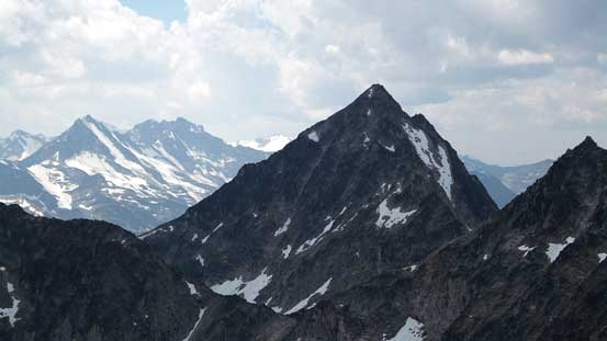
The impressive Donard Peak just to the south
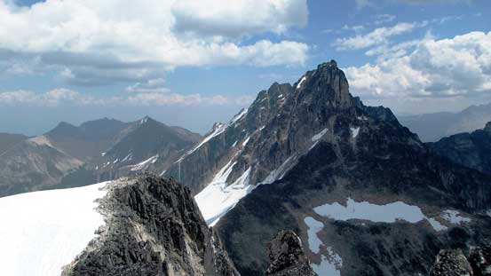
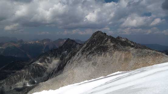
Looking back across the upper glacier towards Antrim Peak
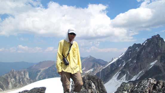
Me on the summit of Leitrim Peak

Another panorama from the summit. Click to view large size.
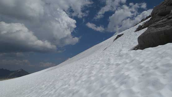
Descending on the edge of this glacier on soft snow
One last look at Antrim Peak. It doesn’t look easy to traverse from this angle.
For the descent we didn’t reverse our route up and over Antrim, but rather picked a diagonally traversing line on either snow or side-hilling boulders. The snow was just soft enough to plunge down and the boulders weren’t too terrible (maybe we just got used to it). After traversing this bench we rejoined my ascent route for Antrim. We didn’t like to descend the shooting galleries in a group of 3 so kept traversing until hitting a big snow field. The snow was a bit too hard/steep for my like to plunge down but by facing inwards I could still down-climb very efficiently (just had to take my gloves out). Once finishing the snow section Eric and Ben convinced themselves it’s better to descend to the middle Welsh Lake and then re-ascend back to camp in order to avoid that gigantic boulder field. I did not like that as that’d involve at least 100 extra meters of height loss/regain so went back the boulder field by myself. It felt a lot easier than in the morning despite the fact I was definitely more tired/fatigued than in the morning. That’s how you can tell we had dealt with a ridiculous amount of boulder hopping in one day…
Ben and Eric descending another snow field below that glacier
And here’s another snow field on the lower slopes
Eric glissading the last bit
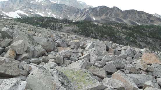
The typical boulder hopping for roughly 2 km distance
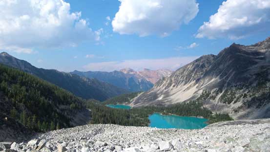
Looking down towards Welsh Lakes from the boulder field
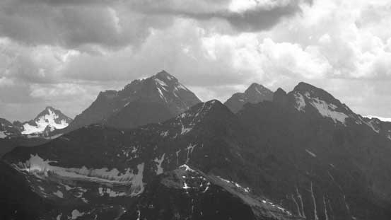
Looking back towards Antrim and Leitrim Peaks
Connemara and Donegal Peaks
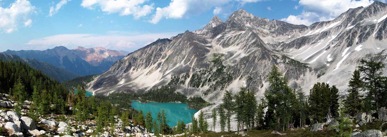
A panorama view from this scenic vantage point. Click to view large size.

The middle Welsh Lake

Killarney Peak
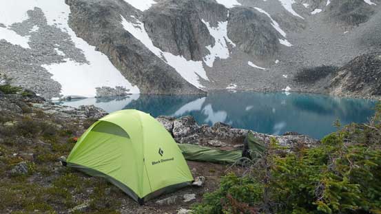
Back to camp. Time to hide inside my tent thank to the bugs…
In the end I proved my way was much more efficient than Eric and Ben’s as they still had to ascend the boulder field. However, they did get the bonus of seeing the middle Welsh Lake up close. That’s the only lake (out of 4) that I didn’t visit in this trip. There were still a couple hours to kill but the mosquitoes were horrible. I had to stay in my tent for pretty much the entire evening except for the brief moment of cooking. There were at least 50 mosquitoes and many more other bugs hovering around if not more… It’s just crazy. While complaining about the bugs we decided to wake up at 6 am the next day for a summit bid on the highest in this range – Gwendoline Mountain.
