White Chuck Mountain
August 31, 2022
2130m
Darrington, WA
White Chuck Mountain is one of the more popular and sought-after objectives in the vicinity of Darrington accessed from Mountain Loop Highway. This peak offers a short approach, good views and some fun scrambling that’s not overly challenging. The only downside is the requirement of a 4×4 vehicle for the logging roads access but that’s typical in the PNW. I had been saving this objective on a day when I lacked time and/or energy but still wanted to get out to take advantage of the good weather. I was tired from the recent trips and I needed to be back home in the evening for work. Instead of asking everybody I know who’s available I decided to just send an open invite via Instagram at the last minute. To my surprise quite a few signed up and none of them had hiked with me. I did not want to make this a large group kind of outing, so just picked the first two responders, Aron from Washington and Shayan from B.C.
Shayan and I met in White Rock at 5:10 am and drove down south in my Tacoma to grab Aron from Darrington. We decided to follow the Google’s direction onto the logging road system instead of taking Rob Woodall’s GPX tracks. Aron had done some research and confirmed that the Google’s direction was actually the more popular choice. The road was never-ending but in decent quality such that I could cruise up in my Tacoma. We did encounter some deep pot-holes and steep and loose spots here and there, but anything we encountered was easy for the truck. I definitely would not want to be here in a 2WD car though. The weather forecast had downgraded at the last minute now showing 20% chance of showers throughout the day. Indeed, it had been raining steadily in the morning on our drive to and out of Darrington. By the time we parked at the trail-head the rain thankfully had magically stopped.

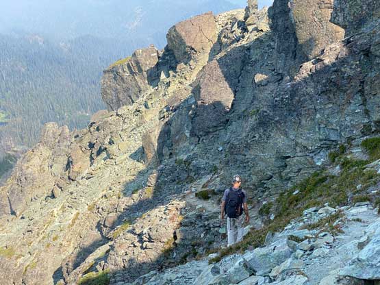
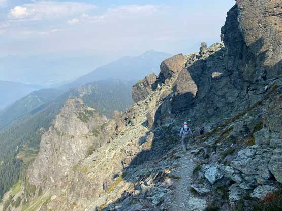
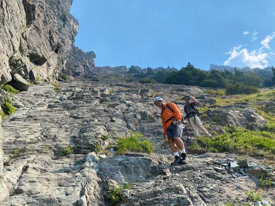
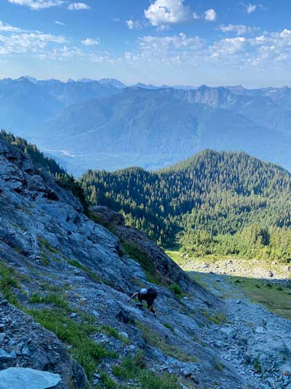
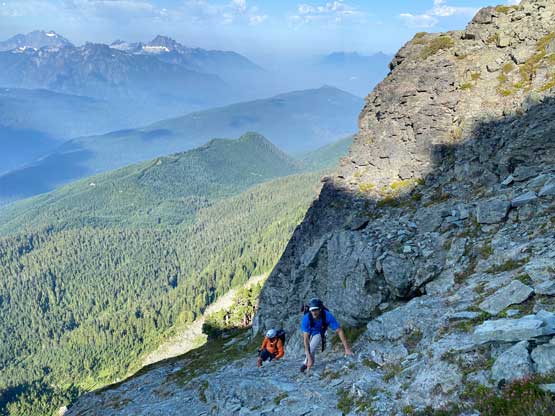
The trail-head elevation is at 1500 m and the summit is just over 2100 m so there was really not that much work left for us. The approach is actually on a well-defined climber’s trail on the NW forested ridge. With intermittent views of the rugged mountains around us the approach was actually quite fun. We encountered two hunters on their way down who seemed to be really quiet and weird. The trail brought us close to the base of an obvious rock buttress and then led us skirting around this buttress on the south side, losing some elevation. We then did a rising traverse ascending into an obvious gully. The terrain here was mostly scree and scree-on-slabs but we were able to mostly stay on the path. There were some scrambling higher up and Shayan took a harder route farther climber’s right. Aron contemplated to follow him but elected to follow me up the “standard route”. The three of us then regrouped on the NW Ridge.
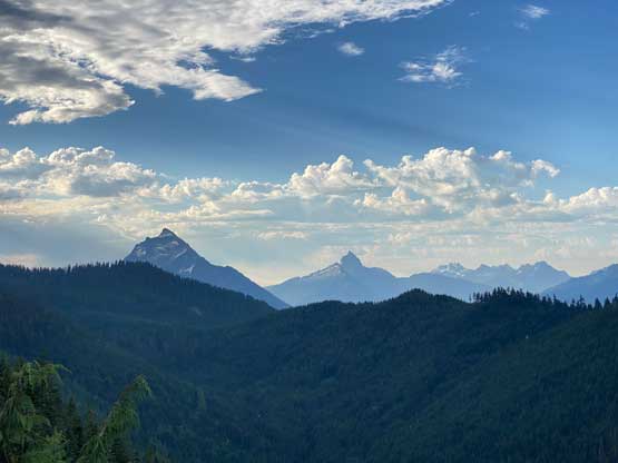
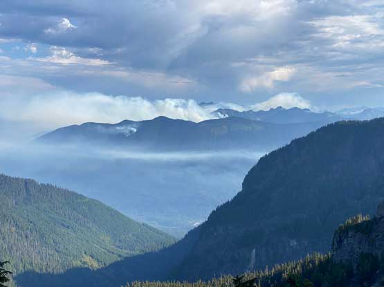
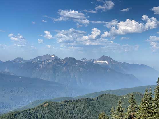
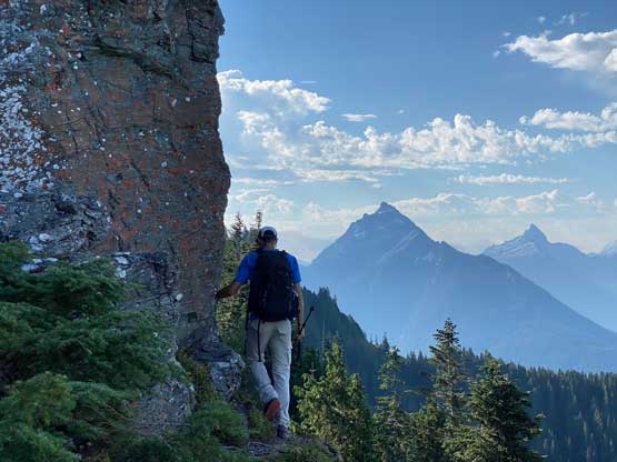


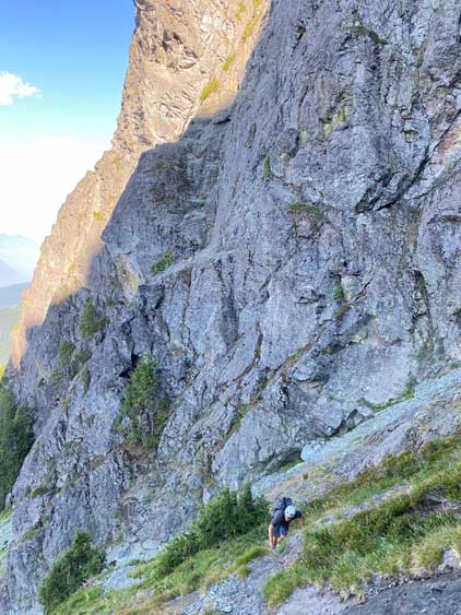

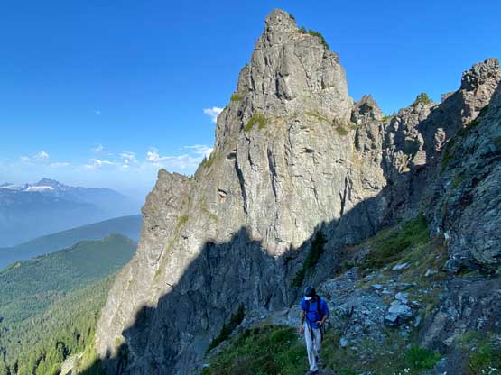

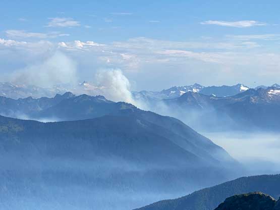

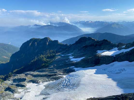
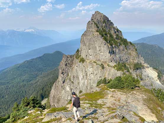
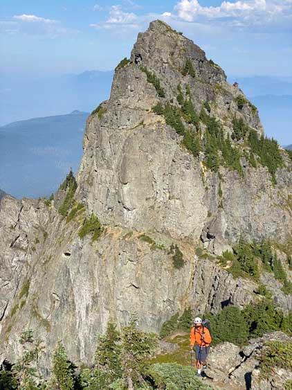
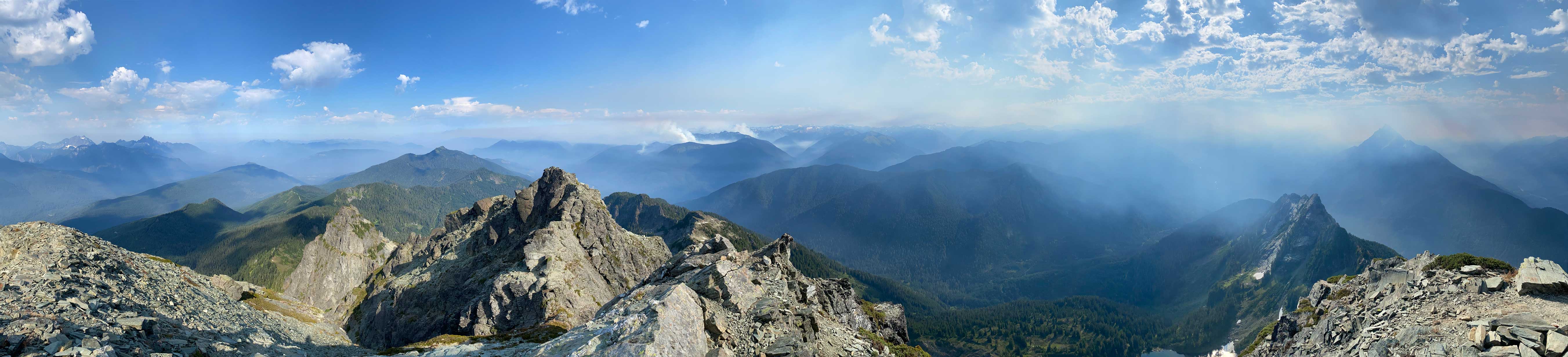
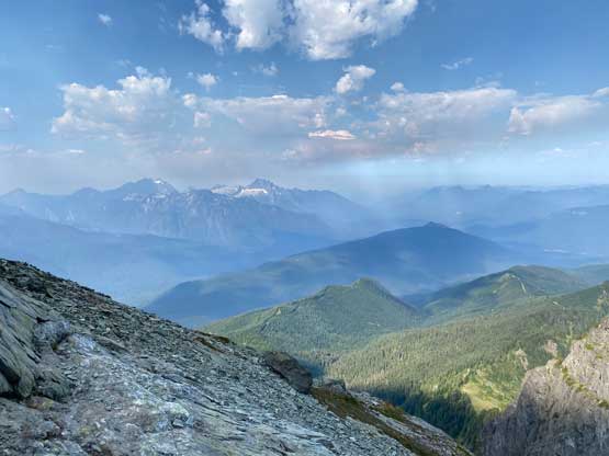
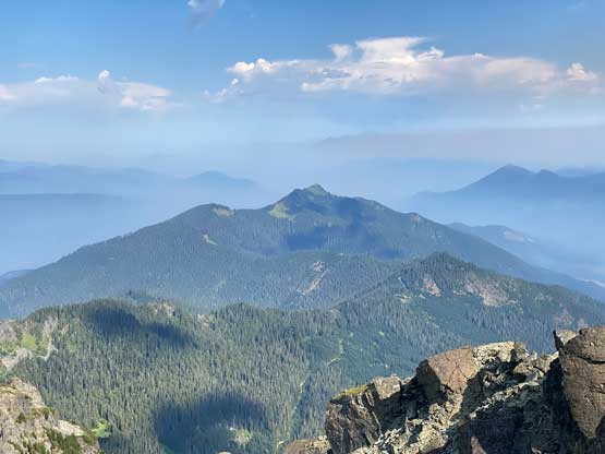
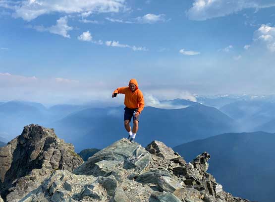
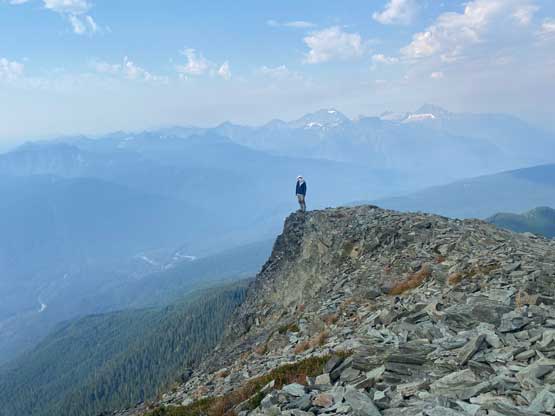
None of us came with a ton of research so we just scrambled whatever that seemed rational. We did encounter hands-on steps here and there but soon we merged onto the “path” again traversing the climber’s right side of the ridge. This traversing path was narrow and exposed, but not difficult and was reasonably easy to follow. We could see the true summit in the distance. There’s one notch to scramble across which looked worse than it actually was, and minutes after that we were on the summit. The views were obscured by the smoke but we actually got some cool photos.
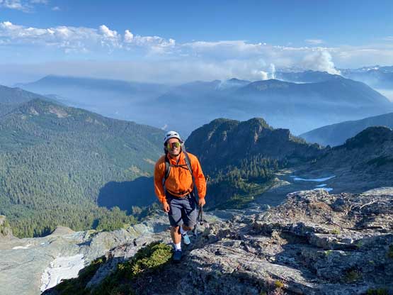
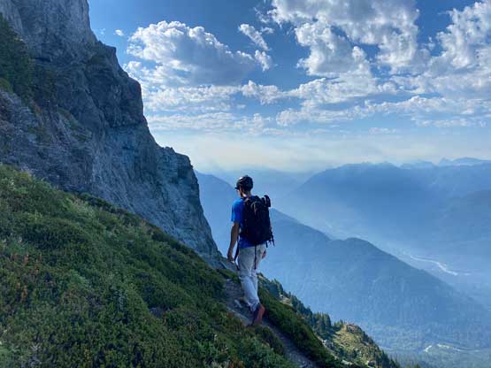


After a long break on the summit we had to start descending. I did some extra scrambling near that notch for fun and photos. We then walked down the traversing “path” but somehow stayed too long on the ridge lower down. By the time we realized the “path” wasn’t leading anywhere we were significantly off-route. To correct the mistake I estimated at least 5 minutes of backtracking which I refused to do. Shayan and I inspected the terrain and decided to down-climb a long section of class 3+ rocks and heather to get back on track. Meanwhile Aron went back to find the standard route and he was only a few minutes behind. The rest of the descent was rather uneventful and quick. Our round trip time was 3.5 hours on a very leisure pace so this was indeed the short outing that I was looking for. We then had a burger lunch in Darrington before resuming our own ways homewards.