Mount Bogart
August 2, 2015
3144m
Kananaskis – Smith Dorrien Valley, AB
Mt. Bogart is the second highest peak in Kananaskis Range – the range that sandwiched between Highway 40 and Smith-Dorrien Road and extends southwards from Ha Ling Peak all the way to the Lawson/Kent Ridges. It’s towered only by Mt. Galatea above to the south and thus, one of the most prominent peaks in the K-Country. Another interesting fact is that Mt. Bogart is covered in both Alan Kane’s (via E. Ridge from Ribbon Creek) and Andrew Nugara’s scramble guides (via W. Ridge from Sparrowhawk Tarns). A few friends had tested out both options and the conclusion I got from their trip reports was to forget about the original Kane’s route and take the Nugara’s option which is shorter and more pleasant. Having Matthew Hobbs’ GPS track to follow was another bonus, so by 9 am I found myself gearing up at Sparrowhawk day-use area for a solo attempt on my 400th summit.
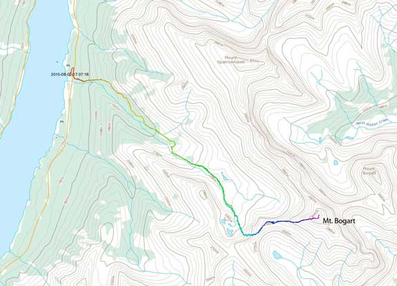
Mt. Bogart scramble route via W. Ridge. GPX DL
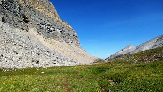
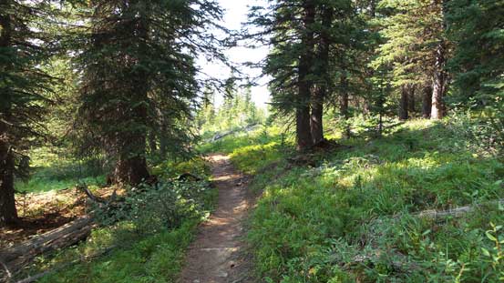
The initial business was to hike 5.4 km along an unofficial, but relatively well-defined trail to Sparrowhawk Tarns. In a short time I passed the turn-off to Mt. Sparrowhawk and took the right fork. It dropped a little bit and then followed closely to a creek, and about halfway up the trail emerged from the forest and into a boulder field. There were abundance of cairns leading me through this field and after that the trail started to gain height steeply into an alpine meadow environment. It’s a beautiful site but I was feeling tired, partially because of the heat (30+ degrees) and partially because of the fact I just solo’d Mt. Murchison, the big loose bastard the day before.

The typical hike through the thinning forest
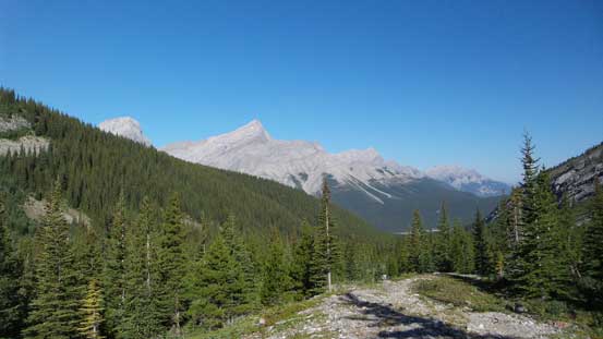
Soon enough the views started to open up

Entering a boulder field
The ridge that I paralleled on right was “Red Ridge” – one of my earlier snowshoe ascents
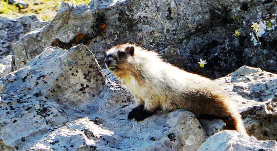
A lovely marmot
Part of Red Ridge again
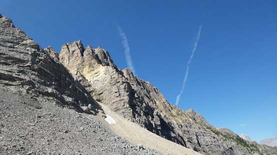
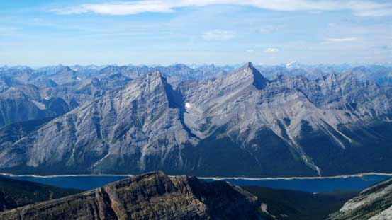
Looking back down the valley, the peak dominating the skyline is Old Goat Mountain

This interesting ramp with an abrupt drop-off is Read’s Tower
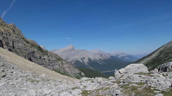
Hiking across a wide alpine meadow
Looking back at this alpine meadow
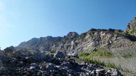
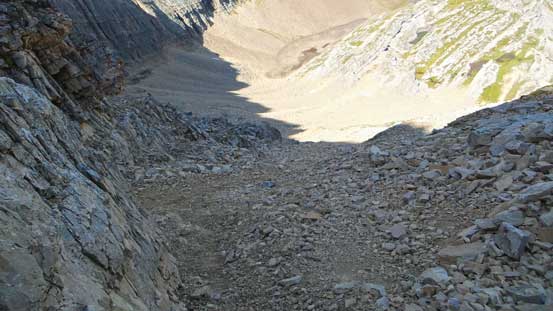
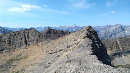
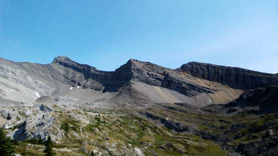
The 300-meter grind up to the high col by Bogart’s W. Ridge looked ridiculously steep and loose but once committing to it it’s not that bad. It’s still very loose but by the Rockies’ choss standard it’s nothing specially worse. There were also a few cairns and some paths helping me on the route-finding. From the col I took Nugara’s suggestion so ascended the minor bump immediately ahead rather than side-hilling trying to avoid elevation gain/loss/regain. Coming down the connecting bump towards Mt. Bogart involved a few tricky steps and at least one of which required detouring to the right (south) on some loose terrain.
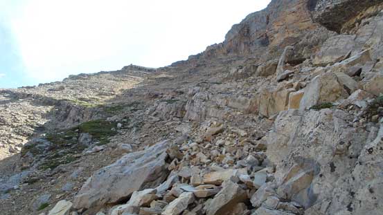
Ascending the loose scree ramp towards the high col

Looking back revealed some nice view of Mt. Sparrowhawk

Looking back towards Red Ridge and the (small) Sparrowhawk Tarns
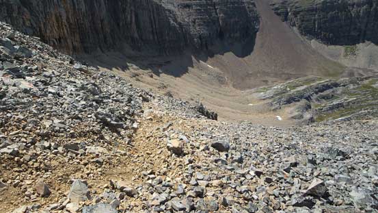
The scree bashing was very loose
Almost cresting the high col now
Finally could see the ascent route of my objective
Looking back from the col. The scree ramp helped bypassing this peak
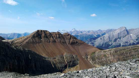
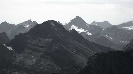
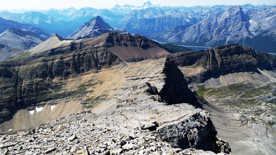
This one is unofficially known as “Red Peak” and/or “North Buller Pass Peak”

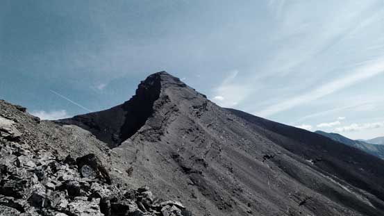
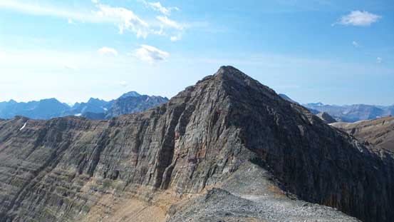
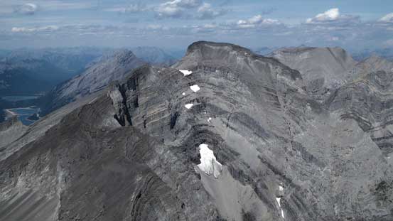
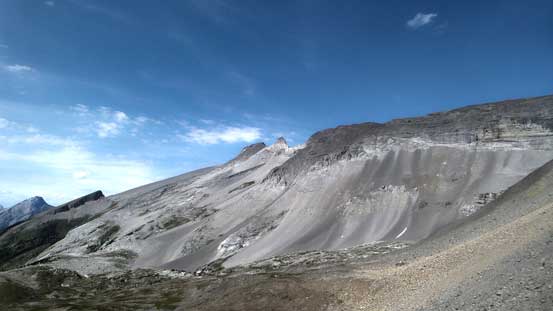
The W. Ridge of Mt. Bogart, where I’d go next
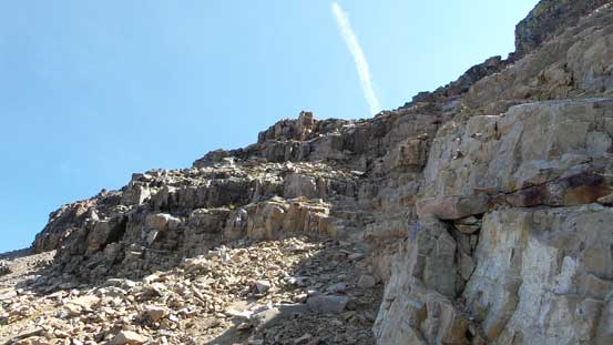
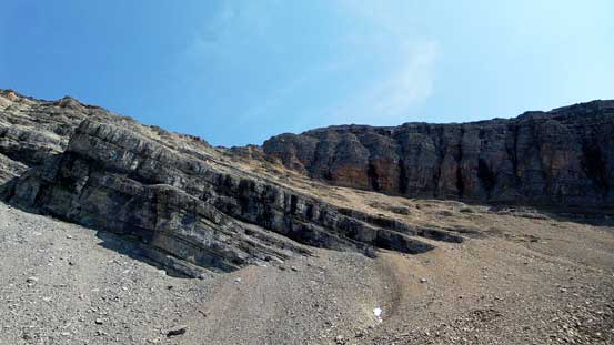
The ascent of Mt. Bogart’s W. Ridge started with some easy slabs (covered by pebbles at places) and soon I arrived at the supposed crux rock band. I was not particularly impressed by the rock quality on this mountain so didn’t bother with the challenge. Instead I took the easier bypass route that ascended diagonally up, climber’s right of the rock buttress. There’s again, some cairns and paths indicating the increasing popularity of this route and after a long while I finally could slog back to the ridge proper. There were still a few places that I had to detour slightly to the right after this crux buttress and the view was in general, quite foreshortened.

Ascending the W. Ridge now. Ahead would be the rock buttress that I bypassed on right
Looking back from the ridge. This bump that I had to ascend up and over
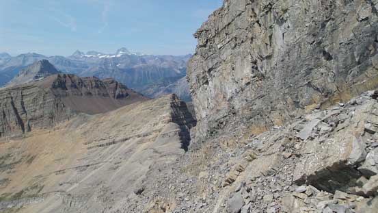
Bypassing the crux on climber’s right side on (loose) ground
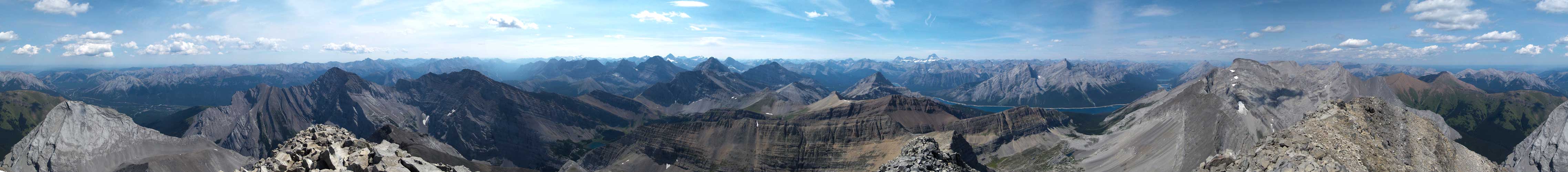
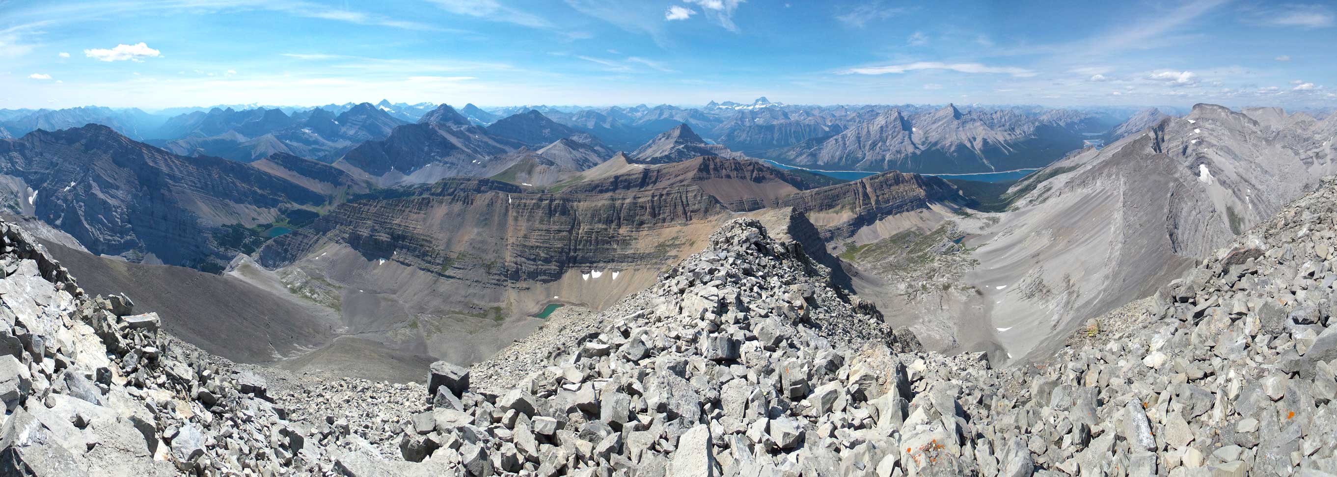
Summit Panorama. Click to view large size.
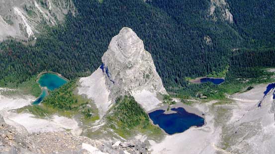
My favourite view from the summit – looking down at Bogart Tower and Memorial Lakes
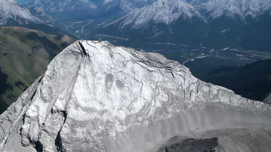
The slabby Ribbon Peak is apparently a tough scramble
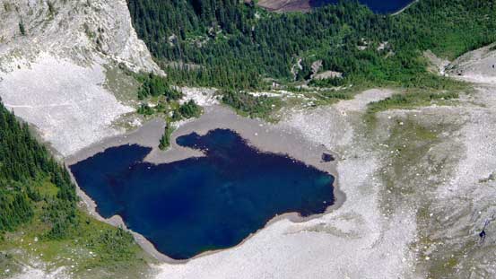
One of the Memorial Lakes

Another Memorial Lake

Wind Mountain is also known as Lougheed IV
Mt. Sparrowhawk
I like the colours on Mt. Allan and Mt. Collembola

Skogan Peak
The familiar K-Country classics – Baldy, Midnight, Wasootch Peak

Mt. Kidd is another classic that I haven’t done yet
Fisher Peak is a tough scramble – bagged 3 years ago.

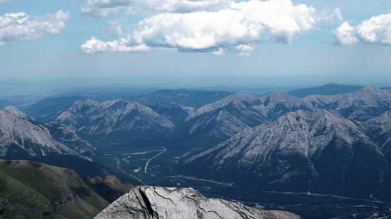
The jagged peaks on Opal Range
Mt. Nestor and Old Goat Mountain – the former is a “moderate outing” while the latter being perhaps the hardest scramble in Kane and Nugara Lists combination, bagged 2 years ago.

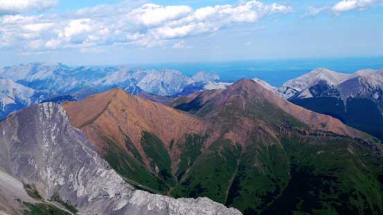
Mt. Assiniboine with Eon Mountain and Aye Mountain to its left

Interesting view of Mt. Buller
The mighty Mt. Sir Douglas rises behind Mt. Galatea
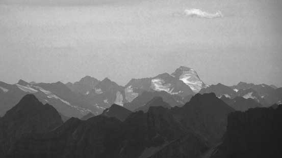
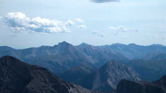
The glaciated Mt. Joffre is the highest peak in K-Country
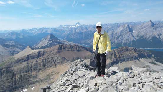
Me on the summit of Mt. Bogart, my 400th summit
Another panorama from the summit. Click to view large size.

Another panorama from the summit. Click to view large size.
Thank to the abundance of bugs on the summit (not to my surprise actually given the heat) I didn’t linger too long. The descent went generally uneventful as I carefully worked my way down the exactly same path that I went up. Just when I had to slog back up to the connecting bump I started to get really tired. From this point onwards I had to take quite a few long breaks. The descent from the high col to Sparrowhawk Tarns felt very tedious and the final 5.4-km hike just seemed to drag on forever… By the time I got back to the parking lot, the thermometer in my car showed temperature at 37 degrees, which gave some indication of the heat…

Still had great view from the descent
Taking a break on this long west ridge
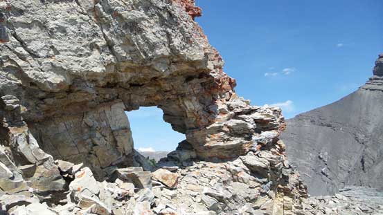
An interesting rock window
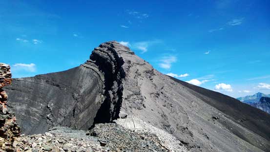
Looking back at my objective
Oh the typical Rockies’ choss…
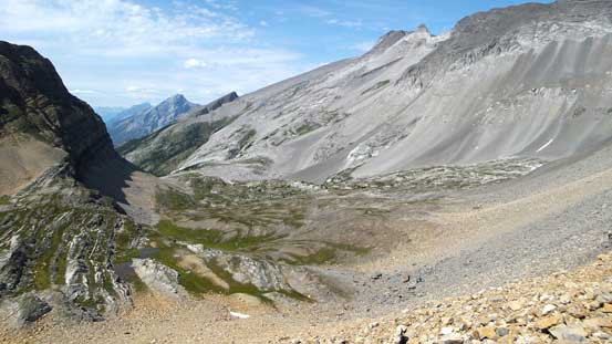
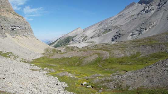
Looking down at this lovely alpine meadow
Mt. Sparrowhawk again
Looking back at this steep scree ramp

Hiking through the meadow
Looking back at Mt. Bogart from the trail
Entering the forest now… The slog game began…
My original plan was to ascend Big Sister on Monday but I was too tired to wake up early and by the time I got up the sky had already turned overcast. I figured it’s probably better to just drive home and rest up. It’s overall a long weekend so by driving back in the morning I’d have less chance getting caught in the traffics.

these pictures you posted gives clear idea of the route thanks
Great achievement. Thanx for sharing!
Photos very nice and helpful.