Ursus Minor Mountain
June 7, 2014
2749m
Rogers Pass, BC
As most of you know, the Columbia Mountains in interior BC has 4 main ranges – Cariboo, Monashee, Selkirk and Purcell. Up until this past weekend, I’d got at least one summit from each of Cariboo, Monashee and Purcell Mountains, but not in the Selkirks. Needless to say, I was hoping to give it a visit at some point. The most popular area in Selkirks is Rogers Pass, where the Trans Canada Highway crosses the range. There’re many classic mountain climbing opportunities in this area including the NW ridge of Mt. Sir Donald, one of the 50 classic climbs in North America. Obviously this past weekend wasn’t the time to climb Sir Donald yet, so Ben and I had to figure something else out as an introductory.
It was quite a tough call to figure out what we should do. We didn’t want to take it too easily but on the other hand, this’s a new area to both of us and we didn’t know the current condition neither. The idea of ascending Ursus Minor Mountain and Grizzly Mountain came from Golden Scramblers’ trips earlier in this year. They did both on skis and we figured they’d be nice to do as late spring snowshoe ascents/snow climbs as well. Ursus Minor is the one involving steep snow so we decided to do it first. If weather and condition permits we’d grab Video Peak and/or Grizzly Mountain afterwards. So on Friday afternoon, we found ourselves driving a long way down southwards to Calgary, westwards into and across the Rockies, around the Purcells and into the heart of Selkirks. At midnight we wondered a bit around Balu Pass trail-head and found snow even at ground level. The trail-head sign area was “flooded” and the trail itself was hard to distinguish. So instead of starting in dark, we woke up at the first light, 4 am local time.
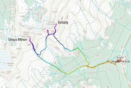
Ursus Minor Mountain and Grizzly Mountain ascent route. GPX DL
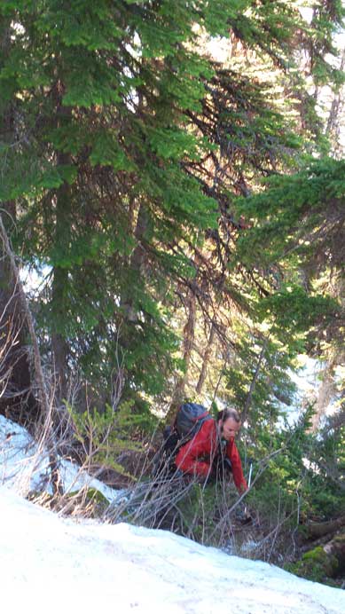
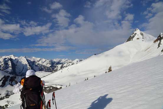
There wasn’t a very good freeze overnight at low elevation but the snow did hold our weight so we kept carrying snowshoes. Once the snow became continuous we strapped the ‘shoes on. After gaining elevation steeply the trail curved right towards Connaught Creek. We briefly lost it at some point but then we just descended a bit towards the creek and found the trail again. The terrain in Connaught Creek valley was huge, with the trail crossing giant avalanche paths one after another. In short time we arrived at the base of Teddy Bear Trees (which is the ascent route for Grizzly Mountain). Since we were gonna do Ursus Minor first, we kept following the trail for a while and crossed Connaught Creek on a good bridge. A side drainage would arrive soon on climber’s right side and that’s where we left the trail. We would soon face the first problem, the lack of snow. For obvious reason we couldn’t ascend via Hospital Gully (raging creek) so we had to ascend the Ursus Trees. The lack of snow coverage meant we had to deal with a lot of alders. The going was painfully slow for a while but thankfully the bush got better once the trees got thicker. Snow also got deeper higher up so we strapped snowshoes on again which helped a lot on traction. This ridiculously steep treed slope kept going on forever and there must be a heck of work to break trail up on skis in the dead winter…

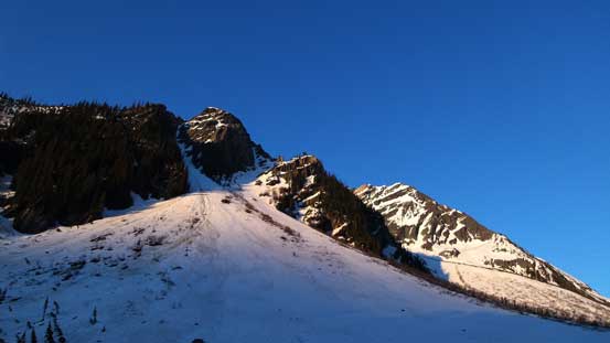
Alpenglow on Balu Peak

Alpenglow on Grizzly Mountain. The rightmost couloir is Grizzly Couloir.
Crossing big slide path on Balu Pass trail
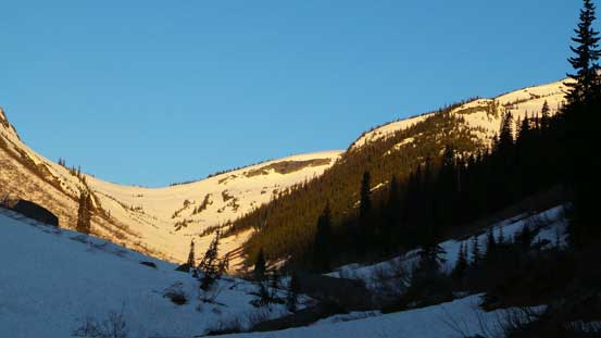
Looking ahead towards Balu Pass. It’s not a long way to get there.
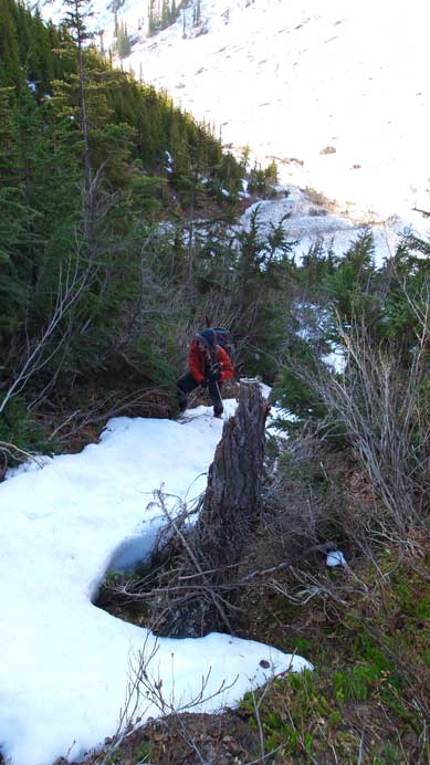
Ascending steep lower bushy section of Ursus Trees.
A bit higher up, still bushy.
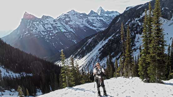
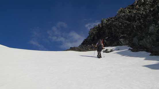
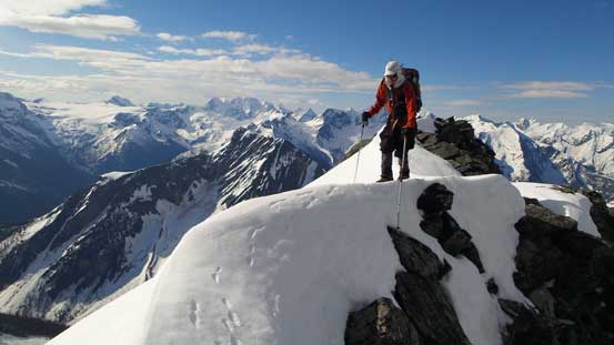
Upon reaching treeline the view opened up nicely. Looking back, our route lined directly up with the NW ridge of Sir Donald. It looked like a sharper version of Assiniboine or a magnified version of Birdwood. Looking ahead, the travel was straightforward on firm snow. With snowshoes on it felt like walking upstairs. We made progress in good time and soon we arrived at the base of the south facing ascent gully. It wasn’t as steep as looked from afar and we managed to snowshoe all the way up to the high col.

Me ascending open forest towards treeline. Photo by Ben
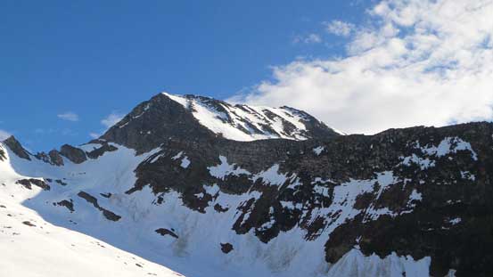
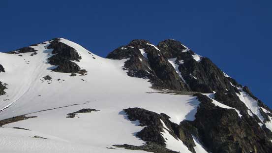
Looking up towards the summit
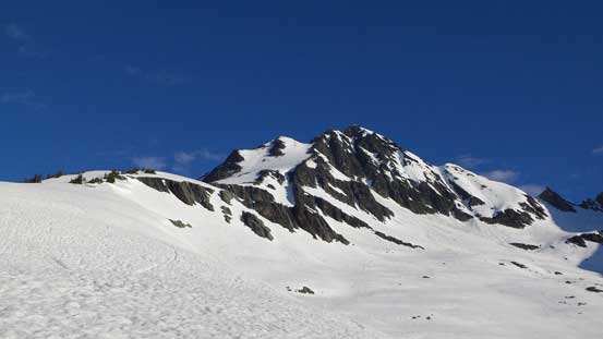
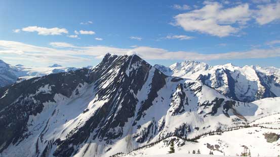
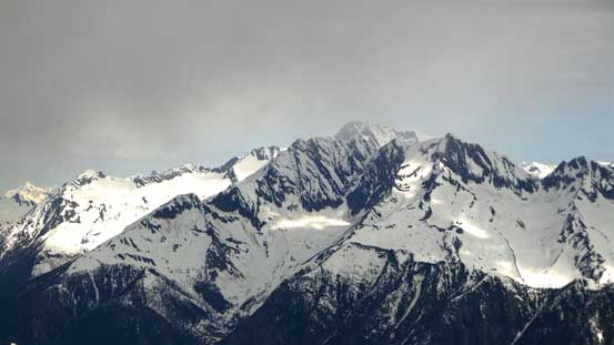
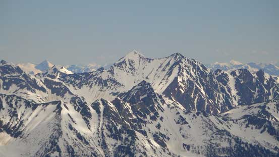
Grizzly Mountain, our next objective
Ben with Sir Donald Range behind.

A view of Video Peak. Looks like a fun snow ascent, but not a prominent summit at all..
Me taking in the views. Balu Peak on right poking behind. Photo by Ben
Cheops Mountain is another scramble
A closer look at Cheops’ summit ridge

Impressive Mt. Bonney
Approaching the ascending gully

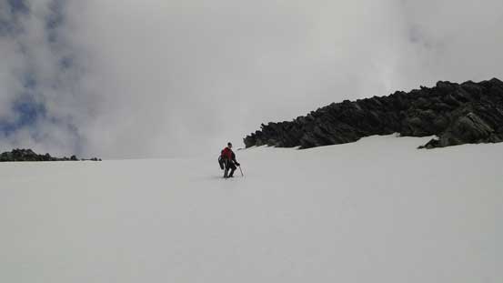
Me snowshoeing up. Photo by Ben
Almost at the high col
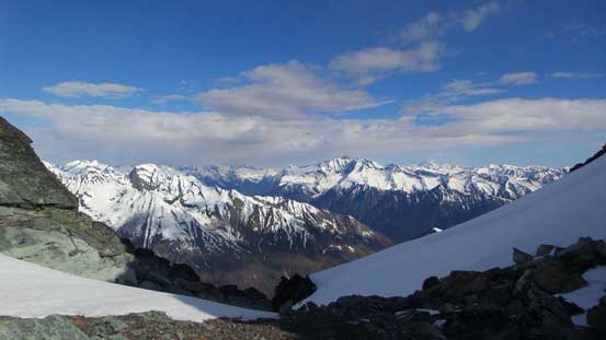
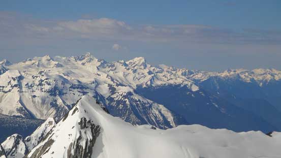
Looking north from the high col.
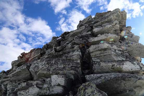
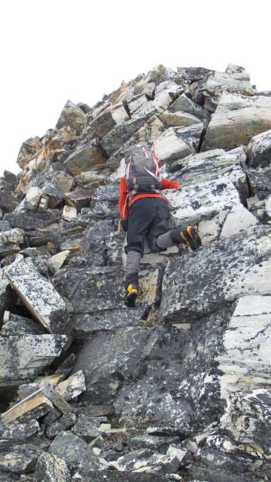
At the col we ditched snowshoes. The SW ridge consists of a few short sections of class 3 scrambling on blocky quartzite rock. Fun time! The summit block also looked very steep but that wasn’t the case once at its base. We attacked it pretty much head-on and soon we stood on the summit, with incredible views towards each direction. Towards the Rockies we could see the massive Columbia Icefield and giants like Tsar, Columbia and Bryce. Immediately to the northeast was Mt. Rogers massive, and towards south was Mt. Sir Donald group, Illecillewaet Neve, Mt. Dawson massive, Asulkan area and Mt. Bonney.
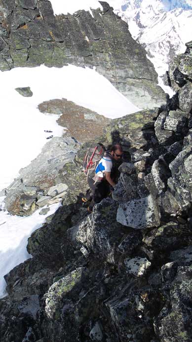
Ben scrambling up the lower rock section

Me doing the same. Photo by Ben
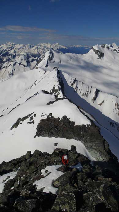
Ben coming up the next step. Balu Peak and Ursus Major Mountain behind

Me approaching the summit block. Photo by Ben
Ben carefully crossing a snow section
Me scrambling up the summit block. Photo by Ben
Ben approaching the summit
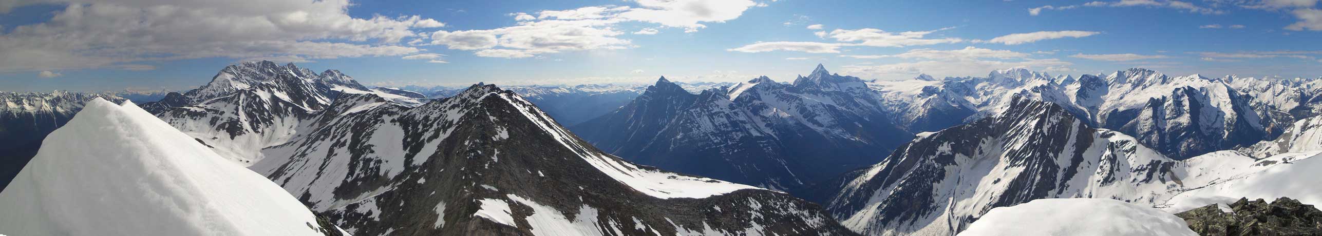
Partial summit panorama. Click to view large size.
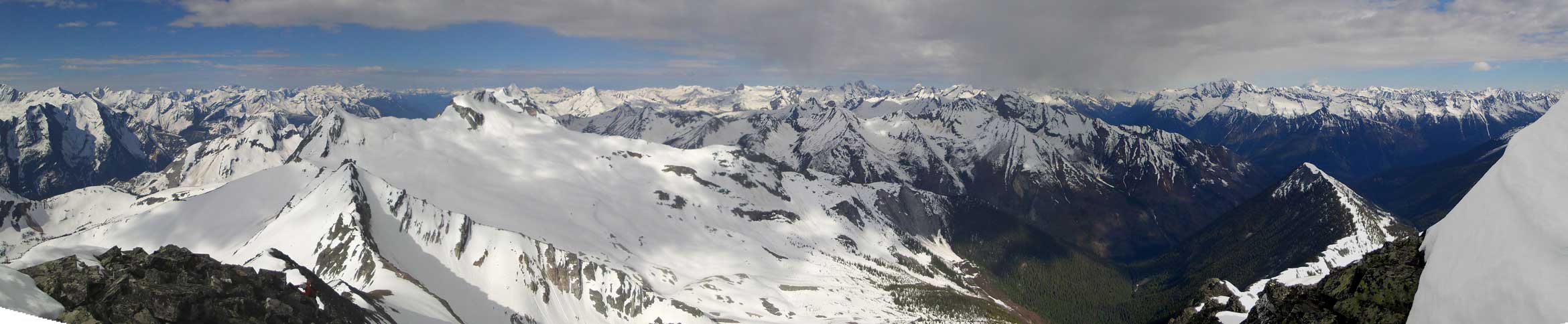
Partial summit panorama. Click to view large size.
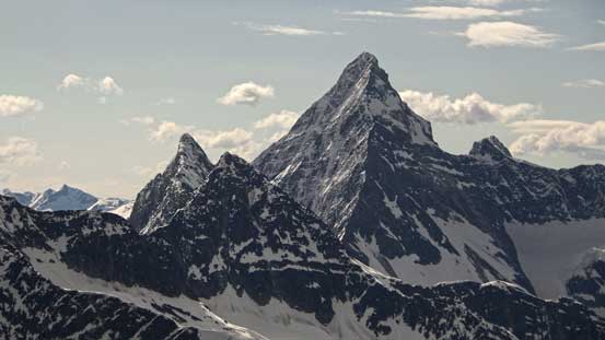
Mt. Sir Donald
Mt. MacDonald
The twin summits of Avalanche Mountain on right. Behind on the left skyline is Mt. Goodsir

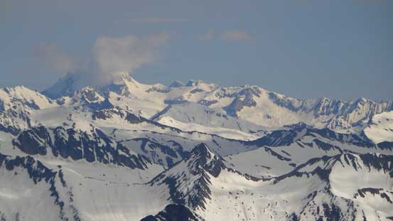
Mt. Dawson is the second highest peak in Selkirks. It’s also an 11,000er.
Mt. Bonney

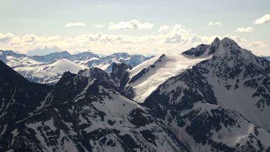
Illecillewaet Neve with Mt. Macoun behind

Zooming-in towards Revelstoke area, Mt. Begbie right of center in the Monashees

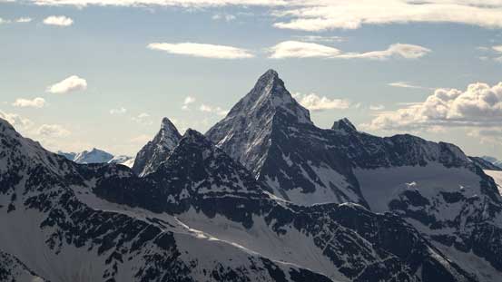
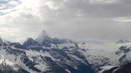
Fang Rock looks impressive

Mt. Columbia and Columbia Icefield
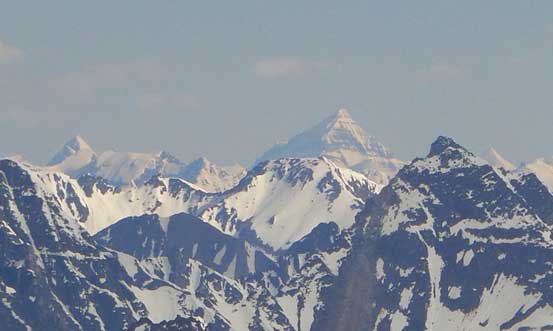
Tsar Mountain in the far distance

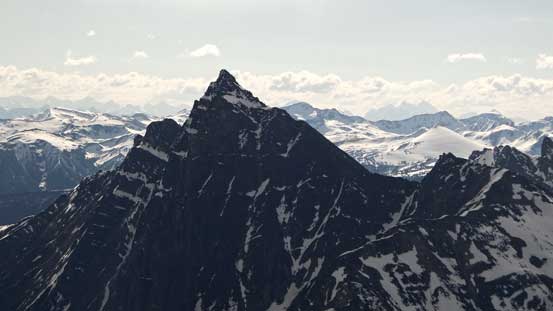
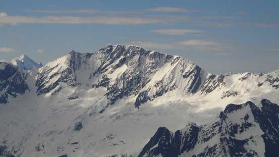
Despite the name suggests, Ursus Major Mountain (foreground) is lower in elevation than Ursus Minor.

Mt. Rogers consists of 5 named summits (Rogers, Grant, Fleming, Swiss, Truda)
Some weather around Iconoclast Mountain
Some clouds obscuring Mt. Sir Sandford, the highest in Selkirks. Behind is Adamant Mountain
Mt. Pearce towards north
More Selkirk summits looking south including Albert Peak

More obscured Selkirk summits, including Virtue Mountain

Tupper pokes just behind Grizzly on right. Behind on left skyline are Mummery and Laussedat
To the left of Sir Donald are Uto Peak and Eagle Peak. To the right is Terminal Peak
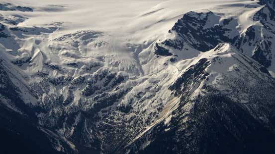
A closer look at Illecillewaet Glacier

Sir Donald group and Illecillewaet Neve
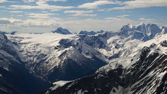
Illecillewaet Neve and Asulkan area
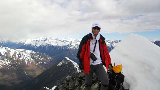
Me on the summit of Ursus Minor Mountain
Ben down-climbing from the summit

Mt. MacDonald from the descent
Some weather moving in from south
Descending the steep gully
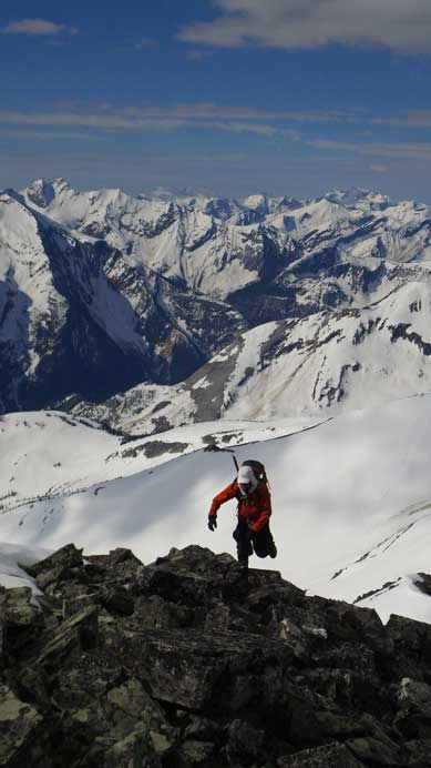
It was still early in the day so we had to do something else. Earlier in the day we could see the nice-looking snow slope on Video Peak but right now it looked like a tiny bump. So we decided to investigate the rest of this day on Grizzly Mountain. After carefully down-climbing the summit block we made back to the high col. We strapped crampons on to descend the steep gully, and lower down once making sense we traversed/dropped into the bowl between Ursus Minor and Grizzly. And the day continued with an ascent of Grizzly Mountain.

Thanks for the report. Fabulous photos!