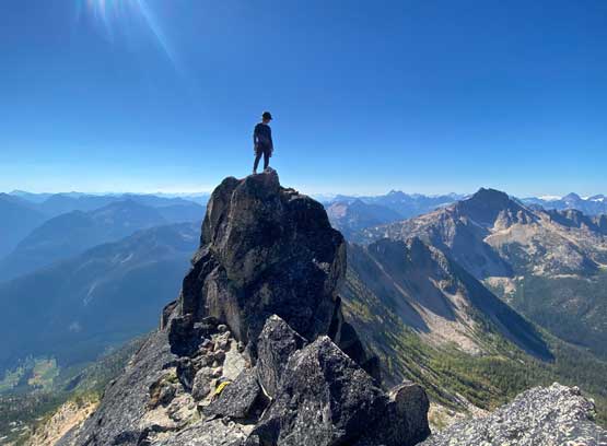
The Needles (Big Methow Needle)
September 27, 2022
2487m
North Cascades Highway, WA
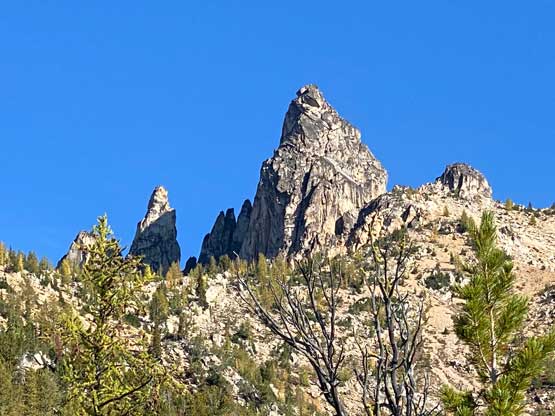
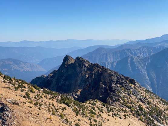
The name “The Needles” is official as one can see from USGS topographic maps, but this peak is more commonly known as “Big Methow Needle” in the recent era. The unofficial name was given by a group of peak-baggers back in the early 2010s. The reason is obvious as “The Needles” sounds rather unattractive. “Big Methow Needle” can also be considered as the highest spire in this group of peaks called The Needles. There is no “easy” way to reach this summit as the easiest option (East Face) involves 3 pitches of rock climbing up to 5.7 and there’s no established trail to facilitate the access meaning some degrees of bushwhacking is also required. A few other towers in this group of peaks seem to be even harder to climb and in fact I don’t think those had been climbed more than a handful times. By contrary the second highest in this group is a walk-up summit as a consolation prize or a bonus bag for many parties in the past, but for me it’s either the true summit or nothing, so I’m only interested in tagging “Big Methow Needle” and that’s it.
I had seen this peak from various summits in the vicinity of Washington Pass but I never actually put in time to research until recently. I learnt that the easiest route was 5.7 and I immediately put it up on the agenda. I reached out to a few rock climbers and two eventually signed up for the challenge. Francis needed no introduction. I had never done anything with Sarah R. but I knew she just did the Chehalis group VRC Traverse, and that’s enough of a resume for me to believe in her ability. There are a few good trip reports on NWHikers.net and the general consensus was the earlier the season the easier that first pitch would be. In fact all but Eric Gilbertson’s 2021 ascent were done with significant snow coverage to shorten the start, but then I talked to Eric and his honestly thought the first 6-7 meters of Pitch 1 was actually not the crux so the 5.7 rating would still be legit even without snow. I usually trust Eric’s judgement so that’s why I decided to do this peak in late September. After the trip I would totally agree with Eric that the bulge (higher up on Pitch 1) and the layback crack (start of Pitch 3) are the actual cruxes and they would never get covered by snow. This further means that I would actually recommend to climb this peak in dry conditions. Not needing to worry about snow-to-rock transitions (moats) and not needing to bring ice axe and crampons is definitely appealing.
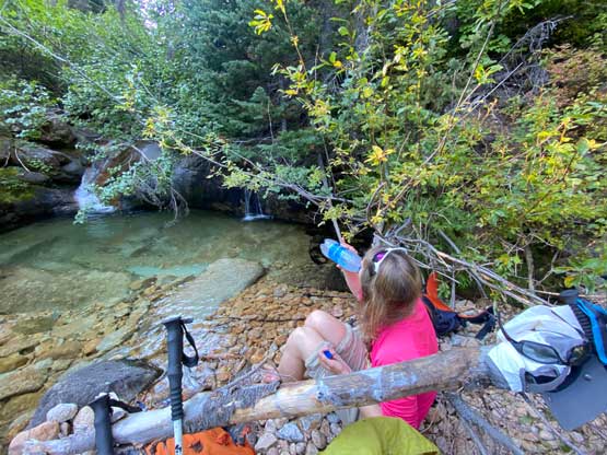
The three of us grouped in White Rock at 9:30 pm on Monday evening and we drove down south across the border in my Corolla. I drove us to Rainy Pass trail-head and car-camped there. Both Francis and I opted to sleep in our respective tents while Sarah slept inside the car. I was planning to also sleep in the car but only the passenger seat was comfortable. The next morning we woke up at 6:30 am and drove to the “trail-head” an hour later. We parked at the tiny pull-out on the immediate north side of Pine Creek (space for 1 vehicle) and started the day there. The other option was to park at Lone Fir Campground but that would add a few minutes of walking on the highway.
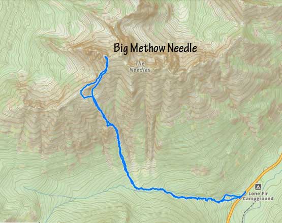
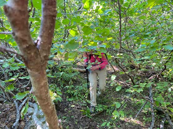
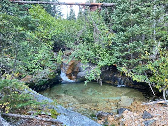
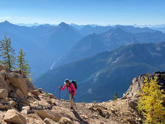
We walked back to the south side of Pine Creek and dived into the bush right away. I knew to find the start of the unofficially maintained trail would be next to impossible so our strategy was to basically treat this as a bushwhack. Sarah volunteered to lead us through this initial sections of the approach and got us onto the trail after about 15 minutes of light bushwhacking. I think we travelled too close to the creek as otherwise we could have found the trail even earlier. The quality of this trail was actually quite good. Near the creek crossing we briefly lost the trail in a field of dead-falls but then we were very close to the creek crossing anyway. The crossing was trivial at this time of a year and to our surprise we actually picked up the trail on the other (north) side of Pine Creek and nobody had mentioned that in the trip reports. This trail brought us to some garbage dumps in the forest and continued through the avalanche path with alders. We were expecting at least half an hour’s thrashing to power through this stretch but the trail kept travelling towards the direction we wanted and we ended up getting through the alders in under 15 minutes. The trail disappeared on the far west side of the slide path but that’s also where we needed to ascend straight up the forested slope anyway and the forest was mostly open without underbrush.
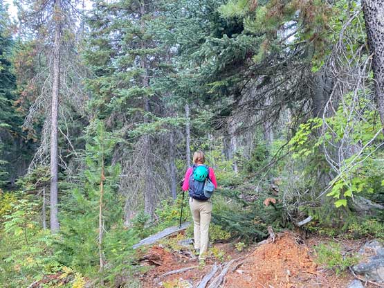
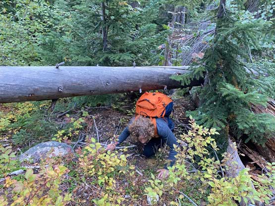
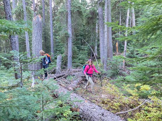

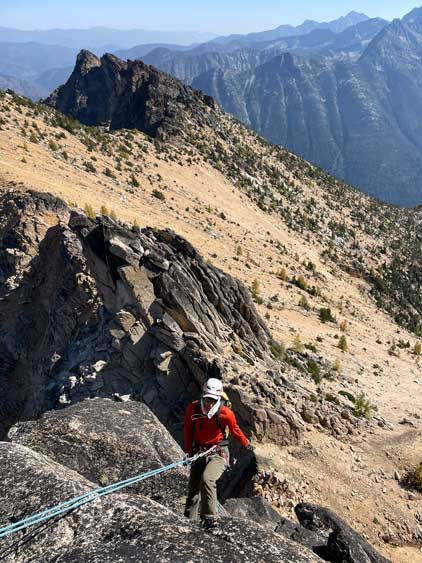
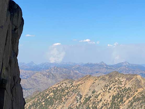
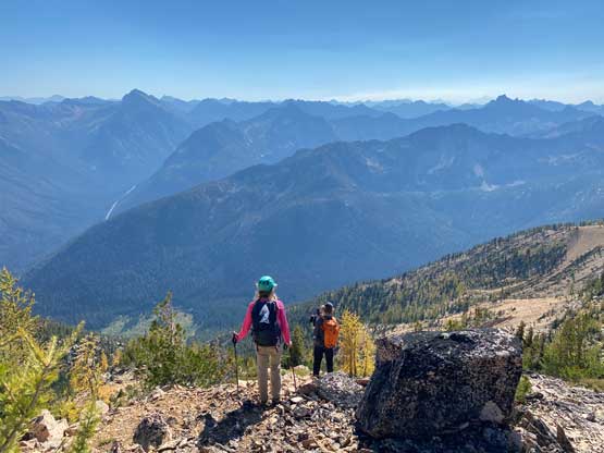
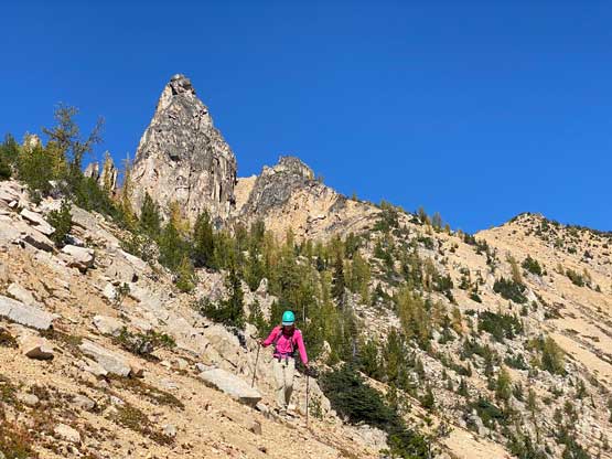
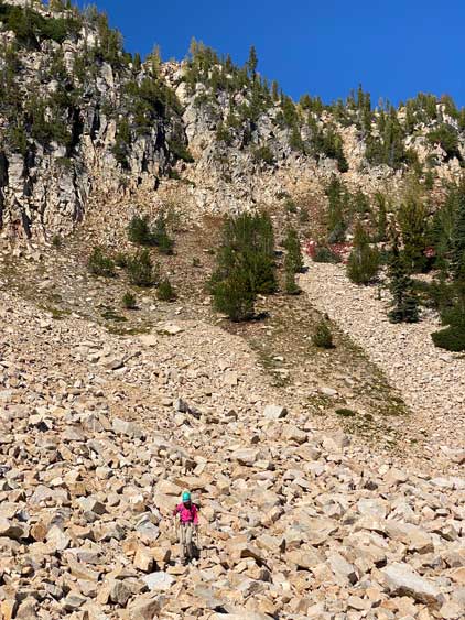
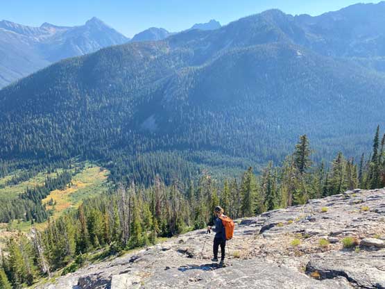
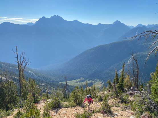
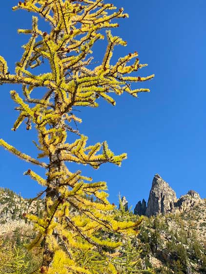
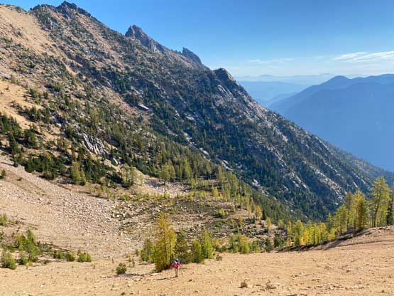
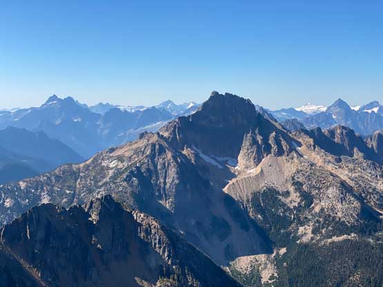
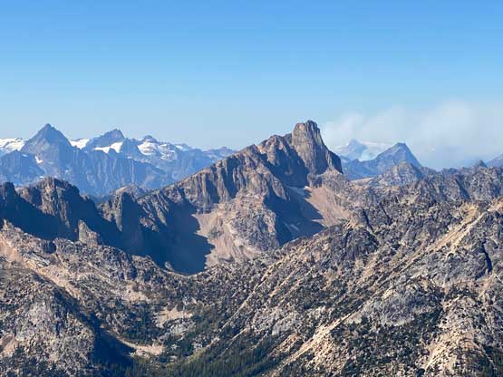
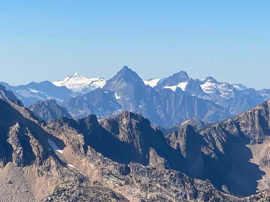
From here it was a 1000 vertical meters of straight-up grunt to the base of the summit tower and the strategy was to break it into stages. After ascending the lower, mature forest we came to a section of slabs. We likely could have walked around the slabs but these slabs didn’t seem to be difficult so why bother to walk around. It turned out that we had to do some class 3 scrambling but nothing exposed. The slabs then yielded back to the ridge crest with some loose rocks and dead-falls. The going was rather monotonous for the next hour and we took several breaks along the way. There’s a bowl showing up to the right and Francis led us traversing into that bowl with some cool larches views. The natural way was then to ascend out of this bowl on the far side, but we made a spontaneous decision to ascend leftwards onto the ridge crest. This added distance but we were doing great on time and we assumed the ridge would offer some different views. This turned out to be a good call as we got some great view of The Needles from this SW Ridge.
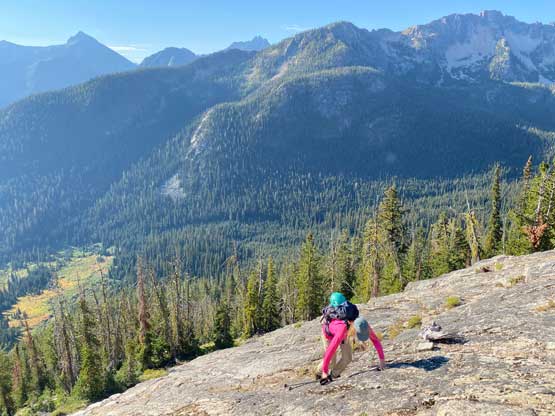


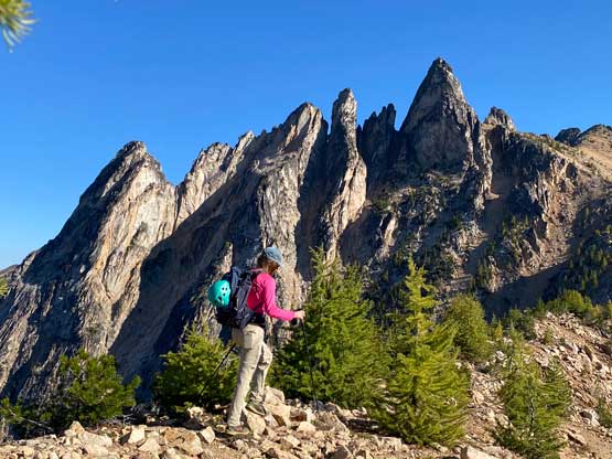
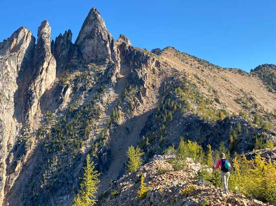

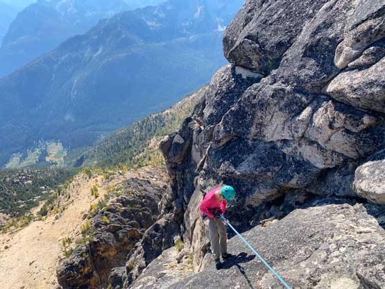
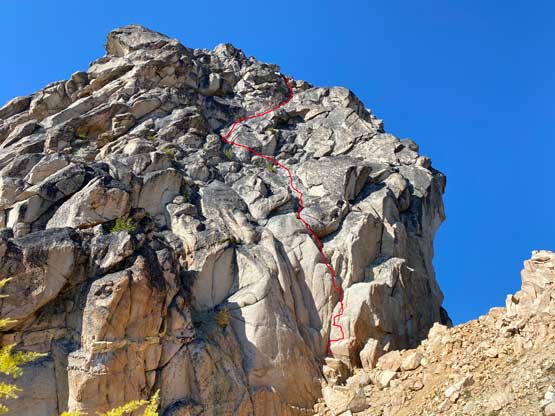
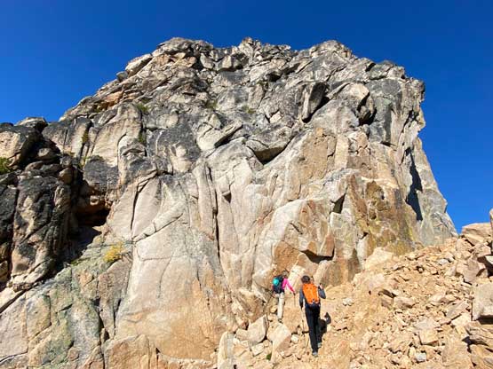
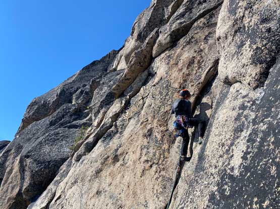
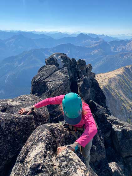
Traversing back to the “standard route” involved some scrambling over a few broken towers. We then plodded up some loose terrain to the base of the rock climb. The climbing appeared rather easy for the 5.7 grade. Sarah and Francis played some rock and scissors as they both wanted to lead the supposedly challenging Pitch 1. Sarah won the game so took the lead, and reported this pitch to be easier than 5.7. Francis and I followed and we both thought that bulge feature would deserve this grade, but there were only two or three moves involved to work around that bulge.


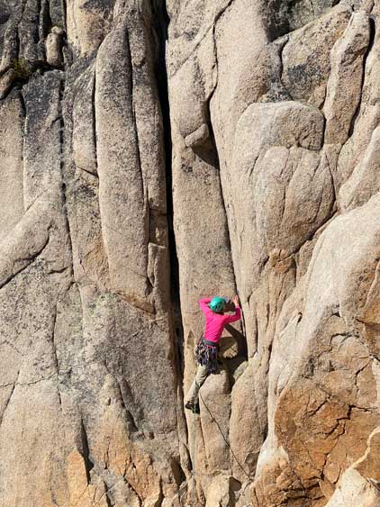


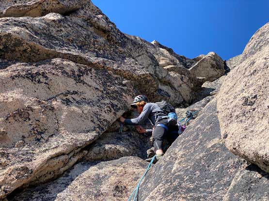
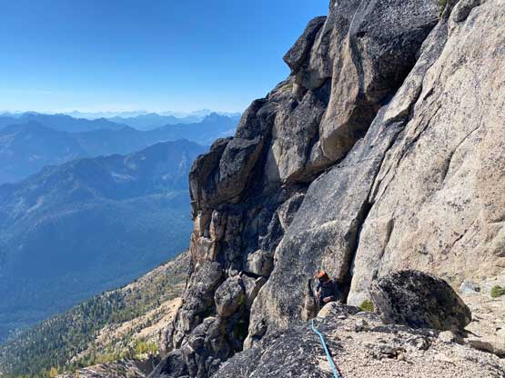
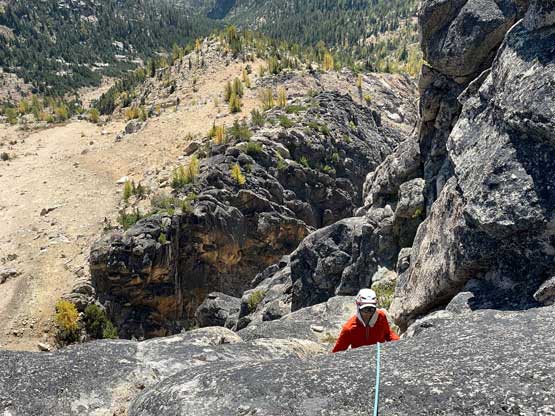
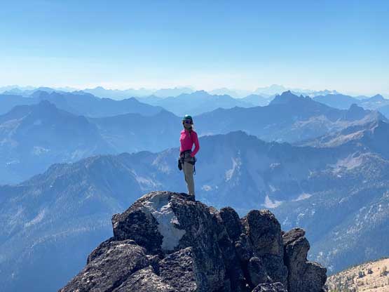
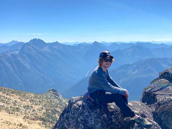
I then took over the lead on Pitch 2 as this supposed to be the easiest pitch. The climbing was mostly 4th class and I could have soloed it, but placed a #2 cam anyway. The second pitch involved climbing upwards towards climber’s left followed by traversing a broader ledge to the right to a rappel anchor. There’s some rope drag and that cam actually served as a redirection point for the rope. Francis led the 3rd pitch which started with that 5.7 layback crack. We all thought this was the crux of this entire route as the climbing moves were rather sustained for a few vertical meters. The crack soon gave way to easier terrain but I couldn’t get one of the nuts that Francis placed. I told him to deal with that on the descent and resumed the climbing. From the top of this pitch we just needed to scramble some 4th class broken terrain to the summit, which itself wasn’t very spacious. I found this register to be another cool one enriched with Washington’s mountaineering history in the past 50 years. There are definitely far more entries than on West Fury but most of the names are well known in this community.


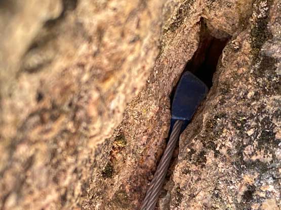


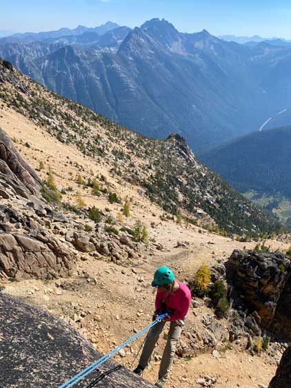
We all down-climbed to the top of Pitch 3 and did three rappels from station to station using Sarah’s 70m single rope. In the end we only used a few cams and a nut. Sarah also couldn’t get Francis’ nut but Francis eventually managed to yank it out using blunt forces so we didn’t leave anything behind. All of the anchors seemed secure and we did not add more tats neither. I was thinking to tag that bonus point but the terrain seemed rather shitty. I could not claim that as a separate summit anyway so didn’t bother. We descended straight down into the larches bowl and then slowly followed our own way out. There wasn’t much worth documenting about the descent other than being patient to stay on the GPS track. I think we made a very efficient track for this route so stick to it and you’ll find the trail. Our round trip time was under 9 hours on a leisurely pace and we eventually got back into Canada exactly 24 hours after crossing the border the night before. Overall this was a satisfactory trip bagging an obscured and technical summit.