North Pinnacle (The Pinnacles)
October 12, 2022
2573m
Cherryville, BC
“North Pinnacle” is the highest point of a cluster of rocky summits called The Pinnacles in the southern Monashee Mountains. This area is separated from the much taller peaks around Mt. Odin by deep valleys and as a result “North Pinnacle” also boasts over 1500 m prominence. Mt. Severide a few kilometers to the north is only 2 m lower according to BC Basemap so there’s a chance that the other one actually boasts the prominence so to be safe, I would need to climb both. I was actually invited to join two separate parties earlier this year but I declined both invites in favour of more important technical climbs. On the other hand, Elise was flying around the area in July and casually mentioned that she had wanted these peaks for a couple years. I was surprised given that this isn’t a well-known objective like Mt. Sir Donald or Gimli Peak. I wanted to go with Elise and she sees Mt. Severide just as important as North Pinnacle. However, this still wouldn’t be on my top priority list due to the lack of technical challenges and the long drive, but when she mentioned again in mid-October I decided to finally make it happen.
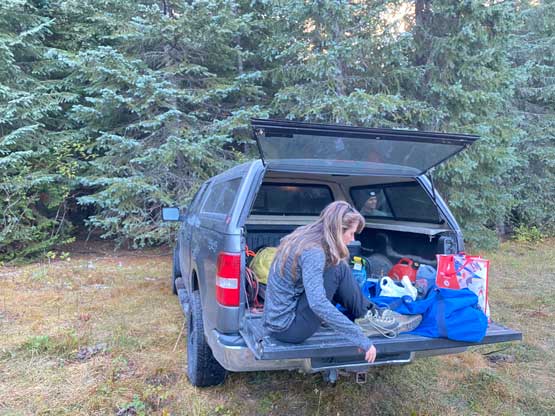
Elise was visiting her parents in Vernon for Thanksgiving so I had to drive 5 hours on my own to get there. I also needed to bail Wednesday off work and that took me a while to commit to. On Tuesday I left home at 7:30 pm and drove up the Coquihalla Corridor and then across the Okanagan Connector in the Corolla. I cruised up the empty freeways faster than I normally would and made to Vernon about 20 minutes earlier than Google’s suggestion. Elise’s parents’ home was difficult to locate and required an additional 15 minutes of drive past Vernon towards the opposite direction. Google directed me onto some smaller roads that were thankfully paved, and I got there at 12:10 am. We previously agreed that I would call her to let me in, but after 5 failed calls I was still waiting, so I rung and bell. Elise eventually got out at 12:30 am without hearing anything on the phone. The plan for the following day was to wake up at 4:45 am and I made sure to set multiple alarms since I anticipated Elise’s phone to fail again. This time we all got up with no mishap. Two of Elise’s friends, Corbin and Nick would come to join us so we all met in Vernon half an hour later.
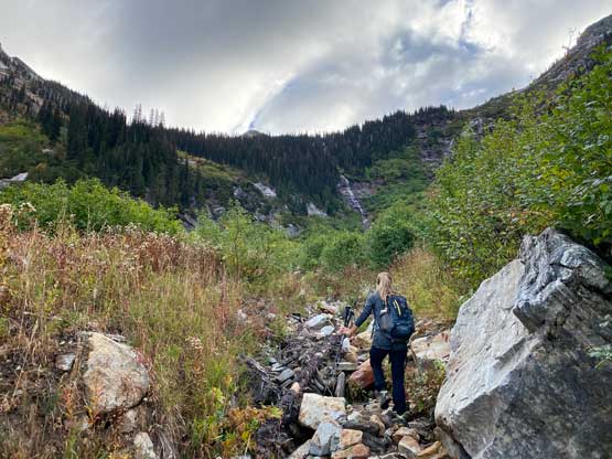
We then drove eastwards to the small village of Cherryville in Elise’s parents’ F150 truck but finding the start of the logging road proved to be the actual crux of this day. I downloaded three map layers (Gaia topo, satellite images and Backroad Mapbook) but none showed the start of South Fork FSR had been re-routed. After finding the start was completely deactivated we drove back a few kilometers and tried another possible connector, but that one had a bridge closure. We then had no choice but to drive back to Cherryville to get some cell reception. I eventually logged into bivouac.com and found out the issues. Breathing a huge sigh of relief we drove back southwards and found the re-routed start, a few hundred meters south of the original start. The condition of this South Fork FSR was excellent to the final few kilometers where we encountered a few rough spots that might necessitate some clearance. I think we could have made the trail-head in Elise’s Subaru but I always wanted to be 120% sure so we took the truck.

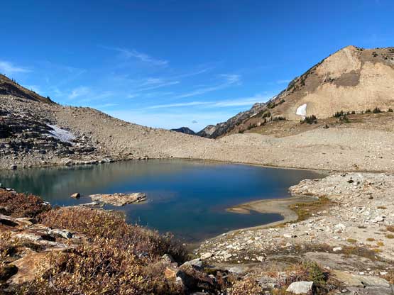
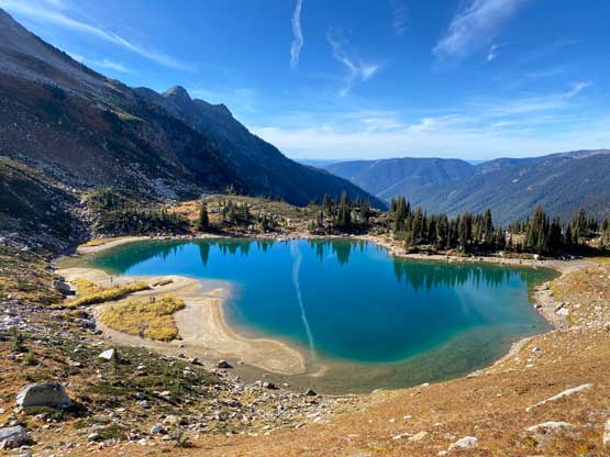
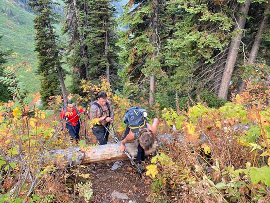
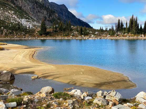
This was my first time hiking in the southern Monashees past the immediate Revelstoke areas and I thought the dense bushes lived up to their reputation. Thankfully this access is facilitated by an excellent trail as the bushwhacking seemed to be otherwise worse than the Coast Ranges. About an hour later we really started to gain elevation. We somehow missed a turn on the trail and dashed up a dry creek bed for a short distance before rejoining the trail. The trail then did a steep ascent out of the forested cirque northwards and then eastwards towards Monashee Lake. This lake isn’t even shown on my Gaia map layer so I had no idea why it gained such a significant name. There’s one loose, but not steep section on the trail with a fixed rope. I on purposely practiced my batman skills on this day and I made sure my partners videoed the action to prove my stand. There had been some hot debates and actions to remove fixed ropes in SW BC in the past few months thank to several individuals. I think that’s a dick move with rude attitudes so even though I don’t like fixed ropes myself I absolutely do not support their actions. In any case the official trail came to an end at the lake and we took the first break of the day.


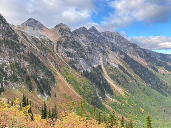

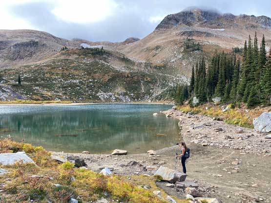


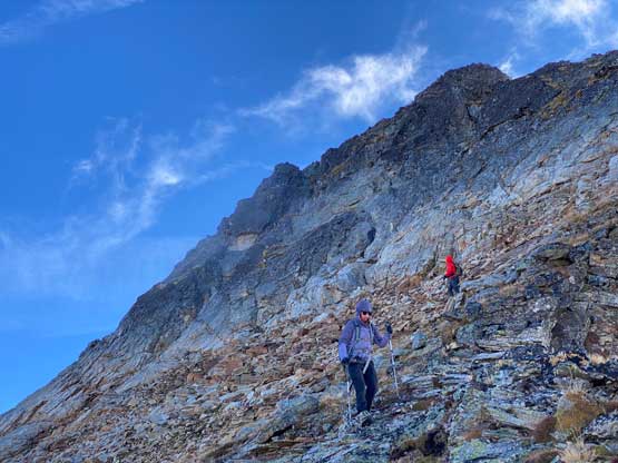
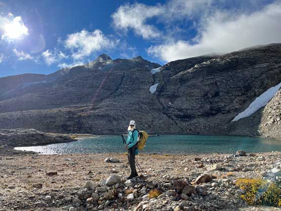
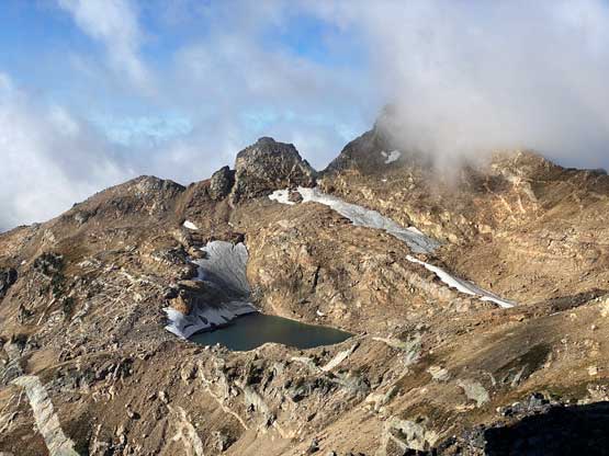
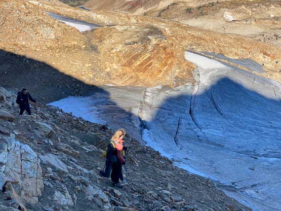
We then followed the numerous GPX tracks downloaded due south-east towards the broad pass between The Pinnacles and “Sunny Peak”. The going was mostly cross-country travel in open terrain and there’s still a faint trail here and there. We took another break at the lake under the north slopes of The Pinnacles and ditched some gears. I had brought crampons to prepare for the possible new snow accumulation thank to Monday’s precipitation, but it seemed like the precipitation had been entirely in liquid form, so I ditched the crampons. I also swapped footwear from trail runners to mountaineering boots and ditched the runners. We also ditched some water bottles. I even brought a filter and planned to filter some water from the lake upon returning. The ascent of the lower slopes of North Pinnacle was mostly class 2 but involved some route-finding. We did not try to on purposely stay on the easiest path so did our own class 3 variations including crossing a small patch of dry glacier.


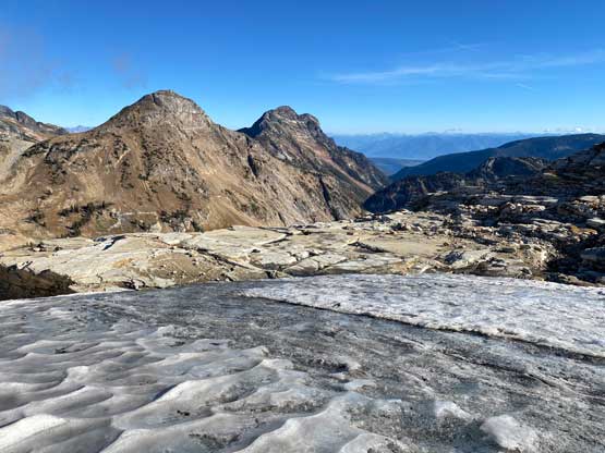

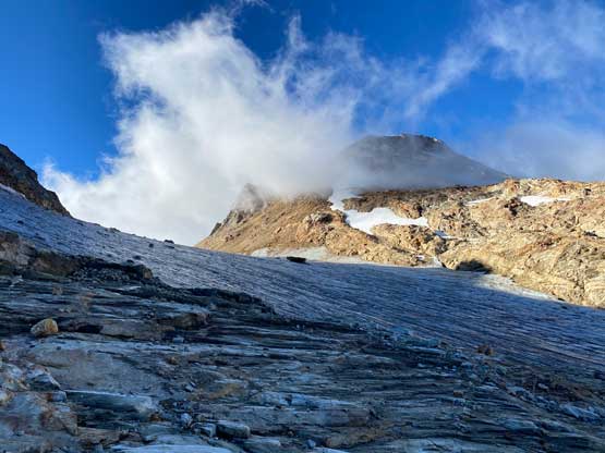
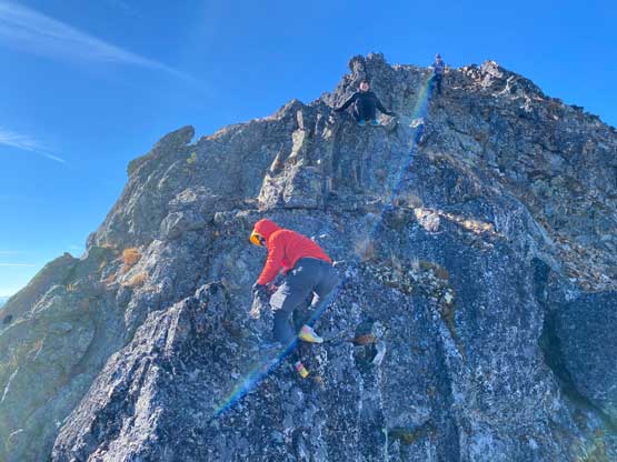
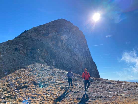
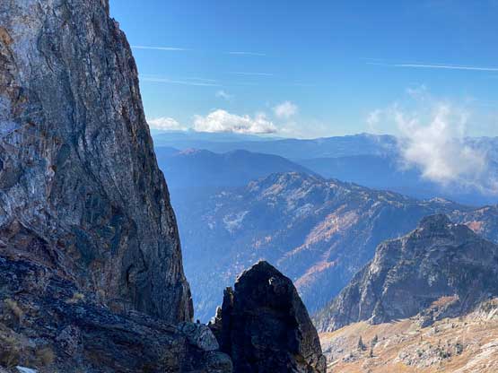
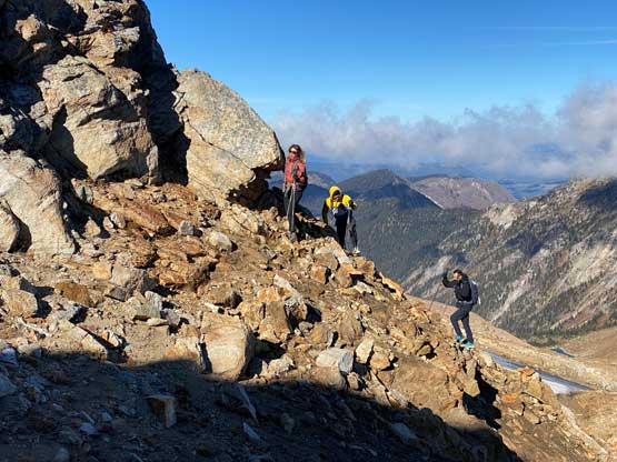
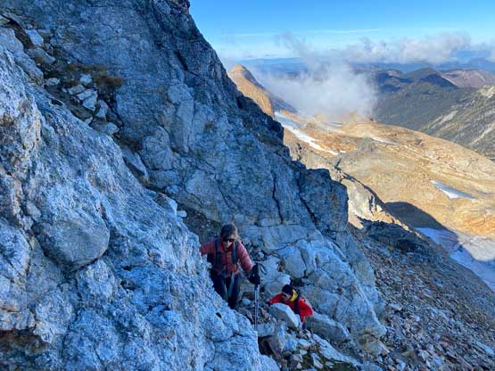
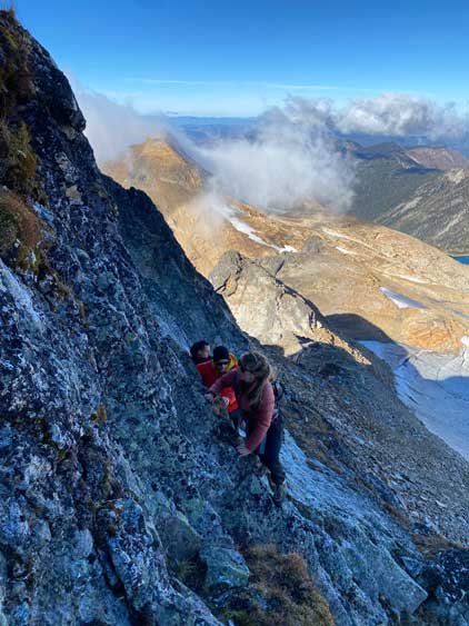
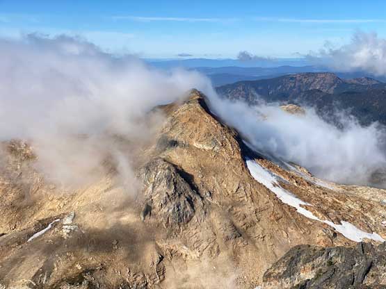
We then ascended another stretch of tedious terrain to get onto the broad NW Ridge of North Pinnacle. At this point we were well above the saddle between the North and Middle Pinnacles. There’s some compact and frozen choss to traverse across and we were hammered by the cold winds blown in from the west. There’s no notable difficulty to scramble to the base of the summit block, but the final ascent onto the true summit was not trivial. I had read numerous trip reports and all indicated class 3 or 4 scrambling with route-finding challenges. I did not try to remember any details but rather did our own route. We linked up two gullies/chimneys and the connection involved a leftwards and exposed 4th class traverse. Again we spontaneously decided to take this line and had no clue whether or not we stayed on the path with the least resistance. The purpose of my route-finding there wasn’t to find the “easiest” route anyway. Near the top of the upper chimney I led the way towards climber’s left onto the summit ridge and traversed across a narrow and loose ridge section which could also be classified as “4th class”. The true summit itself was very windy and cold unfortunately.

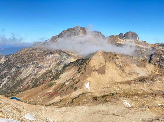


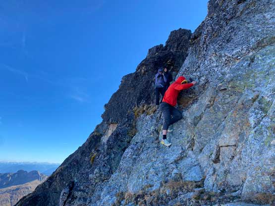
On the descent I briefly contented to find an easier variation but decided to down-climb the exact route that we took, as I thought it’d be more enjoyable. That exposed slabby traverse was actually a little bit spicy given the cold wind and our shivering bodies. I actually had to down-climb most of the route wearing my winter gloves, but I had to take gloves off for that short traverse due to a few delicate moves. We descended about halfway down the lower northern slopes to take a proper lunch break, as we had to descend that far to get out of the winds. The rest of the descent towards Monashee Lake was uneventful but Corbin and Nick was too tired to consider scrambling Mt. Severide which required an additional 500 m gain on more challenging terrain. Elise and I then continued on our own to the secondary objective.