Baby Munday Peak
August 9, 2021
2250m
Chilliwack, BC
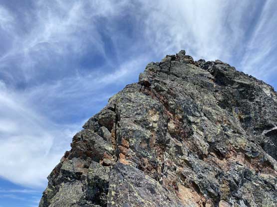
Baby Munday Peak is not the tallest in Cheam Range but rather the hardest and the only peak in that range that requires rope skills even via the easiest possible route. Note that the true summit of this peak is not the one described in Matt Gunn’s Scrambles in SW British Columbia, which is a considerably easier ascent. The true summit has only one published route, the south ridge, which requires a few pitches of climbing in the range of class 4 to low 5 on questionable rocks as well as a few rappels to descend. Francis Bailey had just scrambled the north summit and expressed interest in climbing the real one. After some discussion we decided to tackle the challenge on Monday. I had been wanting to do this peak for a few years and felt pretty excited to finally put together a team for it.
[If the north summit is what you are looking for, then check out my Stewart Peak’s trip report.]
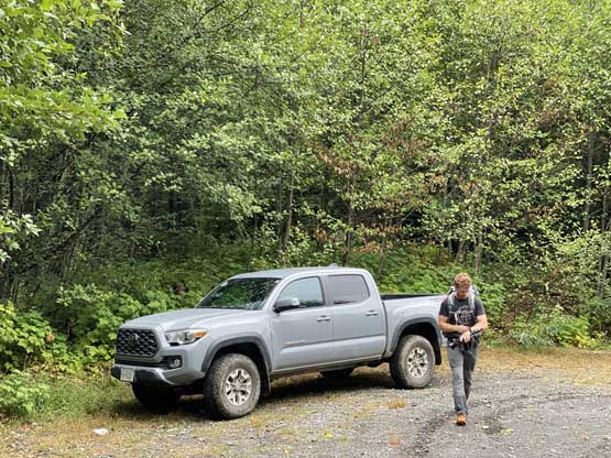
Another challenge of this peak is the access road. While it’s not a huge deal to park one’s vehicle down on the main Foley Creek FSR but that adds a few kilometers of walking with considerable amount of elevation gain just to reach the trail head. The Airplane Creek FSR that one needs to take from Foley Creek to the trail-head is in a rough shape with one massive show-stopper ditch not far up. Based on the few trip reports I was not confident whether or not my long bed Tacoma TRD Sport could make it without scraping the undercarriage but Francis had just driven it up in his short-bed Taco a few weeks ago. Francis opted to take his truck and that resolved any access uncertainty.
The weather forecast was calling for a mix of sun and clouds with zero chance of precipitation but the day was immediately after a period of rain events. I foresaw the approach to be wet and made the call to wear trail shoes and carry mountaineering boots so that the boots could stay dry. We also opted to carry a 60m rope, a rack to size .75 and rock shoes as we weren’t quite sure how difficult this climb actually was. Again there were a few trip reports but one made it sound like a “walk” and other made it sound like one of the harder summits in the North Cascades. I had climbed with two of the three people in that first report in person and I did think the climb would be much harder than how they wrote about it, and I was not wrong. On the other hand, I also have read some reports of that second party’s and I also thought it’s going to be easier than how they described, and I was not wrong neither.
Francis and I met in Abbotsford at 6:30 am and made to the logging roads an hour and half later. The Foley Creek FSR was not bad but slow-going thank to the millions of pot-holes. The Airplane FSR was honestly not as bad as I thought but that could due to the fact I was expecting the worst ever road. I could not tell whether my Taco could make that water bar but other than that spot I would say it’s easier than the nearby Welch Peak’s access road. There were only a few kilometers on these roads and yet the crawling took us almost an hour each way.
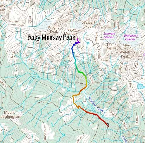
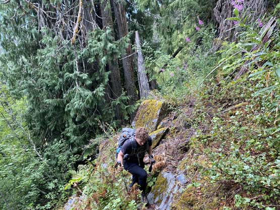
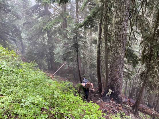
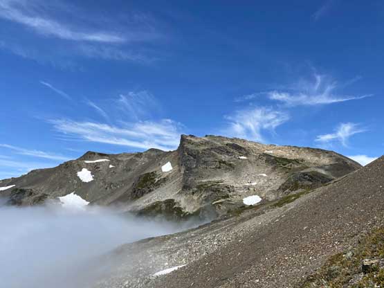
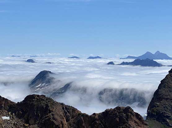
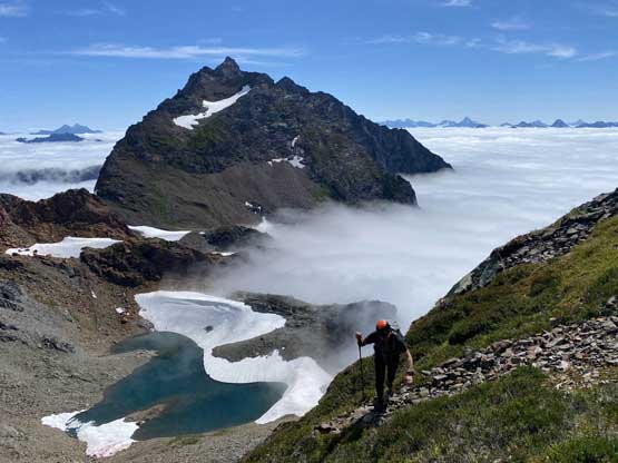
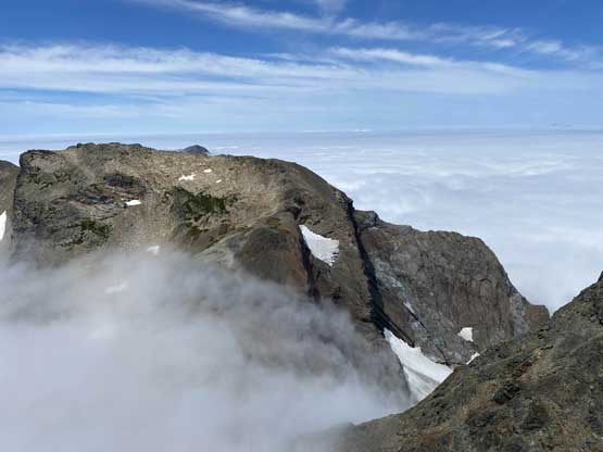
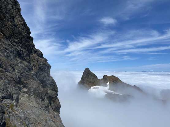
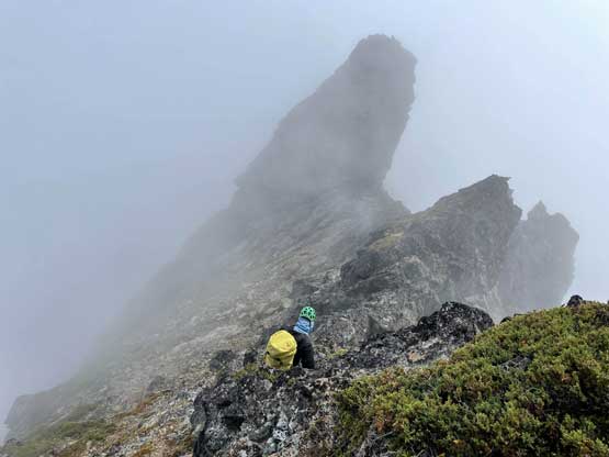
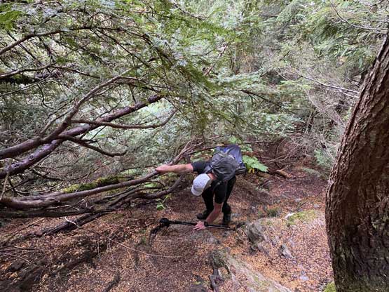
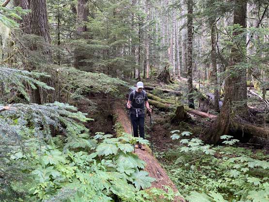
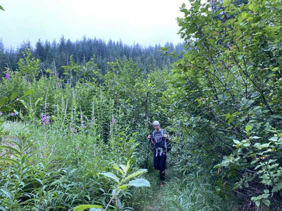
Francis had warned me that the trail was bushy and it sure was. The first 2.5 km was dashing down this deactivated logging road spur that had completely turned into an overgrown mess. There’s a foot bed which by SW BC’s standard, can be called a trail but we were touching the vegetation (sometimes with brambles) almost consistently for the whole period. At the end of this road we had to lose almost 100 m of the hard-earned elevation by dropping down into and across Airplane Creek. At this point we were already soaked but thankfully the trail on the north side of the creek would be mostly in mature forest. We found a large log to ditch the trail shoes. The next hour or so was a steep grunt on a classic “Chilliwack’s trail” that involved mostly ascending straight-up through tree roots and short rock steps with several class 3 sections. Higher up we also emerged out of the forest into some low-grown vegetation and no matter how careful we were the boots were still soaked. The weather was also nowhere a mix of sun and clouds and instead, we entered the thick layer of clouds into a world of white-outs. At the unmarked junction of Baby Munday‘s trail we picked the left branch onto more grassy slopes that were completely saturated with water.


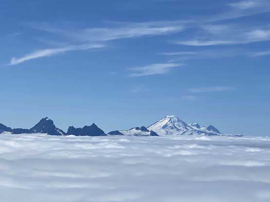
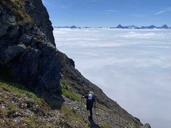
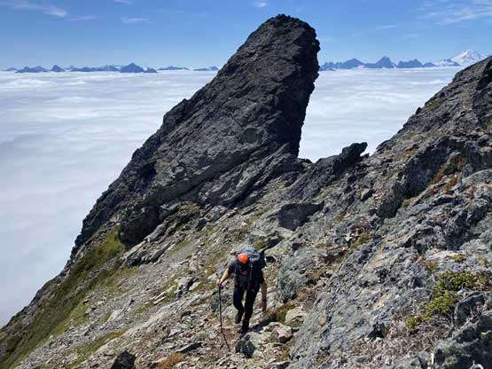
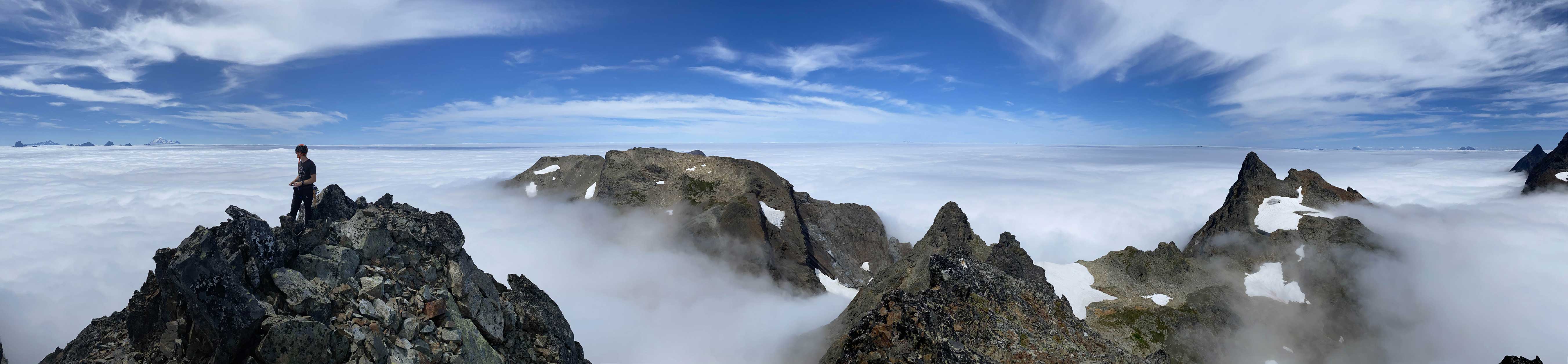
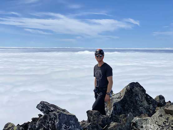
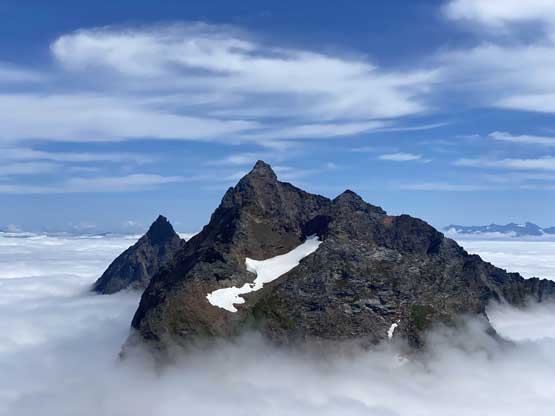
Francis knew where exactly to go so all I needed was to follow him to the base of our objective. We were still soaked in the clouds but I could sense the light becoming brighter and soon enough we could see the sun rays shining above. We hurried up the screw/rubble slope and the next thing we broke through the cloud layer and that was amazing. With the boost in motivation we crushed the next stage of otherwise, tedious scrambling on chossy and down-sloping terrain. We ditched some gears at the base of an obvious ramp. Ascending this ramp was pretty easy but on the other side we had to traverse across a narrow ledge with a few tricky moves and moderate exposure. That last stemming move was a wee bit scary to say the least and although doable, we agreed to find a more preferable way to get down a few hours later.


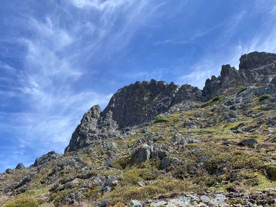

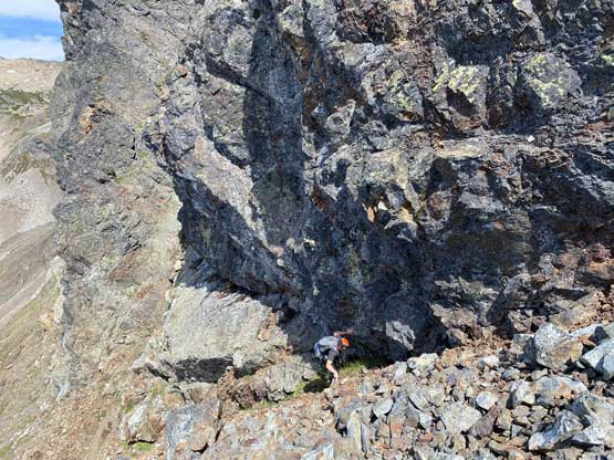
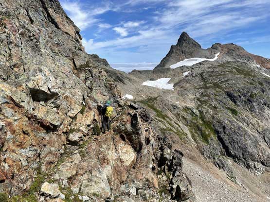
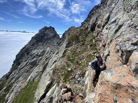
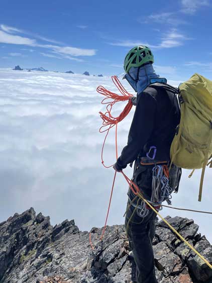
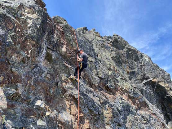
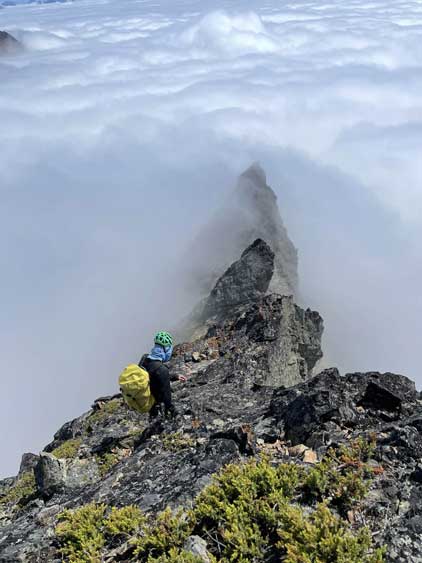
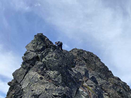
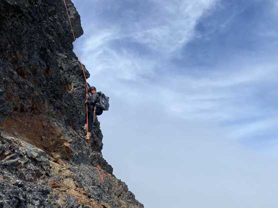
Beyond this sketchy ledge we were able to scramble a long stretch of moderate terrain to get onto the south ridge until the ridge narrowed down. There then came a series of class 4 sections that we opted to solo until we no longer felt comfortable. The rocks were actually not that loose but the type of these rocks meant they could never be fully trusted. Eventually I was able to see the crux step-across move mentioned by some others and the next step was to find a trustful boulder to build a belay station, which took a while as again, the rocks on this peak do not boast confidence. We also opted to swap footwear to rock shoes meanwhile.


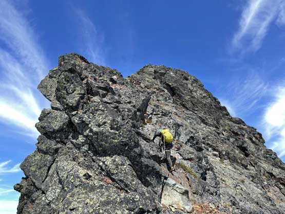

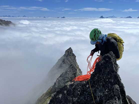
The belay station was bomber but just before that crux step I was only able to put in one piece of protection and that was not very bomber neither. The move was not difficult but the exposure to the left was real and the rock I was going to step onto did not look super solid. But there was no other choice so I had to commit, and thankfully the rock held. Soon enough I reached an anchor that people had used to rappel, but upon tapping I realized the blocks sounded rather hollow and actually wobbled a little bit. I kept climbing until I found a much bigger block, slung it around using my 240cm sling and belayed Francis up. The last pitch to the summit looked easy but since the rope’s out we pitched it out nonetheless.


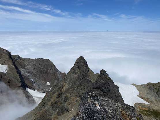

After taking in enough of the clouds scenery we agreed it’s time to get down. We rappelled straight from the summit anchor to the block that I used to belay Francis an hour ago. I had brought 5 meters of cords and that came handy. There’s no way I would leave that expensive 240cm sling behind but these prussik cords were very cheap. Another rappel off this new-built station brought us down to below the crux. We packed our boots and some ditched gears and continued down-climbing until a tricky step. We were about to down-climb it nevertheless but then I saw a perfect rock horn so the decision was to set up an anchor and rappel. This eliminated a section of class 4 lower down as well.


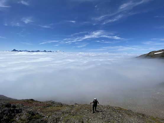
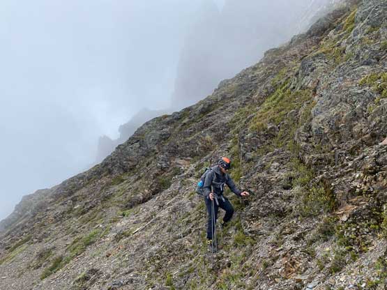
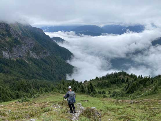
Francis had mentioned that we could bypass that initial ledge traverse by descending the opposite side of a small notch and once there we were pleased to find an existing rappel station. I led down the last rappel which got us just down onto the scree field under the peak. We had to traverse around the base of the cliffs a little bit to retrieve more ditched gears and then descended carefully into the basin under Baby Munday Peka and Knight Peak. At this point we were back into the clouds and were also running late on time. I had the plan to drive to Banff the next day so needed to be back home at a reasonable hour to sleep, so we said no to Knight Peak and continued the descent. The rest of the hike-out was rather uneventful. It’s also not as wet as in the morning and our footwear did not get soaked further. The elevation regain out of Airplane Creek and the last 2.5 km on the road was quite tedious though.


Our round trip time was about 9 hours which was actually pretty decent. Francis did a great job driving us down this sketchy road and were back in Chilliwack at dinner time. I eventually got back home after 8 pm. This was a bit later than I wanted, but not too bad.
