Cerro Cachijirca
June 27, 2022
4992m
Cordillera Blanca, Perú
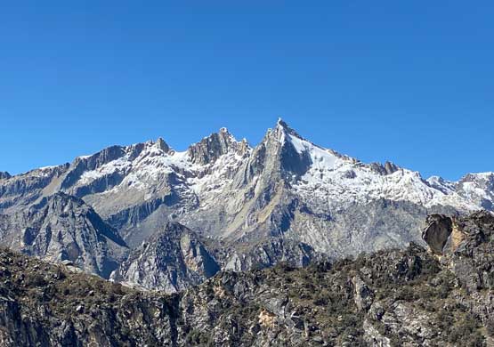
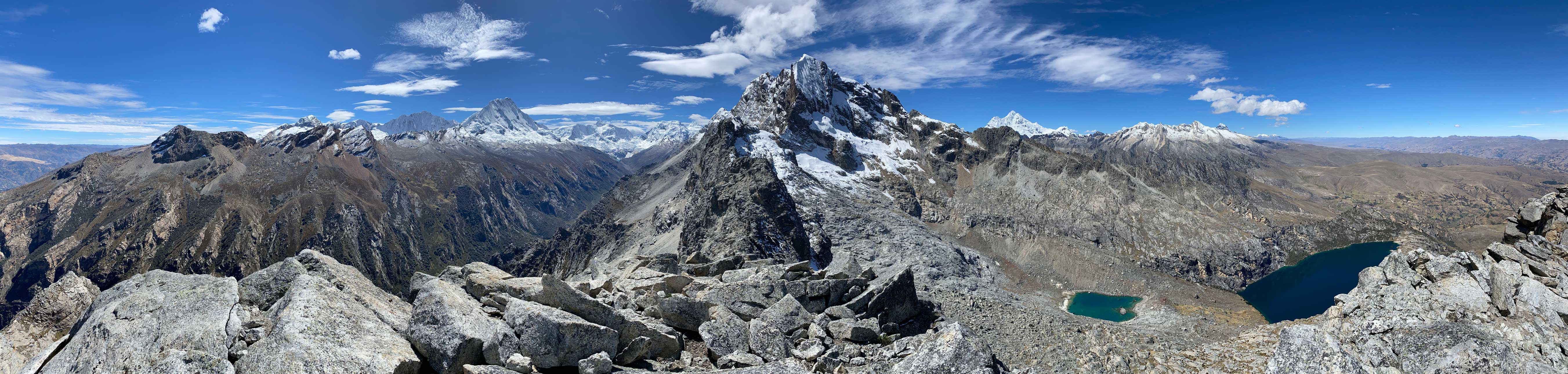
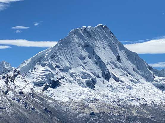
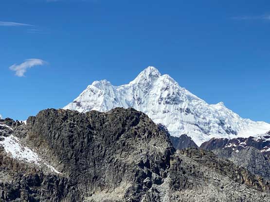
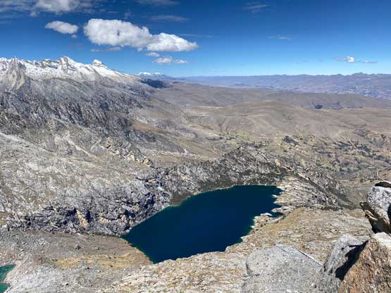
Co. Cachijirca is rather just a pimple on the W/SW Ridge of Nevado Churup but this bump looms immediately above Laguna Churup, which is a very popular hike for trekkers and climbers on acclimatization phase. An ascent of this “peak” was not on my original agenda but I ended up making the spontaneous decision at Laguna Churup as I was feeling better than expected. The ascent was mostly a walk-up but had some fun 3rd class scrambling to reach the true summit.
This was the 3rd day from Lima. On the first day Lily and I took a bus ride to Huaraz travelling over a 4150 m pass in Cordillera Negra. Coming up to that elevation straight from sea level I was definitely feeling the effect but we then quickly descended into the city of Huaraz, at 3100 m elevation. We checked into Hotel Santa Cruz and met up with Sergio, the coordinator of the guiding company we used for ascents of Yanapaccha and Alpamayo later in this trip. On the second day we did a leisure hike to Laguan Wilcacocha from 3100 m to 3750 m elevation and went back to Huaraz for the night. We explored some parts of the city and experienced some local Peruvian food.


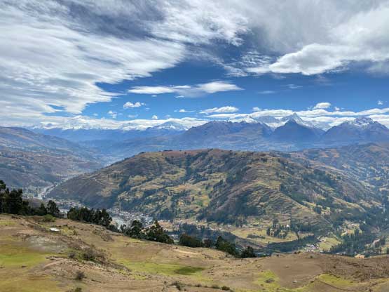

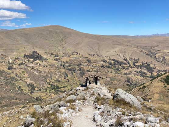
On the third day the original plan was Laguna 69 but a recent transit strike closed that option. I quickly formulated an alternative plan and talked to Sergio about the possibility to hike Laguna Churup instead, which was much closer to the town. David, the driver who worked with the hotel happened to be available so we had our ride to the trail-head at 3800 m at Pitec. The drive to Pitec was mostly on a paved road, which was to my surprise.
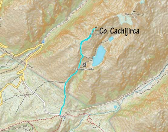
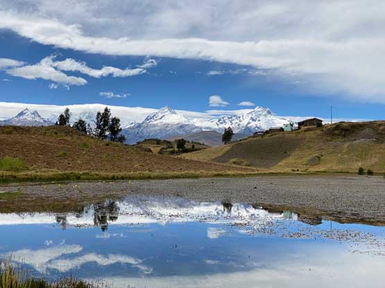
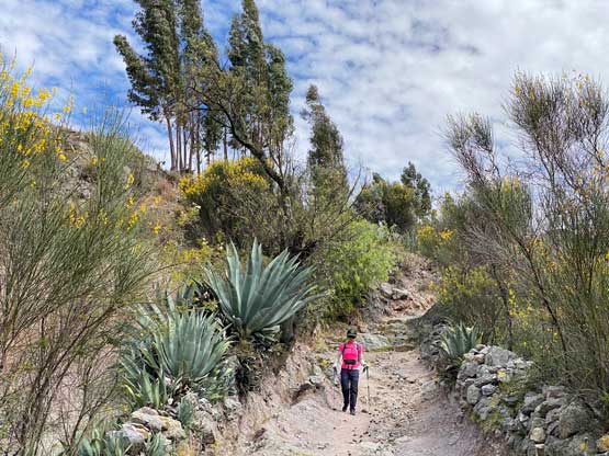
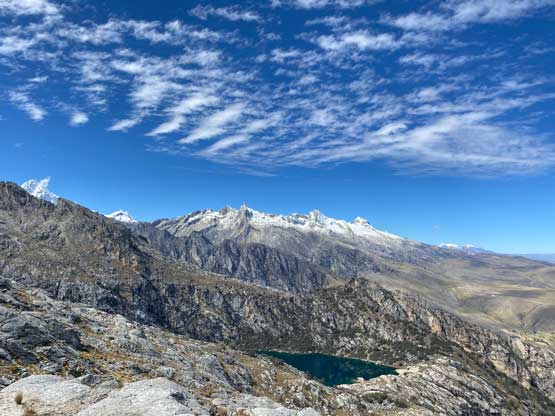
Not wasting much time Lily and I quickly started the trekking and we on purposely hiked at a very slow pace. Still, we ended up passing some hikers in front of us. Just about to enter the national park we paid 85 USD to obtain our climbing permits for this entire trip and then resumed onward. There’s very little worth documenting about the hike. There’s a fork coming up near the lake and we took the left branch staying higher and at around 4500 m we came to another fork.

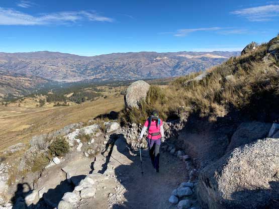
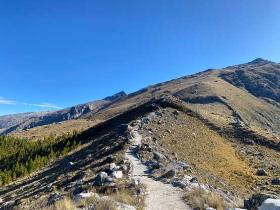
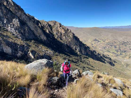
At this point I was feeling strong and wanted to ascend 500 m extra elevation to tag that little summit marked on my map, but this was overall just the 3rd day from sea level and it’s definitely not the smartest idea to push to 5000 m elevation. The new decision was made for Lily to hike down to the shore of the lake and then hike back up to this same position to wait for me. I had little clue how long this ascent would take but I assumed it wouldn’t take me more than 3-4 hours round trip. There’s no defined path but the general bearing was straightforward. I ascended a mixture of grass and rocks onto the broad SW Ridge of Co. Cachijirca and then plodded up the SW Ridge overcoming numerous steps and plateaus. There’s some minor descents here and there as well.

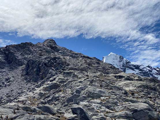
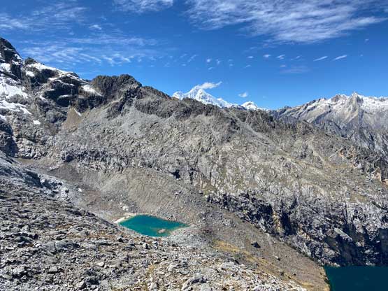

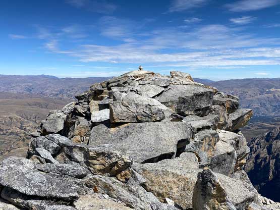
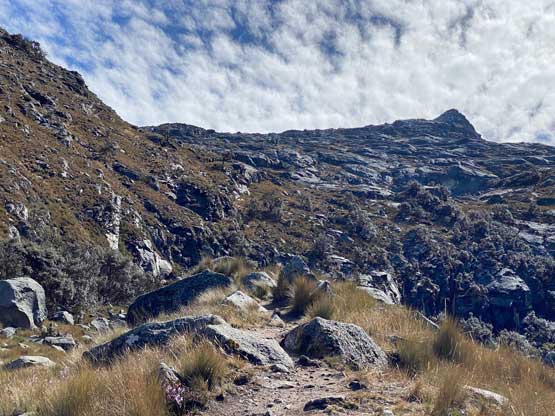
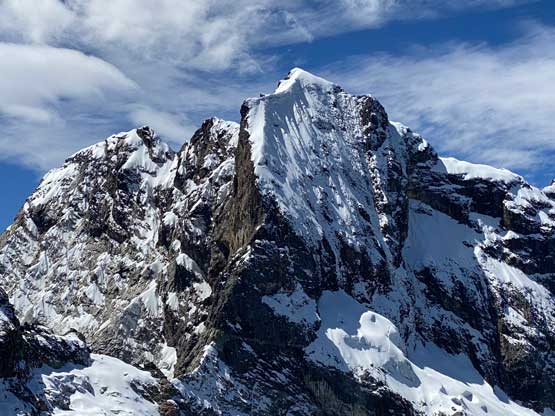
Nearing the summit the terrain steepened and I started to encounter hands-on scrambling but the difficulty never exceeded class 2 or low 3rd class. For the last 100 m gain to the false summit I was finally feeling the altitude and was forced to slow down considerably. Just as I topped out onto the false summit thinking the ascent was done I saw a higher bump about 100 horizontal meters across an exposed ridge so I must resume. The traverse involved one exposed 4th class down-climb on slabs but I found an easier line on the return. The ascent of the far side of the gap was mostly 3rd class but somewhat exposed and I finally could take a long break after reaching the true summit.


After forcing in some food and water I quickly scrambled back to the false summit and made a quick dash down the SW Ridge sticking relatively closer to the GPS track. It’s impossible to stay on the exact same route but I checked the GPS regularly to make sure I didn’t end up descending some other ribs lower. I eventually got back to Lily’s waiting spot and we dashed down the trail together. David was supposed to wait for us at 2 pm at the parking lot and we wanted to make sure we beat that time. In the end we made there with about 20 minutes of spare so overall squeezing this peak into the schedule was quite pushy, but I did make it and that’s all what matters.