McCoy Peak
December 25, 2021
621m
Blythe, CA
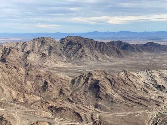
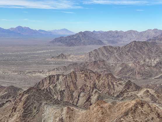
McCoy Peak is a small summit looming above the north side of I-10 about 30 km to the west of Blythe, CA. There are numerous taller summits immediately to the north in McCoy Mountains but this is the only one officially named. Adam and I made the spontaneous decision to ascend McCoy Peak after completing Thumb Peak earlier in the day. I had done zero research but Adam had been to the nearby McCoy Mountains High Point and remembered Bob Burd’s trip report of this little peak. It’s not as straightforward as one would expect.
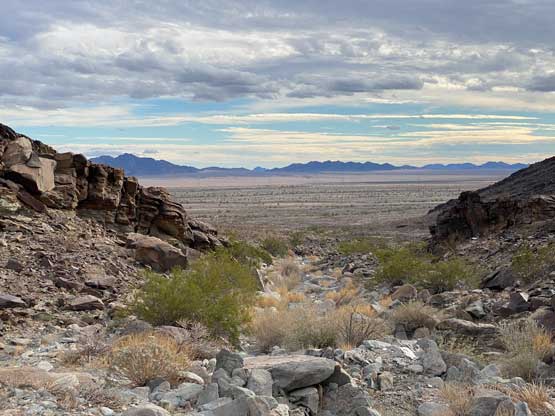
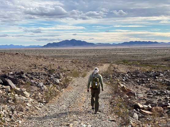
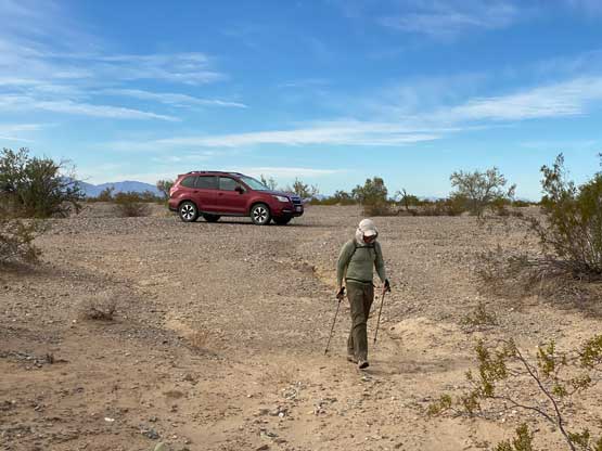
The crux of McCoy Peak was the drive. If one does not mind to walk 1-2 hours across some boring desert flats then the simplest way is to park right next to the freeway. However, this ascent was done in the middle of a big peak-bagging road-trip so we wanted to conserve energy for as much as possible. Adam did not own the most capable off-roading vehicle, but he was determined to drive as close to the objective as we humanly could. Right off the bat after exiting the freeway we encountered some extremely sandy stretches but then we were able to dash down a power line road for a few more kilometers. At some point we turned north onto some narrow and overgrown roads and we eventually turned east again. I learnt from this trip that driving in the desert sometimes does not even require having a road. We eventually parked within 1 km from the start of McCoy Peak’s SW Ridge. For the sake of not getting lost on the drive-out I had recorded the driving section into the GPX file.
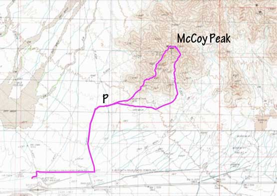
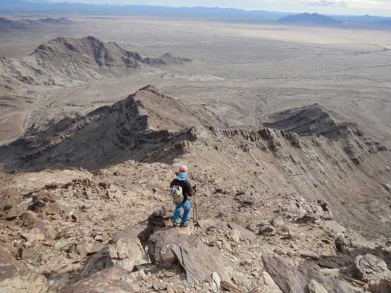
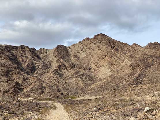
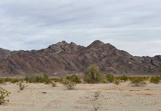
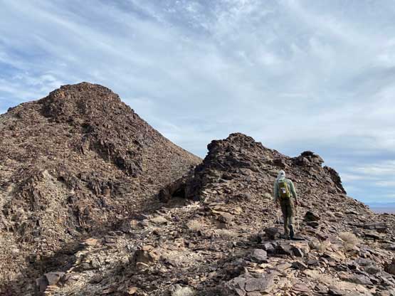
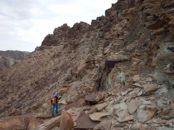
The SW Ridge of McCoy Peak involved several stages with numerous up-and-downs and some consistent class 2-3 scrambling in various parts. We later learnt that it’s not the simplest route to tag this summit, but turned out to be fun nonetheless. After easily dashing across the remaining desert floor we picked up an old mining road to hop onto the ridge. The scrambling started right away and the ridge seemed to drag on forever. I tried pretty hard to side-hill across some bumps to hopefully reduce the cumulative elevation gain. Sometimes the strategy worked, and sometimes did not. Eventually we reached the uppermost west ridge where we discovered another old mining road, which probably have come up from the north side.
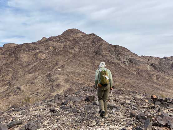
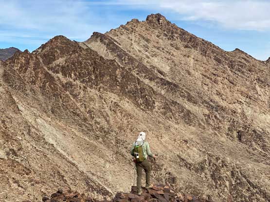
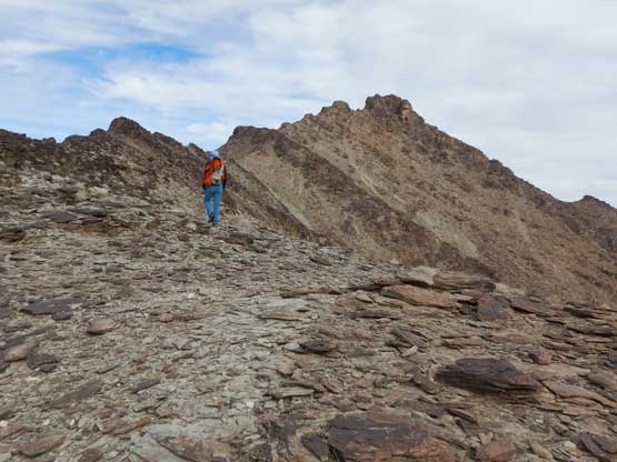

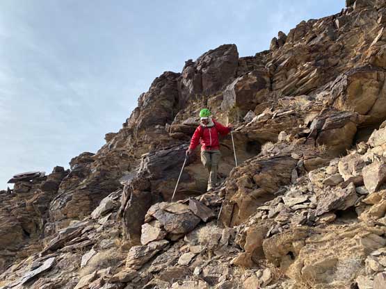
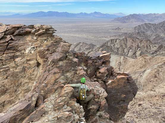
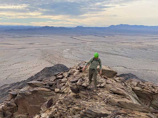
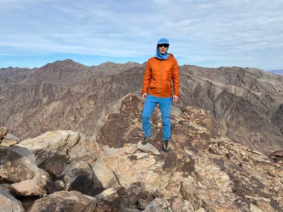
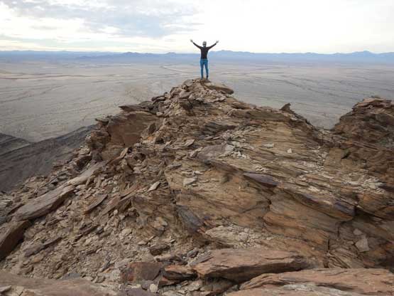
The uppermost west ridge was the most complicated of this ascent. We stayed mostly on the north side of the ridge crest but did hop onto the ridge briefly here and there. The summit was again, attacked from the north side and we must scramble a section of loose 3rd class. We left the trekking poles before the crux zone, but from the summit we could clearly see an easier descent route down into the south side bowl, so I scrambled back down to grab our poles. This ascent turned out longer than what we could have wanted for a bonus summit, even after considering we already shortened the approach by driving some gnarly stuffs.
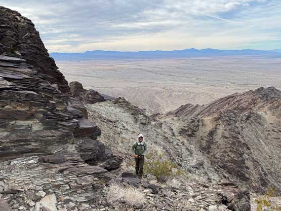

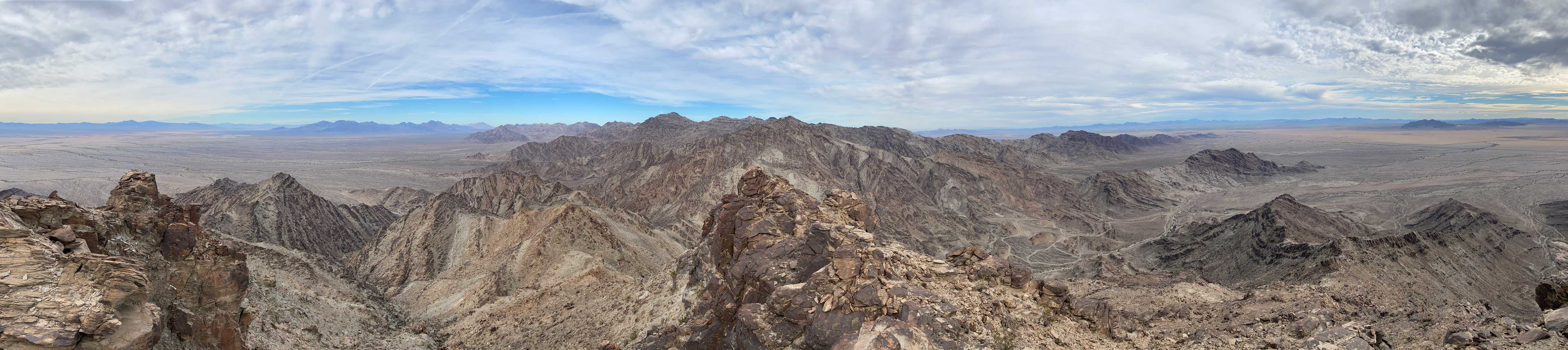
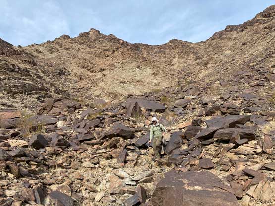
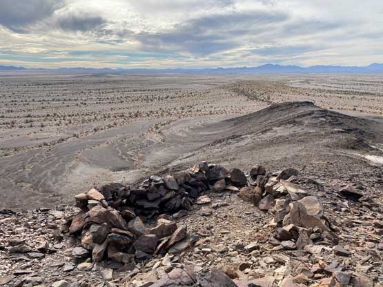
On the descent I led us down the class-2 SE Ridge and then bailed into the south side bowl. The descent was straightforward, but tedious and seemed to drag on for a long time. Eventually the grade eased and we descended back onto the desert floor, but this time we had several kilometers’ plod to get back to the vehicle. The drive-out did require us to use GPS to confirm several turning points. We then drove back into the city of Blythe for food and wifi, and then drove south to car-camp near our next objective.