Mount Wesley
December 2, 2018
906m
Port Alberni / Vancouver Island, BC
Mt. Wesley is rather just a low-elevation forested bump rising abruptly off Alberni Highway in the southern Vancouver Island. It does boast a steep profile and is fairly popular among the locals but given the lowly status it’s apparent that I wasn’t coming from the mainland just for this hike. The true summit is completely forested with no view whatsoever but a rocky platform 50m lower on the SW Ridge provides some decent vistas. The better way to soak the full experience is by hiking the entire stretch of Wesley Ridge running a E-W direction. Al, Vlad, Mel and myself did it in the peakbagger’s fashion, in-and-out via the shorter but steeper SW Ridge combining with the nearby Mt. Horne.
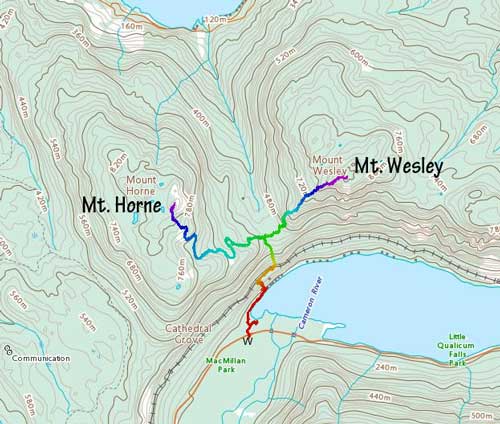
Mt. Wesley and Mt. Horne off Alberni Highway. GPX DL
Upon seeing a dominating high pressure kicking in towards the beginning of this December I quickly gathered a last-minute group for an assault on Mt. Arrowsmith, the highest peak in southern Vancouver Island. The alarm went off at around 4:20 am and within 2 hours the four of us had got onto the Horseshoe Bay – Nanaimo ferry. About 1.5 hours later we got off the ferry and drove northwards along the main island highway and then onto Alberni Highway. This is the highway that eventually heads for Tofino. With some GPS navigation we correctly located the Cameron Connector turn-off but to our surprise the road was closed for logging, even on a Sunday… The Plan B was Klitsa Mountain so we drove farther out to the west into Port Alberni and did some research. 1.5 hours, about 25 km down a series of logging roads later we came to another gate, and this time the road was closed for heli-logging… That sucked. Three hours of logging roads for nothing and we were back to Port Alberni second-guessing our decision to head onto Vancouver Island. The third plan was Mt. Joan but we might not have enough time to catch the 10pm ferry ride back onto the mainland. There went the Plan D – Mt. Wesley right off Alberni Highway… We did some calculation and decided to rush for both Mt. Wesley and Mt. Horne with sunset-watching on the summit of Mt. Horne to salvage this day.

Almost sunrise time, about halfway across Straight of Georgia on the ferry
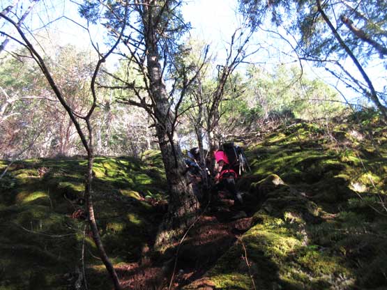
The start of this hike is from Cathedral Grove off some tourist’s trails system. We got lost right off the bat but I realized our mistake not far in. We backtracked and found the correct “trail connector” joining a deactivated logging road. There’s some old cabins at the west shore of Cameron Lake and from there we found that steep trail heading straight uphill joining an old railway track. The trail then heads north along this railway track for a couple hundred meters before bailing steeply into the forest again. This time the trail ascends steeply to the broad, forested pass between Mt. Horne and Mt. Wesley. We ditched a bunch of unnecessary gears and headed for Mt. Wesley, the harder of the two.

A cabin on the shore of Cameron Lake

Vlad charging steeply on the trail

This is where the trail heads into the forest from the old railway
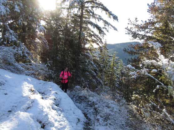
The trail was very easy to follow but the grade was relentlessly steep for the whole stretch shooting straight up the SW Ridge. The crux came at a steep bluff about 1/3 of the way up, that we had to somehow aid the scramble by a fixed rope. Higher up as the trail ascended onto the shaded north side of the crest we encountered patchy snow. The best view came at about 15 minutes before the true summit. The actual summit was entirely forested and we could see nothing other than the summit cairn with a giant register tube..
Al scrambling up the crux bluffy zone

Upwards and onward. It’s very steep for a trail’s standard

Vlad marching up

Mel leading the way. Note the fresh snow
Al coming around a corner

After a long while the view finally opened up.

A zoomed-in view of the multiple summits of Mt. Arrowsmith massif
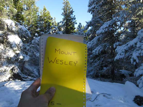
The register confirmed that we’d made this forested summit
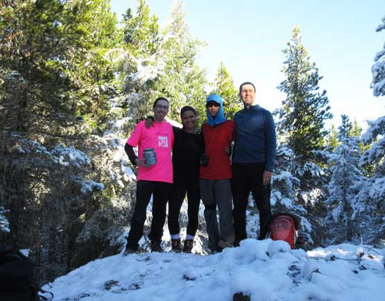
Our group shot on the summit of Mt. Wesley
About 10 minutes later we started the descent but first of all we had to stop thoroughly at that viewing platform for some photos. Another 10 minutes later we all committed to the descent. The trail was very steep and hard on the knees but at least the elevation was lost in no time.
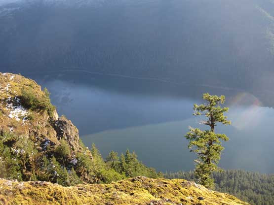
Cameron Lake from that viewing deck

The south slopes of Mt. Wesley is very bluffy and steep

Mt. Cokely and Mt. Arrowsmith

A zoomed-in view of some lowly forested bumps south of Port Alberni
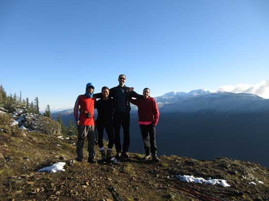
Our group shot at the viewpoint on SW Ridge

Me taking in the views with Mt. Arrowsmith behind

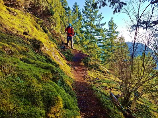
Heading down. Photo by Mel O.
Me and the trail. Photo by Alan B.
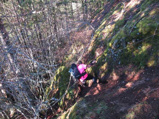
The rope came handy at this bluff section
Once back to where we ditched gears at Wesley/Horne pass we checked the time, and with just over 1 hour of daylight time to kill we immediately started the ascent of Mt. Horne. It’s a race with sunset and we had to win.
