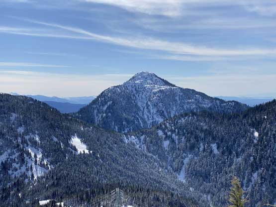
Nursia Peak (Norrish Peak)
March 8, 2021
1340m
Mission, BC
This is the highest point of a wooded but heavily-logged area at the headwaters of Cascade Creek and West Norrish Creek about half a dozen kilometers to the NE of Mt. St. Benedict. This peak is higher than Mt. St. Benedict, offers more expansive views and boasts over 300 m prominence, but the name is very unofficial. I’m not sure who assigned the name first but Robin Tivy on bivouac.com called it “Nursia Peak” due to the “St. Benedict theme of the area” while Grant Myers from peakbagger.com called it “Norrish Peak” due to the proximity to Norrish Creek. I’m not sure which name sounds more legit but Google Earth has adopted the bivouac’s name so I picked “Nursia Peak” as my preferred one.
About a year ago Ben Shewan from Mission had reported an ascent of “Nursia/Norrish” on Instagram I took a mental note on that. The access and approach via some powerline road system looked friendly from satellite images and the south ridge looked to a fun ramble on snowshoes when a thick snowpack covers the bushes. Vlad and I pulled a last-minute trigger for this past Monday. A stretch of stable weather had finally kicked in but the previous storm had dumped a shit ton load of precipitation over the weekend. The conditions in the mountains would be unknown with a great variety of possibilities so we picked this rather easy objective just to be sure we could definitely bag the summit. I opted to carry and use my 30′ snowshoes also to give more contingency in case the trail-breaking effort turned into a nightmare. In retrospect this turned out to be an overkill as the conditions were much firmer than I thought.
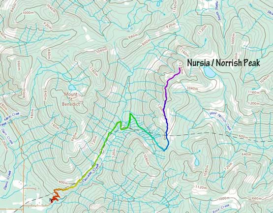
Nursia Peak / Norrish Peak ascent route. GPX DL
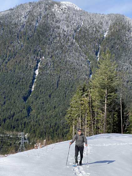
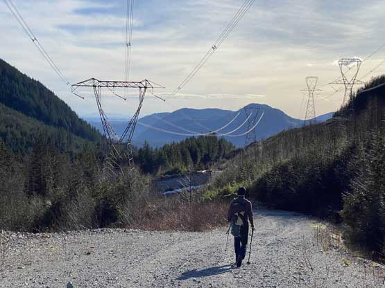
Vlad showed up in White Rock’s bus station at around sunrise time and we were at the trail-head within an hour and half. The actual trail-head has a gate that would be closed after sunset. We parked inside the gate nonetheless as we were confident to get out before dark. The powerline road beyond the parking lot was unfortunately gated. The first half of the hike was a boring plod up this road for quite a few kilometers with about 400 m elevation gain. We hit continuous snow at the highest spot of this flattish stretch of the roads at around 550 m elevation and subsequently strapped snowshoes on. The roads then did about 50 m of descent to cross Cascade Creek (on a nice bridge). Nobody had gone beyond this spot so we had to break trail for the rest of this day. The upper roads leading to the pass at 950 m elevation south of “Nursia Peak” had a few annoying creek crossings. The trail-breaking was averagely moderate but heavy at times due to wet fresh snow balling under our snowshoes.

Vlad plodding up the boring road with our objective ahead

Portrait mode of Vlad

“Nursia Peak” ahead with the obvious powerline cut

Vlad snowshoeing down to the bridge crossing Cascade Creek
Vlad now snowshoeing up the opposite side

Plodding ahead. The trail-breaking duty was getting heavier

Looking back at Mt. St. Benedict (left) and and unnamed peak (right)

The north face of “Rose NW3” from near the road’s end
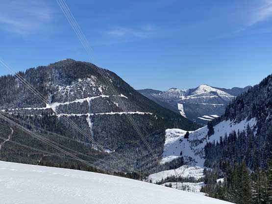
The powerline cut continues dropping into Norrish Creek valley
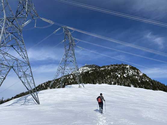
Vlad plodding to the highest cut on this powerline
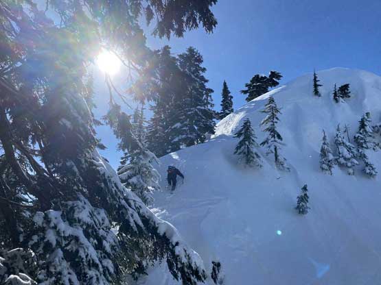
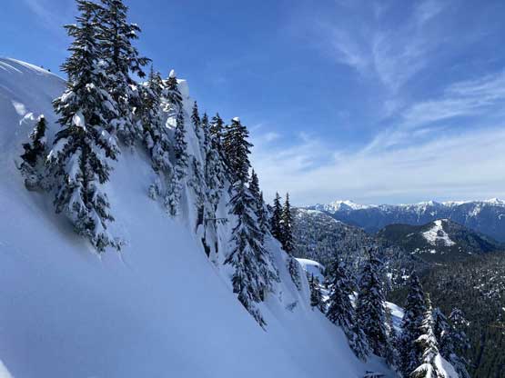
Some cold wind picked up once we reached the highest end of this road. The next stage involved some steeper ascents through tight secondary growth forest. This section would be impossibly ugly in summer time but with a March’s snowpack the going was reasonably okay. We did have to whack through some tree branches but I wouldn’t call this “bushwhacking”. Once the ridge petered out we had to deal with some continuous up-and-downs for a few more kilometers’ horizontal distance, although the views were getting better and better. One particular drop worth noting was right after the first expansive vista point, that we were forced to take snowshoes off and down-climb facing into the slope. It was bout 40 degrees with moderate exposure to skier’s left and the hard crust under the fresh power was very icy. The true summit was on the far end of the ridge and still involved a few more sections of up-and-downs.

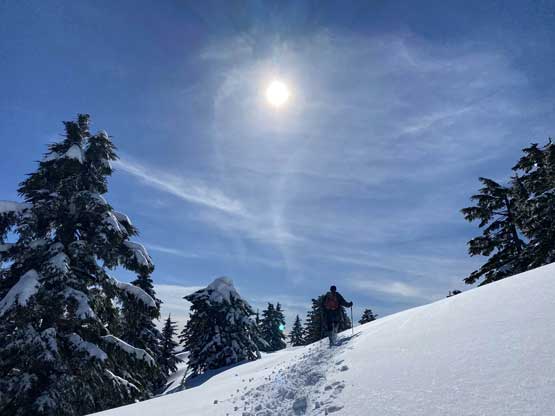
Vlad ascending above the road’s end, looking back
“Gregory Peak” or “Big Miracle Mountain” is another bivouac vs. peakbagger name

Ascending into a section of burnt forest

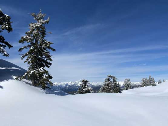
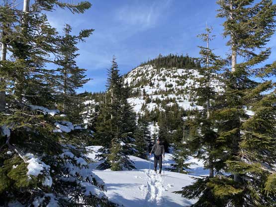
This is actually the typical terrain on the upper south ridge

Our first unobstructed view looking west into Golden Ears Provincial Park
Vlad down-climbing the steep step off from that viewpoint
Vlad ascending with the aforementioned viewpoint behind
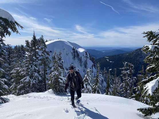
The terrain transitioned back to the undulating and meadow-ish ridge

Finally we were in front of the true summit

Descending to the last col in front of the true summit
Looking back at the last drop

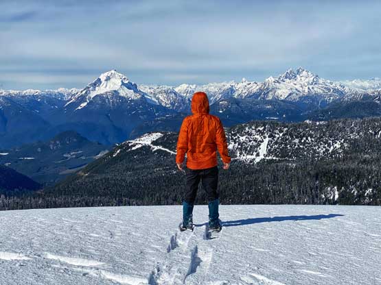
Vlad snowshoeing onto the summit of “Nursia Peak”
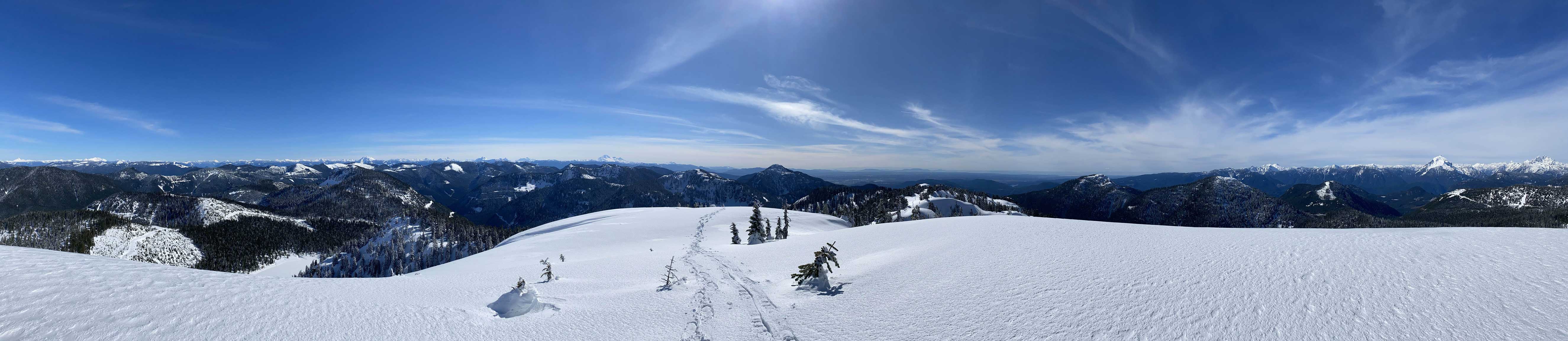
Partial Summit Panorama from “Nursia Peak”. Click to view large size.

Partial Summit Panorama from “Nursia Peak”. Click to view large size.
Another view of “Gregory Peak” / “Big Miracle Mountain”
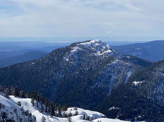
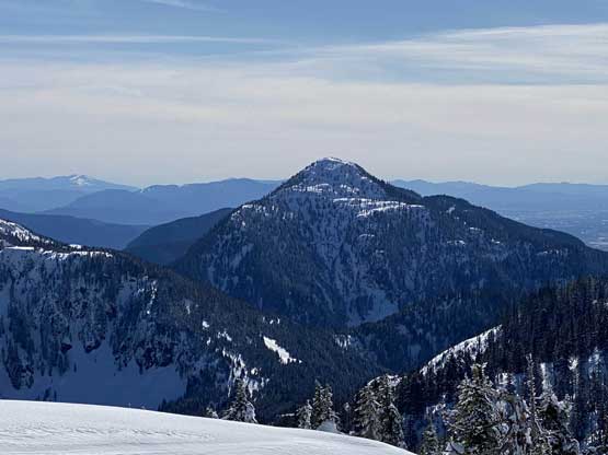
Mt. St. Benedict is the only officially-named summit in this large area

A zoomed-in view of Golden Ears group of peaks

“Raven Peak” on left; Mt. Martyn on right – two remote summits in Golden Ears Park

A closer look at Mt. Robie Reid

Our tracks in the foreground with Fraser Valley flatlands behind
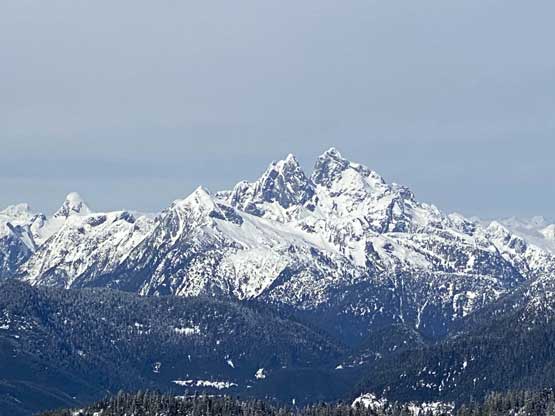
Mt. Judge Howay with Mt. Kranrod in front and The Defendant on far left

Robertson Peak in the far distance behind “Winslow Peak”

Stonerabbit Peak et al. in the core Chehalis Group

Mt. Urquhart right of center on the skyline

The cut-blocks in Norrish Creek valley in foreground

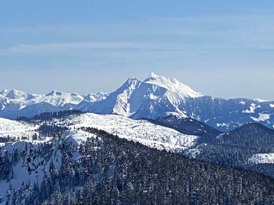
Mt. Baker dominates the southern skyline
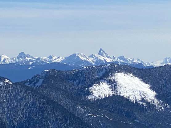
Slesse Mountain is always eye-catching
Cheam Peak and Welch Peak in Cheam Range

Mt. Snider is that long ridge and Tulameen Mountain is that prominent peak
Vlad doing his sandwich art on the summit

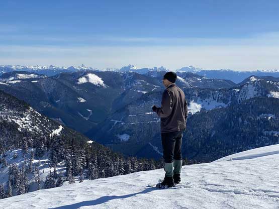
Me soaking in the views from the summit of “Nursia Peak”
Me in front of Mt. Robie Reid and Mt. Judge Howay

Vlad and I on the summit of “Nursia Peak”
The true summit had a nice 360-degree panoramic view as well as cell services so we lingered quite long. Eventually the cold wind forced us to retreat. I took a glissade down from the true summit but got snowed in my pants, and decided to just walk down for the rest of this trip. The snow condition was a bit shitty for descending on snowshoes. We both constantly slipped on the icy surface and the fresh snow on top of that layer had turned slushy at this point. A few steep rolls required some caution. Vlad talked about to ascend the unnamed peak “Rose NW3” but I didn’t quite echo that as I didn’t want to claim that unofficial name. Thankfully Vlad wasn’t quite interested in that added task once we got back onto the road section, so we leisurely walked down. Near the end of this trip we paid a quick visit to Cascade Falls. I totally see this place gaining popularity once Instagramers discover it.

Back through those rolling terrain on the ridge
Another photo of the rolling terrain on the upper south ridge

Vlad re-ascending that steep step

Snowshoeing down the mature forest on the ridge
Back to the secondary growth sections

Back onto the powerline road with “Rose NW3” ahead

Vlad snowshoeing down with Mt. St. Benedict ahead

The bridge crossing Cascade Creek ahead

Re-ascending 50m after the bridge
Running out of snow now
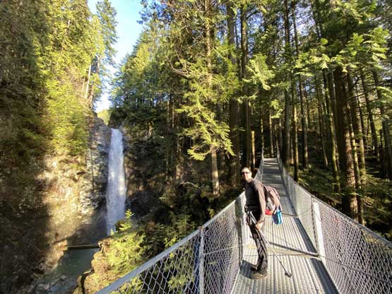
We opted to check out Cascade Falls which turned to be a good call

Cascade Falls
Our round trip time was under 8 hours on a leisure pace, covering 20 km distance and over 1200 m cumulative elevation gain. Comparing to Mt. St. Benedict this is a much longer hike but the rewards and views were also much better. There is one steep step on the ridge but even without continuing onto the true summit you can still get most of the views from the false summit before that step. This peak definitely deserves more attention than a simple Google search suggests.
