Scuzzy Mountain
September 8, 2016
2223m
Boston Bar / Fraser Canyon, BC
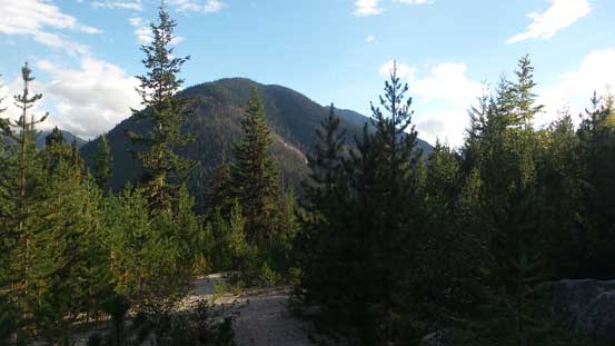
Scuzzy Mountain is a prominent peak with a fairly impressive north face in the “East Harrison” area. The access is via some logging road systems from a small town called Boston Bar in the Fraser Canyon. I had previously never visited that way and I always wanted to check something out in that general area. I got this idea by simply looking at the topographic maps and then there came that brief search on the Internet. The normal route up the SE Ridge seems to go at a mere “class 2” and is mostly just a walk-up. The weather wasn’t looking too promising for the first Thursday after the new semester started, but that’s the only day I could get out for a whole week. After some debating and deciding it was Michelle Hyun, Brian (Muskeeto), Tom Cardle and myself heading for Scuzzy Mountain.
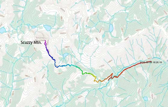
Scuzzy Mountain scramble route via SE Ridge. GPX DL
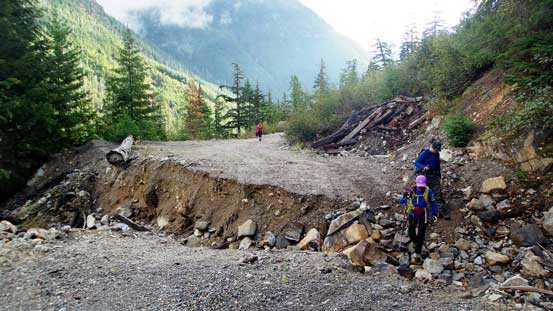
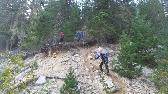
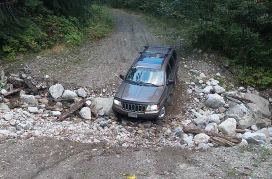
By 5 am we all met at the Chevron near Boundary Road in Vancouver and in short time we were cruising eastwards along Highway 1 in Brian’s Jeep. It had been a long while since I saw these guys. My last trip with Michelle was back in this March and my previous trip with Brian was Mamquam Mountain back in the fall of last year. And not to mention that I had never met Tom Cardle before. It always felt good to reconnect with friends so the drive to Hope didn’t seem to take long. The weather wasn’t quite on our side though and the rain almost made us to rethink our plan. Fortunately as we drove up the Fraser Canyon (Highway 1 northbound) the clouds slowly lifted up revealing more and more blue colours on the horizon. We kept the original plan so onto the Scuzzy Creek FSR we went. Most of the road was in a good shape but all the sudden it deteriorated. There was one major cross ditch that Brian barely made through and then we kept on driving for a while overcoming lots of waterbars and even a few downed trees. Eventually there came a major landslide path and we had to park, about 3 km before the Scuzzy Spur Road turn-off.
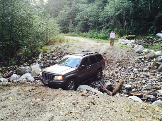
Brian mastered this ditch in his Jeep Grand Cherokee
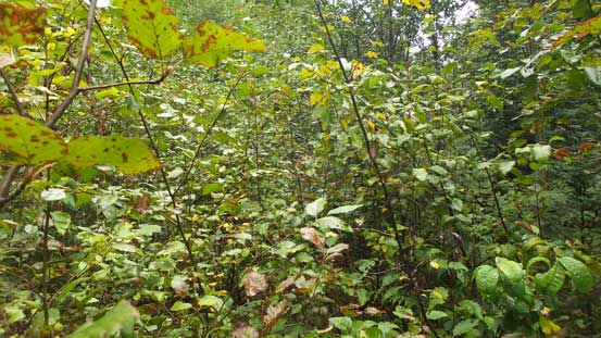
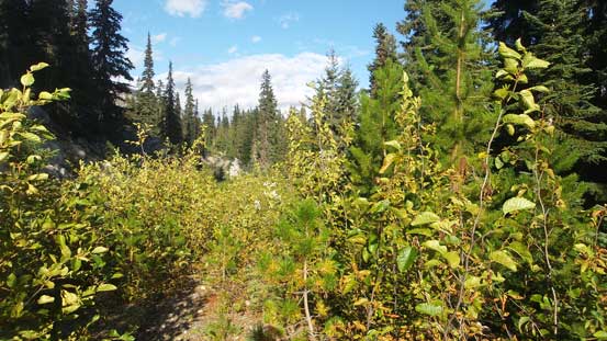
For the logging road walk I opted to hike in my sneakers while carrying my heavy mountaineering boots. This always seemed unnecessary on the way in but I knew I’d be much happier towards the end of this trip. Beyond the landslide/boulders path there was one major ditch that no vehicle could make through so this road was really approaching the end of its lifespan. At the first turn-off we followed a narrower branch down and across Scuzzy Creek (fortunately the bridge was still there). Up the other side the alders soon closed in and we all spent a few minutes putting waterproof gears on. The bush was wet from previous few days’ rain and it was not fun. In about 10 minutes up the spur road I happened to check my GPS and bang, we were on the wrong road… Backtracked to the bridge we actually had to spent a minute or two looking for the correct branch. It was severely overgrown and hard to distinguish, but since we were there anyway we had to give it a try.

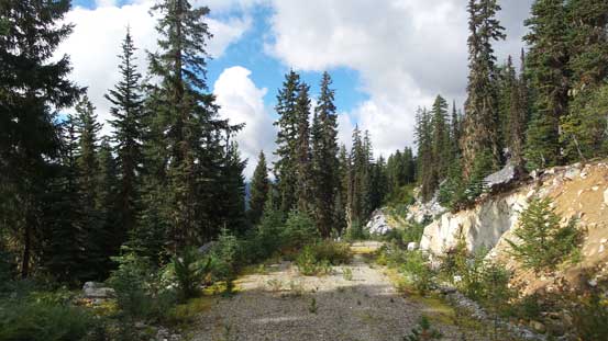
The ascent started with some logging road walking
This ditch would prevent any vehicle to go any further…
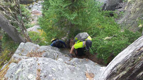
Thankfully the condition didn’t seem to be that bad higher up. It was still pretty bad in general but the bush was “on and off” and the openings did boost the spirit among our group. Some light drizzle didn’t help though but we were already got soaked through from the wet bush so nobody cared that much now. Our pace was slow but by looking back down at the valley we knew we were at least making some progress. After a few switchbacks the road was about to cross a creek. Here the alders got very bad again and we made the call to bail into the forest. We were about 300 vertical meters below the highest point on that road (at least according to Simon’s trip report from a few years back), but nobody was in the mood to continue any further not knowing the exact status. We were hoping the old growth forest could offer some fast travel and we were correct. The forest, although steep and bluffy at places, was indeed an easier route choice with mostly open travel. The bluffs did require some route-finding but the scrambling was quite fun and added some variety to the otherwise, boring and monotonous forested ascent.
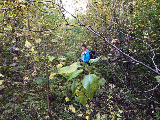
Me going into the alders…
Hard to picture but here we were actually following the spur road up…

Eventually we decided to just bail into the forest
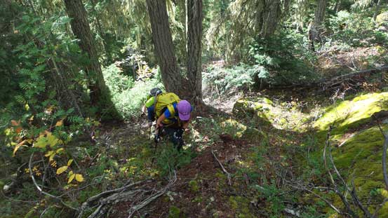
Ascending the lower forest. Not bad, not bad…
It was steep at places but otherwise, fairly smooth sailing
Bluffy at other places.

We had to circumvent this major bluff. There were many of these higher up.
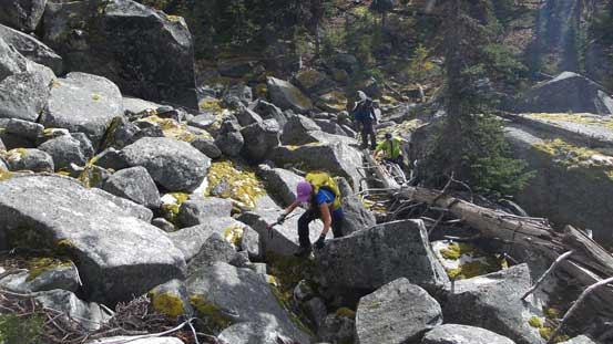
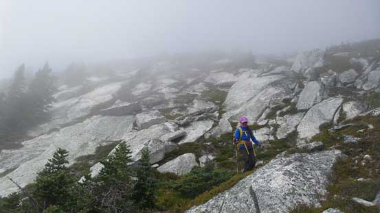
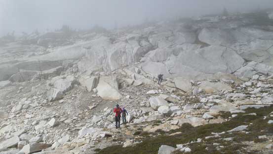
The typical boulder field that we had to negotiate. Those rocks were mossy and wet…
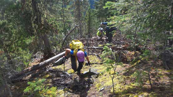
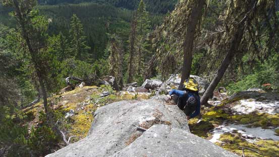
About an hour later we came to another opening area, and sure enough that’s the upper road branch. We followed the road leftwards for a while to skirt the impressive bluffs above and once making sense we headed into the forest again. For the next long while we had to deal with some steep forest, lots of bluffs and lots of route-finding. It wasn’t obvious where to go at times and we had to make some guess work, but all work eventually led to a solution and then there came the next bluff. Too bad the underbrushes were getting increasingly thick through the process and not to mention they were wet… There was one particular miserable spot that we had to basically haul the vegetation to pull ourselves up against gravity. At other times we had to negotiate slippery boulder fields and that’s not fun neither. But it was all about staying positive and the problems were solved one by one. Eventually the terrain levelled out and we made to the first highpoint. A long break was sure in the order and it seemed like there’s still a long way to go.
Reaching the upper portion of this spur road.

Lots of route-finding through micro-terrain
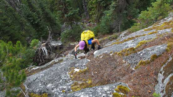
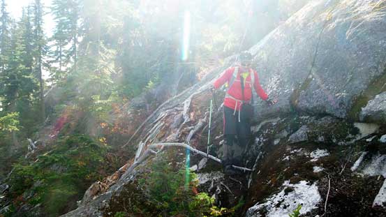
A bit of scrambling here and there.
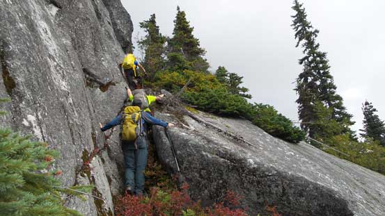
Lots of bluffs to negotiate. It never seemed to end.
Another bluff to ascend through. Left, right, left and then back right…
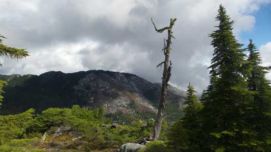
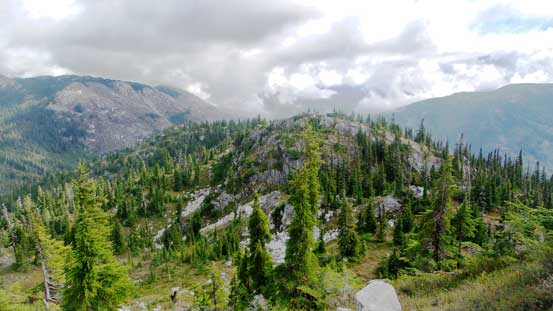
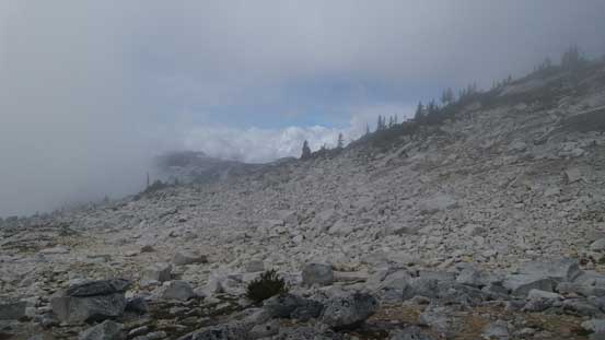
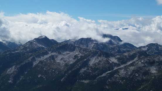
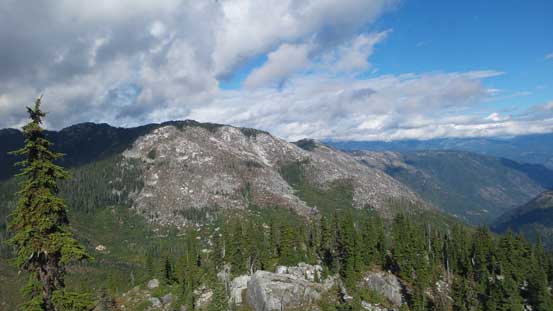
Finally could see some views.
The summit was in sight now. That seemed like a long ways away…..
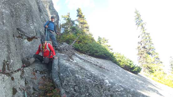
It also seemed like we’d have to deal with more up-and-downs and lots of micro-terrains. I knew we had to get going so after forcing in some food I said it’s getting cold and let’s keep moving. Easily descending into the first saddle I led the way plodding up the next bump, and sure enough there came another drop not visible from the previous bump. I searched around and found a reasonable route to get down on the left (south) side and there came another section of uphill plod. Brian took over the lead here and led us through a section of moderate scrambling terrain and then we hit the next (major) bump along the ridge.
Going up the next bump. There appeared to have lots of up-and-downs yet
Looking back at the first bump we just traversed over
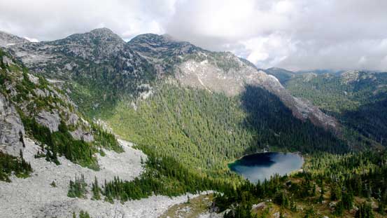
Looking down into the bowl/cirque with a cool lake down below
Ahead seemed like another section of a major elevation loss
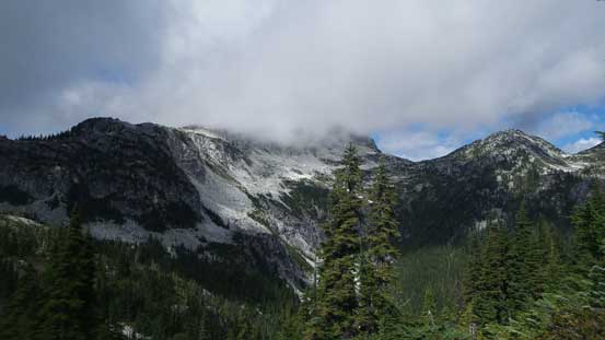
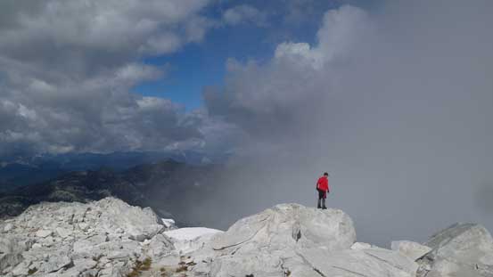
Looking ahead the final summit was still soaked in clouds but at least didn’t seem to be that far now… Down to the next saddle we had now done the last major elevation loss, and there came that final plod towards the summit. The terrain was technically easy and we generally stayed near the edge on climber’s right side. Just before entering the clouds layer I said let’s take a final break. We were now about 300 vertical meters below the summit and I thought it’s going to get cold and windy up high and we wanted to make the final push in one shot. Of course the weather always had other plans and soon enough it started to clear up and we were back into the sunshine. No complaint this time and we all took our time enjoying the last bit of the scrambling. The summit was soon attained and we were actually treated by some decent views and that’s definitely some bonuses that I wasn’t quite counting on.
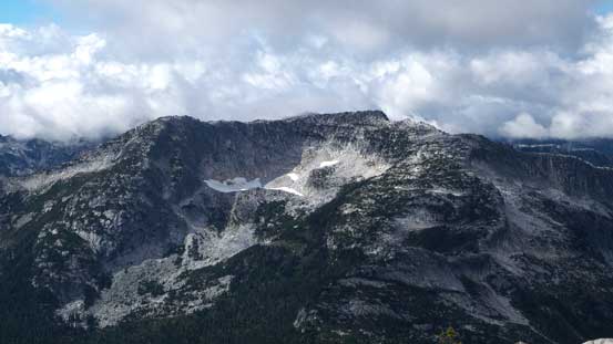
There were still lots of bluffs and micro-terrain even on the ridge proper…
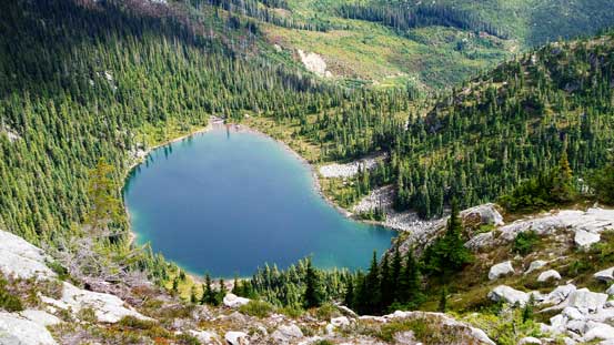
That lake was quite neat though
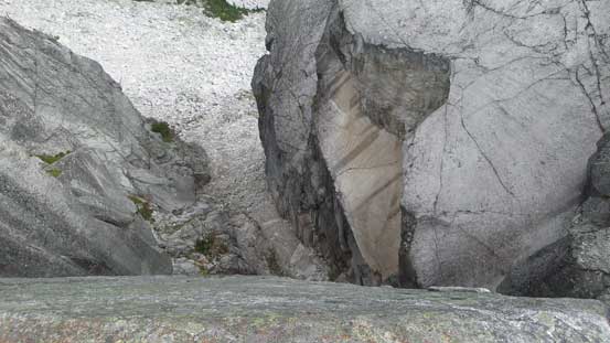
A giant split in the rocks. Cool to check out but I didn’t want to step too close to the edge.
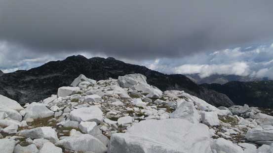
Lots of white granite rocks along the ridge
Brian marching up
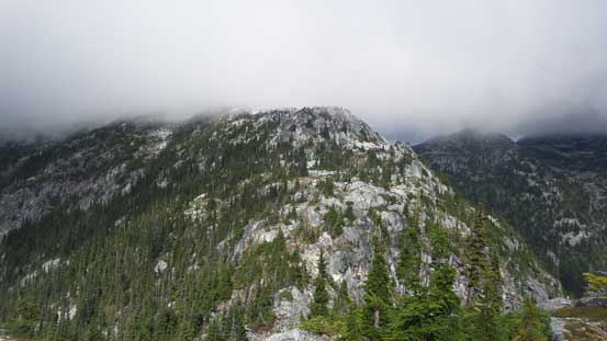
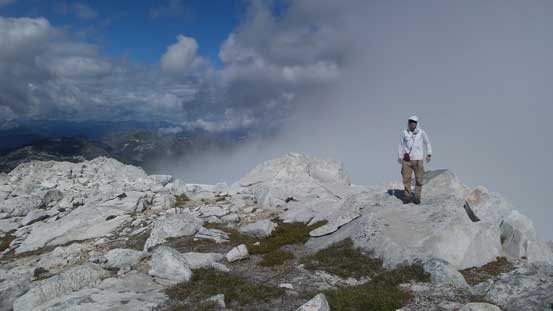
It was getting foggy now.
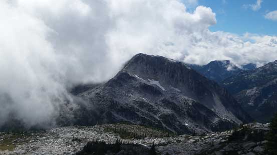
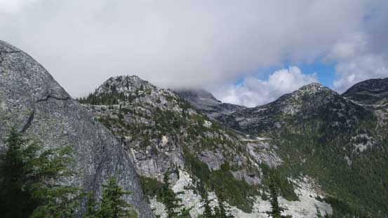
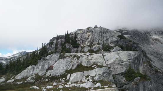
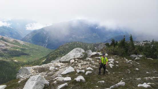
The fog dissipated and we got some nice views towards Cam’s Peak
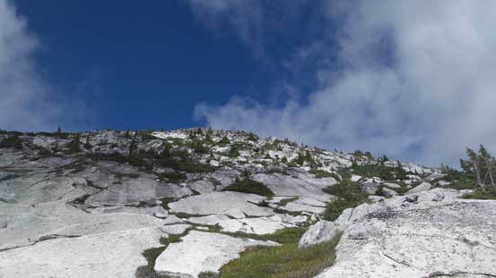
Almost there…
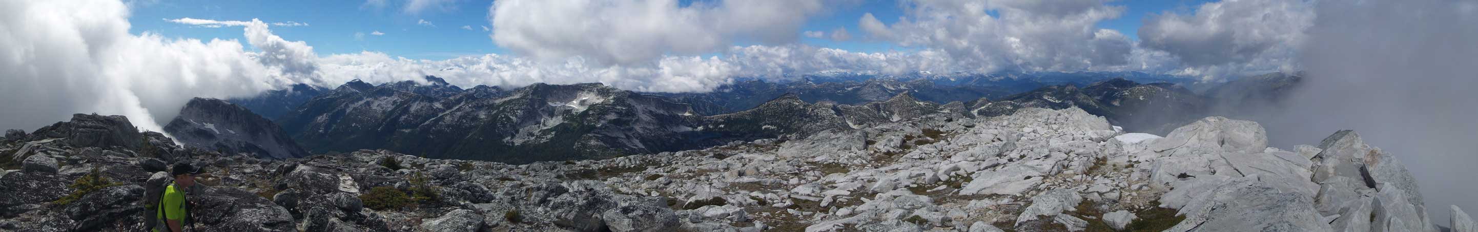
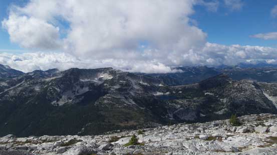
Summit Panorama from Scuzzy Mountain. Click to view large size.
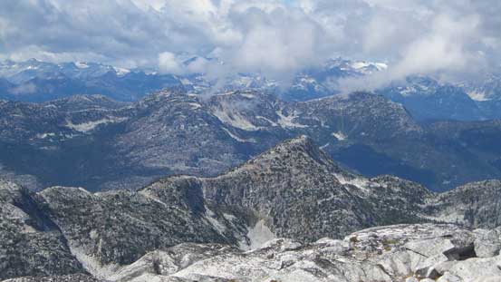
Looking deeply into the “East Harrison” area. I think most of these peaks are unnamed.
Fraser Peak to the west
Looking over the summit of Mt. McEwan towards distant giants by the Stein Divide
Brian checking things out
Another view looking west towards Fraser Peak et al.
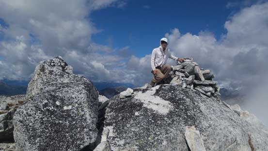
Me on the summit of Scuzzy Mountain
Another picture of me on the summit

Our group shot on the summit
Down the south ridge we went we took a more direct line but lower down not paying attention to the route I accidently led the group into a section of ugly krumholtz field. After this section of bashing I decided to follow my GPS track closely not doing any unnecessary wondering anymore. By that way the bluffs were overcome one after another and it didn’t take us long to get down to that undulating section. Up and over a couple bumps it’s time for another break before committing to the steep forested descent lower down…
Time to head down
Descending the upper SE Ridge

One of the many sections of elevation regain
The weather was clearing up in the late afternoon.
Nobody was looking forward to this section but let’s face it… I led the way down from there on by following the GPS tracks. When in doubt all I had to do was to look at that little screen and then reconnected with my memories from earlier in this day. There’s no way I could remember all the details about those bluffs but problem seemed to get solved fairly smoothly, one at a time. The few scrambling cruxes were fun to descend and then we were back to the upper road branch. Into the forest again we skirted around a few more bluffs and then had no further problem following open terrain down to the lower road branch, and then there came the unavoidable alder bashing. Now it’s downhill so much easier than on the way up and the bush was mostly dry now which was nice.
Descending back through those bluffs.
Another bluff.
Down to the upper end of that spur road
Descending the steep back into the lower reach of that road
The road plod began.
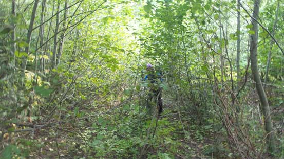
Oh the alders…
Now it’s time to change my footwear back to the sneakers which felt very nice. The final 3 km road plod seemed to drag on for a long while but that might due to the fact I was getting tired. Now came the final part of this adventure. Brian managed to negotiate back across that ditch safely and the rest of the drive out via Scuzzy Creek FSR was uneventful. The rest of the drive back home seemed long but we all got back before midnight.
It’s Jeep time…
Overall this was a classic “Type II fun” trip with friends and I’m sure only the peak-baggers are keen on adventures like this. There weren’t much fun terrain throughout but the satisfaction from bagging Scuzzy Mountain was high among our group. I don’t think I would recommend this trip to others but if you’re a peak-bagger I do think you should consider doing Scuzzy Mountain soon as the road seemed deactivated and would only get worse…
