Mount Nkwala
March 22, 2019
1019m
Penticton, BC
Mt. Nkwala is a lowly, but locally prominent summit immediately to the north of Penticton in the Okanagan Valley of British Columbia. This is not a popular hike on the internet judging by the available trip reports (I couldn’t even find a GPS track to download), but I’m sure most of the local hikers had gone up there. Most of these locals are against publication of trip reports.. A service road wraps up around the west and north side but the more scenic route ascends its steep south-east flanks linking up several trail systems. That would be the route I took.
This was the 4th, also the last day of my spring break peak-bagging trip in Okanagan Valley and I wanted something not committing, but at least somehow interesting. I was already tired of the area and thought about just driving home, but given the incredible weather I just had to stick around to finish the trip as planned. I crashed in my vehicle somewhere dark and quite within the city of Penticton the night before. In the morning I slept in and had a luxurious breakfast in a local McDonald’s before driving for the trail-head. The trail-head beside the old Kettle Railway path could only fit two vehicles and that further confirmed the “obscured” status of this peak on the internet.
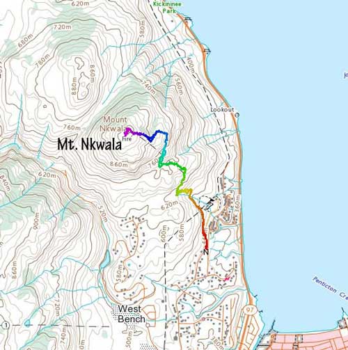
Mt. Nkwala hiking route. GPX DL
The route starts by walking a short way due north along the old Kettle Railway path and then I got to hike down a (gated) paved road for ~50 meters before picking up a steep path that led to an old dirt road. In less than 1 km down that dirt road I bailed into the woods picking up a maze of paths/trails with horse shit almost everywhere anywhere. It was nearly impossible to not step on a pile of horse shit. I immediately found that using those game trails was more confusing than ascending straight up in the woods so I pretty much just picked my own way to intersect the next-level trail system at around 600 m elevation. For a while the trail was easy to follow but I got confused again at around 700 m elevation. Too frustrated to find the “correct trail” I decided to find my own way again and this time, mostly by bushwhacking along a rib feature wrapping around the east side of the peak. The route-finding was easy in the broad way and travelling in the open forest was straightforward.
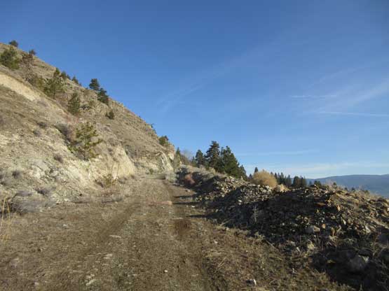
Hiking along the old road at the start

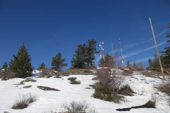
There’s still snow at low elevation. This had been a very cold winter

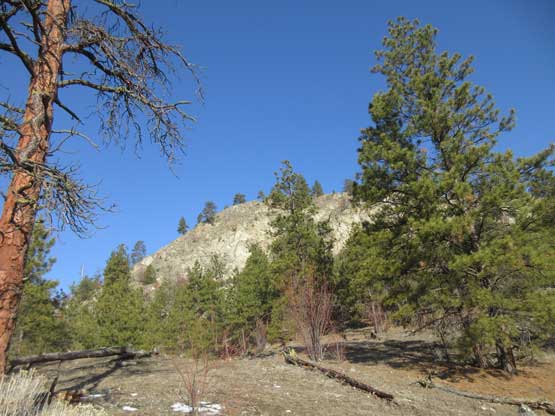
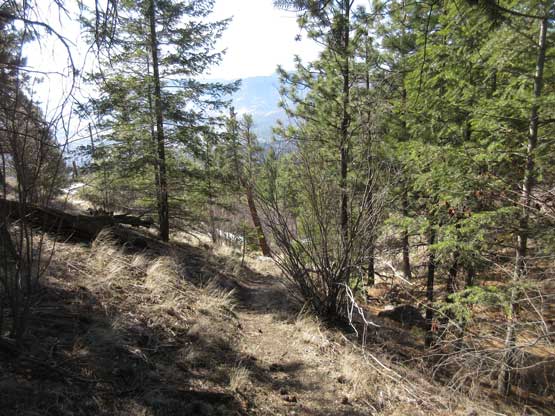
Ascending open forest
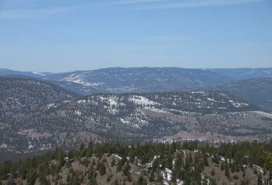
The south side of the peak. This is the typical view

Picking up a better set of trails near 600 m elevation

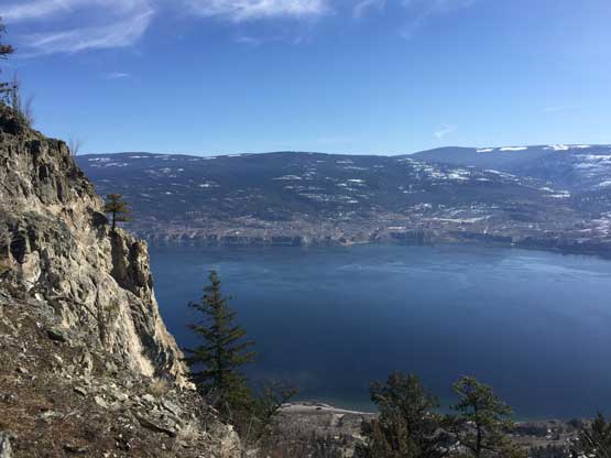
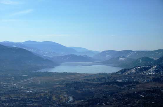
This stretch offered some neat view down towards Okanagan Lake
Another look at Okanagan Lake, from a different viewpoint
This is looking south towards Skaha Lake
At around 850 m elevation I made a 90-degree turn due west aiming for the summit area and it was here that I was punished by some knee deep post-holing. The snow was isothermal top to bottom even in the mid-morning and I sank to the bottom no matter how “careful” I stepped on. Wearing only trail-runners without gaitors meant I was soaked through in no time. I pushed through a stretch of deep snow and once the slope angle increased I could find dry ground again. The rest of the route to the summit was uneventful with occasional spots of post-holing. The view from the summit was not as good as advertised but nonetheless, I was satisfied.

Ascending in the woods again. This is the upper east slopes
Almost there.

Summit Panorama from Mt. Nkwala. Click to view large size.
Giant’s Head to the north. I was supposed to bag it as well but got lazy.
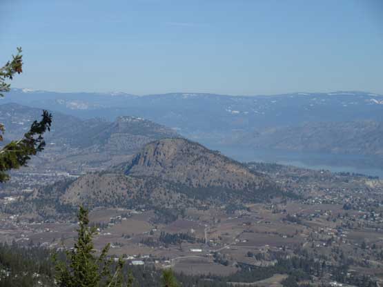
Mt. Conkle in the foreground
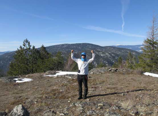
Me on the summit of Mt. Nkwala with Blue Mountain behind
After staying for over half an hour attempting to dry the shoes I decided to hike down. There are other routes that goes up to this summit but not being familiar with the area I decided to just retrace where exactly I went. I couldn’t remember how exactly I linked those trails but that’s why I brought the GPS device. At sections I was hiking down while holding and staring at the phone and needless to say, I had no issue reversing the route. I even found where that trail was near the 700-800 m zone and knew exactly why I missed it in the morning. The ground had turned super muddy and that further added to the challenge of dodging horse shits. I tried to be cautious but pretty sure I stepped on several piles of them, but oh well. The shoes were then washed in the lake so no big deal.

Time to head down.

Okanagan Lake provides a really nice backdrop of this hike
I found this stretch of trail that I missed in the morning.

Another look at Okanagan Lake, from lower elevation zone
Instead of immediately driving back home I decided to take my time playing with some tourism near Penticton. This was only my second visit and my first time was just a 1-day road trip back in 2009 during high school.

The south end of Okanagan Lake from Penticton

The pier of Penticton. It’s no wonder why this is a tourism central. Beautiful indeed.

Mt. Nkwala and its reflection in Okanagan Lake

Sunset in Penticton.
The drive back home was a complete shit show. A trailer flipped over on Highway 97 south closing both directions of travel but thankfully I found a short-cut that linked me to the Okanagan Connector without having to wait for several hours. A couple hours later I was back in Fraser Valley and thank to the rush hour traffic the whole stretch from Chilliwack to Surrey was crawling at no more than 50-60 km/h, a good way to up one’s patience.
