Mount Patterson
April 8, 2015
3191m
Icefield Parkway (South), AB
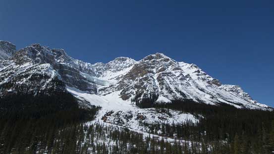
The massive bulk of Mt. Patterson (along with its more-famous Snowbird Glacier hanging on the steep East face) is among those eye-catchers for tourists driving along the Icefield Parkway. However, though covered in Chic Scott’s Summits and Icefields book, it seems like it hasn’t drawn enough attention to skiers and mountaineers like some of its neighbours do (say, White Pyramid). Through some research on the Internet I could see a reason or two as the approach along Mistaya River is ugly, the travel through Delta Creek is committing and complex, and the ascent via south gully/slope is steep, very foreshortening and avalanche prone. That’s a bit unfortunate but won’t deter me from attempting it. I just have to be very patient timing for the right day.
Mt. Patterson ski/snowshoe ascent route. GPX DL
This week (mid-week) saw some of the best weather and condition lining up nicely, but unfortunately my school work schedule would only grant 1 day and even that I really had to squeeze this day out. And at the same time my regular climbing partners couldn’t come along (some had to work and others would be climbing Mt. Athabasca), so once again I had to do all the work solo. I gave full respect to the seriousness of this ascent so there’d be no time to waste in the morning (I was timing myself to be off the south facing gully before midday). After a lengthy and exhausting drive I only managed to catch up less than 2 hours sleep and started the ascent at around 4:30 am, in pitch dark, knowing right at the start the first hour or so would be mainly GPS navigation.
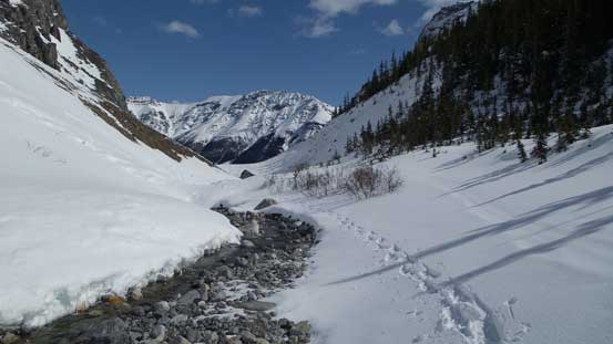
One word to describe the initial part of this approach – confusing… Even where to park was confusing. There was no proper parking lot, nor even a pull-out. It’s roughly 6 km north of Bow Summit/Peyto Lake Viewpoint and that’s it. Right at the start I entered the bush, and a few minutes later I arrived at an obvious cutblock, the one that Vern talked about in his trip report. I strapped my snowshoes on and followed it for a short while before an old set of ski tracks led me gradually descending towards the frozen Mistaya River. The ski tracks were visible but intermittent and not easy to follow exactly. I lost it in the bush and had to down-scramble a steep river bank.
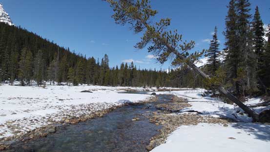
Negotiating Mistaya River had almost come to its end for this season. In another week or two those suspicious snow bridges would likely be gone and you’ll have to wet your feet multiple times fording the river. Thankfully I didn’t need to do that. I brought my river crossing shoes just in case but ditched them later once hitting the Delta Creek’s long flats. The river seemed to be OK for a while until it narrowed down to a canyon. Note that this isn’t the Delta Creek’s canyon I’ll be talking about later. I followed the old ski tracks steeply up climber’s left side into the bush and managed to bypass the canyon, and not long after that I arrived at the Delta Creek’s long flats.
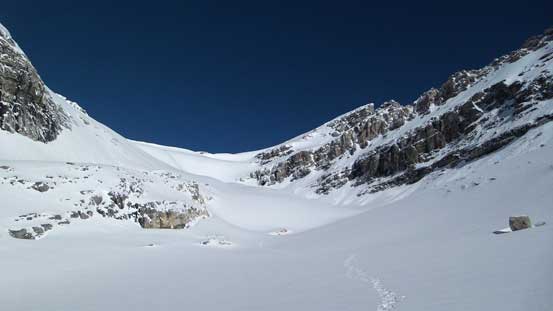
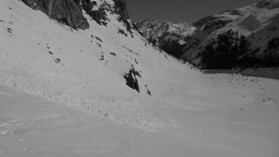
With the faint moonlight I could see the distant canyon entrance between Caldron and Patterson and I basically aimed straight towards it. It’s quite a long way across and I managed to pick up the ski tracks again near the opposite end. Soon I arrived at the supposed-very serious canyon. And yes, it’s indeed very serious. First of all the run-out zone is very bad, secondly it’s subjected to big slopes from above, and thirdly I had to ascend basically straight up this avalanche path, steeply up climber’s left side of the canyon. It’s much steeper than appeared on some of the photos I found and basically I should say it’s a 40-degree snow climb. I had to switch gear from snowshoes to ice axe and crampons, about midway up the slope… That was awkward but oh well. I was also confused as where to exit this slide path as obviously I couldn’t see any farther given the darkness (and had lost the skier’s tracks again). Thankfully I managed to pick the correct spot cutting sharply climber’s right and then descended about 20 meters down to the creek again. There were more “fun” sections yet to come as I started overcoming one tight spot after another.
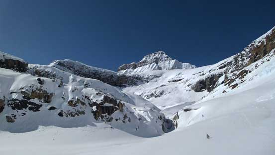
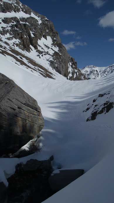
Eventually at just over 2 hours into the trip, near the rear end of the Delta Creek the sky finally became bright enough so that I no longer needed the head-lamp. There was still one tight spot/waterfall to bypass and in order to do so I had to traverse below some steep and thin south facing slopes on the climber’s right side. There were evidence of some surface sluffing on these slopes perhaps due to the new snow a couple days ago. And after that I arrived at the place where I should take a sharp right-turn and start the long and foreshortening south facing gully.
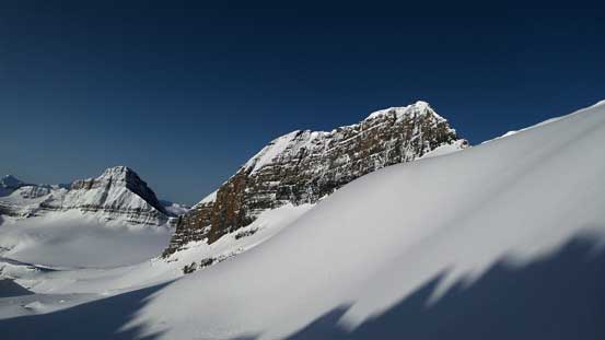
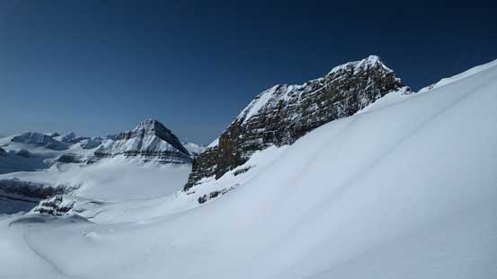
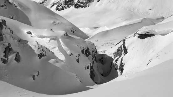
From here on there was really not much rocket science involved and it’s simply putting one foot in front of another. The freeze was super deep (-14 degrees at Bow Summit) and the slope had become bullet-proof. For a long while the only mark I left on the snow surface was the crampon mark of the snowshoes. With the assistance of the heal-lifts it was a very fast upstairs walk. I was also in a great cardio condition and managed to maintain a fast pace with only some breaks by taking pictures. It didn’t take me long to arrive at the base of an impressive rock feature. Here the route went up climber’s right side of it and here’s also roughly where that small pocket glacier starts. Checking my GPS I realized there’s still more than 500 vertical meters to go which was kind of discouraging. But overall I was doing very good on time. Soon enough I had to ascend the steepest roll in this gully. No matter what route to take it’s 35+ degrees, convex and south-facing. The skier’s tracks went climber’s left but I opted to go straight-up.
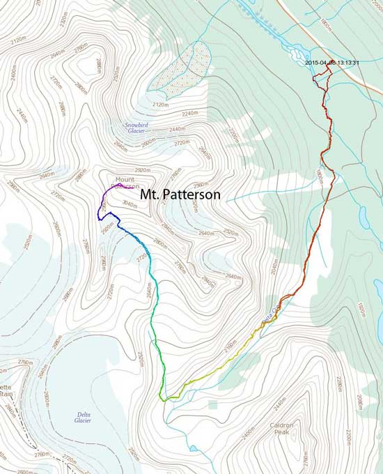
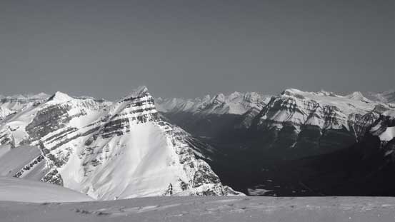
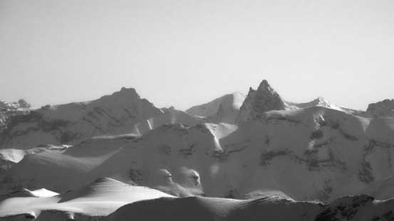
Alpenglow on Mistaya Mountain
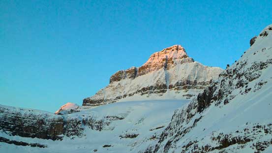
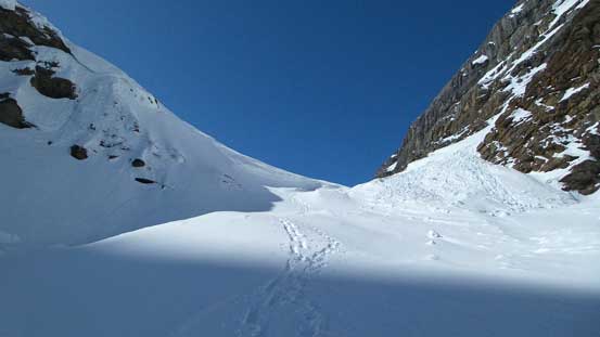
A view of the foreshortened south facing gully. Route goes right of the rock pinnacle
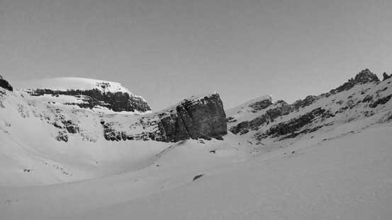
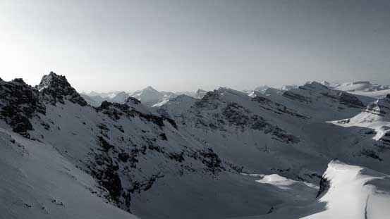
Another view of Mistaya Mountain
Gaining the steep roll on the glacier.
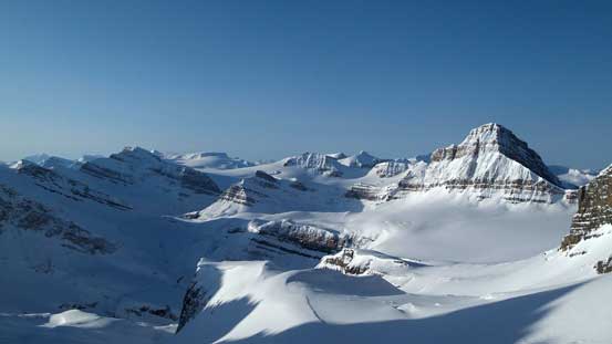
Looking back towards the familiar Wapta.
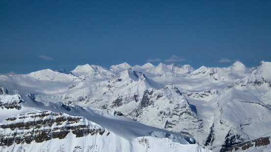
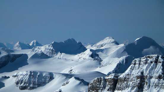
Starts to see some bigger peaks in the Eastern horizon.
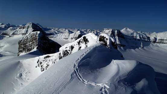
Arriving at the next flatter bench I had to make another decision. Instead of continuing going straight up (another roll which looked to be even steeper) I took a sharp left turn to hit the ridge first before following it eventually to the summit (and overcoming an interesting narrow step). The final slog to the summit was also very foreshortening and seemed to drag on forever. It was here that I finally started to feel the height gain on my legs so slowed down quite a bit (to enjoy the views anyway). Unfortunately the wind was cold and quite fierce preventing me from staying any longer than necessary. The views were mind-blowing towards all directions though.
Gaining the ridge now. It’s going to get narrow immediately ahead

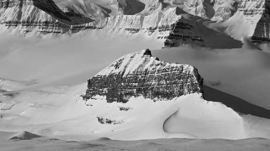
Looking back at an outlier on Patterson’s west face

The final slope to the summit.

Looking back again. That outlier is getting smaller and smaller
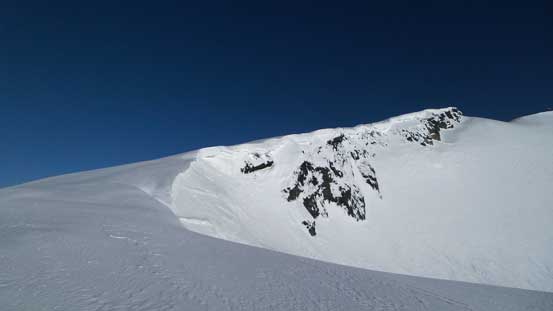
Here’s an interesting section on the ridge.
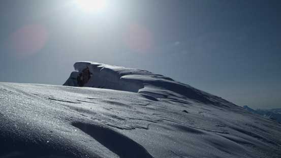
The last bit to the summit is heavily corniced
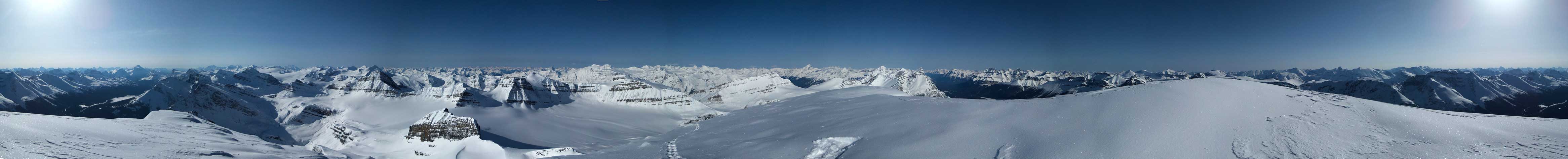
Summit Panorama. Click to view large size.
Mt. Hector dominates the skyline looking over Bow Pass
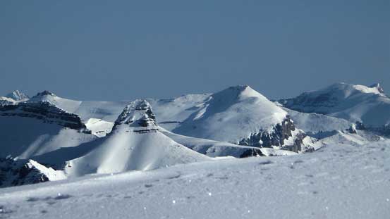
White Pyramid, Chephren and Wilson. I bagged them in the same year – awesome trips.

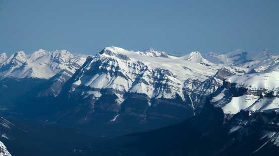
Mt. Murchison and Murchison Towers.
Peaks on the Freshfield Icefield.
Ah this is that outlier. Looks tiny now!

A view looking down towards Delta Creek and Delta Glacier.
Mt. Hector

The Goodsirs rise behind the shoulder of familiar Wapta peaks
From L to R: Carnarvon, Collie, Des Poilus and Baker

Way in the distance are giants in the Southern Selkirks including Mt. Wheeler and Mt. Dawson

Mt. Sir Donald and Mt. Laussedat are always the eye-catching giants

Mt. Mummery is massive.
The mighty Mt. Forbes and the Lyells behind on the far right

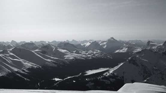
Looking over the shoulder of Howse Peak I could see giants on the Columbia Icefield

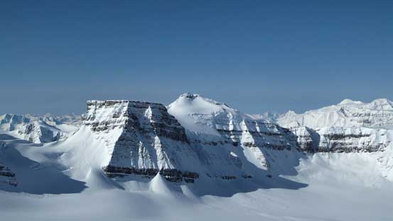
A closer look at White Pyramid and Mt. Chephren
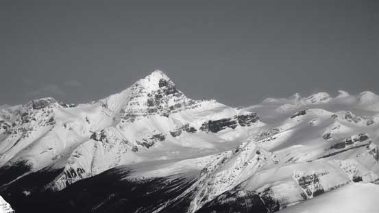
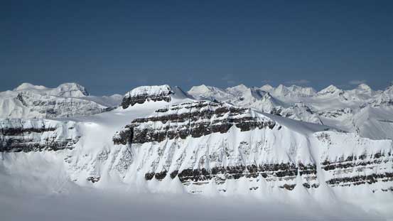
Mt. Wilson the massive bulk. It’s a grand day as a snowshoe ascent..
Mt. Noyes looks striking in the foreground
Recondite Peak looks wild
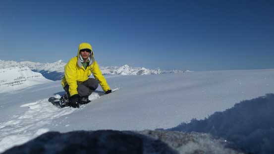
Me on the summit of Mt. Patterson
Descending the upper ridge and then the huge south facing gully was as simply as putting one foot in front of another while re-tracing my footprints. I took a longer break once getting out the wind, actually hoping the sunbeam to soften the snowpack a little bit. Just a little bit softer the pressure on my knees would have been reduced significantly, but unfortunately (or fortunately?) the entire gully stayed relatively bullet-proof during my entire descent.

Time to head down!

Looking back at my tracks on the upper mountain

The very flat Barbette Glacier
The super-sexy Barbette Mountain
Parapet Mountain in the foreground
Descending the steep roll on the glacier

Awesome terrain!
Continuing down the long valley…

More of the views from the descent
Looking back. One roll after another.

Can’t get rid of these views. Mistaya is starting to look big again.

A zoomed-in view of Peyto Peak. You can see the summit nipple
Looking back at the route which goes climber’s right of the rock face.
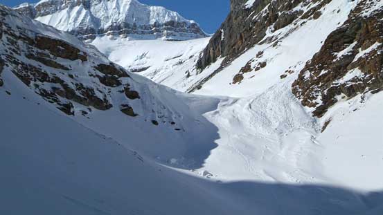
Now came the Delta Creek. Since I didn’t take any picture in the morning I’ll have to show more here. Again, I basically just retraced my footprints back down. Near the end I again, switched gears to crampons and ice axe and carefully walked down the biggest slope (and definitely the crux of this ascent), and then I was down to the long flats. Thankfully the snowpack was still very solid at this point so there’s still no post-holing in isothermal snow needed. For this reason I didn’t take any more break and walked back relatively fast (again, using my own tracks mostly with the exception of the last bit where I went a little farther down Mistaya River).

Down to Delta Creek drainage now.
Firstly I had to traverse a long ways on this south facing section
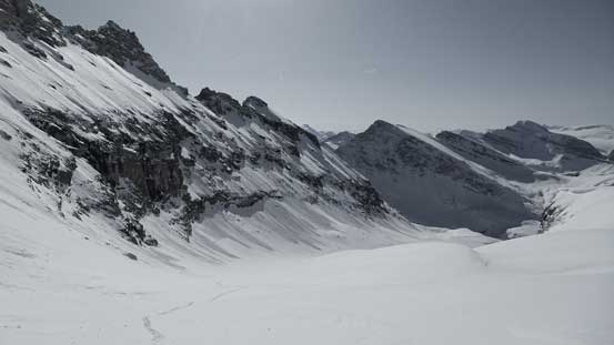
Looking back, Mistaya Mountain dominates the skyline
This is a section I had to bypass on climber’s right on those south facing slopes
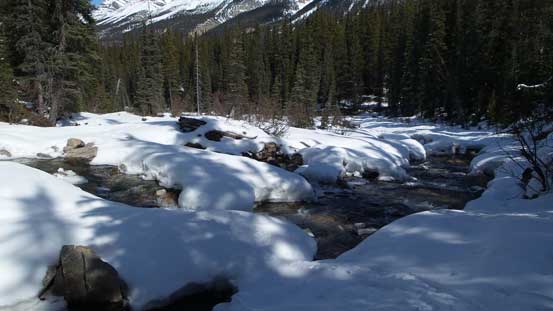
Delta Creek
The creek is getting narrower now. Fun times!
Another steep roll
Looking back at that steep roll

Now here’s the crux… It’s steeper than appeared. 40-degree snow climb.
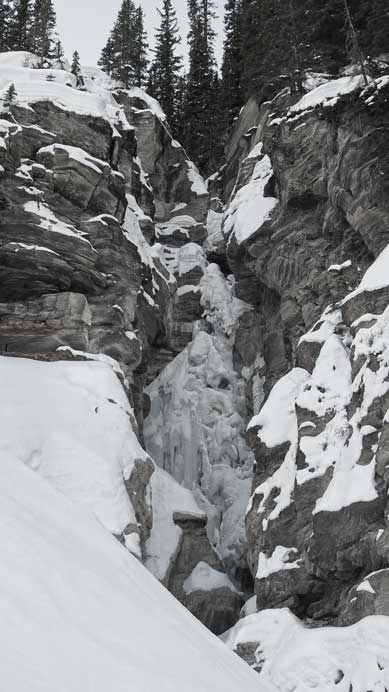
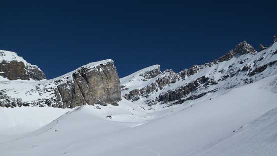
This is the waterfall/canyon I had to bypass using that big slope
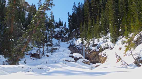
Looking back at the canyon. That big slope isn’t visible though.
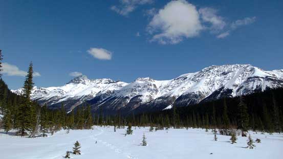
Down to the long river flats now. Ahead is Mt. Weed and Silverhorn Mountain
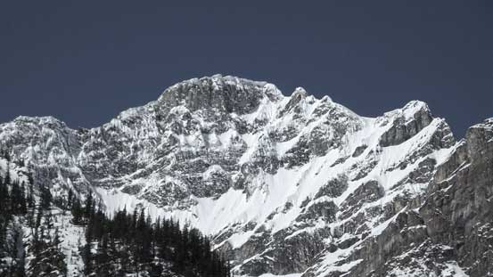
Looking back towards the striking Caldron Peak
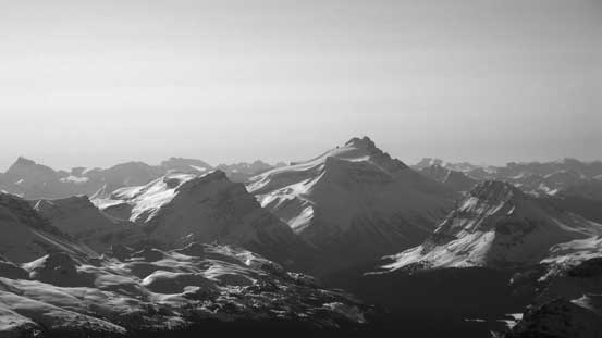
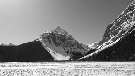
A zoomed-in view of Mt. Patterson’s summit
A few hours ago I was way up there…
Following Mistaya River out
Bushwhacking wasn’t fun
The snow bridges on this river are soon gonna collapse…
My round trip time was just under 9 hours which was faster than expected. I had to thank the excellent condition for allowing a fast ascent and overall it was another very satisfying day in the mountains. Mt. Patterson is among the few remaining winter day-trip glaciated peaks in that general area I was still working on and I’m happy to have it successfully bagged. Speaking this objective, it’s not a peak to be taken lightly but in the right conditions it’s a fantastic trip. Finishing the trip at 1:20 pm was a little weird as I’d have plenty of time driving back home..
