Mount Hamell
May 19, 2013
2129m
Grande Cache, AB
Ben, Eric and I still had energy after the long days on Daybreak Peak and then Chetamon Mountain. We drove to Grande Cache where had the best weather forecast with only chances of showers and no thunder storms in the afternoon. Eric didn’t bring his Passport to the Peaks book, so we had to wait till 9 and get some information from the info center. Luckily for us we was able to get a free trail map. It was tempting to do Mt. Mawdsley, so we drove to its trail-head near Sulphur Gate staging area. The Smoky River was raging and fording it seemed suicidal. However, we did get some really nice view from a couple viewpoints. There definitely has some really good rock climbing opportunities. Too bad I didn’t bring my camera up to this viewpoint.
Our plan B was Mt. Hamell. It’s merely a walk up the ATV road but this is a relatively isolated peak and offers some nice view. We didn’t get much view from the highest in this area, Lightning Ridge, and we were hoping this trip could make up for the loss. There are a couple possible routes up this mountain, with one of them being a scramble. We opted for the one with the least amount of elevation gain since we were pretty tired. Ben did a good job driving his small car up the rough Beaverdam Road, 500 vertical meters up to a high parking lot. This route does overall save some elevation, but longer than others and involves some elevation loss and regain. Now I wouldn’t recommend this route as it’s probably the least pleasant.
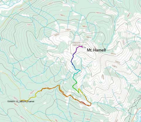
Mt. Hamell hiking/ATV ascent route. GPX DL
The route essentially follows a well defined ATV trail to the summit, so there’s not much to say about it. There were a couple snowy patches and we were forced to do a bit of detour into the bushes. Other than that it’s straightforward even for hikers. However, the trail was apparently designed for ATV travelling. A long unnecessary branch goes climber’s right for a few kilometers, keeping losing elevation. I don’t mind the long branch/switchback, but at least it should be going uphill, now downhill… Oh well..
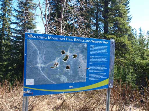
Someone had shot the trail-head sign…
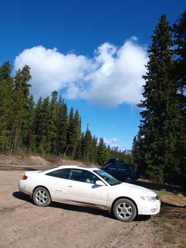
Ben’s car at trail-head.

There were too many things like this to negotiate.
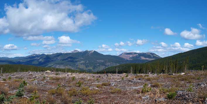
Already great views not far into the trip.
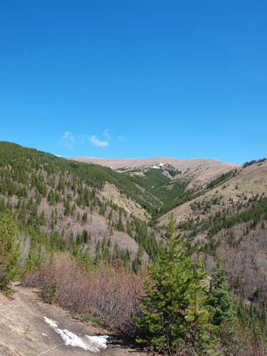
Hamell looks quite innocent
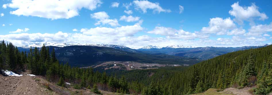
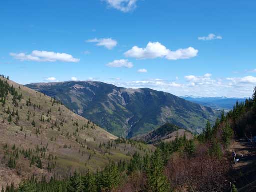
Panorama view from an opening area.
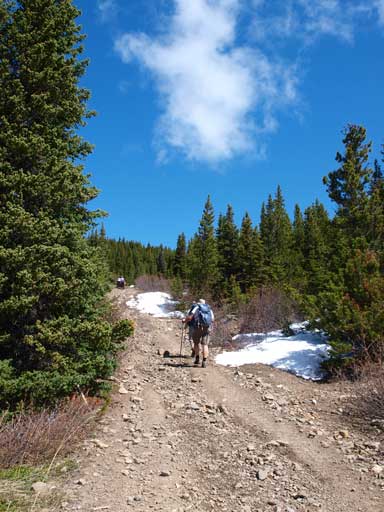
Hiking up the ATV road
Once at treeline, the wind picked up. It was cold wind and glad we brought extra layers up. The summit did offer great views of many obscured peaks. Towards north-west we could see a giant mountain. Later we realized it’s Mt. Ida, the northernmost 10,000er in the Rockies. This trip inspired us to explore the area around Mt. Ida which is basically the Kakwa Provincial Park at some point.
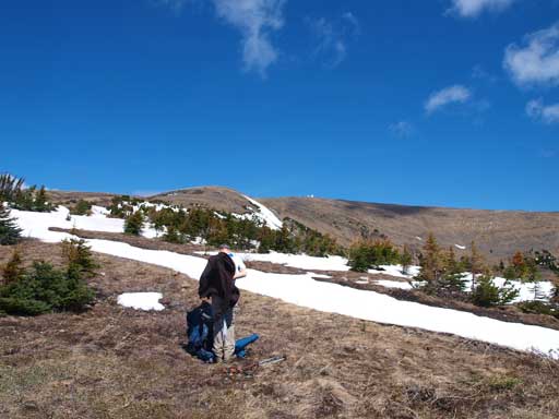
At treeline, we had to add layers
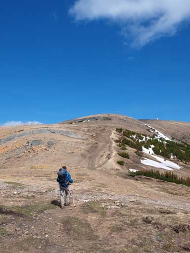
Hiking towards the summit
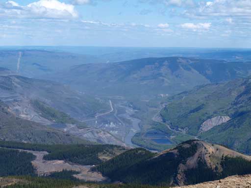
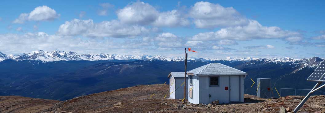
The other side, full of mining operation
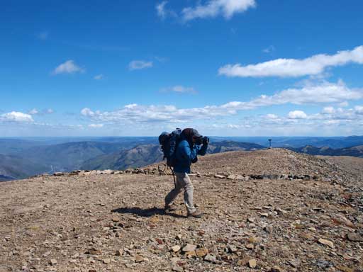
Ben taking photos, battling against the wind

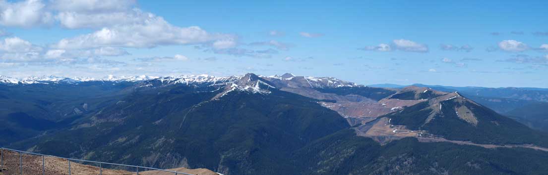
Panorama of the prairie side
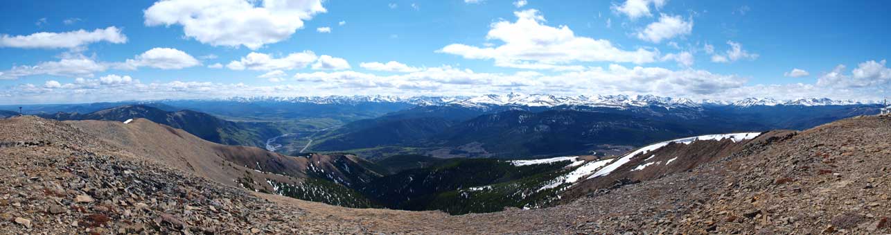
Panorama of the mountain side

Looking south

Lightning Ridge to Volcano Peak area
Northwest view.
Cairn Mountain

A zoomed-in view of Mount Ida
Grande Mountain, another hike in this area
Due to the coldness we didn’t stay long on the top. The descent back to car went on forever especially the uphill section. Got passed by numerous ATVs and one ambitious Jeep near the trail-head. Interesting to see all these stuffs that we normally don’t see in the Parks.

Eric hiking down the quad road
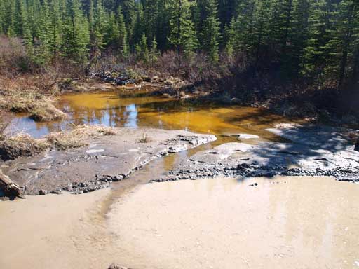
Interesting mixing of water.. Looks like iced cap…
Our round trip distance was 18.5km, and we got very beat by this 3-day weekend, and went back home afterwards. It took me a few days before the soreness disappeared and than I was back in action. Of course…
