Mount Gillespie
September 4, 2016
2021m
Squamish / Mamquam Main FSR, BC
Mt. Gillespie isn’t the tallest in its immediate vicinity, but is the only one officially named among the whole bunch of peaks south of Mamquam Mountain and north of Meslilloet Mountain. This general area is more famous for the picturesque Pinecone Lake in the northern Pinecone Burke Provincial Park, as well as Watersprite Lake – nearby which a new cabin is now under construction by BCMC. For peak-baggers like myself, there have lots of easy/moderate scrambling objectives nearby and the 20+ km logging road Mamquam Main offers some easy access, albeit a high clearance vehicle is required as the road is rough and steep at places.
The weather wasn’t quite inspiring for the Sunday of this past Labour Day long weekend, but I didn’t have much flexibility to swap my days around. I had to either pick an objective or stay home hoping the next weekend’s gonna be better (which you never know). There’s a recent trip report on ClubTread that someone just went up Gillespie/Seed so I knew the road condition was at least “OK” in this year. There’s one thing I’ve learnt about peak-bagging in SW BC – for those involving extensive driving on logging roads it’s sometimes all about the access and once it’s in, it’s time to give it a go as you’ll never know if the road will still be drivable in the following year.
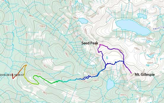
Mt. Gillespie and Seed Peak scramble route. GPX DL
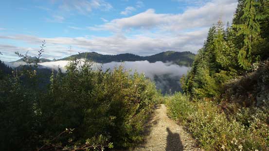
After a 4 am wake-up call I was soon cruising northwards up the Sea-to-Sky Highway, and just before entering the district of Squamish I turned on the bumpy Mamquam Main FSR and just as what I’ve remembered from previous trips (Mamquam & Dreadnought), there were lots of pot-holes to deal with. After a while I passed the Skookum Dam Road turn-off and then it was all new ground to me. The Mamquam Main was still in a decent shape but had become narrower and rougher at places. I almost missed a critical turn by taking a wrong branch but soon realized my mistake and backtracked. The partially broken bridge was somehow fixed by adding a few pieces of woods in, and then there came that two wash-outs and both of which required 4×4 HC. The Jeep handled them fine but soon after the second wash-out the alders had grown in, and another kilometer or two later I parked at the E 100 junction. With an ATV or a dirt bike you can drive an additional 4 km up the spur road but I didn’t have that option.
Up I went on foot the E 100 spur road was in good conditions from hiking perspective (didn’t have to push around alders by much). I opted to wear my sneakers for this part while carrying my mountaineering boots. The boots were heavy (more than 2 kg each) but I knew I’d be pleased with this decision towards the end of the day when it eventually came to the last 4-km downhill walk. The start of Pinecone Lake Trail was marked by an orange tape but the initial section looked bushy enough so that I decided to don boots, gaiters, rain jackets and rain pants right away. The bush was soaked wet from previous days’ pouring and even with those layers I still got soaked through. It was miserable as my boots had lost their waterproof ability. I’m not sure whether or not I’d found the easiest path though as before entering the mature forest I had to deal with about 15 minutes of ugly bushwhacking.
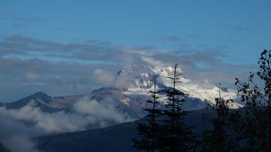
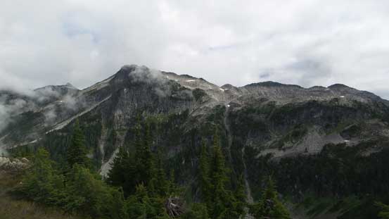
Morning view of Mt. Garibaldi massif. Not long after this it was engulfed in clouds
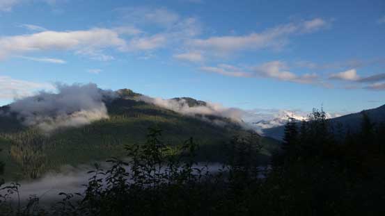
Looking back at the valley I was travelling through.
The E 100 spur road was quite grown in, but good for foot travel
Quite some nice weather in the morning.
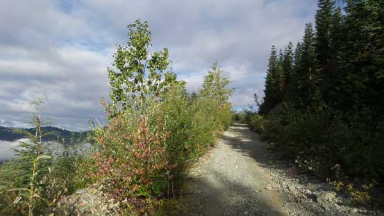
The spur road gained more than 400 m elevation

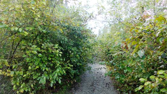
The start of the Pinecone Lake Trail was bushy and very wet…
Once into the mature forest the travelling had become much faster, but apparently I had just missed the trail. I ended up bushwhacking for another while before intersecting the trail about 100 vertical meters higher up. Once on the trail it was a pleasant hike up through the forest. Before long I came to the first opening area but the view of the rest of the ridge suggested that there was still a long ways to go. A few steeper rises were then overcome (with one section aided by a fixed rope) before making to the first highpoint of the route. There appeared to have some significant elevation loss right after the first bump which was quite discouraging.
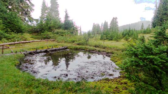
A little tarn along the way. Not many mosquitoes around though which was good…
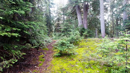
The trail was mostly easy to follow
Could see the route ahead. That bump is the first highpoint – still quite a long way to go
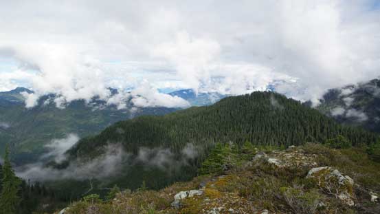
Neat views from the ridge, but clouds were moving in already…

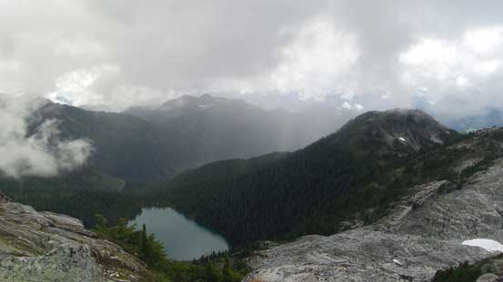
Meslilloet Mountain to the south. It’s the closest glaciated peak to Vancouver
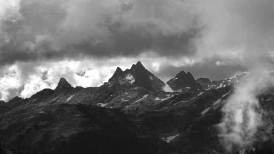
The very remote Five Fingers group along Coquitlam – Pinecone Divide
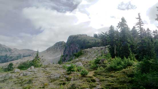
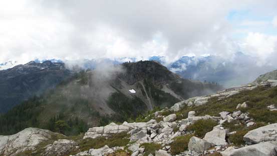
My first objective – Mt. Gillespie and the elevation drop in front
My second objective – Seed Peak
The drop was actually not as bad as it looked at the first glance but about halfway down the slope I somehow lost the trail/path and ended up too far skier’s right on some steep grassy country. I realized the mistake and corrected my bearing by some side-hilling. At the low saddle it’s time to plod upwards again. The trail was still in a decent shape even at this stage (which was kinda to my surprise) and led me all the way into the alpine. There was a small snowpatch and a neat tarn. The weather was holding nicely and it’s time to take another break, and for the most important, take the not-so-comfortable rain pants off and switch to my normal hiking equipment.
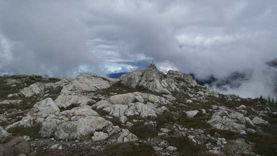
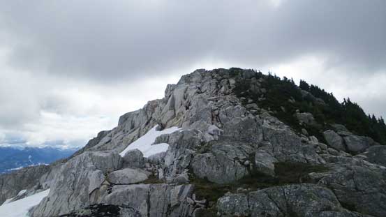
Arriving at the first highpoint of the day.

Sky Pilot Mountain looks very different from this angle..
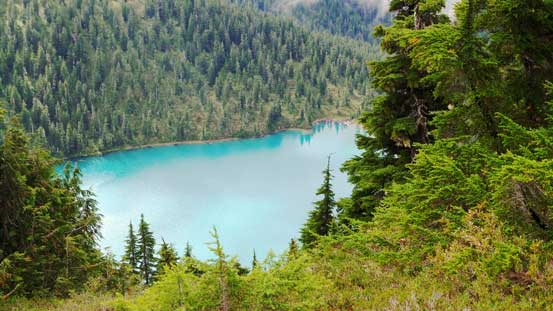
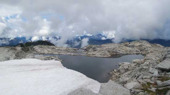
November Lake to the south. Probably not many people have visited this lake
Looking back towards the first bump, and the ridge I just travelled through
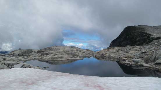
A neat tarn fed by a snowfield
The same tarn

The slopes on Seed Peak – just as easy as it looks from here.
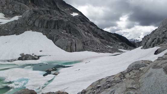
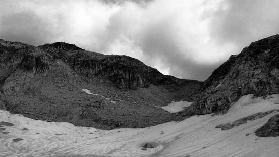
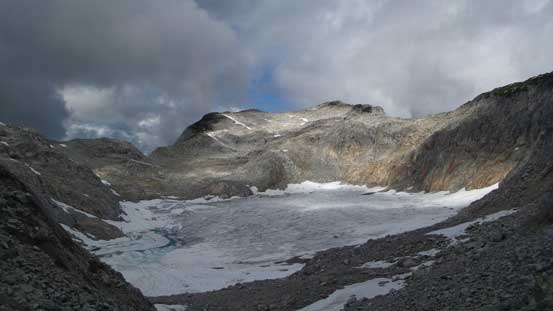
The next section appeared easy on the topographic map but actually not so much. There appeared to have another section of significant elevation loss unless I wanted to cross the small pocket glacier on my left side. I didn’t bring crampons so that’s out of the question. Staying on the rocks I had to lose height all the way to the outflow of that pocket glacier (with a bit of route-finding down some steep stuffs near the bottom). I crossed the outflow on continuous snow and then side-hilled around to the entrance of an obvious gully ahead. This gully was loose but a few patches of snow helped me greatly, and brought me to a low saddle on Mt. Gillespie’s NW Ridge.

Ahead is that pocket glacier, and I had to lose height down to its outflow…
Lots of elevation drop…
Finally down now. I had to skirt around on snow
Aiming towards that obvious gully

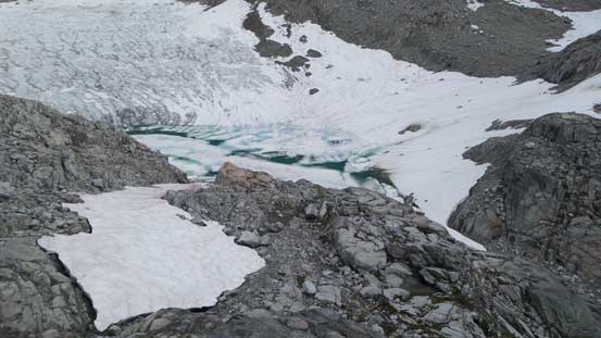
This glacial tarn hasn’t quite melted yet.
Partway up the gully, looking back at the glacier
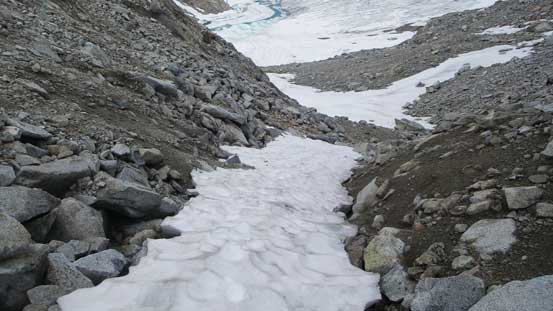
Really appreciated this patch of snow otherwise it’d be a choss fest…
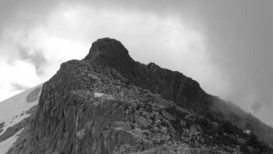
From the saddle I turned right up the NW Ridge and the trickiest section was actually the initial 100 m or so. There’s a bit of route-finding involved in the glacier-calved terrain and I didn’t pick the easiest line. I took a challenging route which proved to be more difficult than appeared (with one Class 4 mantle move to finish with which was interesting to say the least). Then the ridge levelled out for a while but at the same time, some weather was moving in and the summit was soon soaked in clouds. I knew rain was finally about to come, as forecasted, so I hurried up hoping to tag the summit before it turned into a white-out. The final rise up the NW Ridge appeared narrow and steep from afar but actually not (Class 2 scrambling with some route-finding at max) and soon I was on the summit.
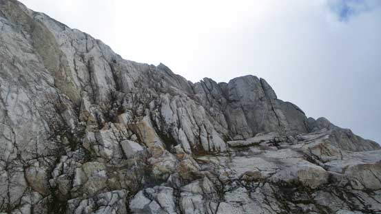
For this part I took a difficult line. You should go around climber’s left side

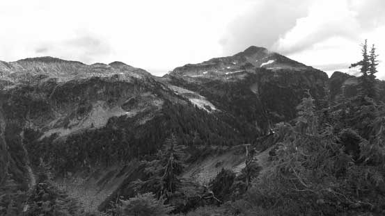
Looking back at the ridge connecting Mt. Gillespie with Seed Peak
November Lake and some weather was finally about to move in.
The ridge levelled out here
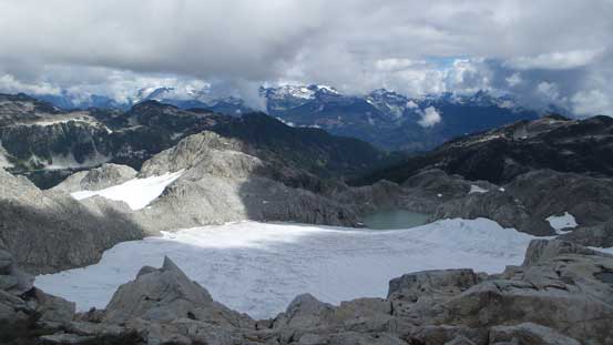
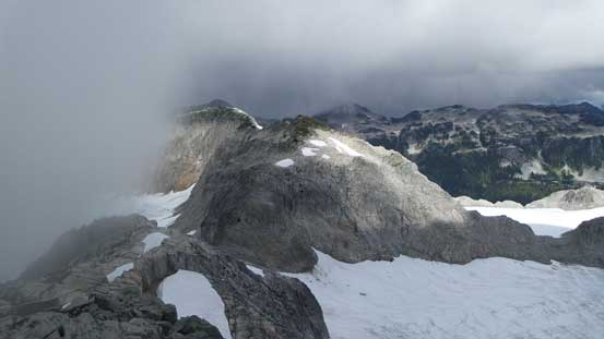
There’s another pocket glacier on the east side of the divide.
The summit of Mt. Gillespie is in sight
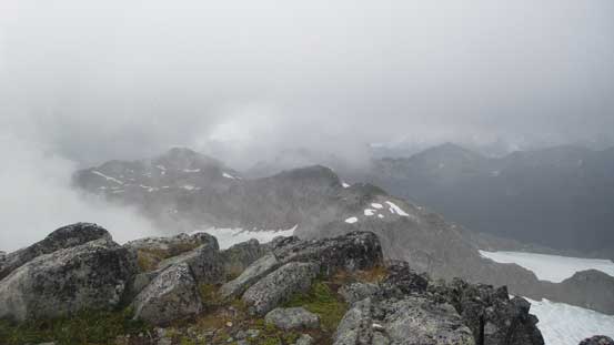
Clouds were moving in fast
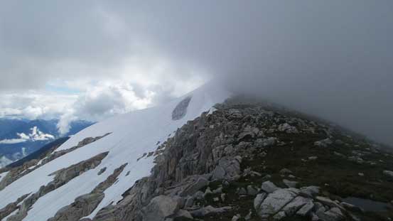
The summit was now disappeared in the weather
I quickly snapped a couple shots of this beautiful tarn on the east side of the divide
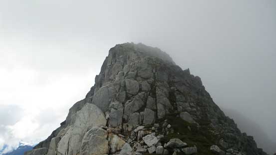
The summit block

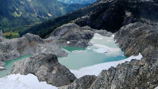
Looking down the east side into Pinecone Burke P. Park

The typical scrambling on the summit block.
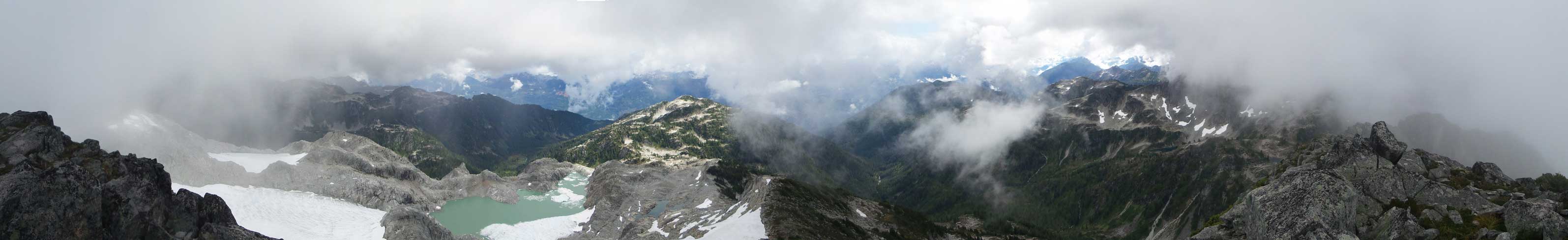
Summit Panorama from Mt. Gillespie. Click to view large size.
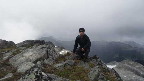
Me on the summit of Mt. Gillespie
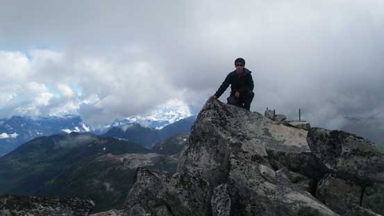
Another picture of me on the summit
After taking some obligatory pictures it started to drizzle so I didn’t linger any longer than necessary up there. I did spend another few minutes for some food and water but that’s it. Down the NW Ridge I had no problem reversing what I just did, and lower down I managed to avoid that crux step by taking a ramp (bit slippery given the rain) further down skier’s right before cutting back left, and then I descended some loose ground to the low saddle.
It started to rain pretty hard for a while so I had to quickly go down

Quite a long drop down to November Lake

Seed Peak will be my next objective.
The rain had temporarily stopped now but it looked like I would get hit by at least a couple more storms in this day. The traverse to Seed Peak was reported to be fairly enjoyable so despite the weather, I had to press on.
