Mount Stearn
May 24, 2014
2013m
Grande Cache, AB
The weather was a bit tricky. Both Vern and Ben could only manage a day-trip on Sunday but weather looked miserable. Saturday was gonna be the better day, but even so, Grande Cache was the only area without rain in the forecast. Therefore I had two choices – solo ascending something easy in Grande Cache, or wasting another weekend at home. Obviously I chose the former.
For a long while I wanted to save Mt. Stearn as a snowshoe objective when avalanche condition or weather isn’t at the greatest. However, after last year’s miserable Lightning Ridge trip I started to have other thoughts. Remember on that trip we had tracks to follow and even so, it was one of the worst post-holing suffer-fests I’d ever done. Mount Stearn shares the same approach as Lightning Ridge and I wasn’t sure if I had the mood to repeat that suffering. To make things nicer, I’d hike it rather than snowshoe.

Mt. Stearn hiking/snowshoeing ascent route. GPX DL
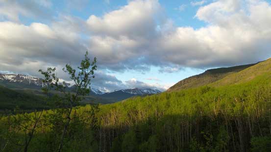
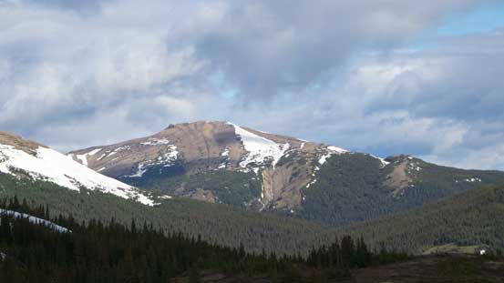
However, as I got a view of my objective from the town of Grande Cache, I decided to haul all gears up (snowshoes, ice axe and crampons). There was still a lot of snow at treeline elevation and near the summit a steep snow slope remained. I hate unnecessary weight but it’s overall not a long trip, so better safe than sorry…
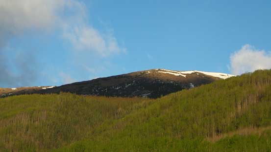
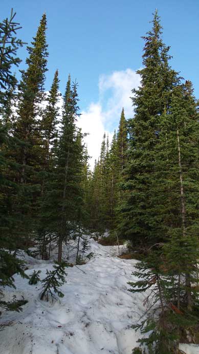
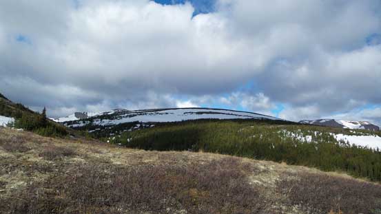
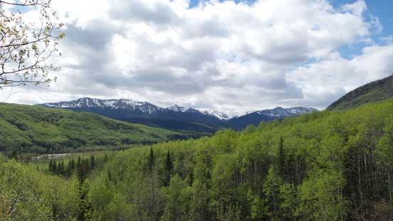
Mount Stearn’s trail is very easy to follow even for newbie hikers, but it is a long one. There are a couple spots that one can get a glimpse of the summit and it appears to be “right there”. Don’t be fooled with this deceiving view though. This trail is very sloggy and seems to drag on forever (you don’t get much view other than the trees). On this day, condition was summer-like at lower elevation and I didn’t encounter snow until an hour or so into the trip. But soon after that the trail started to get very muddy, with a “stream” running on it. Further up (isothermal) snow covered the trail and once snow became continuous I strapped my snowshoes on. They surely saved me a lot of post-holing. Without them it would have been waist-deep.
A view from just after the start
Looking towards the ridge line. The summit should be to the left
Start to encounter snow

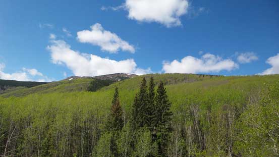
Near treeline

More view from near treeline
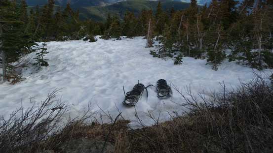
Ditched snowshoes at treeline
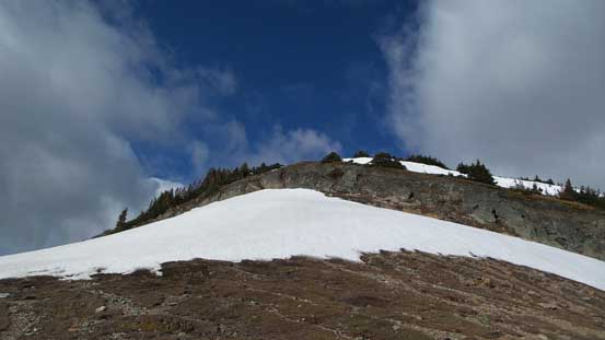
At treeline the route deviates from the main trail. It’s very obvious though, as you pretty much just need to go uphill, climber’s left and you’ll hit the ridge. Then follow the ridge to the summit block. I avoided some elevation loss/regain by traversing on the gentle north slopes rather than following the ridge crest. The summit block requires either a short scrambling section or losing elevation. On this day I kicked step up a snow slope directly to the base of the rock band. The scrambling was short and fun, and soon after that I was on the summit.

Looking up the broad slope to ascend.
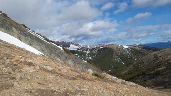
A view towards Lightning Ridge

Looking back towards Grande Mountain and townsite of Grande Cache

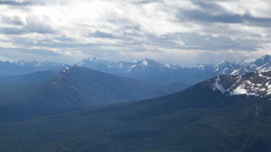
I hiked up Mt. Hamell nearly a year ago
Volcano Peak is another hiking objective

On the ridge crest, looking towards the summit

Zoom-in of the summit block.
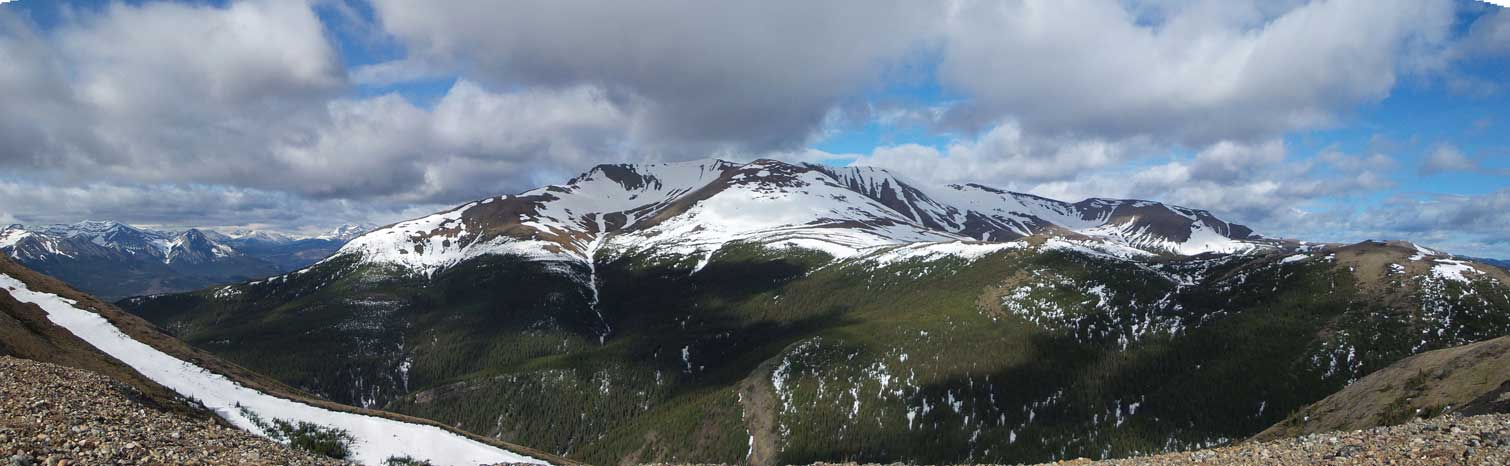
Panorama of Lightning Ridge
I ascended straight up the snow slope and then scrambled through the rock band
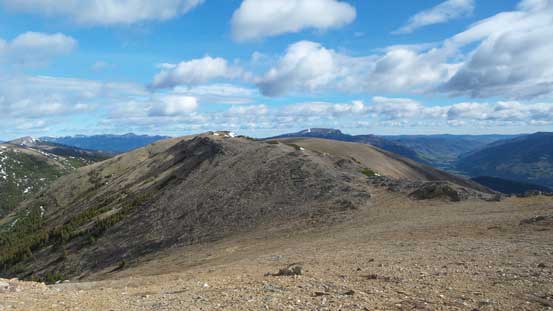
Looking back along the long and broad ridge
The rock band that guards the summit
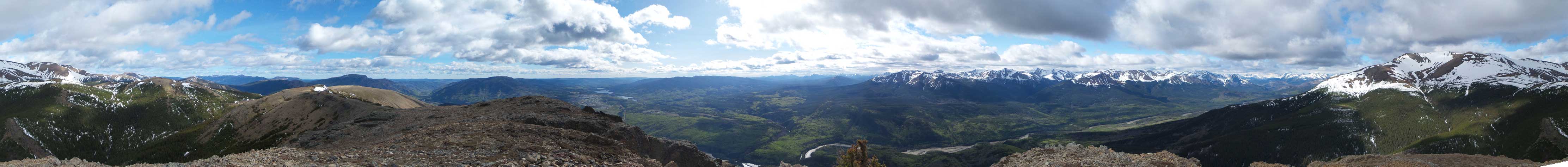
Summit Panorama. Click to view large size.

Peaks buried deeply in Willmore Wilderness

Grande Cache

Lightning Ridge

An interesting looking unnamed peak
Hayden Ridge in foreground, left of center

Mawdsley et al.

Peaks including Mt. Braithwaite

The summit mailbox

Summit selfie
On the descent the snow had softened considerably but with snowshoes it was still strong enough to hold my weight. Lower down I met a couple going up (with their objective being Lightning Ridge). They just started the snow section and they didn’t have snowshoes. The rest of the descent went by fast. My round trip time was 5.5 hours. It was lunch time only but I was short on motivation for anything else so drove home.
Almost back to the parking lot
Looking back up towards the summit.
In the end, just like other Grande Cache peaks, there’s nothing spectacular about Mount Stearn, but it serves as a good shoulder season or off season objective. There’s a good amount of elevation gain and if snow covered, the post-holing will keep you in shape.

Beautiful pics, the pic that is unnamed peak is Mt. Kvass on the right, this is a bit harder as you have to cross the Smokey river, we carried a raft and rode mountain bikes, then rafted home later that day, 18 hrs total, great day!
Thanks for the peak name. Man I miss the old playground in the Rockies. Haven’t been back to that part of the Rockies since 2014.