Cirrus Mountain
May 31 – June 1, 2014
3270m
Icefield Parkway (North), AB
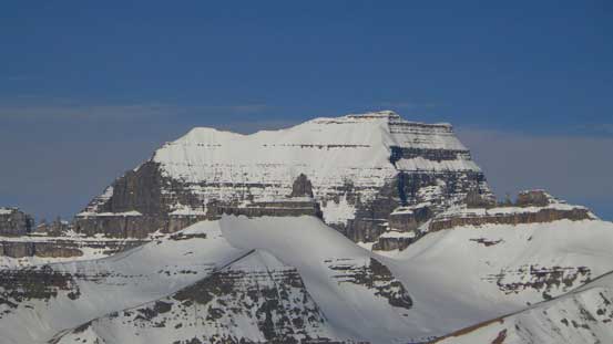
This lofty peak on the east side of Icefield Parkway isn’t a popular summit to scramblers and mountaineers. It’s probably more well-known to road-trip tourists (for its amazing rock formation viewing from near the “Big Bend”) or ice climbers (for various routes on the Weeping Wall). Apart from Raff’s photos and Golden Scramblers’ trip report, there isn’t much of a route beta. Well, it’s listed as a ski mountaineering objective in the old version of Chic Scott’s Summits and Icefields, but eliminated in the newest version. I can totally see why. The approach via Coleman Lake is ridiculously steep and wouldn’t be very “skier friendly”. We figured the best time is from late spring to early fall when there isn’t much of avalanche danger on the approach.
This past weekend seemed to be the right time for “big stuffs” – cool temperature and clear skies. Cirrus Mountain was our original objective but we also briefly increased our ambition for something “grand”. Eventually the weather made our decision as the system wasn’t absolutely stable. There was still rain in the forecast and forecasting models didn’t agree with each other. The distance and elevation gain for Cirrus are somewhat similar to Wilson’s so we could have day-tripped it, but we decided to plan 2 days to give a better chance of summitting. Of course this wasn’t summer yet so we had to carry snowshoes, but other than that we pushed really hard on travelling light. In particular we didn’t bring rope/harness because the glacier crossing was supposed to be very brief (if there’s any) and we were all very confident on exposed terrain (the summit ridge).

Cirrus Mountain ascent route via Coleman Lake. GPX DL
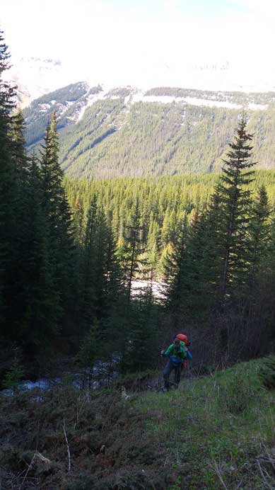
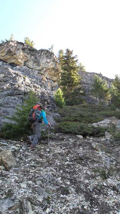
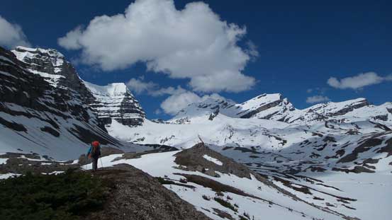
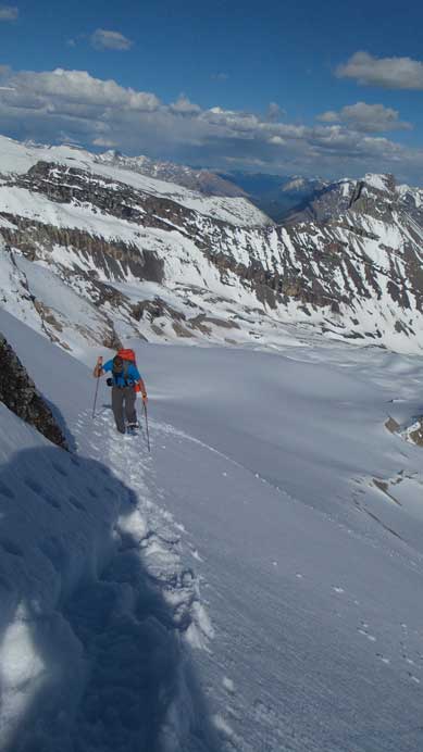
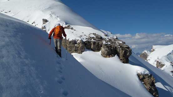
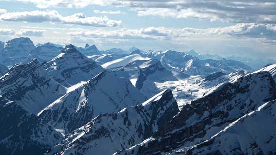
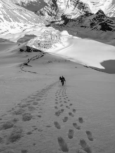
On Friday evening, Ben, Eric and I drove out of town and camped at one of the free camping grounds in David Thompson Country, and met Vern at the trail-head the next morning at 9 am. We had lots of stories to share since we were all busy doing different things in the previous few months. Eric just finished the North Face ski mountaineering leadership course organized by ACC Edmonton section, Ben just ski’d the epic traverse from Jasper to Columbia Icefield with ascents of Mt. Clemenceau, Apex Mountain and Chaba Peak, while Vern and I were busy ticking off the remaining (difficult) summits on the Wapta Icefield. The initial few hundred meters of height gain was a pure grind with heavy pack. We stayed climber’s left side of the creek/waterfall. It’s mostly a very steep hiking on off-trailed terrain but if not paying enough attention you’ll scramble over some cliff bands. Higher up the terrain levelled a bit and we started to have some gorgeous views towards Amery and Monchy Icefield, but there was still a fair amount of height gain to the first lake.
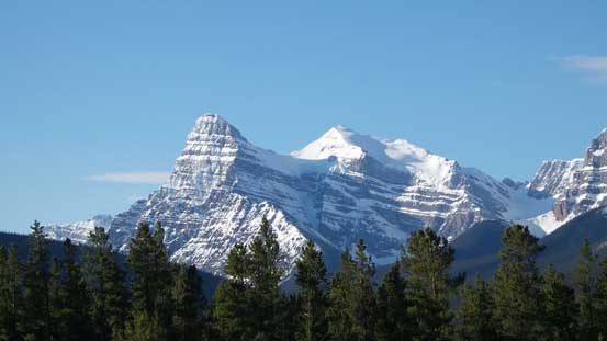
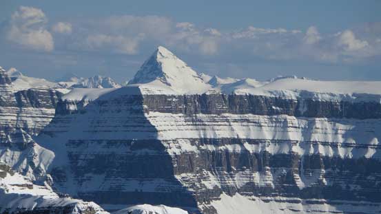
Mt. Chephren and White Pyramid from Saskatchewan River Crossing
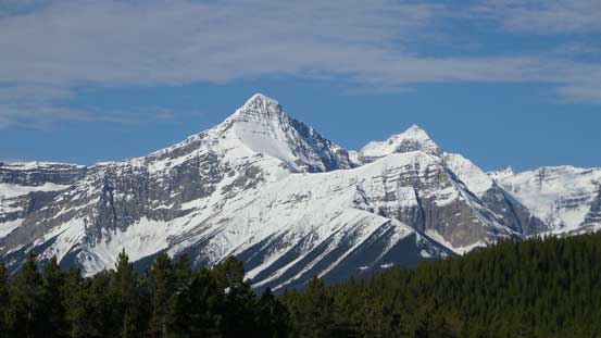
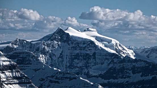
Mt. Outram and Mt. Forbes from Saskatchewan River Crossing
Vern starting the initial steep grind
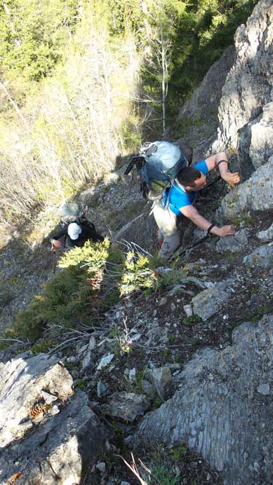
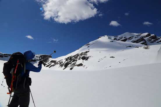
Eric scrambling up an unnecessary difficult step
Continuing up the steep forest

Typical terrain

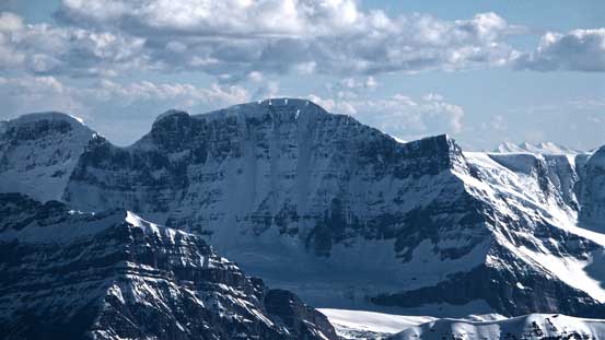
Impressive Mt. Amery
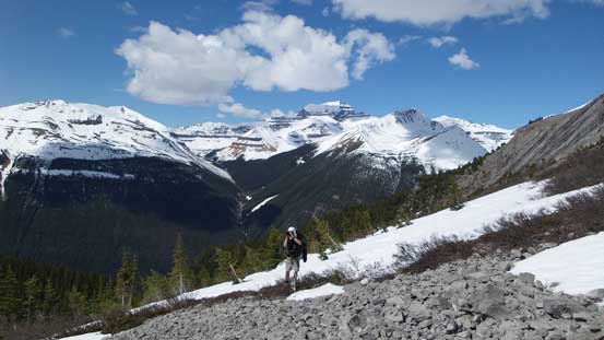
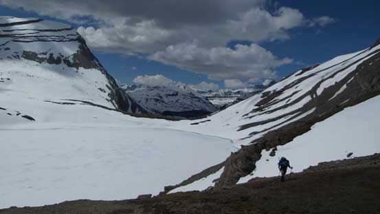
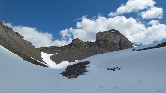
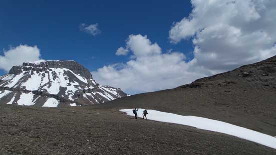
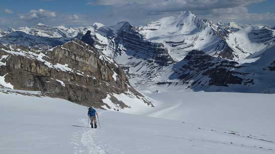
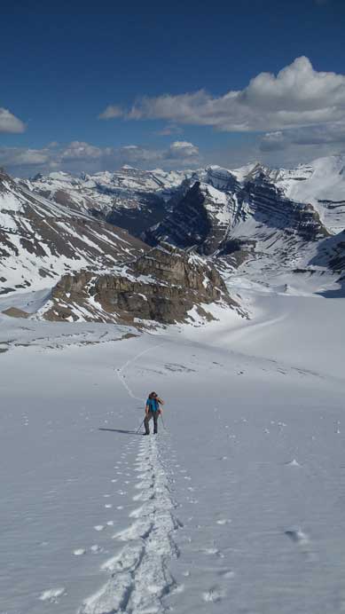
We stayed high on climber’s left side so bypassed the first lake completely by side-hilling on scree and rubble and occasionally, deep isothermal snow. The snow wasn’t continuous so we didn’t bother to use snowshoes. Soon after that we reached the much-bigger Coleman Lake, which was still frozen. We again, circumvented it on climber’s left side on either scree or snow. There was a rock band towards the rear end of this lake and we broke through it by ascending a snow gully. And after that, more side-hilling followed by ascending a foreshortened snow/scree gully, we were at the broad Coleman/Cirrus col.
Terrain starts to open up. Behind Ben is Mt. Saskatchewan
Surprisingly the first lake was partially melted already
Ben with Mt. Coleman behind
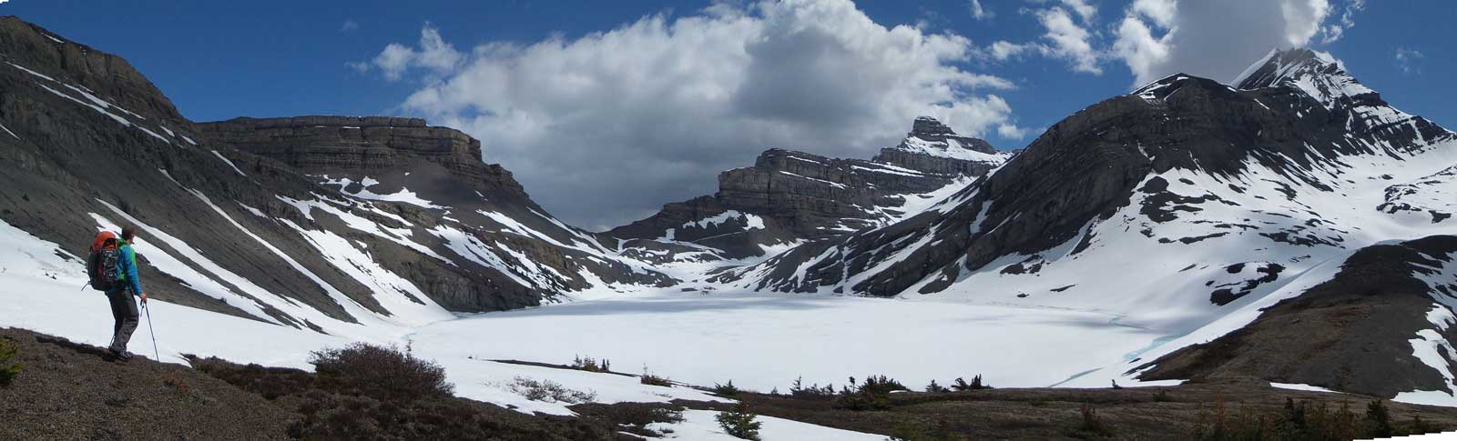
Panorama of Coleman Lake
Walking around Coleman Lake

Ben with a steep snow slope behind
Coleman Lake
The next step was slogging up this gully

Looking down at Eric slogging up snow. Behind is Mt. Coleman
Vern and Ben cresting the high pass between Cirrus and Coleman

Ben with our objective behind
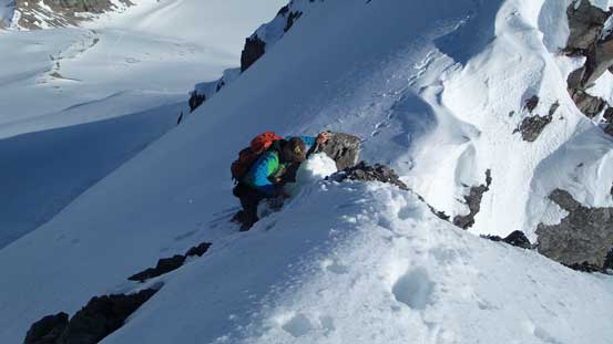
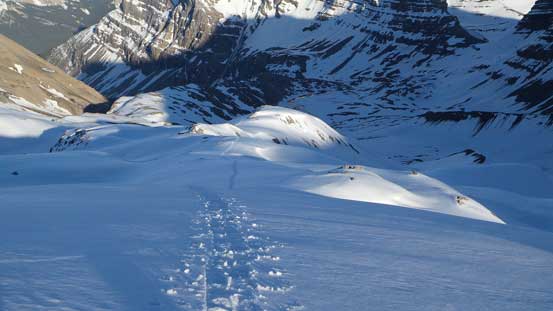
From this col we had to lose about 200 vertical meters towards the bivy site. There was again, some isothermal snow to wallow through. We found a nice spot to bivy at the last bit of “green” and set up our camp. It only took us 4.5 hours from car to here so even though we spent 1 hour setting up the camp, it was still very early in the day. Weather was also much better than forecasted. It didn’t take us long to make the call of ascending the peak “right now” rather than waiting till the next morning. With snowshoes on the post-holing was near non-existent. Except for a couple thin areas, the snow condition held up nicely.
Descending from Cirrus/Coleman col
We lost quite a bit of height
Searching for a prime bivy spot

Here’s our camp site
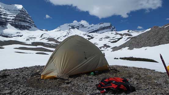
My tent with Cirrus Mountain in the background
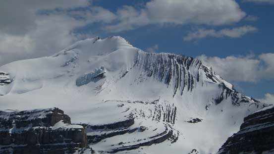
Zoom-in shot of the north face of Mt. Coleman

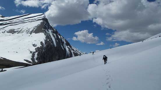
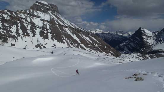
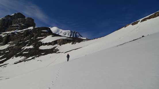
Vern snowshoeing up the typical terrain.
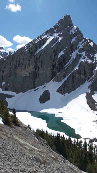
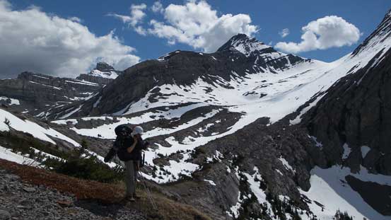
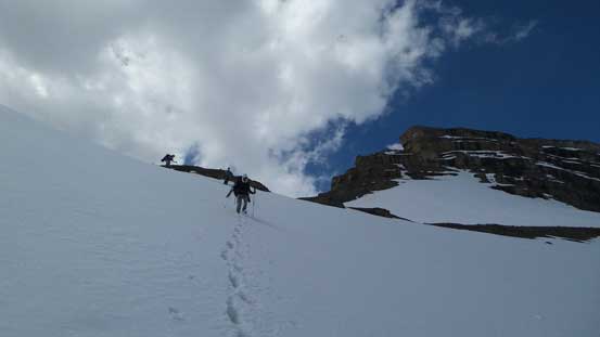
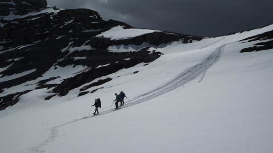
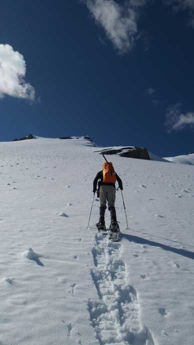
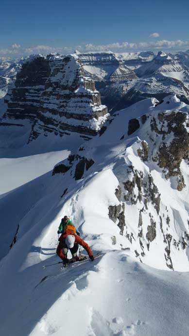
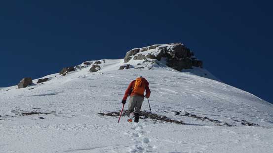
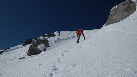
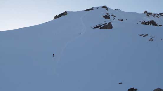
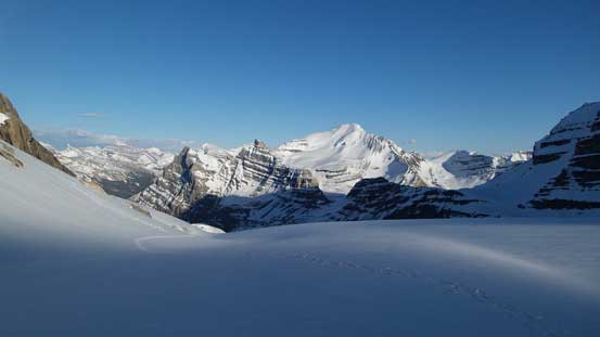
We aimed towards the distance “rock fin” that separates Huntington Glacier into two parts. The view was very foreshortening though and it was much farther than appeared. In fact, we had 1000 vertical meters to gain from camp to the summit. Once at the base of the “rock fin”, we picked a nice snow ramp down left to the Huntington Glacier. In front of us was a steep snow slope. I had vague memories from the other trip reports that folks did gain the ridge earlier by aiming climber’s left side, but on this day we decided to snowshoe straight up the slope. It worked perfectly and it felt like walking upstairs. (Take a note that our Lightning Ascents gripped perfectly on this 30-35 degree slope. With poorer snowshoes you’ll have to walk it up). The slope was not as steep as it looked and we managed to keep snowshoes on all the way up. That saved us lots of potential post-holing.

Ben leading the way, aiming towards the distant rock fin
Looking back towards our tracks
Wet snow avalanche coming off steep terrain

We found a nice snow ramp to access Huntington Glacier
Me examining the next stage. We decided to ascent straight up.
Off the glacier, looking back at Eric slogging up

This unnamed peak between Cirrus and Coleman looks very difficult
Vern snowshoeing up
Ben leading the way, snowshoeing straight up the slope
Towards the end, we traversed climber’s left to crest the ridge
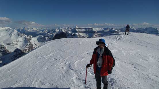
Me on the summit ridge, just about to switch gears. Photo by Vern
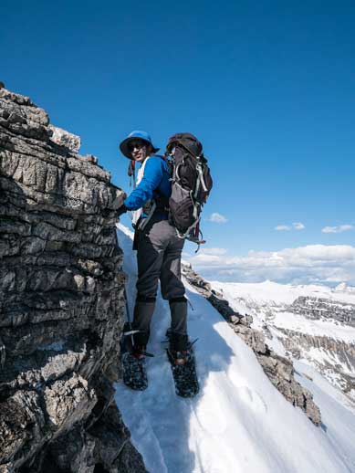
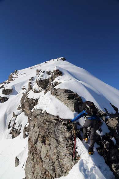
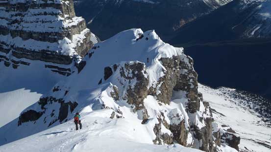
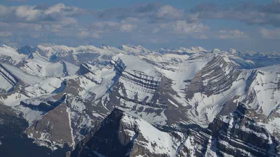
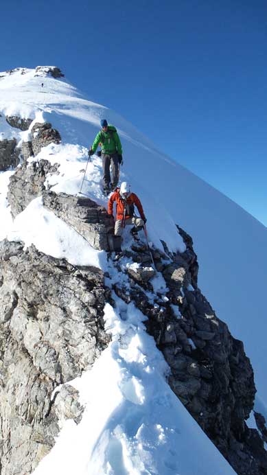
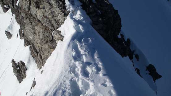
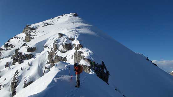
Once gaining the summit ridge, views opened up nicely, but we didn’t have much time soaking them in since we also saw the challenging ridge ahead. It appeared to be harder than expected so we soon took out ice axe and crampons. They were crucial for this ridge. Apart from traversing some steep snow to avoid cornices, there were two very exposed rock steps, both with snow on making things even trickier. I found the first step technically harder but the second one with much more severe exposure. After these bits of excitement we were on the final slope leading towards the summit. Up the last steep slope (climber’s left side of the summit block), we eventually reached the top. This is certainly a lofty viewpoint with incredible views all around.
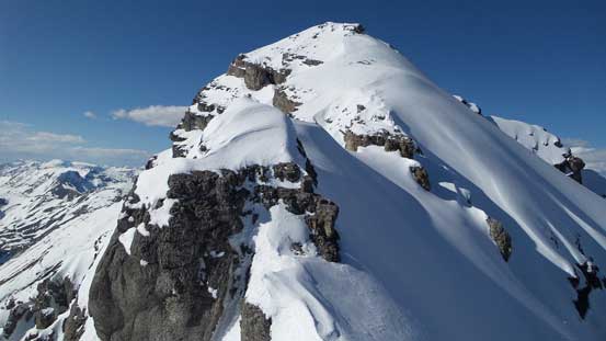
The complex summit ridge. Ahead is the first rock step crux

Vern starting the summit ridge

Ben climbing up the first step
Vern climbing up the first step
Traversing steep snow to avoid cornices that we couldn’t tell the boundary

Ben ascending the ridge
Me challenging up the second step. Photo by Ben
Ben climbing up steep terrain just above the second rock step
Same as above
Looking back at Vern taking photos. Can you spot Eric on the ridge?
Ben ascending easy terrain towards the summit block
Towards the end we traversed climber’s left and then ascended this slope
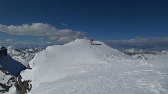
The last few steps to the top
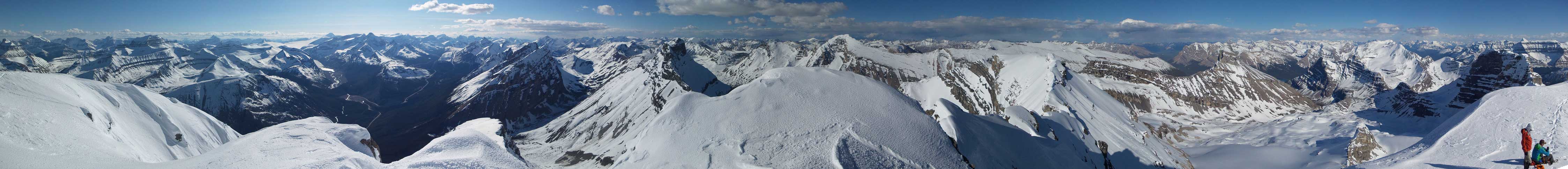
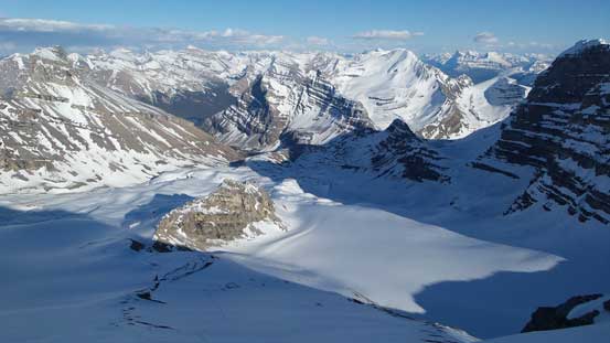
Summit Panorama. Click to view large size.
Mt. Forbes rises behind the shoulder of Mt. Amery
Lyell I, II, III
Mt. Alexandra

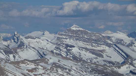
Mt. Saskatchewan
Mt. Bryce

The three peaks of Whitegoat Peaks
Mt. Cline
The north face of Mt. Coleman
Mt. Stewart appears to be a scree/snow slog

Obstruction Mountain might still be unascended

I had great memories from the snowshoe ascent of Castleguard Mountain
Oppy Mountain in a near-11,000er between Lyells and Alexandra

Mt. Columbia is the 2nd highest peak in the Canadian Rockies. Too bad we didn’t get a chance to climb it this spring…

Willerval Mountain looks cool

Monchy Mountain
Mt. Brazeau is the highest peak in Rockies’ front range. It’s another favourite of mine

Mt. Erasmus is very difficult to ascend
The distant peaks on Freshfield Icefield
Peaks on Columbia Icefield including Athabasca, Snow Dome and North Twin
Peaks towards north. Mt. Alberta on the far left and Mt. Smythe left of center
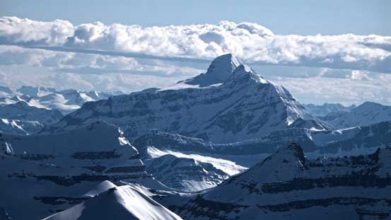
Unnamed but sexy-looking peak between Wilson and Coleman

Sunwapta Peak

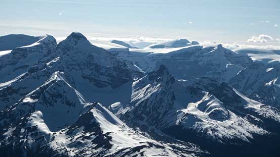
Another impressive outlier of Cirrus Mountain
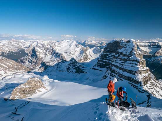
Me on the summit

Another group shot on the summit. Photo by Vern
After taking hundreds of photos we eventually started the descent. The snow had hardened a bit on the way back since the sun had lowered down. Down-climbing the cruxes weren’t as hard as expected and we got through quickly. We originally planed to glissade the big slope but with the snow hardening up we decided to keep the crampons on to walk down. This worked perfectly for the steepest upper section. Lower down we started to post-hole so strapped snowshoes on. From there on it was a nice and easy walk all the way back to our camp following our tracks. We made back shortly before sunset time and now it’s time for a well deserved dinner.

Starting the descent. Photo by Vern

Me descending the upper slope. Photo by Ben
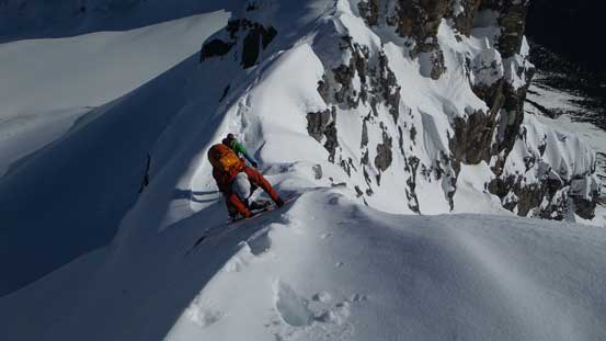
Ben down-climbing the tricky second rock step
There really isn’t much room for error…
Vern down-climbing the second step. Eric descending the upper slope in the background

Traversing around another rock outcrop

Ben ready to down-climb the first step
What a view.
Me and Ben packing our snowshoes in the backpack. Ready to drop down. Photo by Vern
Dropping down the big slope. Photo by Vern

Vern plunging down the big slope
Ben and Eric descending the big slope
One more impressive outlier of Cirrus Mountain
North face of Coleman

Our tracks on Huntington Glacier
On Huntington Glacier, looking towards Coleman
Our tracks lower down
We didn’t set up alarm for the next morning but we all woke up reasonably early. The night wasn’t very cold but there was a solid freeze so travelling was easy in the morning. Well, the freeze was almost too good. We had tracks from previous day plus the sun had been out for a couple hours, so by using our own steps we didn’t need crampons. Slogging back up Coleman/Cirrus pass was tiring and side-hilling around Coleman Lake wasn’t pleasant neither. The most miserable part came towards the end where the forest was too ridiculously steep that every step was hard on our knees. We also got a bit lost in the bush. Thankfully I checked my GPS otherwise we could have gone too far skier’s right. We had to circumvent a cliff band way towards left side to find a break. Lower down we paid much more attention on route-finding so avoided unnecessary down-climbs. It was not even lunch time when we got back down to the road. It’s almost tempted to do a short scramble in David Thompson on the way back home, but I was too tired to even think about that… Our round trip time was 14.5 hours that includes spending 1 hour setting up camp on the first day.
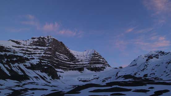
Morning view from my tent
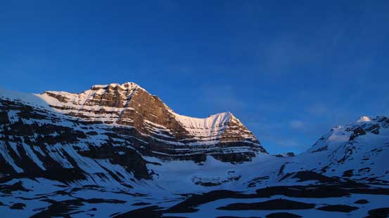
Sun beam shining on the unnamed peak
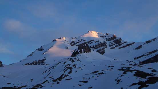
Morning light shone on Cirrus Mountain
Slogging back up Cirrus/Coleman pass

Looking back
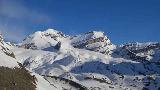
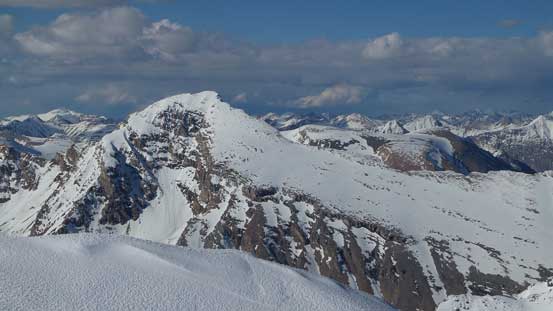
Our objective. What a beautiful mountain

Morning view of Coleman Lake
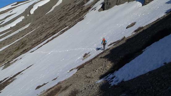
Side-sloping across scree and snow
Mount Saskatchewan. It deserves more attention than some of the 11,000ers.

Side-sloping to bypass the first lake. Photo by Ben
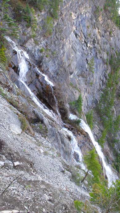
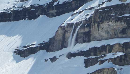
Steep waterfall lower down
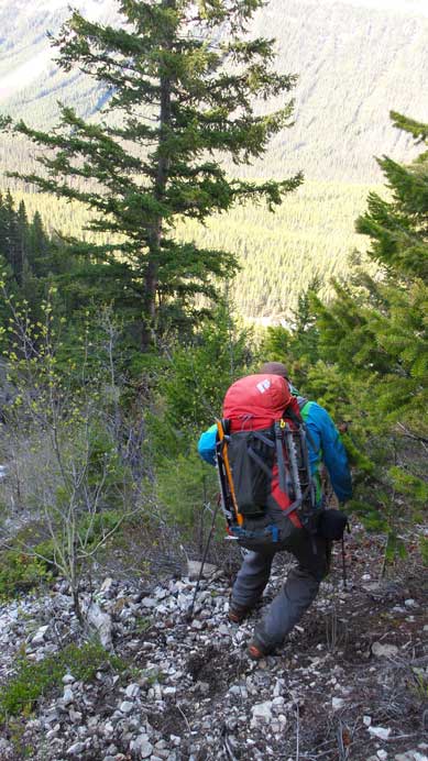
Steep descent in the forest
Overall, it was a very satisfactory trip with good friends again. I’d been wishing to do Cirrus Mountain ever since I saw it from the “Big Bend” after my Castleguard Mountain trip two years ago. Speaking this objective, I’d highly recommend as a late spring/early summer objective for people that enjoy snow climbing. Of course you can carry skis up if you “only ski”, but for peak-baggers snowshoes are certainly the most efficient way. For scramblers, later in the season once the snow melts the summit ridge should not exceed moderate scrambling, so waiting till late summer is another option if not comfortable on steep snow.
