Mount Baker
April 17, 2016
3286m
Baker Lake / North Cascades Highway, WA
The mighty Mt. Baker is the northernmost of the Washington volcanoes and also the 3rd highest in the entire state. This is easily the tallest and biggest mountain visible from the Lower Mainland of British Columbia and having it in sight for pretty much every time I go to work I knew this mountain had to be climbed in this year.. Two routes are commonly used – the Coleman-Deming which is the shorter option especially for folks coming from Vancouver, BC, and the Easton Glacier from south which is the “easiest” according to various sources.
Both routes involve fair amount of driving on logging roads to get started and thank to a wash-out at milepost 1, the access road for Coleman-Deming Glacier route is closed for this season. For folks like me lacking experience in mountain-biking, the Easton Glacier route would be the only shot. This route has some huge crevasses all over the places so the best time to get done is in spring, thank to the incredible amount of snowfall this area receives (especially for solo ascent like this trip). Skis would be in favour over snowshoes even for someone like me and a day-trip decision was made knowing the logging road had been snow-free to within 1.5 miles from the trail-head.
A bluebird day was in the forecast for this past Sunday but the problem was, it’s going to get nuclear hot by the afternoon. This was not a short trip (about 2500 m elevation gain) and adding to the (relatively) long drive I had to make a realistic decision to car camp at the “trail-head”. Otherwise I’d have to push for another “all-nighter” approach which was never a good thing unless I don’t have a choice. I finished work earlier on Saturday afternoon, packed and drove out southwards down Interstate-5 in the evening. After a few left-turns onto North Cascades Highway, the Baker Lake Road, SR-12 and finally the rough SR-13 I eventually made to the place where everybody parked by around 11 pm. The short stretch ahead looked still snow-free but I figured there must be a reason why everybody stopped here, so I did the same thing. Another party was also car-camping and it’s apparently gonna be a busy mountain.
Mt. Baker and Sherman Peak via Easton Glacier route. GPX DL
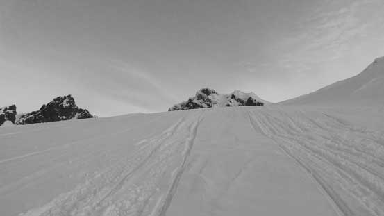
My plan was to wake up at 3 am but the other party woke me up at 2 am. I figured might as well just get started anyway. It took me less than half an hour to have breakfast and sort the gears out and by 2:30 am I had already started the plod. Initially I carried the skis and after a few long dry stretches (about 500 m) I started skinning. The snowmobiles had pretty much destroyed the road and it’s never a fun thing to skin over those “micro bumps”. But nonetheless they did do me a favour by packing the trail down so I’m not going to complain. They also eliminated route-finding for me and that’s quite a bit of difference from my Mt. Shuksan experience a few weeks ago. I cruised up the “snowmobile highway” across Schriebers Meadows and then up the drainage separating Railroad Grade with Metcalfe Moraine. This dumped me right at the toe of Easton Glacier and it’s still pitch dark at this point.
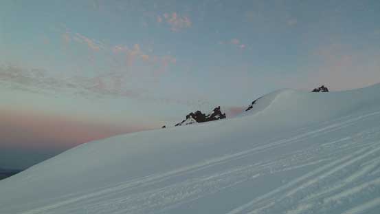
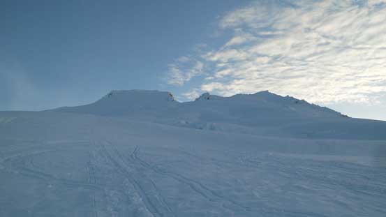
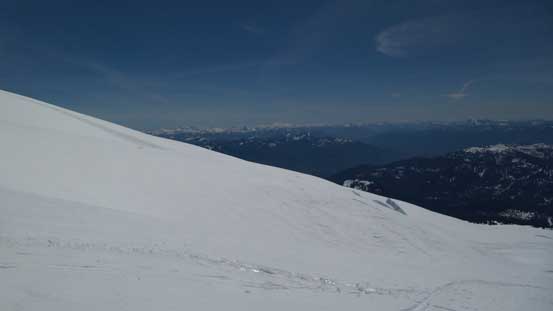
Following the “highway” of tracks by snowmobiles, skiers and snowshoeers I gained the Easton Glacier. A few big depressions were avoided and the tracks trended climber’s left for a while before swinging back to climber’s right. This was at elevation of roughly 2000 m and there’s not much stuff for me to do other than checking the GPS regularly (to constantly remind me how foreshortening a typical volcano like this is). Eventually the sky became bright and then I got treated by some fantastic alpenglow views on the Twin Sisters Range. The “Black Buttes” looked intimidating in front as I slowly approached the upper stretch of Easton Glacier.

Just before alpenglow time, looking towards Twin Sisters Range
Plodding up. The “Black Buttes” started to show their tips

Glacier Peak is another volcano in Washington
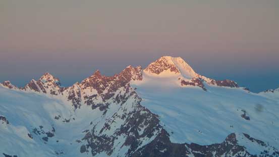
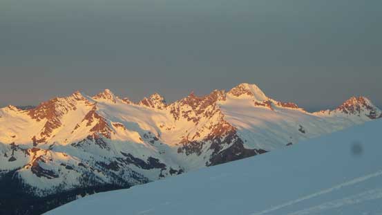
Alpenglow on South Twin
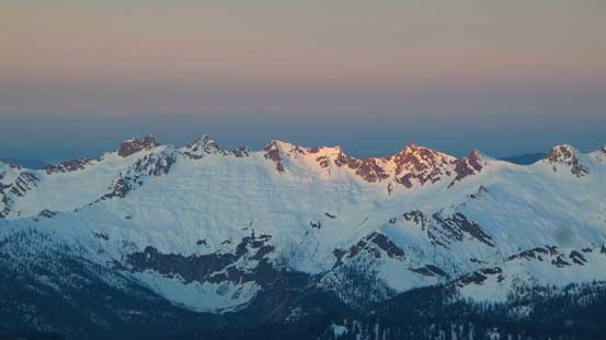
Alpenglow on other (unofficially named) peaks south of South Twin
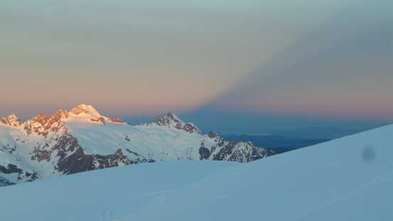
Note the shadow created by Mt. Baker massif
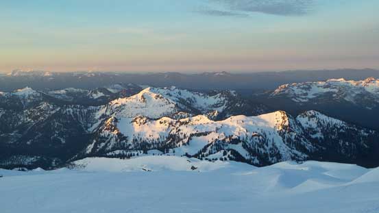
Morning light shone on Loomis Mountain et al.
Another look at South Twin
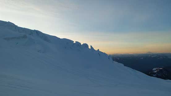
One more shot of the morning colours on the horizon. Note the seracs
Following the snowmobile tracks.
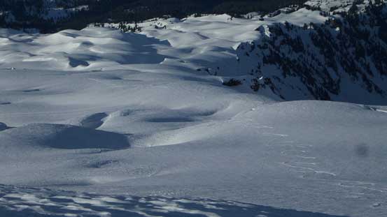
As I mentioned before there’s no route-finding for me whatsoever for the entire ascent but I have to say that this glacier was fairly impressive with huge saggings all over the place. In addition to that, a few crevasses had already opened up and it was freaky to say the least to travel around those “features” knowing there’s nobody around for miles. Upwards and onwards the grade also steepened to the point that I started to slip backwards on the icy surface. I did bring my ski crampons but based on my past experience I knew mine were only to be served as a “psychological aid” as they never seemed to do their job properly. I didn’t bother to apply them this time and instead I took the skis off and boot-packed a long stretch up, until the grade eased again near the Sherman Crater (also Baker/Sherman col).
The upper reach of Easton Glacier. Very, very foreshortening.

Freaky stuffs…

Freaky stuffs…

More freaky stuffs…

Colfax Peak looks cool. I’ll do it one day from Coleman-Deming route
Looking down the immense Easton Glacier where I came up from
Getting higher than everything nearby now.
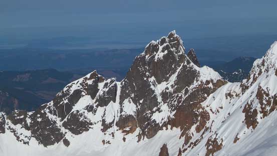
Lincoln Peak is one of the most difficult peak-bagging projects in Washington state.

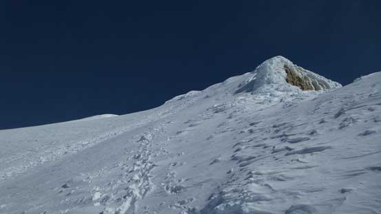
The Roman Wall ahead.
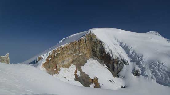
Mt. Baker summit from the rim of Sherman Crater
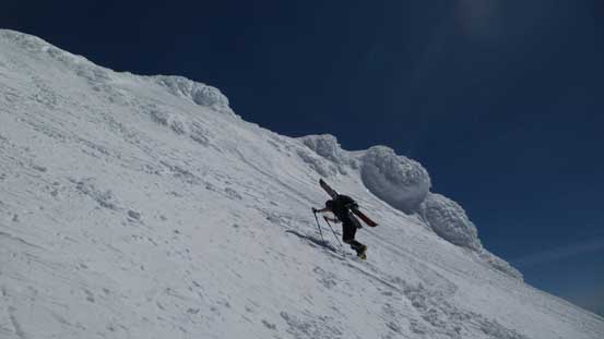
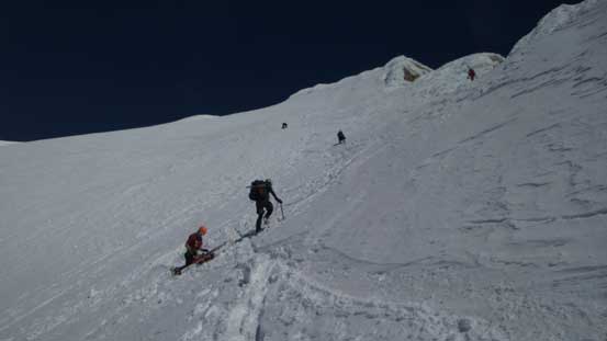
The Roman Wall ahead looked much steeper than what I was expecting so to give it some extra time to soften up I made the call to ascend Sherman Peak first. The other group(s) were nowhere in sight which was kinda to my surprise. They were ascending the Squak Glacier which was supposed to be a more direct route but oh well. The ascent of Sherman Peak was written in a separate trip report as it’s a different peak but I have to mention here that it’s well worth the effort. By the time I got back to Baker/Sherman col the other groups were still far behind. Up the Roman Wall I went I soon had to take the skis off. I ditched them as I figured based on my skiing skills I shouldn’t attempt to solo descend that steep wall especially given the fact there’s a huge open crevasse at the bottom of its run-out zone… The route was fairly firm and icy and became quite steep near the top (35+ degrees).

At the base of Sherman Peak, traversing towards the Roman Wall
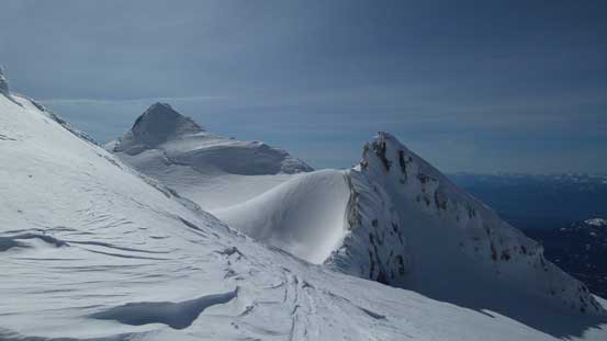
Looking back towards Sherman Peak
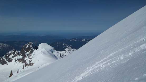
Ascending the Roman Wall
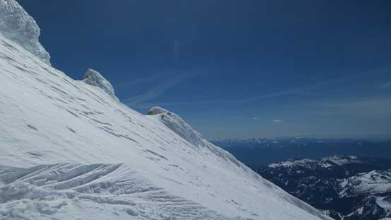
The upper slopes of Roman Wall
Looking down into the Sherman Crater (and Sherman Peak)
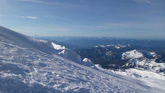
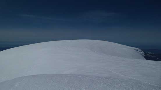
Eventually after what seemed like a long haul the grade eased and then there’s still fair amount of plodding required to hit the first (dome) summit. Based on my GPS the true summit was the pointier one on the far side so I had no choice but to tag that one too. There’s nothing technical in traversing the summit plateau but it was surely a tedious process. The views from the summit weren’t as good as I thought mainly because it’s too high of a peak so everything was far below (kinda like the view from Mt. Columbia which was also not very good).
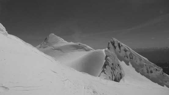
Above the Roman Wall now
Twin Sisters Range looks tiny now!

There’s the true summit
This is that dome summit
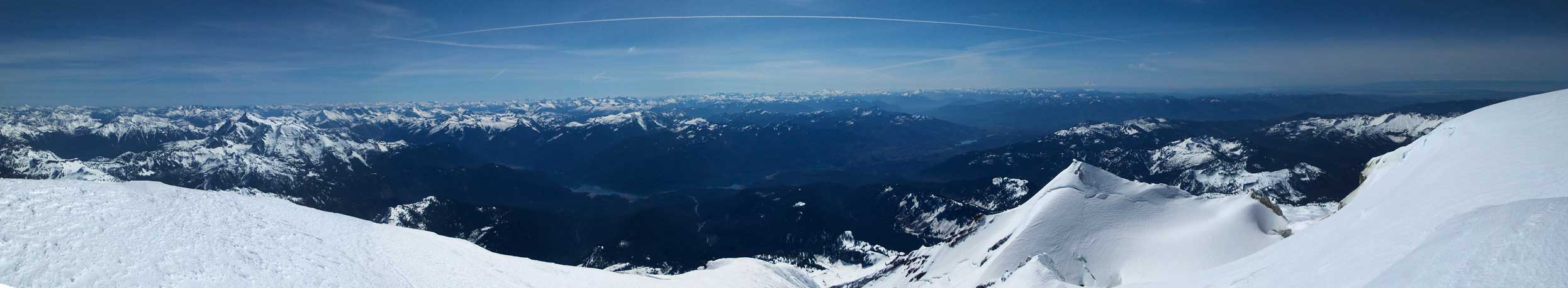
Partial summit panorama from Mt. Baker. Click to view large size.

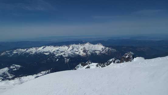
The mighty Mt. Rainier dominating the skyline looking south
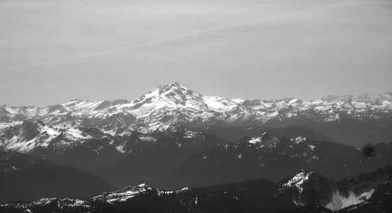
Glacier Peak – the most remote of the Washington volcanoes
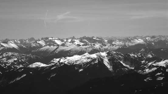
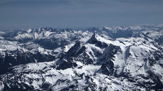
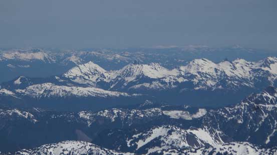
Eldorado Peak et al. in the North Cascades
The beautiful Mt. Shuksan in the foreground. Now looking not nearly as mighty.
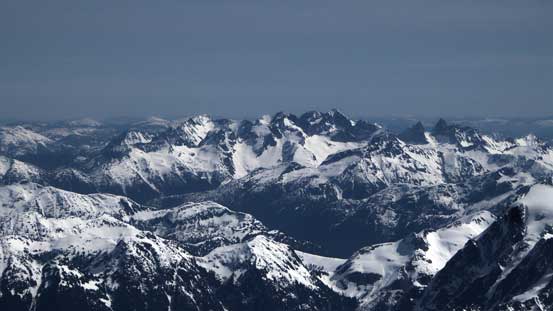
In the foreground is an infamous one – Mt. Fury
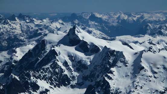
Another look at Mt. Shuksan
Mt. Spickard et al. in the North Cascades
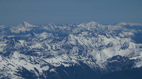
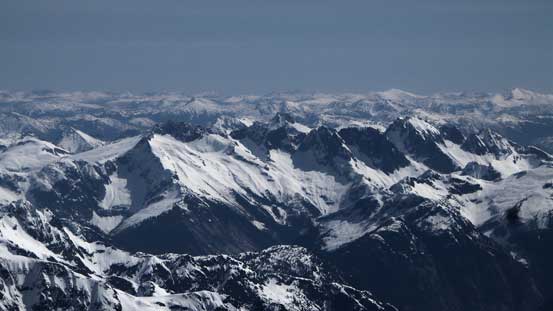
On the horizon are giants like Mt. Outram and Silvertip Mountain
All peaks in Cheam Range are looking small

Looking north towards Harrison Lake area

One of the many glaciers surrounding Mt. Baker

A closer look at the Twin Sisters
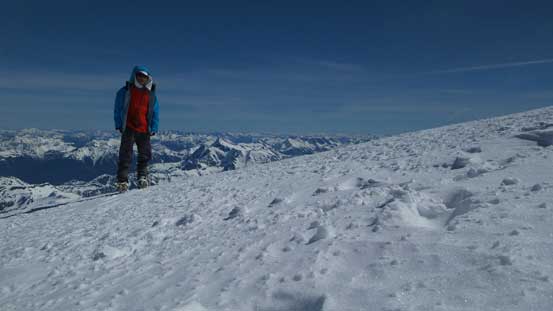
Me on the summit of Mt. Baker
I didn’t linger too long up there as the gas from the Crater was blowing towards my direction. It smelled like shit and I wanted to be off those smells as quickly as possible. Down the Roman Wall I finally saw those other climbers on their way up. The snow had become very slushy at this point and the top layer (from recent snowfall) was balling under my crampons for every step downwards. It was very frustrating and to safely descend the Wall I had to face inwards and down-climb (even though the grade wasn’t nearly that steep to require down-climbing). After some short chatting with every of those groups I resumed the descent. Back to where I ditched skis I spent about 2 minutes to swap gears. The skiing was OK for a while but soon enough, the snow had become completely slushy. It was not easy to make a turn but still, much faster than snowshoeing thank to the open and mellow terrain.

A solo snowboarder on his way up the Roman Wall
The same snowboarder going up
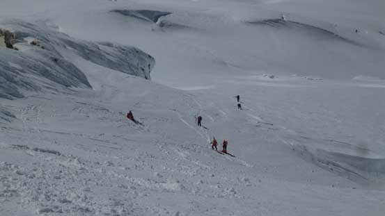
More folks were coming up!
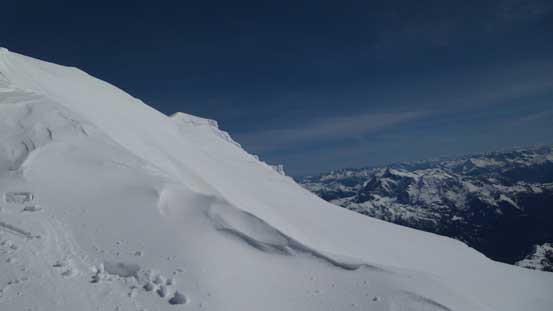
Looking across the Roman Wall face
It’s a popular mountain!
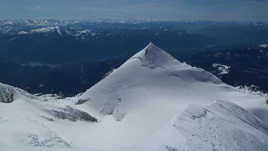
Sherman Peak

Looking back at those guys ascending the Roman Wall
Skiing down Easton Glacier was fast!

Seracs…
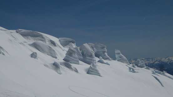
More cool seracs.
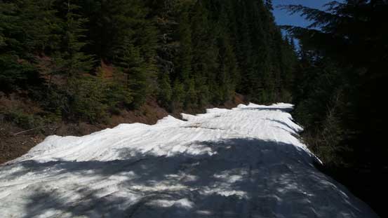
Lower down I found it’s actually easier to descend on top of those snowmobile tracks as it’s a little bit less slushy than the untracked slopes. And once entering the trees the skiing became better again. Further down the grade eased to (nearly) flat, but thank to the slushy conditions I didn’t have to put skins back on. And of course the final stretch along the logging road was done by boot-packing (as usual for other spring ski trips).
Still had lots of height to lose
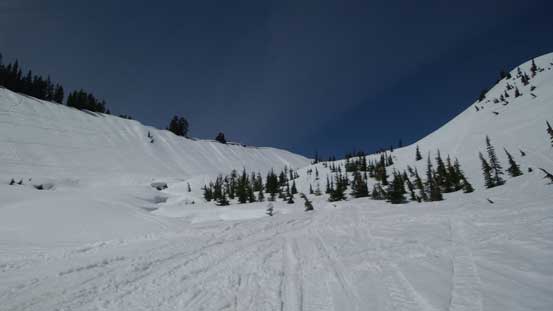
Down into the drainage beside Railroad Grade

One interesting creek crossing
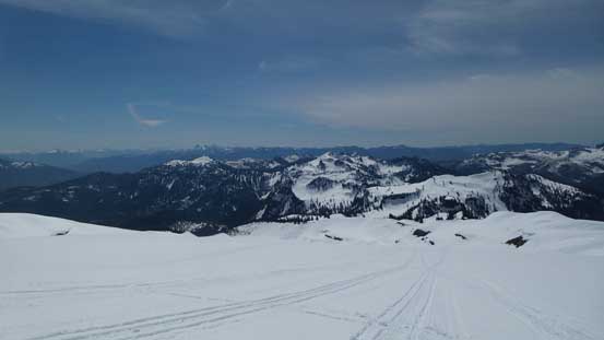
The road plod near the end
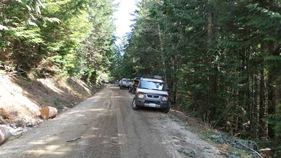
Done!
All in all my round trip time was under 12 hours which was just as planned. I surely felt good to finally have Mt. Baker bagged after pulling the plug and changing objectives a few times at the last minute. I’m glad I waited for the (near) perfect conditions to experience this beautiful volcano. The route, however, was quite a slog and skiing is definitely the best way to enjoy it. And other than that, the Roman Wall might be a bit steeper than you’d expect.
