The Old Settler
July 17-18, 2021
2132m
Harrison Lake East, BC
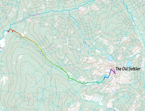
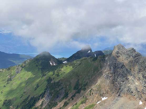
The Old Settler is a cluster massif of several summits that stands above its immediate vicinity and is extremely visible from literally anywhere in the Fraser Valley areas. It’s not a tall peak by SW BC standard but boasts over 1100 m prominence. This peak isn’t extremely remote, but the access had degraded over the last decade that an ascent has become a rare thing nowadays. A few years ago this peak had gained the reputation of being one of the worst bushwhacking ever. In the last couple years the logging company had improved the North Talc Mainline but the road’s gated at the bottom and there’s still substantial amount of bushwhacking from the end of the new logging cuts to Daiphy Lake at the base of the peak.
The new status of this peak had been explored by Matt and Katie in September 2020 such that we knew what exactly to expect. Vlad and I had talked about this peak for a while and our general plan was to break it down into two days with a camp at Daiphy Lake. Speaking the climb we would only do the so-called “standard route” to tag the north (true) and the central summits and skip the harder south summit so that we didn’t need to haul mountaineering gears. There’s a classic climb called the “west buttress of south peak” but I’ll leave that for rock climbers. We also received confusing words about the status of the gate. It’s been reported “open” in May long weekend and we decided to take a gamble on that. Of course we lost the gamble in the end. I managed to convince Lily and Bala to join. They would aim to climb the west buttress but at least we could suffer through the approach bushwhack together to somehow dilute the pain.
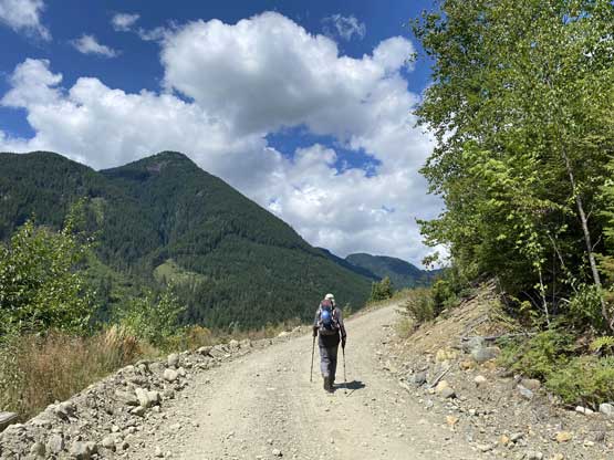
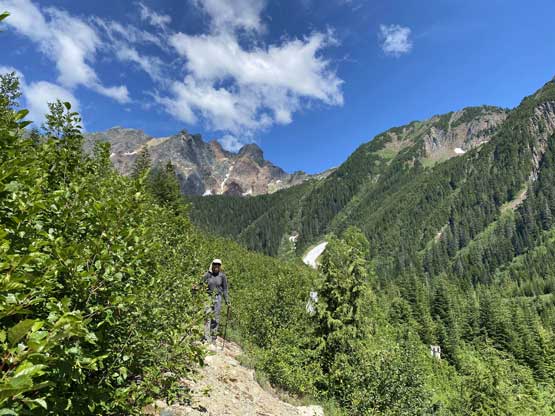
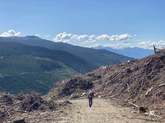
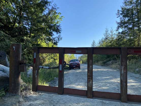
Because we counted on the gate being open we did not need to leave city too early. We agreed to meet up in Harrison Hot Springs at just past noon and made the dusty and bumpy drive up the East Harrison FSR together. When it came to the moment of truth we discovered the gate was locked. After some discussion Lily and Bala decided to switch objective to Ibex Peak’s south ridge but Vlad and I would stick with our plan. There’s about 9 km of road with 1000 m elevation gain. That’s equivalent to 2.5 hours of walking at the worst case so we decided to just embrace it. The elevation was depressingly at 52 m at the gate so we had to earn this peak basically from sea level up.
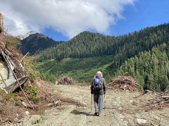
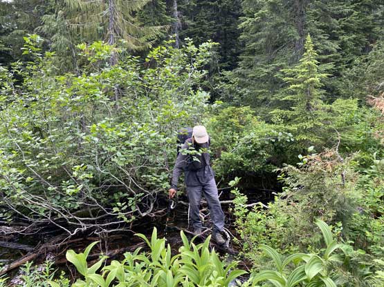
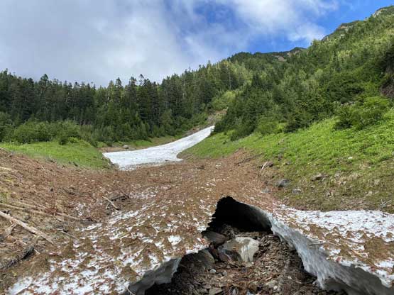
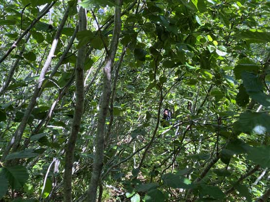
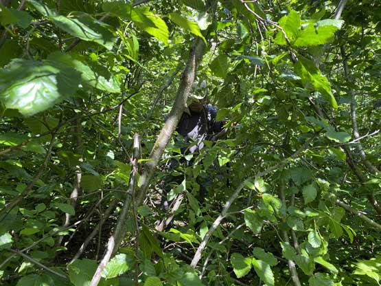
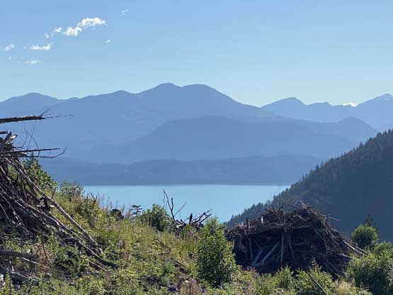
As expected the road walking was boring as fuck but at least we had some views from point to point. My mentality was to treat it as plodding up the Garibaldi Lake trail and I honestly preferred this one because there’re some views. We made to the road’s end faster than we thought and once there we took the first break of the day. I also needed some time to switch footwear from trail shoes to Trango Tech mountaineering boots. Once the road ended we dived right into the overgrown section embracing the sustained level-3 bushwhacking. The start wasn’t too bad but a while later the alders had become super annoying. We followed Matt’s track to bail the road, ascending over 50 m straight up climber’s left side to intersect a higher spur. This stretch gave us a temporary relief from the alders. Beyond this stretch we dived into the bush again but then I found a nice open line just on the uphill side of the road and we had at least half a kilometer of travel without bushwhacking, albeit with side-hilling on scree.


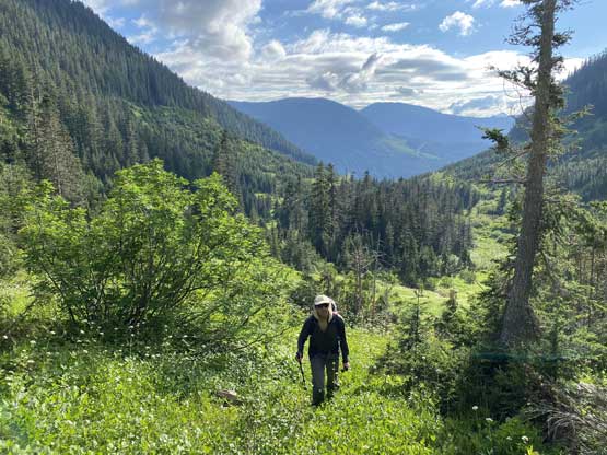
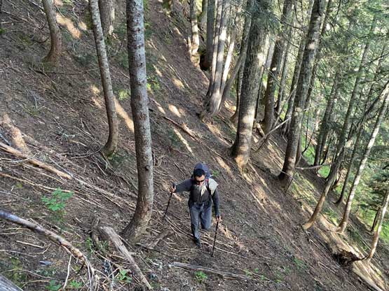
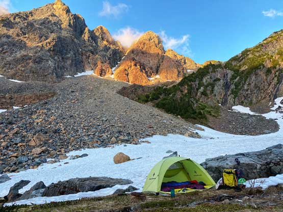
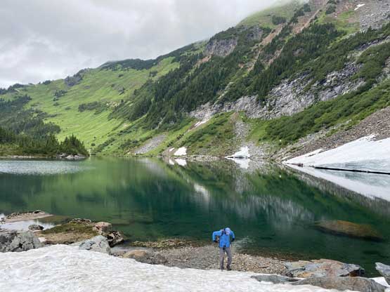
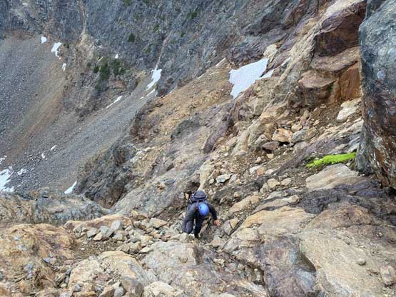
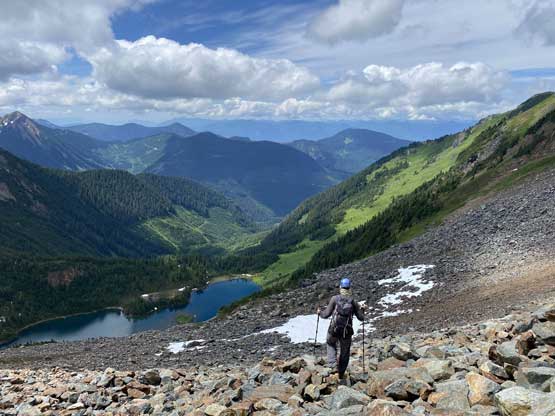
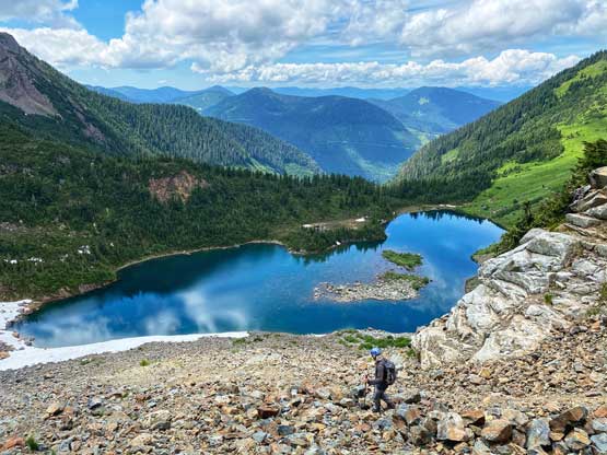
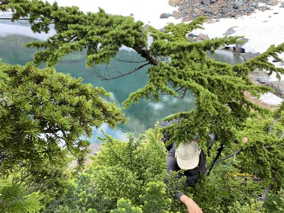
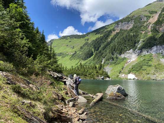
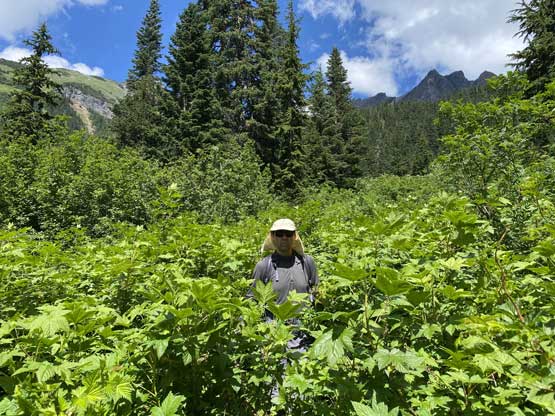
Once that side-hilling “highway” ended we again, dived back into the alder-chocked road and the bushwhacking started to become pretty annoying. We did manage to find easy stretches here and there including another “highway” on the downhill side of the road but for the most parts we had to thrash through the alders. A while later I made a call to bail the road again to the uphill side and did a long traverse side-hilling on grass, which might or might not have saved some time. On the return we just thrashed in the alders on this stretch as either way sucked. At the end of this overgrown road we followed Matt’s GPS track rock-hopping across a stream then traversed a short section of old growth forest into a “meadows” zone. Traversing/ascending this meadows wasn’t too bad overall but there’s one stretch of chest-deep high grass with lots of brambles in it. Higher up we ascended climber’s left back into the old growth and the going soon became steep and slippery. We crested the wooded ridge at 1450 m elevation and thrashed down 30 m on incredibly dense vegetation to the shore of Daiphy Lake. The traverse to the far end of Daiphy Lake wasn’t too bad as we could just walk across the lake’s shore but one bluff did force us to thrash back into that densely vegetated slope. The campsite was however, a top quality one with flat ground, views and running water.


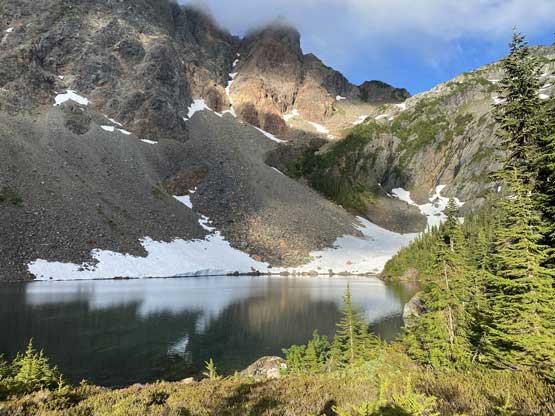


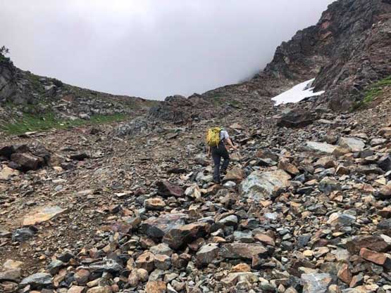
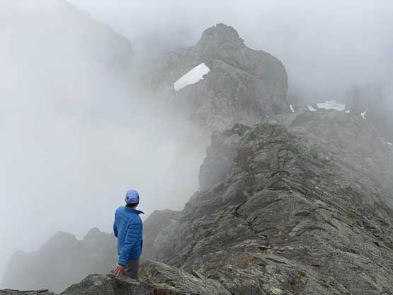
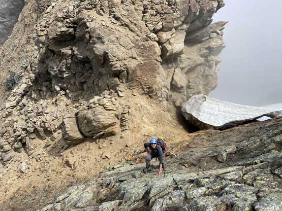
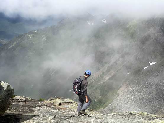
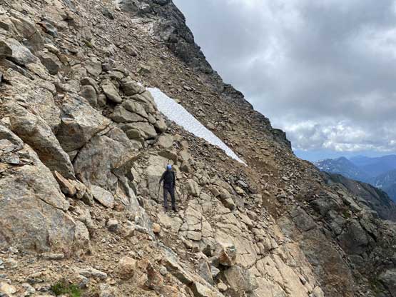
The next morning we were disappointed about the objective engulfed in some low clouds but there were also patches of blue skies above, so we decided to sleep in for two extra hours. By 8 am there was still very little sign of improving but it’s time to go regardless. The key for Old Settler’s ascent was to locate that traversing bench “highway” but to get there we had to slog a few hundred vertical meters of talus and scree. There were still patches of snow on the lower section of this bench traverse but we were able to avoid most of them. There’s also a few short sections of scrambling in the middle parts of this traverse but most of the time the scrambling would not exceed “class 2”. Admittedly I also did not look hard to stay on the easiest path as there were many options to pick.


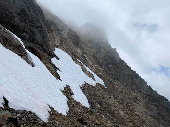
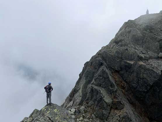
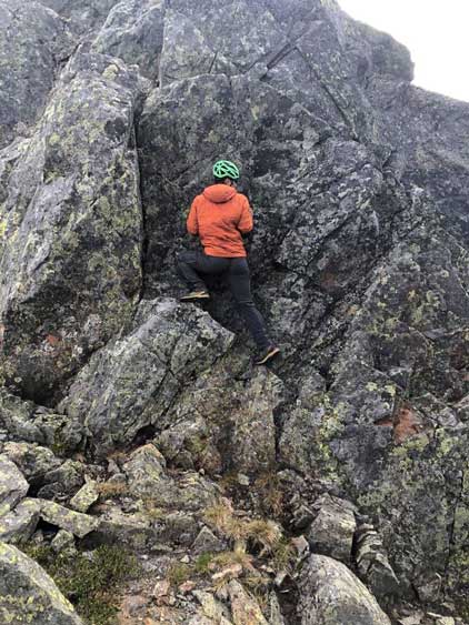
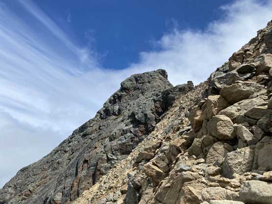
The col between the north and central summits were completely soaked in the clouds. We decided to ascend the north (true) summit first to get the job done. The crux looked imposing from below but the key was to commit to it. There were plenty of up-sloping holds and the scramble turned out much easier than expected. The exposure was deadly but the technical difficulty did not reach “class 4” in my opinion. Higher up we attacked the summit block on climber’s left side following Matt’s GPS track and sure enough we were on the very top. We lingered for about 10 minutes but with no sign of improving weather we reluctantly retreated. We did get some views while descending the upper ridge above the crux. There’s one massive rappel station above the crux but we did not bring a rope, so just down-climbed it.


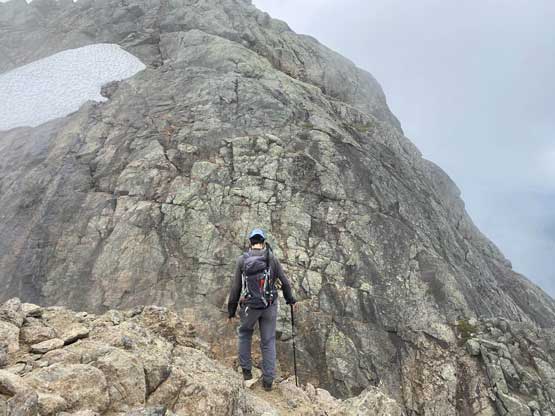
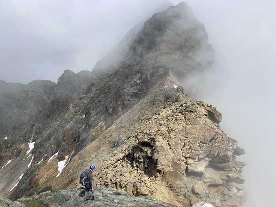
Vlad was keen to check out the central summit as oddly enough that’s the one described in Matt Gunn’s scrambles book. I was extremely pissed about the inclusion of a few sub-summits in his book. In this particular case the central summit is easier to ascend than the true (north) summit but that doesn’t mean this is substitute option. If you only followed Matt Gunn’s direction to the central peak then you have not climbed The Old Settler yet and you have to come back to put that check mark on the peak. But anyway since Vlad wanted to check it out then I agreed. There’s still some fun scrambling involved to get there and we also had a bit more views from this central peak.


The skies had finally started to open up by the time we descended below North/Central col back onto that traversing highway. I was even tempted to slog back up to the north summit to get some views but the laziness kicked in, so we reluctantly slogged back down to camp. The descent was not difficult but felt tedious as we must watch our feet for every single movement forward.


We spent over half an hour to pack up the gears and off we went into the bush again. I insisted to follow our exact route out instead of trying different things. This meant a nasty 30m regain to get back up onto that forested ridge and this stretch was a sustained BW4 thrash in dense timbers. And then we committed to that uber-slippery descent of the steep old growth forest. The thrash back across that chest-high grassland wasn’t as bad as we thought, but the alder-thrashing back across the old road sure felt like a drag. We persisted it through and made back to the good road, but there’s still 9 km and 1000m of descent to go. My strategy was again, to consider this as a hike-out on Garibaldi Lake trail except for this time we had views. I unfortunately developed a big blister on my right foot but it didn’t look too bad a few days later.


I was a bit worrying about the break-in given the amount of campers not far from where I parked, but the worrisome turned out to be unnecessary. Most of the campers were already gone but the drive-out on East Harrison was still a dusty one. A few hours later I made a detour to drop off Vlad in Richmond before driving back home.
