Mount Alberta
September 4-8, 2017
3619m
Jasper / Icefield Parkway North, AB
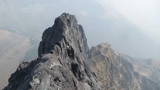
Immediately north of the Columbia Icefield, buried deeply behind the bulk masses of Mt. Woolley and Diadem Peak and hidden from view from the now-tourists-chocked Icefield Parkway sits one of the most formidable fortresses of the Canadian Rockies. The sixth highest in this range, Mt. Alberta rises sharply into the sky like a fin guarded by three big walls with no easy way up whatsoever. The so-called standard route, the Japanese Route on the east face goes at an alpine grade of V, a dozen pitches up to 5.6 on horribly loose rocks with sketchy protection if anything at all. The approach is arduous and involves a major river crossing, a massive amount of up-and-downs on unpleasant terrain. The summit ridge is often heavily corniced that in some years this mountain simply does not come in shape at all. Thank to the global warming a snow-free ascent of Mt. Alberta is now very possible but even so, by any mean it at least ties in with Mt. Robson to be the most difficult and the most dangerous 11,000er that for many climber an ascent of Mt. Alberta stays only as a dream. Few actually put in effort to try, fewer got to the summit and down in a safe manner, and even much fewer got it without being benighted, shivering through the most miserable night ever.
Towards the end of this summer it’s very tempting to just play lazy, downgrade my ambition and settle on some easy-to-attain summits but by heart I knew I’d kick myself hard for not giving Mt. Alberta a solid attempt. After crushing Robson, Deltaform, Hungabee and Whitehorn down in a roll with pretty much fluent flow I was in my best mental state on handling loose rocks and the historically dry summer has put Mt. Alberta at probably the driest conditions it has ever seen. A quick check on the weather forecasts reveals a week-long high pressure ridge dominating the first week of September and sure enough, Robb Schnell was apparently thinking the same thing. The plan was quickly made and that left me about two full days to do my homework. I had to abandon some plans on a few long sought-after peaks in the west coast, the first week of work and a scheduled car maintenance but Mt. Alberta is one of the few objectives that I’d ditch ANY other plan in life. If I get a chance I’m going for it. No question. Period.
Two days were enough to make a solid plan and in particular I consulted with at least half a dozen summitters including the guidebook anchor, Bill Corbett himself, ACMG Jeff Bullock who guided an ascent just a few weeks ago, and of course my usual partners Ben Nearingburg/Ferenc Jacso who provided valuable information. I had pretty much pinned down the route-finding challenges to the very little details that without even looking at my own picture the procedure was already well memorized. If we got off-route onto terrain harder than 5.8 then I’m fucked and I deeply knew that as a grade of 5.6-5.7 is pretty much the hardest I can handle. Packing light is another important thing especially considering we had to haul a set of bivy gears all the way to the summit (we had to PLAN a forced bivouac even though with Robb and I’s experience I did believe we could get down in one day). Another thousand dollars were spent in MEC at the last minute – a new 68L backpack, a thermarest Xlite and some other pieces of equipment, and then the whole day of Sunday was spent driving to Canmore, dealing with much of the long weekend gong show. Getting out of Vancouver at 10 am was brutal but elsewhere wasn’t that bad although there were cops everywhere.
The next morning I slept in till whenever I wanted in my car at Canmore info center. I had planned to have a luxurious breakfast in the McDonald but the long weekend Monday gong show had put a huge damper on things. Eventually I just sucked it up and went for the drive-thru which was probably a little bit faster and then picked up Robb at his home just after 10 am. Robb had a good plan on the technical climbing approaches that we’d simply use his two 60 m 7.5mm twin ropes which felt so much lighter comparing to my 4-kilogram single rope. We would not bring a full set of trad gears neither although considering the full 60 m pitches I had some doubt on that even though I did not speak out. Ben and I always overgeared on our trips so why not go a little bit lighter this time. I knew I could pretty much solo any Rockies 5.4 if I had to… And the next thing we drove up the Parkway and parked at the correct pull-out.
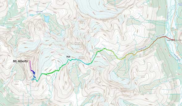
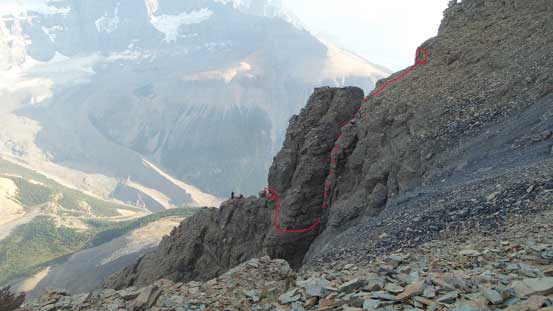
Mt. Alberta via Japanese Route. GPX DL
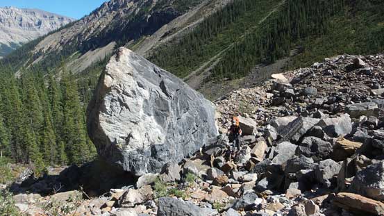
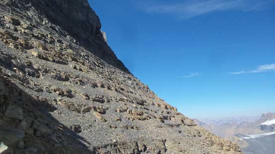
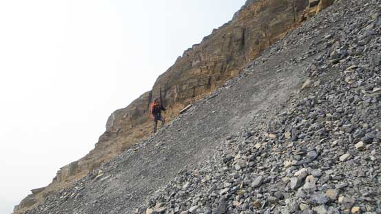
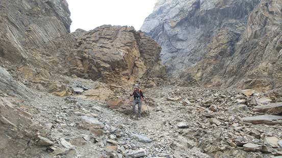
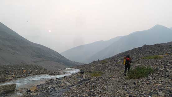
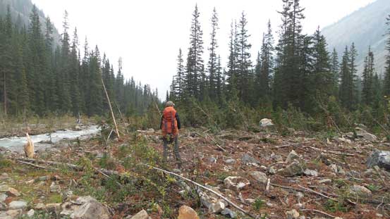
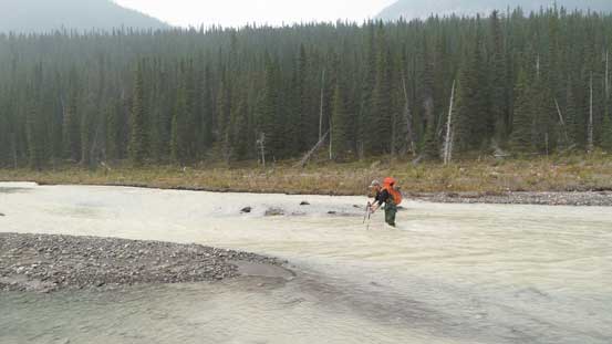
Three other cars were parked. Woolley/Diadem are mostly out of shape at this time of a year so where the heck those guys were going! We nervously looked inside the windows and at least two cars had climbers and the third we could not tell. I had some eerie feeling that we might get shut down because of the traffic jam but Robb was positive that the others must have gone for Woolley/Diadem. I added that they might be scramblers going for Mushroom or Little Alberta, elite alpinists going for the mighty North Face of North Twin or explorer-climbers venturing down into the head of Athabasca Valley for some elusively remote summits, so we set off hoping our positiveness was correct. Wading the Sunwapta River seemed a little bit more challenging than my memories from three years ago although the water was much warmer. The main channel was thigh deep and fast flowing. I did not give it a second thought as usual, dropped in and bashed through but was a bit shaken afterwards. My mental state on this water crossing thing would probably never be the same after the slip on Kind Edward’s return. Quickly drying off and switching footwear we then correctly picked up the Woolley Creek trail. A steep grunt beside an impressive waterfall later we dropped about 30 m down to the creekside. The next hour was following the sometime-washed-out trail upwards into the valley.
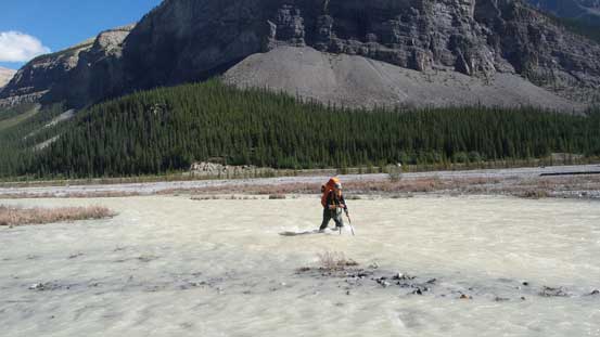
How many times you start an 11,000er trip with this kind of fun?!

The Woolley Creek waterfall is more impressive than you might think
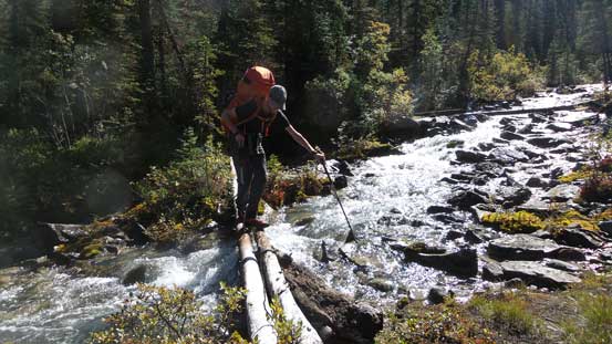
A tricky slippery log crossing. You sure don’t want to ruin the trip here…
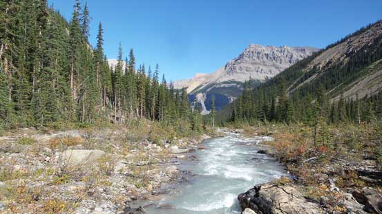
Woolley Creek valley.
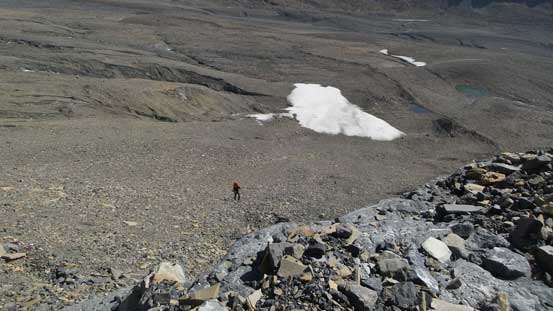
Traversing on some boulder fields
Upwards and onwards. Into the alpine now.
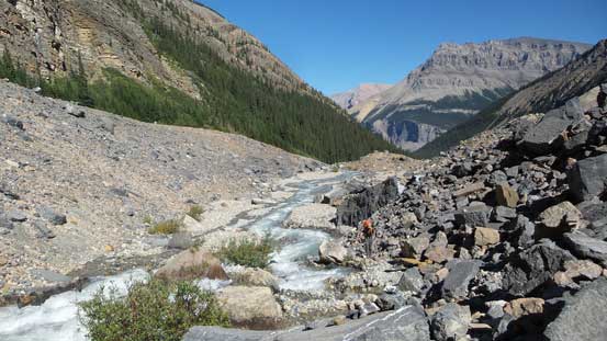
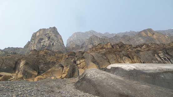
Towards the head of this valley we finally started gaining some elevation beside the creek, on either a faint trail or some boulders. The path was well marked by cairns and I had two GPS tracks to follow so there’s little to worry about. After another while the route trended upwards climber’s right and then into a draw at treeline. We took a lengthy break and then carried on over a steep moraine to the usual Woolley/Diadem bivy. I dropped my backpack and started searching around right away but no sign of other tents to be seen. That feeling was getting even eerier now. I had thought about at least a dozen ways to fail this mountain but getting shut down because of “too many people” was not one of those.. Oh well. We leisurely set up camp and enjoyed a scenic evening nonetheless. There’s no smoke and the views of the nearby giants had brought up some good memories from my trip in the fall of 2014.
Slowing slogging towards Woolley/Diadem bivy
This is by no doubt a 5-star bivy site. Highly recommended
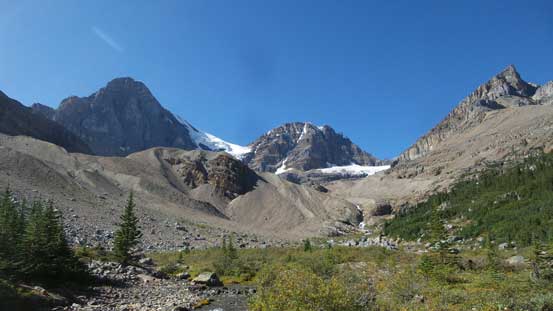
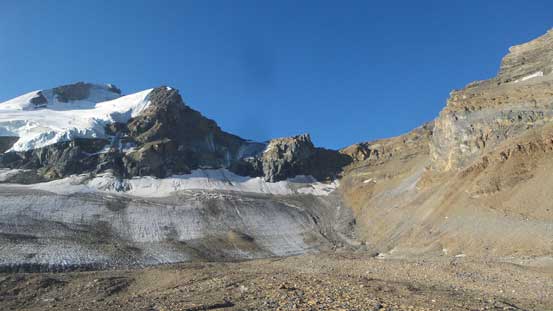
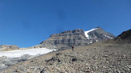
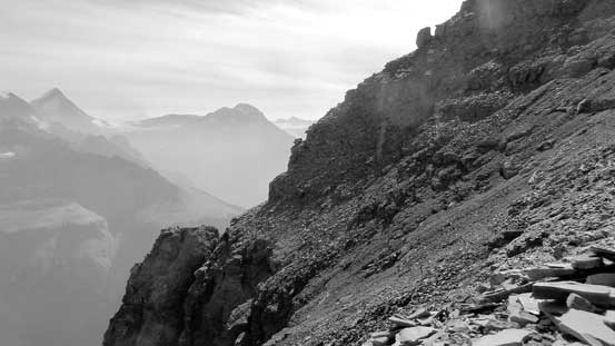
The next morning we woke up at sunrise, quickly forced in a breakfast, broke camp and then up we went towards Woolley Shoulder. The route was still reasonably marked by cairns and paths but again with the two set of GPS tracks there’s no excuse to even briefly get off route. Indeed, we picked the most efficient line possible into the rock-covered glacier section and ahead was that steep grunt to the shoulder. There’s about 200 m of tedious scree plod but higher up we picked up the path again, zig-zagging through a few weaknesses and the next thing we topped out on the shoulder with the bulk black mass of Mt. Alberta displaced directly in front.

Woolley/Diadem in the morning. Already checked off three years ago.
Up into a draw then on the edge of Engelhard’s glacier

The typical terrain with Mushroom Peak behind
Robb slogging up Woolley Shoulder
Arriving at Woolley Shoulder
What’s this mountain?!
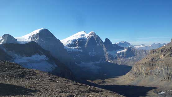
Looking into the “Black Hole” with the Twins sticking out behind
Looking back we could see smoke blowing in… Oh no…
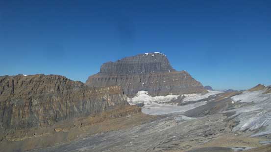
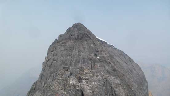
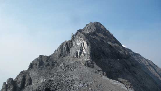
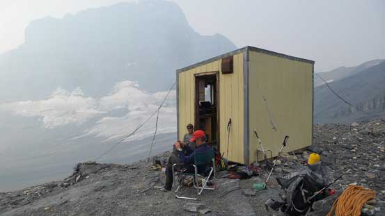
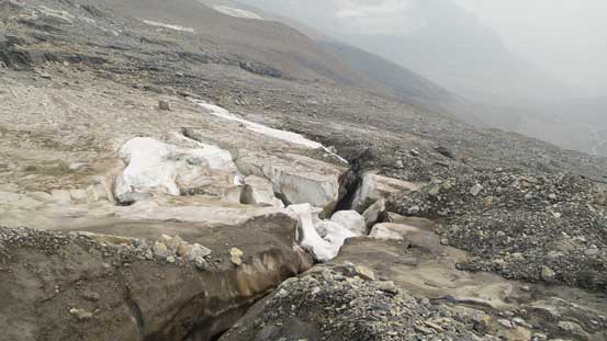
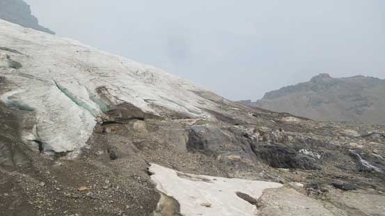
The sight was inspiring, intimidating but also exciting as we could see the whole route was next to bone dry. The chilly wind forced us to drop down the west side towards Lloyd MacKay (Alberta) Hut sooner than later, and sure enough we picked up a set of boot tracks heading down a permanent snowfield. There’s no track going outwards and the footprints were certainly made by mountaineering boots so things were not looking good, and then looking ahead we saw a couple climbers staring at us from the hut. We plodded towards the hut at a faster pace but the terrain required some great caution. Lots of rubble-on-slabs must be traversed in order to skirt around the glacier but even so we had to step on the rock-covered glacier briefly at places with crevasses to be aware of. The general route-finding was not a big deal but there’s considerable amount of up-and-downs involved. Near the hut we veered right and then ascended the dry ice (no crampons needed). Two climbers turned around because of the number of people, two just left for the Japanese Route and four were going up NE Ridge earlier this morning. A total of 10 climbers were gunning at the summit of Mt. Alberta on either Tuesday or Wednesday such that Robb and I were left speechless. We sat down outside the hut, discussed some strategies and all the possible scenarios and then I said let’s keep going.

Skirting on the edge of this glacier required lots of route-finding
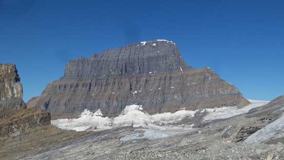
Here we go… East Face of Mt. Alberta in perhaps the driest condition in history
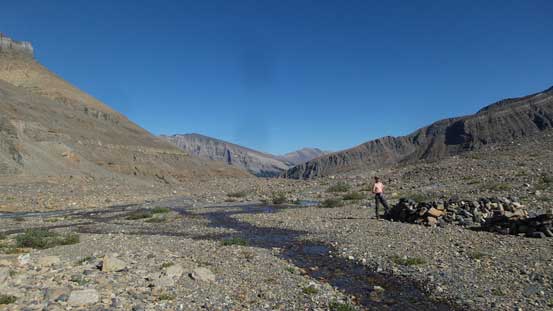
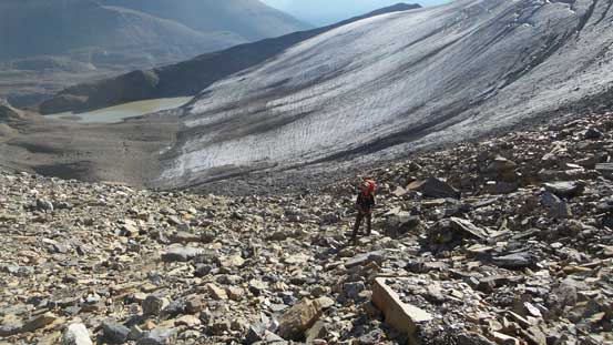
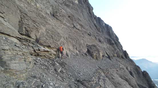
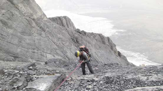
The 4 climbers on NE Ridge must make it down today and considering the seriousness of that route this is not guaranteed. The other party of two must either turn around, or work collaboratively with us. All 4 of us on Japanese Route must be OK with this group-of-four thing and if they said no then we had to wait for another day. We might have enough food for that but then we had to count on them being able to finish the climb in one day. We stopped talking now but kept plodding nonetheless. Finding a way down to the broad plateau involved some route-finding again, but roughly we followed the scramble route on Little Alberta sticking closer to the wall on down-climber’s left. We did not veer right until near the bottom. This added a bit of extra loss/regain but was the easiest in terms of route-finding. Plodding across the plateau was painful with all the up-and-downs but we did make a good progress. Another long break was taken at the what we thought to be the last water source. I loaded a full 2.5 L and then up we went.
Descending from the Hut. We had to lose a lot of elevation here.

This picture captures the elevation drop. Little Alberta is the steep wall on left

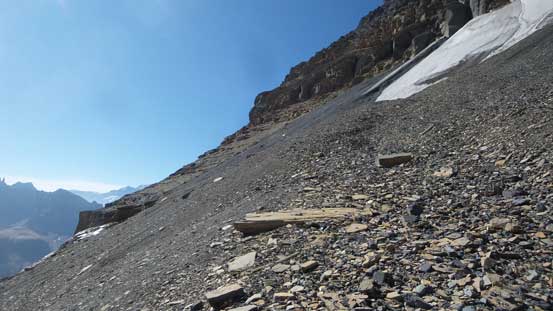
From the plateau we could spot the lower approach section
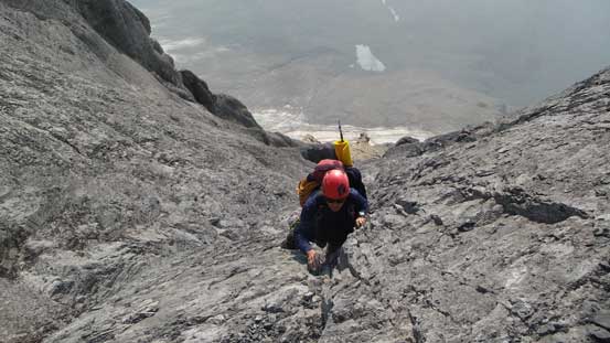
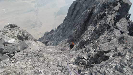
There’s one more water source about 100 m up the initial scree cone but we didn’t bother to stop this time. Beyond that the long leftwards traverse started and the terrain became increasingly ugly the further we went. The worst was a band of black rocks (covering glacial ice underneath). It’s either horrendously loose or compact hard which made lots of 4-letter words flying around. At least it’s just a matter of tediousness and once the ledge narrowed down the looseness eased off a little bit. We had come across a cairn with a pole sticking out so that’s good. And then we kept traversing a long ways due south before making sense to break through the short cliff band directly above us. I scrambled a section of 4th class egg shell while Robb detoured around and slogged up more loose scree. The next while plodding up the upper scree cone was not too bad initially but once the terrain forced us to trend climber’s left it’s becoming super shitty. We spotted a line of weaknesses directly above and went for it. The previous group’s footprints were spotted here so we knew it’d go, and indeed the gullies went at 3rd class at most, and the next thing we traversed about 50 m back right on the lower wide ledge to the “low bivy” where the other two were waiting for us.
Starting the lower scree cone
Tedious traverse…
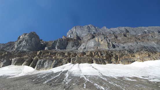
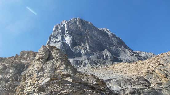
Does Mt. Alberta look any easier from the base? Not really…

Traversing this key ledge a long ways due south.

Then we found a break and ascended up a minor cliff band.
Now into the upper scree cone. Looking up.
Tired of the scree we opted for a 3rd class line to get onto the lower wide ledge
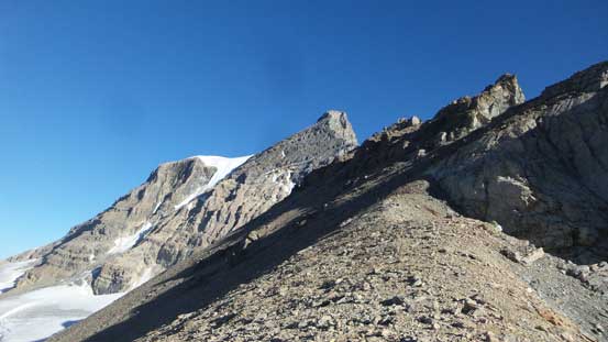
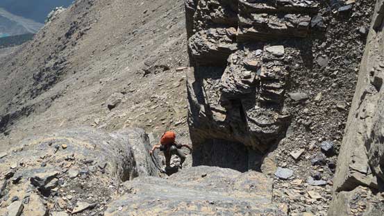
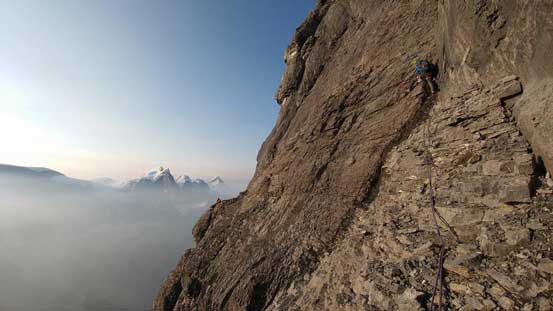
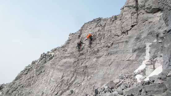
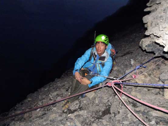
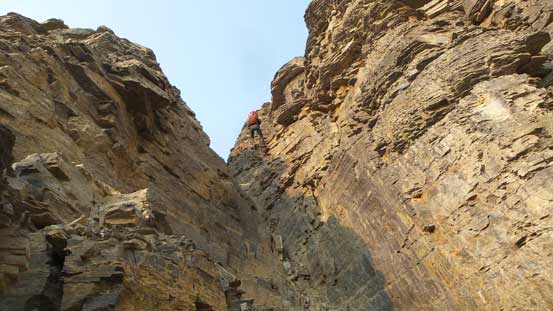
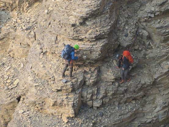
After a brief talk we recognized each other out that they were Blair Piggot and Jim Everard. I had never met them in person but sure had followed their trips for a while on Facebook. These guys climbed some pretty full-on stuffs dating back to Dave Stephen’s days and I’m pretty sure they had waited for this opportunity to climb Mt. Alberta for a decade. On top of that Blair and Jim had just made an attempt a week ago so they knew all the route on the lower part. This was such a relief that climbing in a group of 4 on Mt. Alberta you better be super confident on each other. The plan was to bivy on the upper ledge (high bivy), ascend in two rope teams of two close together and descend in a group of 4 and everyone agreed. Robb and I took off ascending towards the upper ledge with Jim and Blair following up about half an hour later. The scrambling was mostly 3rd class on yellow/brown choss steepening to 4th class towards the top. The rope was out soon then Robb led an easy, but loose gully to a terrain belay in a small notch. I then took over the lead climbing out of the notch on some 5.easy ground and then found the bolt anchor Ben talked about.
Starting the buttress/rib between the lower and upper traversing ledges
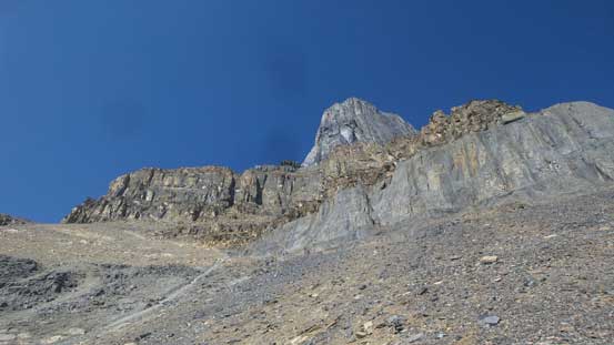
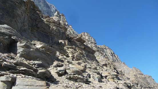
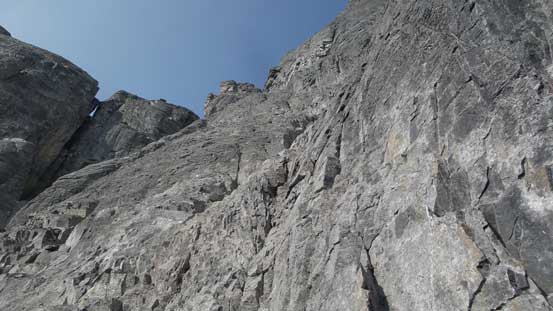
The upper black towers are super impressive

Robb scrambling up
We decided to pitch out the last 30 meters of this part. It looked hard
This is the upper traversing ledge.
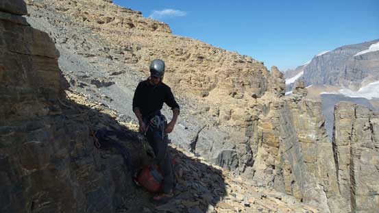
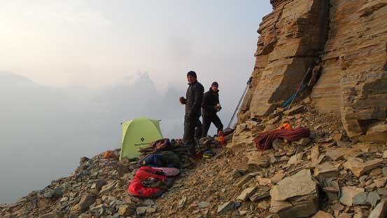
Traversing rightwards for another 50 m we made to the “high bivy” on this upper ledge. This site was pretty good and the “just-enough-room-for-4-people” quoted by Jeff Bullock was accurate. Robb and I set up the tent in the middle while Jim and Blair used their bivy sacks on each side. My door was literally less than a meter away from a drop-to-death but I guess it’s better than a portaledge, albeit less cool. An hour later Robb and I set off to scout the lower route out just as we planned. We did a long horizontal traverse across two bowls. Robb found a seep of water in the Japanese Gully while I scrambled up to find the start of the pitched climbing. We both achieved our goal but backed off shortly after thank to the rockfall. Pretty sure the NE Ridge party was rappelling. Back to camp we double-checked with Blair/Jim for the start of that route which seemed a bit off. I’m 100% sure I found where Ben/Ferenc started but after a while Blair kindly handed us their secret route topo. Problem solved that if you start way to the left there’s a variation to get rid off the 5.7 Elephant Asses crux pitch. Meanwhile the party of 4 ultra fast French guides came down. There came the eight of us crossing each other’s path on Japanese Route of Mt. Alberta on a weekday.
From our high bivy, looking back
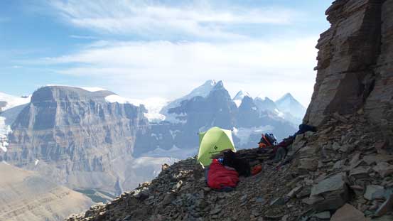
Tents are all set

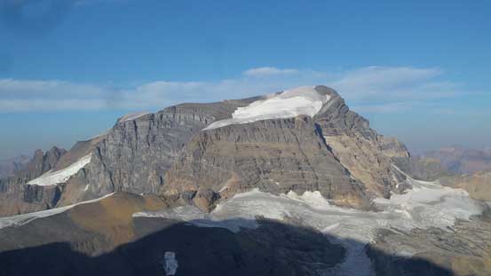
The Twins and Mt. Columbia – checked them all off a couple years ago.
Mt. Woolley from an unusual angle
Watching the French guides descending/running was inspiring to say the least. They surely made some of the worst Rockies terrain look like a walk in the park. The big good news for us was that 1. they did make down so we could go up the next morning. 2. absolutely dry conditions that no crampon/ice axe needed. The new inReach message (from Ben) confirmed that we still had at least two full days of window and freezing level would stay 4500m high. By this point I was finally confident that we’d make it. Sleep did not come very easily thank to the heat and the excitement. The alarm went off at 5 am and then it’s the summit day – the final exam day.
The 4 French dudes descending. I’ve labelled this part of the route too.
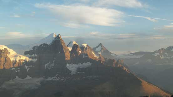
The Twins
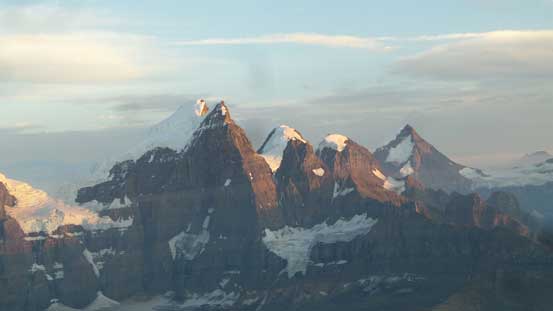
Evening alpenglow on the Twins. Money shot from this bivy site!

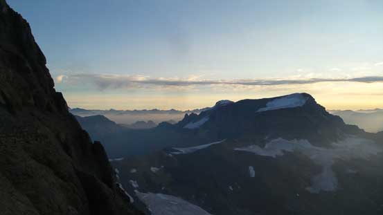
The north face of Stutfields is just as impressive, but nobody cares about
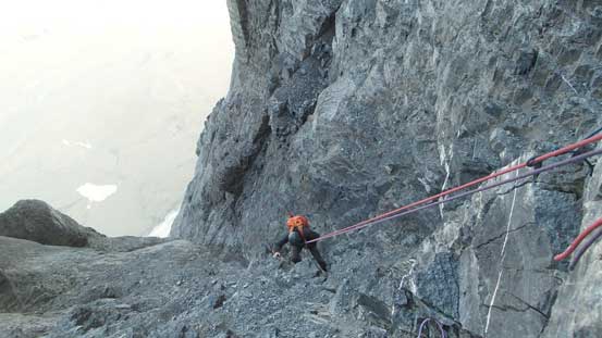
In a pitch dark Robb and I set off with the new beta provided by Jim and Blair. They would follow the same route, but starting about 20 minutes behind us. We traversed across the first bowl and then went straight up towards climber’s right side of the first buttress. The terrain was super shitty 3rd class steepening to 4th class near the base but we both managed to scramble through. The route-finding in micro-terrain did require some zig-zagging and backtracking but went by fairly fluently. At the base of the buttress we decided to pitch out and meanwhile wait for Blair and Jim to catch up. Once they were out of the fire zone Robb led a full pitch of 5.2 angling right up a series of shallow chimneys ending up on a ledge. I took over the lead continuing straight up the low-angled face which ran a full 60 m of 5.2 with a few trickier moves near the top. I found a couple cracks on the wide ledge above, built a trad anchor and belayed the boys up. Then it’s an easy, albeit super duper exposed traverse across a scree ledge rightwards to rejoin the normal route. These kind of traverses were best done with the assist of one pole (which I brought up just for that purpose).

Looking down from the top of Pitch 1
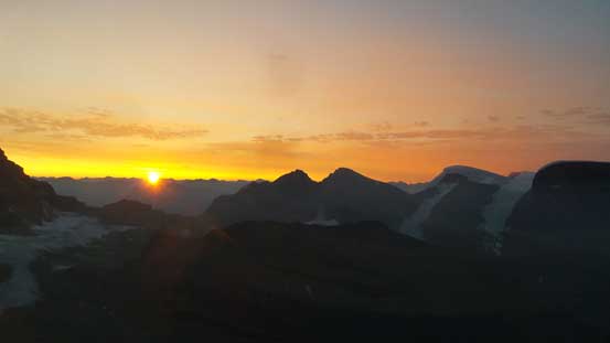
It’s sunrise time!
Jim coming up Pitch 2
Mt. Woolley and the morning horizon
Robb leading across the sketchy traverse to rejoin the routes above the Asses

Jim at the top of Pitch 2 belaying Blair up
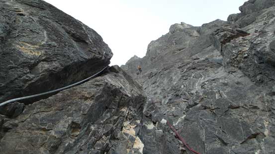
I spotted an anchor about 15 m up a corner and the terrain in between looked like low 5th class. In retrospect I should have gone way high up running a full 60 m swing but stopped at the intermediate anchor. Robb took over the lead into the main gully but then led across the gully to the right hand side. There’s a good anchor on the other side but I’m 100% sure that’s one of the rappelling stations, possibly a new one installed by Jeff Bullock. To correct this error I led a diagonal line traversing back across the gully overcoming a tricky, wet move in the middle. A brisk sized rock zipped right past me and almost got my head chopped off and then there came a whole series of rock fall which I dodged. We made across as quickly as possible and meanwhile Jim and Blair caught up on top of what’s supposed to be the 3rd pitch of climbing. The next pitch was Robb’s lead and ran about 40 m up. The terrain had become increasingly more difficult here mainly because of the down-sloping nature of the holds. I ran the 5th pitch which turned out to be the “middle crux” – a full 60 m swing, sustained 5th class pitch up a series of chimneys with a cruxy step about 2/3 of the way up. I knew it’s sustained when I started to run out of gears and had to pretty much solo the last 20 meters.
I ascended this short corner. Should have gone a full 60 m up, but oh well..

Can you spot Jim traversing the scree ledge?

Jim and the Twins
Me leading up the off-route correction pitch. Photo by Robb

Climb on. Photo by Blair

Climbing up Pitch 3. Chossy as typical.

Robb led the way up Pitch 4 out of sight
Jim leading Blair up Pitch 4 following me.
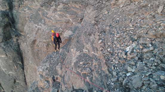
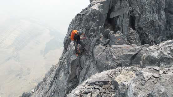
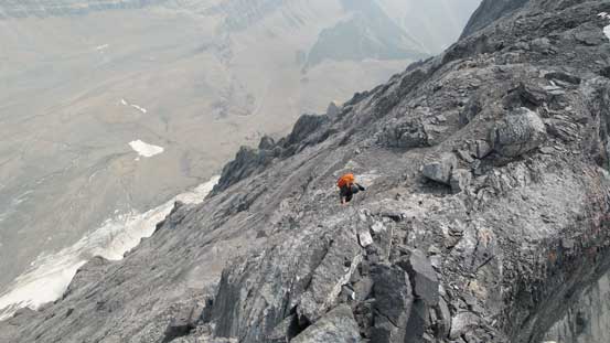
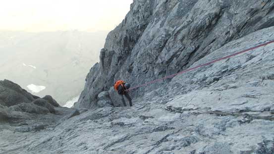
The top of this pitch was a wide scree ledge and offered a natural spot to take a break. Consulting with Blair’s topo we did a rightwards traverse along this ledge back into the gully. There’s a trickle of water which we greatly appreciated. The 6th pitch was probably the most dangerous as it ran directly up the fire zone. Robb probably had some previous dodge ball experience as I had no idea how he managed to lead and dodge at the same time. Seconding this pitch was nerve-wrecking to say the least as you never know when a basketball could come down chopping your head off… This pitch was also the critical one as it got us across the main gully to the right hand side. The top anchor is that infamous “white rope anchor” which I remembered from various sources. It was then my turn to lead the crux (7th) pitch. After about 5 m up I decided to don rock shoes thank to the slabby nature and then a full 60 m stretch of 5th class climbing. The crux 5.6 moves came at roughly halfway up and definitely deserves its grade. It took me a while to figure the sequence out but to be honest this is the only pitch of “enjoyable” climbing on the whole route. By “enjoyable” I mean a relative term. It’s still terrible thank to the pebbles-on-slabs and sparse protection.

Robb leading up the “cross-over/shooting gallery” pitch.

Blair starting up the gully

Another shot of Blair ascending this pitch of terror

Me starting up the crux pitch. Photo by Blair
From the top of crux pitch looking upwards.
It took a bit of time for everyone to don rock shoes but that just meant we got another much-needed food/water break. Once everybody caught up Robb took over the next run, diagonally up climber’s left back to the edge of the gully, then up a rib with a few strenuous moves but once the rope ran out he had to build a trad anchor to belay me up. Meanwhile Blair went for a more direct line which I thought was the better option. It turned out that Robb/I were still the faster team topping out so maybe it’s harder than it looked. From where Robb’s station was I led two consecutive short low 5th class pitches and then we were on the summit ridge. Jim and Blair was one pitch below us. Robb and I decided to go ahead, figuring out the route, scrambling as fast as we could to set up the notch rappel.

Jim climbing up the crux pitch.
Robb following me up the lower of the two short pitches near the summit ridge
Ascending this gully onto the summit ridge.
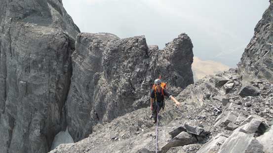
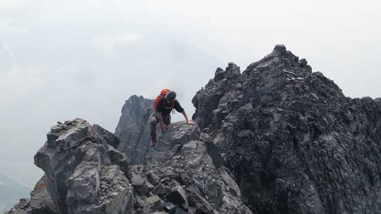
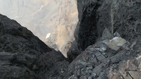
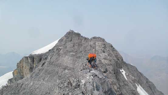
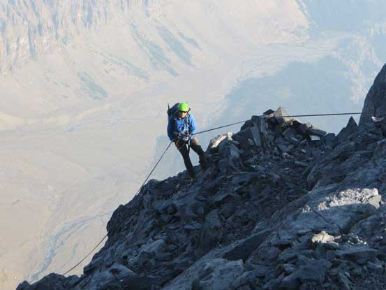
The summit ridge looked pretty intimidating but far better than the tedious climbing lower down. It’s pretty much just a “difficult scramble” albeit an ultra exposed one, especially whenever we had to detour to the sides. A couple steep steps had to be attacked on either side and all felt super committing (from scrambling perspective), but nothing went too crazy. One particularly steep step had a top anchor which we decided to rappel on the way back, and then there came the notch. Surprisingly there’s no anchor cord to be found but we did find a piton, backed up with a sling around choss bollard. Robb rapped into the notch first and then I followed, paying extra caution thank to the ridge nature so to not take a pendulum swing. Scrambling out of the notch looked nasty but actually not bad. A few 3rd class moves at the bottom and mostly about that.
There we go the summit ridge.
Typical, typical…
You have to be able to scramble this kind of terrain.
Talking about exposure…

One of the steeper steps.

Rappelling into the notch.
The west face from the notch is almost overhanging….
A series of pinnacles soon followed as we progressed towards the summit. This is where those money shots of “climbers on Mt. Alberta with the Twins behind” were taken from but then thank to the dry conditions we did not have to stay on the ridge. Dropping and around on the west side solved the problem and it’s just a loose scramble. The Twins were not visible neither thank to the thick layer of smoke so a bit of disappointment. However, the summit was soon reached. It’s hard to describe the feeling of reaching this summit. It felt more emotional than Mt. Robson for some reasons and now I understand why many climbers made here with tears in their eyes.
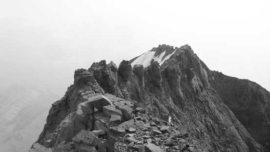
Looking back at the jagged pinnacles section. Too bad the Twins aren’t visible
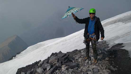
Me on the summit of Mt. Alberta. Rockies 11,000ers #45 /58
Other than taking the victory shots there’s minimal time to linger. We were doing good on time but still there’s not much extra time to kill. Jim and Blair were still on their way up but not too far from the summit. As Robb and I descending we past each other at those “jagged towers” section and then discussed some strategies. My task would be to find a permanent snow/ice patch and melt some water (since I got the stove). Robb would keep going down the ridge and set up that intermediate rappel anchor, as well as the first face rappel. Robb and I would take a rope away from Jim/Blair while they would disintegrate the notch anchor and we would all join each other at the top of the first face rappel. By the time Robb finished fixing the second face rappel anchor Jim and Blair were not far behind. I quickly ran my way down and then 15 minutes later everybody was down. The drag from pulling the rope had destroyed that perfect bivy corral and thankfully those microwaves did not fly onto us…
We past each other at this section.
Robb continuing down the ridge

Re-ascending out of the notch
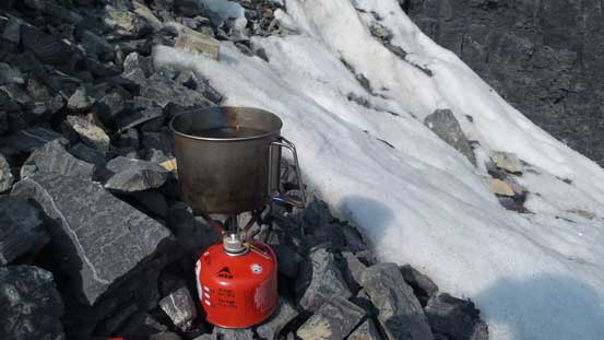
My job now was to melt at least 1 L of water from dirty ice…
Beautiful ridge though
This shot is very intimidating

Starting the first rappel down East Face
Me rapping off the top pitch. Photo by Blair
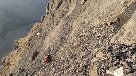
I led down the second rappel but since we did not use our exact ascent line I managed to drop down too far skier’s left hence missed the next anchor. The other three corrected this mistake and I’d start Rappel #3 from partway down by traversing a sketchy scree ledge and then cutting into the line. This worked well and the 4th rappel got us down the 5.6 crux pitch. The 5th rappel down the shooting gallery went without incidence and then it’s time to take another long break filling up our water bottles. Robb and Jim got that job done while Blair and I carried the rope rightwards along the scree ledge and then got the 6th rappel set up. This is the full 60 m pitch but the rappelling was easy thank to the steeper grade. The next one I led down diagonally aiming at skier’s right. I paid close attention this time and did not missed that anchor, and then on the 8th face rappel I went down connecting the previous short pitches into a full swing, exiting the main gully and back to above the “Elephant Asses”.
Down the crux pitch
This shot from below the crux pitch shows the infamous white rope
Robb dropping down the shooting gallery pitch of rappel

Very interesting anchor…
Blair leading down the “middle crux” pitch.

Me leading down the next rap. Photo by Jim E
It’s getting dark and in another 20 minutes would be head-lamp time. For the next couple rappels we would not follow our ascent line (since our 5.2 variation was secret and had not fixed anchors). Blair and Jim had made this far on their previous attempt and with Blair leading down in the dark we got the next two full 60-m rappel done fluently. We opted for an 11th rappel which got rid of some sketchy 4th class down-climbing. And then Blair and I went ahead traversing/descending sketchy 3rd/4th class terrain to figure the route out. My GPS unit came super duper handy and even though we did not ascend my previously scouted route that short trip paid off right now as we’d be descending that exact line. The correct traversing ledge back to camp was about 40 meters vertically below and getting their required lots of frustrating work but in another hour or two everybody made it down, and then back to camp. A full 18.5 hours day starting and finishing both in dark but we did manage to skip a forced bivouac. Not bad in a group of 4.

Tired yet? Lots of guess work and GPS navigation now.
Me waiting for my turn. Photo by Jim E
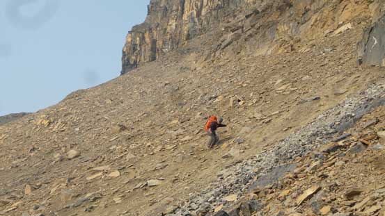
For some reasons probably the dehydration the sleep did not come easily at all. I had to skip a dinner as we were running very low on water and that was not very comfortable, but worked nonetheless. The next morning we got going at sunrise with Robb and I about half an hour ahead of Blair and Jim. We did two rappels using a single 60 m rope down the 4th class choss. Given the tired legs and the heavy packs it just didn’t feel right to down-climb anything overly sketchy. Then more 3rd class choss later we made down to the lower ledge. A long rightwards side-hill bashing we opted to traverse all the way to the top of “scree cone” avoiding down-climbing more 3rd class terrain. At this point I wanted to keep things simple even though it’s more arduous. Descending the scree cone trending a hell of way skier’s left required traversing some long sections of compact hard moraine type of ground and that sucked. Traversing the lowest scree ledge and the back across the black choss bend, onto the rock-covered glacier and then another 20 minutes later we were off this sketchy mountain. One vertical mile of choss pile with hardly anything aesthetic.

Super smoky sunrise on Day 4
Time to head down
Rappelling the approach
A sketchy traverse after the rappel. Photo by Blair

Descending the rib

It never ends

Traversing…
More traversing… Very bad terrain here.
Off the mountain now, looking up
This section of black rocks were horrible
We took a mandatory break and I had to make up for that missed dinner. Blair and Jim past us and then another half an hour later Robb and I started the long trudge back to Lloyd MacKay (Alberta) Hut. Plodding back across the plateau was fine but re-ascending back to the hut felt like a pure slog. The hut stay was short thank to again, the lack of water and then there came that undulating back skirting the edge of Woolley’s south glacier. It was painful to say the least but at least the final slog back to Woolley Shoulder was mostly on a path. Descending down to Woolley Creek bivy was terribly bad again with the first half on choss and the second half on nothing but Rockies rubble-fuck. Eventually I got so frustrated that I just went ahead, got down as fast as I could and then got the tent set up. Nobody had any desire to push out on Day 4 so that’s about it. The views were extremely smoky that we could barely see Woolley/Diadem from this bivy. There’s no way to tell whether it’s cloudy, or smokey or whatsoever.

Slogging back up to Alberta Hut
Relaxing a bit in the hut

Walking down ice
Strictly speaking you have to step onto this glacier. Just a rock-covered glacier…
Picking a line
Descending from Woolley Shoulder. It’s a long process down…
The only problem for not going out on Day 4 was my lack of food. I rarely bring more than necessary food on these kinds of trips that if it was planned to be a 3.5 days then that means I’d only have 3.5 days of food. Thankfully Robb had a whole lot of extras so with an added dinner problem was solved. The sleep again, did not come easily probably because I was too stoked and excited. I ended up listening to hours and hours of music and eventually past out after 1 am. The descent down Woolley Creek on 5th day was uneventful and actually didn’t feel that bad, although then there came the sting in the tail. The Sunwapta River was apparently very angry at us for knocking Mt. Alberta off on the first try. The volume was much higher than on our way in and even the first channel was mid-thigh deep. By the time we reached the main channel – a full 30 m wide, fast flowing brown water with no bottom to be see, I had lost all of the confidence. I thought we were seriously fucked but upon closer examination it was actually not that bad. Robb had a wader and went ahead to scout things out. A couple long zig-zags inside the channel solved the problem.
Heading out on Day 5
Navigating a field of avalanche debris
The first channel of Sunwapta River

The main channel….
Walking towards my car I was glad to have not seen smashed glasses, but then there came a sheet of paper on my windshield. “Fuck me no way”, I thought after years and years it’s finally my turn having to pay a ticket for not obtaining a bivy permit or park pass or sorts like that, but then it’s not. A congratulation note from Ben so what a surprise was that. It’s a Friday and it’s starting to rain which had put tourists at bay so the drive back to Canmore was not very bad. The rest of the day I pushed on all the way back to Merritt and then resumed the rest of the drive back home on the 7th day of this trip, feeling ironically sad that this awesome trip was finally coming to an end.
Without my partner, Robb Schnell and the other team – Jim Everard and Blair Piggot’s excellent team work spirits there’s no way Mt. Alberta could happen. All four of us contributed to the team and worked together and then the project was a huge success. It went pretty much as planned with no delay or whatsoever. I have to also thank the 3rd team for sacrificing their own desires and turning around as a group of 6 there’d be no way, and also the fast process of the NE Ridge team-of-four making the summit and back to hut in one day. The inReach messages from Ben provided valuable weather updates as in a trip of 5 days on the edge of Columbia Icefield you just never know what the weather was going to do. Overall would I recommend the Japanese Route of Mt. Alberta as a climb? Fuck no… It’s a terribly dangerous route with a shit ton load of objective hazards and unless you like dodge ball game then don’t even bother to consider. However, if you are a bold, single-minded, top-notch Rockies scrambler wishing to push the limit then Mt. Alberta is not just a dream. To put in short, an excellent scrambler with mountaineering skills you can have a good shot on it. Rock climbers with terrible scrambling skills they don’t even have a chance.
Thank to the lack of beta I decide to attach a detailed topo and a pitch-to-pitch analysis for this climb. Keep in mind what I’m writing down here is the route we took, and I know for sure Ben/Ferenc started further to the right, Jeff Bullock’s team started even further right, and the Smileys started even further and had to cut back left. There’re many ways and given the amount of anchors this justified that so don’t just blindly follow our route.
The Approach:
- Ascend the scree cone at the bottom and then traverse diagonally up leftwards. You’ll cross a very bad band of black choss. You stop gaining height upon reaching the bottom of the first band of cliffs.
- Traverse horizontally out to the left. You want to traverse far enough to below the upper scree cone.
- Either break the band (3rd/4th class), or keep contouring until you can gain the scree cone.
- Slog up the scree cone.
- Then either ascend a broad gully feature (3rd/4th class), or ascend to the top of this scree cone (very tedious)
- Traverse right on the lower of the two wide scree ledges. You want to traverse a long ways due right, around a broad corner with a good set of bivy corrals.
- Then trend back left. It’s not a “gully”. You climb up face and ledges, climber’s right of the “rib”. Terrain should not exceed 3rd class for a long while.
- Trending left on this rib and terrain soon becomes 4th class. And then you are close to the edge.
- Once it becomes climbing, take a narrow ledge rightwards, horizontally out for about 20 meters into a narrow chimney/couloir. Then ascend this chimney to a “hidden” notch. Ascend out of the notch on the uphill side and continue up for 15 meters to an anchor with a bolt. Most parties would want belayed climbing here.
- Traverse right on the upper scree ledge for 50 m to the set of bivy corrals.

Route topo of the approach section.
The Climb:
- Traverse horizontally right across one major bowl.
- Upon reaching the first “rib”, scramble up loose 3rd steepening to 4th class aiming at the base of the black buttresses above. The terrain is horrible, but not technical.
- Find a belay station at the base of a steep cliff.
- P1: Ascend a full 60 m pitch trending rightwards up chimneys and ledges. Need to build a trad anchor. (5.2)
- P2: Ascend another full 60 m pitch straight up, on faces and chimneys. Need to build another trad anchor. (5.2)
- Traverse right on a horizontal scree ledge. Ultra exposed.
- P3: Ascend a left-facing corner then cut right into the main gully, then stick to the left wall, diagonally up on good ledges and face holds. Full 60 swing or break it down into two pitches. (5.3)
- P4: Ascend the left wall of the main gully, initially trending right then straight up. Holds gradually becoming down-sloping. About 40 m. (5.4)
- P5: Crux #1. Move left a bit, then ascend straight up a series of chimneys and ledges. This pitch brings you a bit away from the main gully on the left wall. A sustained pitch of climbing with one cruxy step (felt 5.6 on boots) about 2/3 of the way up (5.4)
- Traverse right on a horizontal scree ledge into the main gully.
- P6: “The crossing-over”. Either climb up just to the left of the fall line or straight up in the gully. Wet. Then ascend the left side on loose holds, crossing over to the right and find an anchor with a “thick white rope”. Most dangerous pitch on our route. (5.4)
- P7: The Crux. Switch to rock shoes then climb up slabs and sometimes pebbles-on-slabs. A full 60 m swing straight up. Two fixed pitons for intermediate pros. (5.6)
- P8: Move left a bit then up ribs or ledges. A full swing of 60 m then build a trad anchor. (5.4)
- P9: Continue straight up and hit the summit ridge, onto west face then up a step, then move right (east) again, traverse a short ledge to an anchor (5.3)
- P10: Ascend a short, easy gully feature back onto the summit ridge (5.3)
- Traverse the summit ridge, stay mostly on the crest but a couple steps requires detouring. Rap into the notch, leave one rope there for return. Then tag the summit.

Route topo of the climbing section
The Descent:
- Reverse the summit ridge with maybe one or two rappels.
- Rap 1: Do not go down the gully you came up. Instead go down the ridge/rib straight down east face. Basically rap over the wall of bivy corral.
- Rap 2: A shorter one. Rap to down-climber’s right and keep going down-climber’s right. This should bring you down to the top anchor of that crux 5.6 pitch. Take great care to not miss it…
- Rap 3: Down the crux pitch.
- Rap 4: Down the shooting gallery/”Cross-over” pitch to a wide scree ledge. Then traverse right along the ledge.
- Rap 5: Down the “sustained 5.4 pitch”. Full 60 m.
- Rap 6: A shorter one. Down and then trend skier’s right making sure to not miss the anchor. (Reverse P4)
- Rap 7: Diagonally down along the wall, onto a platform, cross over further skier’s right then down the corner to the start of P3. A full 60 m swing.
- Traverse along the scree ledge for about 20 m to find a big rock anchor.
- Rap 8: A full 60 down. Mostly on the fall line but a little bit skier’s left. Find another big rock anchor.
- Rap 9: Another full pitch down mostly on the fall line. Find the “chockstone anchor with a red sling”, left of an Elephant Ass.
- Rap 10 (optional): Keep going down the 4th class terrain, for as far as you want.
- Rap 11 (optional): Keep going down.
- Down-scramble/traverse back to where the correct elevation is for your bivy (GPS handy). Then traverse back to bivy.
- Descending the approach might require at least 1 additional rappel if not two. Lower down recommend you to reverse your ascent line unless you have tendency of back-tracking and wondering on shitty terrain.
