Pika Peak
August 22, 2017
2536m
Meager Creek / Lillooet South FSR, BC
On the very far northern edge of Pemberton Icefield sits a small summit officially named Pika Peak. This peak is so insignificant that it only has 66 m prominence such that in some areas like Washington state it doesn’t even qualify to be a peak. The concept of prominence hasn’t caught up here on the Canadian community so nobody really cares about those numerical stats, myself included. This peak does look somewhat impressive from the north side as it rises a shear 2000 m above the confluence of Meager Creek and Lillooet River. The most obvious access is by a direct bushwhack up the broad, forested NW Ridge but one can also take a bush-free, but contrived approach from Harrison Hut. The plan between Adam (Gimplator) and myself was to ascend the latter but descend the former making a supreme peak-bagging loop combo, and this was already the last peak of this trip.
Overseer et al. around Harrison Hut. GPX DL
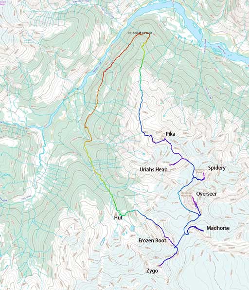
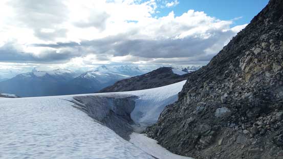
Earlier in this day we had already finished off Overseer, Spidery and then Uriah’s Heap. It seemed problematic to do a direct ridge traverse to Pika Peak but the glaciers around offer some alternative paths. The plan was to stay on the edge of the glaciers and bypass at least one bump along the way. The descent on that glacier was easy in general but did involve stepping across multiple crevasses. And then we got too low down and had to backtrack. Onto rock we traversed a loose and narrow ledge to cut off some elevation and then we were down at Pika/Uriah’s Heap saddle. From there we stayed on easy ledges and plateaus and no problem reaching the summit of Pika Peak.
Descending the glacier north of Uriah’s Heap
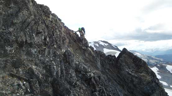
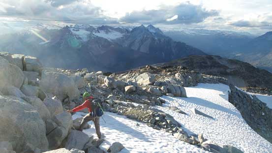
Adam carefully negotiating this section. Lots of probing had to be done
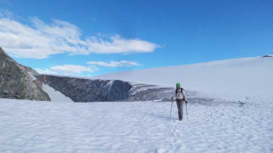
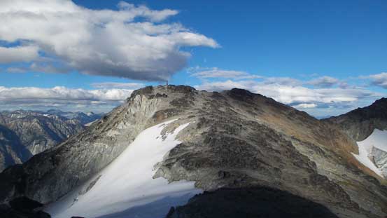
Pika Peak ahead

Looking down the glacier into the upper Meager Creek valley
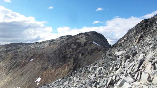
This short traverse is exposed and loose
Cresting the ridge again, now looking across Lillooet River into the north side

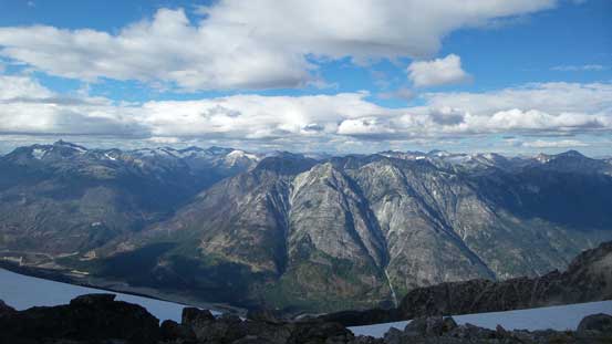
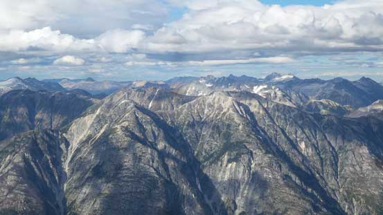
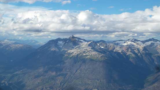
Summit Panorama from Pika Peak. Click to view large size.

Looking down the Lillooet River Valley
Sugus et al. in foreground with Mt. Thiassi and Mt. Vayu behind on the horizon

Mt. Ethelweard is that big one on the skyline
Mt. Athelstan stands out no matter how you look at it
It appeared like the weather had collapsed. The sky had turned almost completely overcast and the chilly wind picked up. We had about 2 or 3 hours of daylight time left. There’s no way to descend all the way back to parking lot before dark but none of us wanted to camp in rain and then deal with the wet bushwhacking the following morning. The agreement was to push all the way down even that meant descending a steep, unknown forest in dark. Well, now the clock’s ticking and we had to speed up. Up and over a subsidiary bump saw us merging onto the broad NW Ridge. The upper portion of this ridge involves lots of steps and ledges and generally, moderate route-finding throughout.

Time to head down
Pika Peak from the subsidiary bump to the west

Uriah’s Heap is heavily glaciated on the north side
Working our way down the broad NW Ridge, slowly and steadily
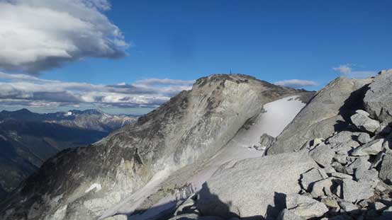
Another review shot of Pika Peak. It does look like a peak from this side
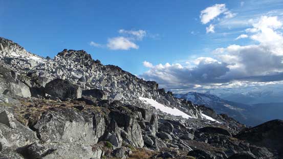
The typical terrain on the upper NW Ridge

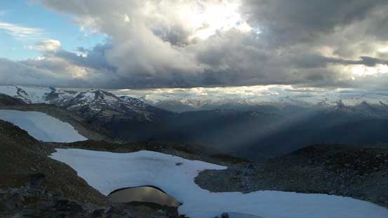
Very cool lighting into the upper Meager Creek valley

Plinth Peak et al. on Mt. Meager massif
There’s a 2300-meter bump along the way that we had to make a decision as how to attack it. Going directly up and over required the least amount of brain power but would involve a substantial elevation regain. We opted to bypass it on the west side but then the micro-terrain also forced us to do lots of up-and-downs so in the end I don’t think we had saved too much time. And then the terrain’s getting steeper and steeper. There’s one stretch where we managed to utilize snow but then the snow ran out and we had to descend the granite ledges and boulders. More route-finding involved to get down to treeline. The sun was already down below the horizon and we didn’t have much time left.
Another shot of the cool lighting

Down, down and down…

It’s obvious we were running out of daylight time…
Into the bush the forested travel was pretty straightforward for a while. We did not stay on the exact ridge crest and instead, the terrain funnelled us into some gullies feature. These gullies led us slightly trending down-climber’s right for a long time. Eventually I checked the GPS and realized we had to bail the gully and get back onto the broad ridge crest. So far, so good. The next stage was negotiating a section of flat ridge which was done purely by GPS navigation. The micro-terrain did confuse me as I actually led us doing a circle without actually relizing that, but we did sort the confusion out and then we were looking down at the final section. The last part of this forested ridge appeared very steep on the topo lines and it sure was. Lots of vege belays, guess work, swearing and then down-climbing one troublesome rock band later saw the grade eased off again, and then we were back to the trail. The GPS showed we were actually east of where we started so this must have been the “old trail”. Traversing this stretch of trail back to the parking lot was not very fun neither with lots of up-and-downs and some very boggy sections, but we did manage to get back before 11 pm. We were completely beat so we just car-camped at the trail-head for another night.
The next morning we woke up around sunrise. The sky had turned completely overcast but the rain did hold off. Driving down the spur road was kinda fun actually as we could see the views down into the Lillooet River Valley. Once down to the main Lillooet South FSR it’s just a long, but bumpy ride back to Pemberton, and then back home. A great trip overall but now the weather’s looking golden again so let’s plan the next adventure.
