Bald Eagle Peak (Squaw’s Tit)
June 24, 2012
2500m
Canmore, AB
As of 2021 the name of this peak had been officially renamed as Bald Eagle Peak and as you all know I’m a big fan of official names so I’ll go with the new name for now, but I’m too lazy to go down and change all the names in the trip report. The trip was done in 2012 and at the time, there was only one name for this peak, that was “Squaw’s Tit” so the report should also reflect the background of that time.
I wasn’t expecting to do another ascent after finishing Pigeon Mountain in the morning, so I drove back to Canmore, and refilled energy with a large fries in MacDonald. I sat beside the west facing window, eating while keeping an eye on the familiar mountains. After a quick shower, the sky cleared, totally cleared… That was something I didn’t expect. Quickly finishing the lunch, I soon drove to the Info Center, and the weather forecast still called for cloudy with thunder showers… I totally ignored the forecast and my logic was, even just doing a hike was better than staying in MacDonald wasting time. Squaw’s Tit came across my mind instantaneously. This politically incorrect name is a nickname of one of Mt. Charles Stewart’s outliers and appears like a nipple viewing from Canmore. The standard route is described as a “moderate scramble” in Alan Kane’s Scrambles in the Canadian Rockies.
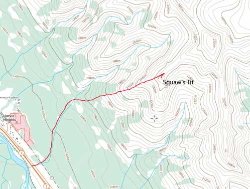
Squaw’s Tit standard scramble route
Starting at Harvie Heights, I soon found a trail system leading uphill. I followed the signed Tibits Quarry Trail to the end, crossed the drainage, and started the bushwhacking. There was supposed to be a trail, or precisely, a beaten path, but I was too lazy to try finding it. The bush wasn’t too thick neither. With good attitude, I soon reached the treeline.. The weather still held nicely and it was only getting better. From here to the top of the triangle shaped base (the start of the ridge) was quite a bit tedious due to scree. I tried to use the solid slab for as much as I could. Once on the ridge, I was surprised by how much of hands-on scrambling involved. However, nothing too exposed nor difficult. There was just one spot of smooth slab with exposure and no good holds. I would rate this step a “difficult scramble” and everything else “moderate”.
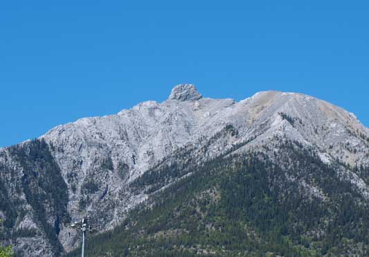
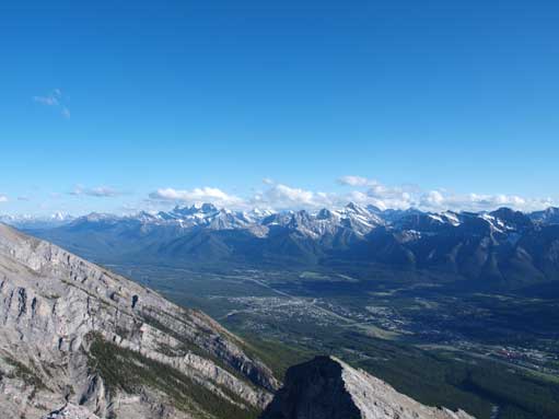
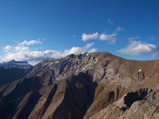
Squaw’s Tit seen from Canmore Info Center
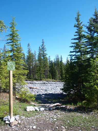
The signed trail ends here. I crossed the creek and soon started bushwhacking
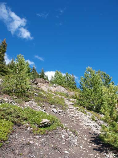
I regained a path further up, and followed it to treeline
Looking back towards Canmore from treeline
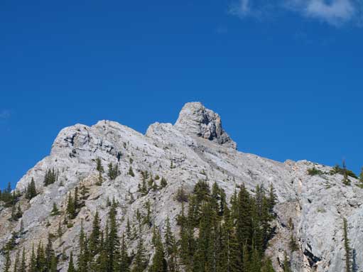
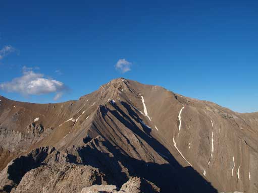
Looking towards the summit nipple. The route goes up left skyline
Looking down at a slabby section with exposure
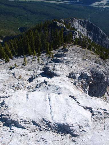
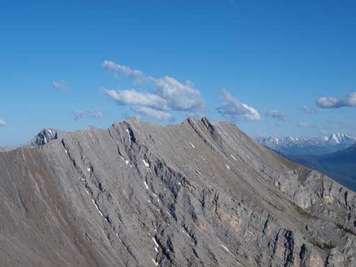
Typical view on the ridge
It didn’t take me long to arrive at the base traverse below the summit nipple. Thankfully it was bone dry, and imposed no difficulty to me. After 2 hours and 20 minutes leaving the car, I was standing on the summit of Squaw’s Tit, looking towards the impressive west face of Mount Charles Stewart. I wonder if there is a scramble route up.. I stayed on the summit for about 15 min soaking in the views and regaining my energy.

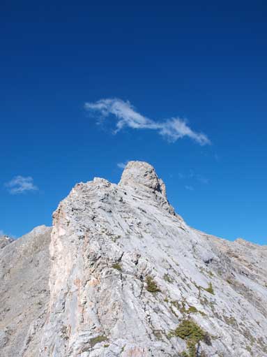
This is the summit nipple

Traverse on climber’s left. It’s not as steep as it looks in this photo
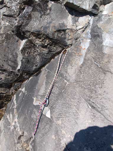
Some folks needed rope for this part. I guess they encountered wet condition.

Terrain was a bit loose. Series of ledges led me up the backside of this tit
Mount Lady MacDonald

Mount Lougheed
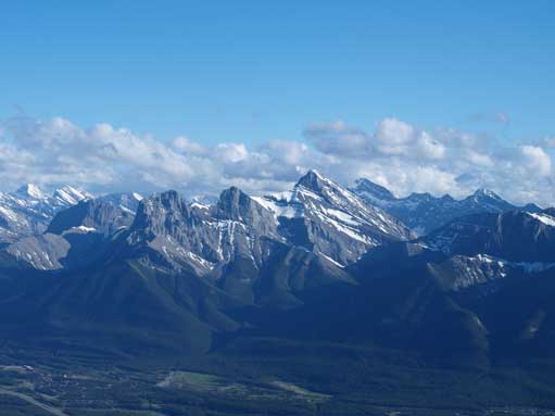
Three Sisters
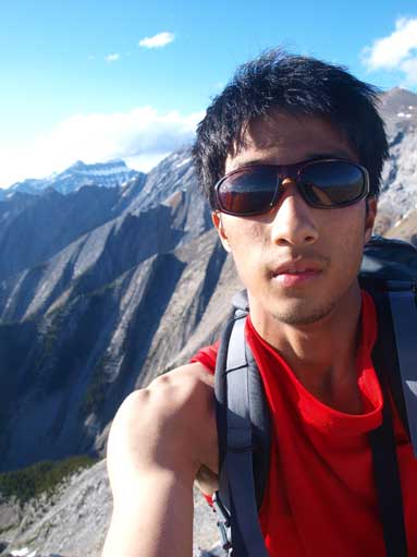
Me on the summit

My entry
Mount Charles Stewart
Mount Charles Stewart South
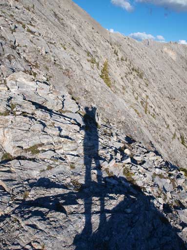
My long shadow
On the way down, I enjoyed watching near-sunset over the Banff skyline (towards NE) at the treeline. Further down, I stayed more towards skier’s right for better scree run, and even found a trail leading down. This trail ended in the drainage with high flow. Except for doing a tens of crossings, there was no real difficulty, but I still got one of the boots wet…
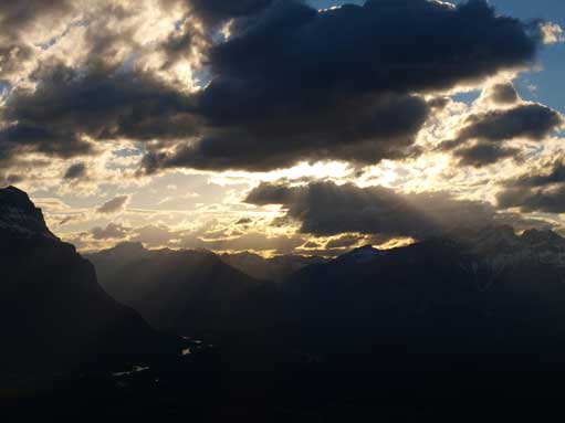
A near-sunset
The forecast for the following day wasn’t looking too promising, but I still had lots of energy to kill. The forecast was proven to be totally wrong on this ascent so I was hoping for the same trend for the next day…

hey Steven. I tried to find a place to email you privately about this, but I don’t see one.
Being “too lazy to go down and change all the names in the trip report” – when the name is *this* derogatory – isn’t good enough. this is a great example of an action you can actually *do* in the vein of reconciliation (and gosh it’s pretty minor in the grand scope of things…!?). please change the name, don’t continue to use it in any way. perhaps mention that it previously had a tremendously racist and disrespectful name that you are respectfully not going to continue to reprint. don’t hide behind, “the report should also reflect the background of that time.” no, we don’t need to use that name. you are not a lazy person, you can figure out a way to refer to a peak having a previous name that is not ok to continue using.
i know you can do better and I support you in your journey.
You are right that I can definitely include a bit of the history and link something in and why it’s changed. I’ll find out in a bit.
We do need to discontinue the using, but it’s not needed to completely erase that old name from the searching engine, nor is that possible given that it’s printed out and written in all of the Kane’s 2nd edition guidebook and been stuck as “the name” of that peak for 30+ years. People do however can learn about the history and why it’s offending etc. and use this as an learning example.
[…] Steven Song – Bald Eagle Peak […]
[…] Steven Song – Bald Eagle Peak […]