Mount Haffner
January 5, 2013
2534m
Kootenay National Park, BC
Mt. Haffner is one of the objectives that can be relatively easily done in winter without too much of an avalanche concern. It’s well documented in Andrew Nugara’s Snowshoeing in the Canadian Rockies and my initial interest came from reading that book too. Its higher neighbour, Vermilion Peak, is also doable in winter but is much more serious with a complex traverse along its corniced summit ridge. Grant and I felt adventurous and decided to combine these two to make a long day.
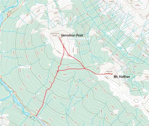
Vermilion Peak and Mt. Haffner winter ascent route
We dropped down to Vermillion/Haffner col after summitting Vermilion Peak. Thank the skier group (Vern, Eric, Kevin P and Kevin B) for breaking trail for us and we could just use their tracks. Mt. Haffner is very easy compared to Vermillion Peak. Near treeline, I noticed three of them coming down. None of us had seen Kevin P at this point and we all started to get worried… We took off snowshoes fairly early but then we were punished by some unexpected post-holing. Sugary snow wasn’t pleasant to go up, but with positive attitude, we both made to the summit. There were high clouds rolling in from west, but they did create some variation on the views.
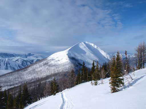
Vermilion Peak seen from slope on Mount Haffner
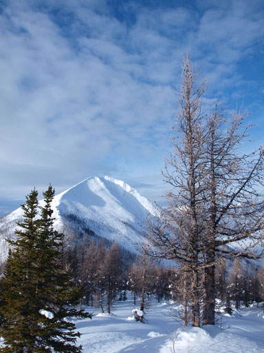
Vermilion Peak and a neat tree

What a neat slope. Wish I have skis on!

The upper slope of Mount Haffner
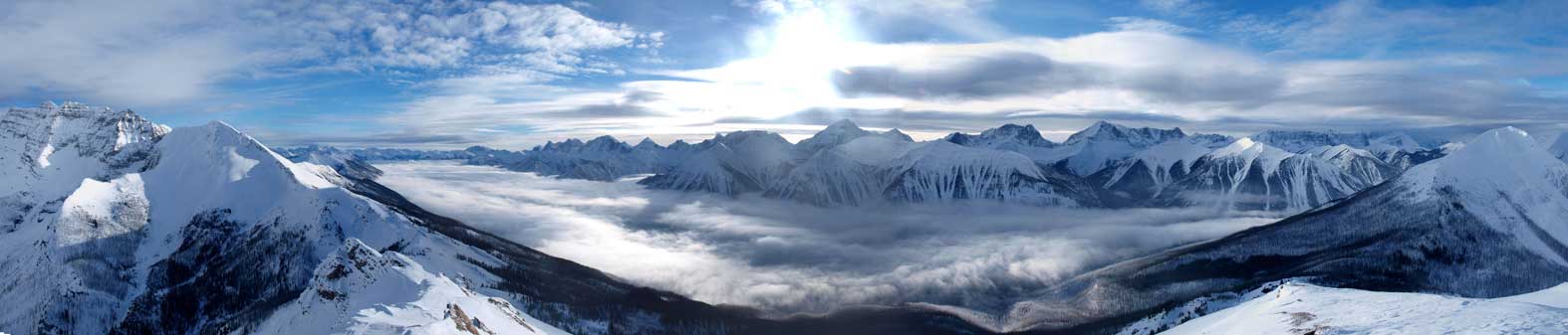
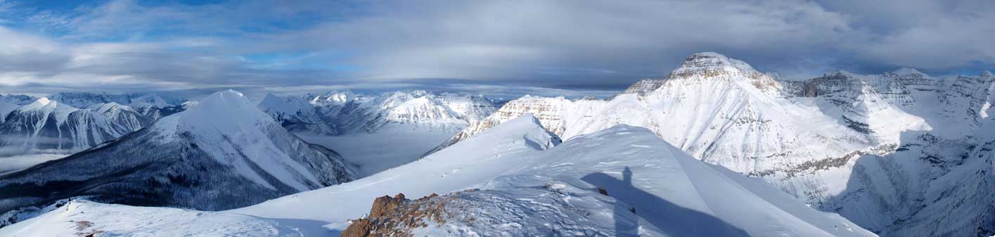
Summit view looking south and west. Click to view large size.
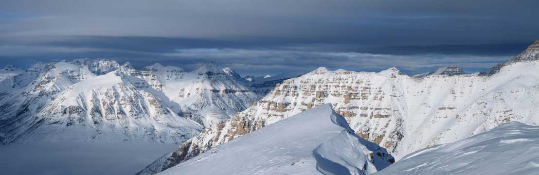
Summit view looking north and east. Click to view large size.
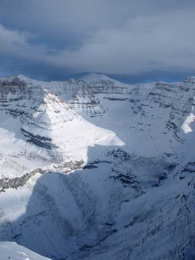
Interesting rock formation in this area. Mount Whymper at center

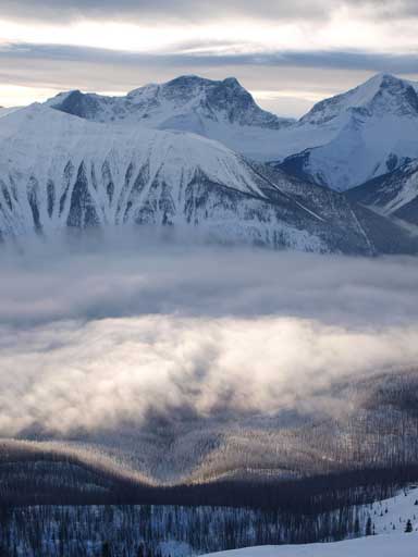
What a beautiful inversion over Vermillion River Valley

Stanley Peak
Mount Ball
Foster Peak
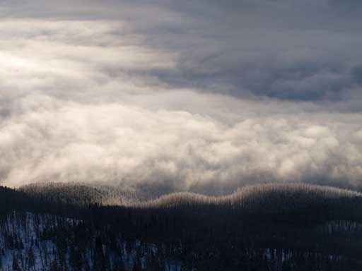
Looking down towards the low clouds
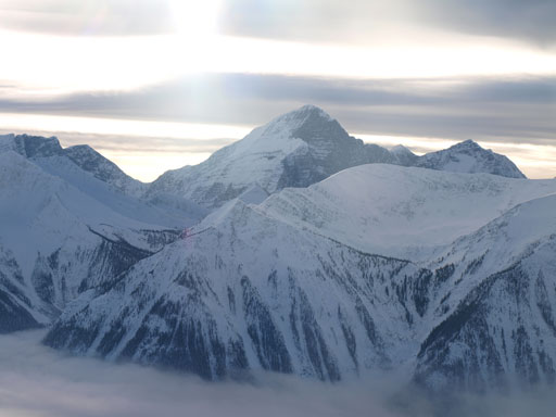
Hewitt Peak rises behind Vermilion River Valley
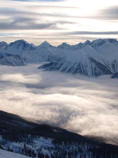
Peaks on the skyline includes Mount Verendrye and Floe Peak
The broad Vermilion River Valley. What a neat inversion!

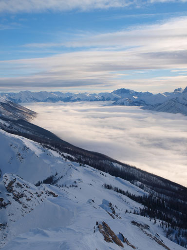
Peaks on the south end of Rockwall Range
Again, we were running a bit late so didn’t stay on the summit and immediately focused on the descent. Instead of retracing our snowshoe tracks, we descended diagonally towards skier’s right from Vermilion/Haffner col, and eventually joined our up tracks. Grant’s snowshoes were too small and he constantly fell in the weak spots to his waist. He also didn’t have snow baskets on the hiking poles so he had to follow our uptracks down (less sinking but awkward). I could just plunge down the powder and that was also easier on the knees. Lower down the slope, the little trees created some problems to us. Both of us constantly fell into weak spots and thus post-holed to waist deep. We still had enough of daylight time so we decided to take our time and descend our uptracks, and eventually made back to car.

Time to descend
The clouds still hadn’t lifted up yet

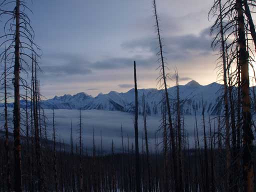
Neat view through the burnt forest on the descent
Overall, it was a very satisfying trip. I would never think about succeeding both Vermilion and Haffner in early January, on the 4th day in a roll of intense snowshoeing, but this day I did it!
