Wasson Peak
March 21, 2017
1429m
Tucson / Saguaro National Park, AZ
Wasson Peak is a popular objective in the west unit of Saguaro National Park west of the city of Tucson. It’s also known as the highest peak in the range of Tucson Mountains and the summit offers an unobstructed 360-degree panorama of the surrounding Sonoran Desert landscape. This might not seem as famed as taller peaks such as Mt. Wrightson but equally worth a visit IMHO. The standard ascent route is via the well-maintained Wasson Peak trail which ascends through King Canyon, and then loops back via Gould Mine.
This was my last day in the Tucson area and I wasn’t particularly keen on pushing hard. The hot weather, the fact I had to drive northwards to Phoenix and the temptation of sleeping in saw me locking my objective on Wasson Peak. The elevation and mileage suggested it as a reasonable half-day outing. In the morning I slept in till whenever I wanted, leisurely checked out and then went for a nearby McDonalds for some food. It was already 9:30 am when I eventually started the hike and needless to say the sun was already beating down mercilessly.
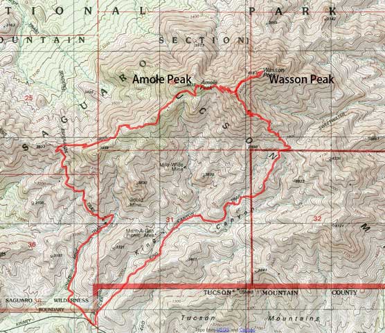
Wasson Peak and Amole Peak hiking route. GPX DL
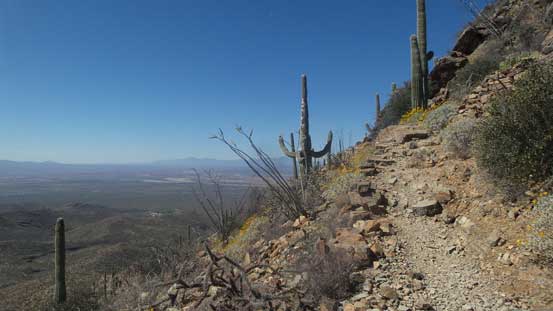
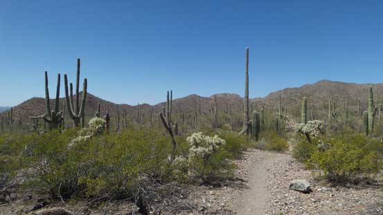
One thing that makes this peak stands out is the endless Sonoran Desert scenery with saguaros everywhere anywhere. Eventually I got tired out taking those pictures so just went on. The plod through King Canyon seemed like quite a drag but mostly due to the temperature. The bulk part of the elevation gain didn’t start until a couple miles into the trip when the trail ascends out of King Canyon towards a high saddle where it’ll meet Sweetwater Trail. I took a long break just above the saddle as I was seriously running out of energy in this heat. Most others hikers were coming down already suggesting I should have started a couple hours earlier.

Starting up the King Canyon trail

As typical as the views get from here
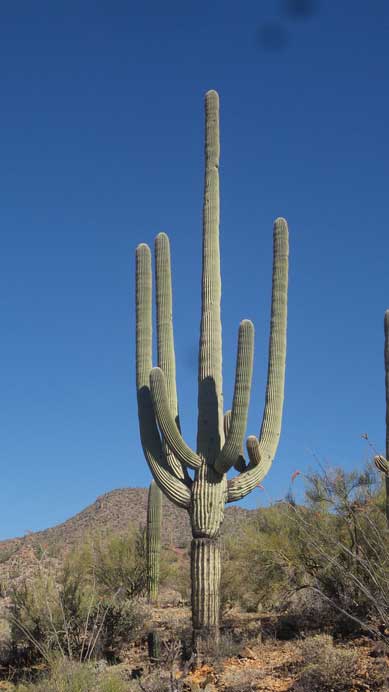
Saguaro
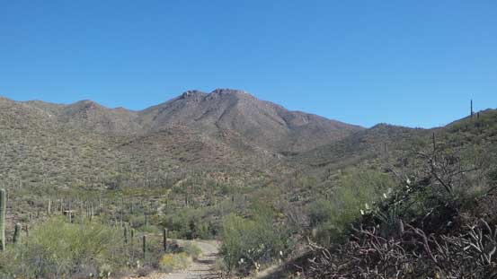
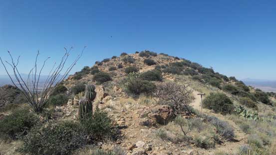
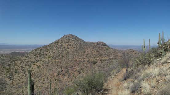
My objective – Wasson Peak ahead

Hiking through a dry wash area

Lots of desert species

Flowers and saguaros

More flowers. It’s blossom season here!

You don’t want to touch these though. Full of brambles…

More flowers but I’m not interested in figuring out their names.
Gaining height gradually

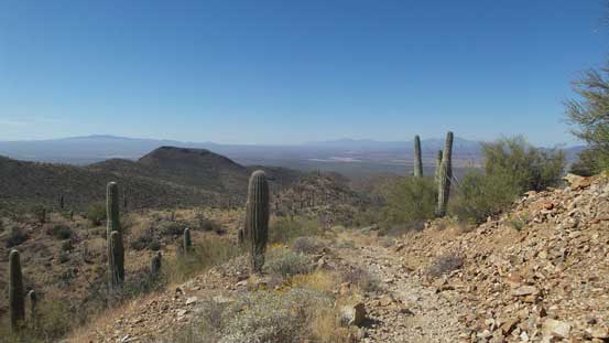
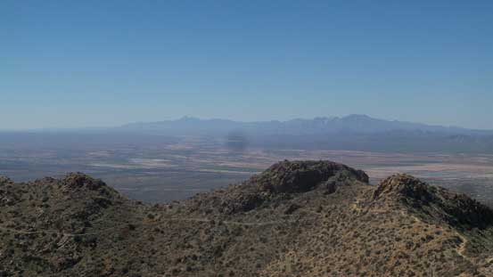
Cresting the first shoulder now, looking down towards the city of Tucson to the east
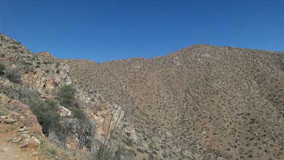
Eventually I figured I had to keep going so resumed my slow ass pace up the trail and my speed did not pick up again until hitting the upper portion of SW Ridge where the views finally opened up towards all directions. The plod along the final summit ridge was quite a drag too but at least the elevation gain was mostly finished, and once on top I took a lengthy break regathering my strength.
High up on Sweetwater Trail now
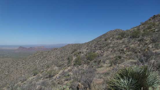
The upper mountain displaced in front. Still a bit of ways to go…
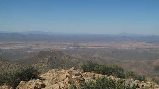
Already higher than the other Tucson Mountains now
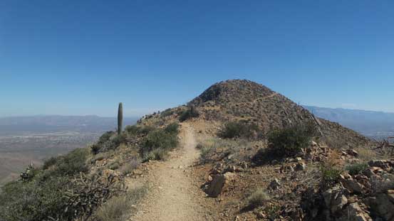
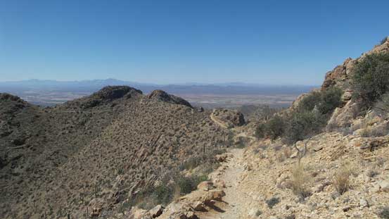
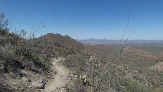
The final summit ridge traverse
The last push.
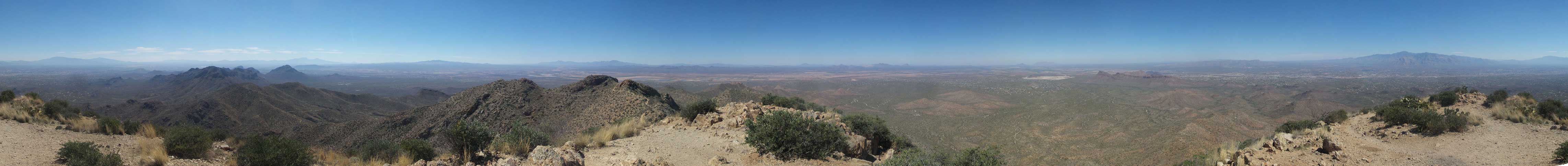
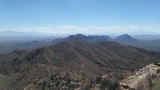
Summit Panorama from Wasson Peak. Click to view large size.

Looking down at the rest of Tucson Mountains
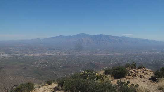
Mt. Lemmon and Santa Catalina Mountains on the horizon
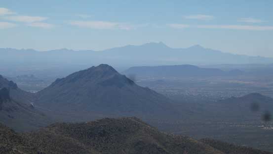
Golden Gate Mountain in foreground with Mt. Wrightson behind
Baboquivari Peak and Kitt Peak on the southern horizon
This is a western view with more peaks that I’m too lazy to figure out the names

Me on the summit of Wasson Peak
My plan was to do the full loop with another ascent of Amole Peak along the way but at this point I just wanted to go back. But I knew I would regret later so the decision was eventually made to push on, and down the west side from the high saddle I went. The ascent of Amole Peak required some brief off-trail travel and is written in a separate trip report. The trail seemed to have dragged a long ways down Norris Ridge before eventually splitting up at a critical junction. I took the left branch which looped back via Gould Mine. I did not bother to check out the mine site and instead, went straight back to car for a much-needed air conditioning.
Time to head down..

Looking back at the uppermost of the trail

Heading down the opposite side of the high saddle now

Can’t stop shooting the desert scenery
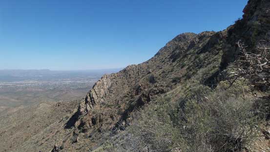
This side of Wasson Peak does look a little bit more impressive…
Amole Peak ahead – my second objective
Way low down now. The trail was a long drag…
It goes on and on and on.. Brutal in the heat..
Almost done…..
The thermometer was reading 35 degrees which was not to my surprise. It was certainly beyond the “comfortable zone”, but here I made it back and got both summits bagged so there’s nothing to complain about. Not doing any further lingering I directed my iPhone app towards Phoenix so up northwards I went. There were still a couple hours to kill in the late afternoon so not wanting to just waste the valuable daytime hours I went to check out Saguaro Lake. The scenery there certainly worth the spent.
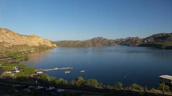
Checking out Saguaro Lake near Phoenix. It was totally worth the spent.
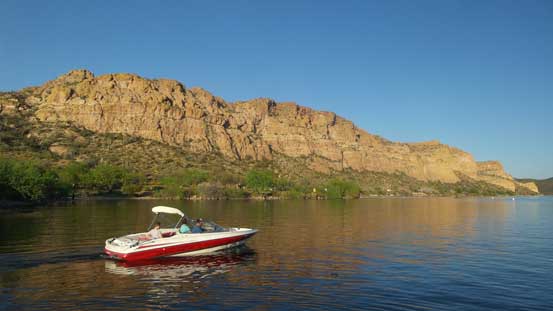
More about Saguaro Lake.
Eventually the sun went down and I leisurely drove back to the city of Phoenix. The objective for the following day was Camelback Mountain and that meant I would spend the night in this city, and not wanting to spend another 70$ ish I opted to sleep in my car and that’s a really bad call thank to the crazy temperature even at midnight…
