Mount Burman
August 26, 2017
1754m
Strathcona Park / Vancouver Island, BC
Mt. Burman in the heart of Strathcona Provincial Park overlooks at least three or four gorgeous lakes and on a clear day the summit offers some of the best views of the surrounding island landscape. It is therefore the proximity to Golden Hinde – highest peak on Vancouver Island that makes Mt. Burman very much overlooked. This peak sits literally right besides Golden Hinde’s standard approach but very few people would actually bother to ascend. For one reason that the approach to Golden Hinde is already beyond most parties’ physical capability so very few would actually have the strength to bag more peaks. This is not the case for Adam and myself, however.
There appears to have more than just a few ways to reach this somewhat unimpressive and rounded summit. We chose the broad north ridge as it requires the least amount of detouring from a high camp on “Burman Ridge”. The ascent was however, a bit more involved than we initially thought it’d be.

Ascent routes for Golden Hinde, The Behinde and Mt. Burman. GPX DL
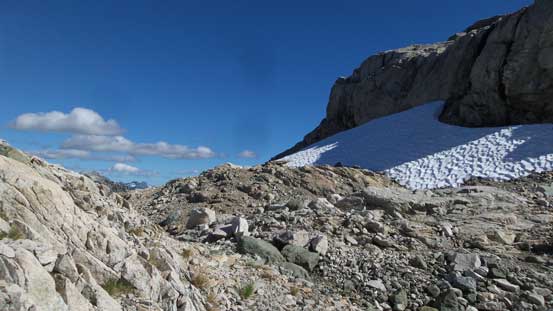
The ascent of north ridge can be broken into two major stages. The first stage was simple climbing up a series of steep granite ledges to a subsidiary bump (false summit). This part did not look very scrambler-friendly from our base camp but there’s only one way to figure out. As expected, a short, 5-meter 4th class step was a little bit problematic at the start. I climbed it without giving too much of a pause but Adam opted to detour around. And who knows.. This detour turned out to be a very long one and eventually he had to bypass the northern subsidiary summit all together. I waited for at least 20 minutes and eventually Adam showed up and we resumed the ascent together.
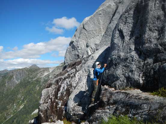
Me attacking the initial 4th class step. Photo by Adam

Adam trying the same step but he opted to detour around
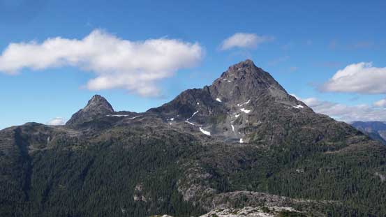
What a view looking back at Golden Hinde and The Behinde

Hitting the top of the subsidiary bump now
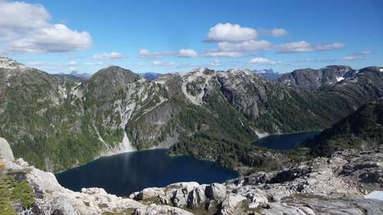
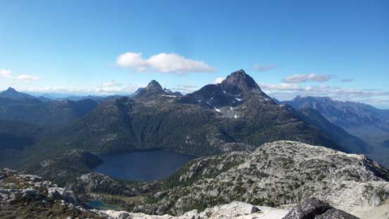
Schjelderup Lake and Carter Lake with “Greig Ridge” behind
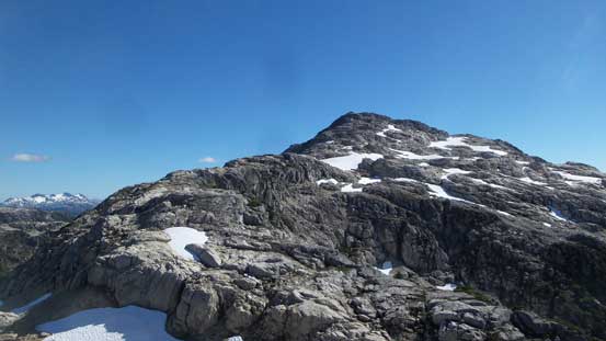
Looking towards the true summit of Mt. Burman
Down to the saddle now
Can’t believe there’s still snow this late in the season
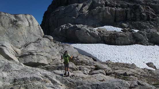
The second stage was much simpler and also much more scenic. All we had to do now was plodding up the broad granite ledges and steps with nothing particularly tricky. There’s still constant route-finding involved as sometimes the easiest line through the steps wasn’t obvious. This is especially true towards the summit once the terrain steepens a little bit. The difference – this time the terrain didn’t give us much of a problem.
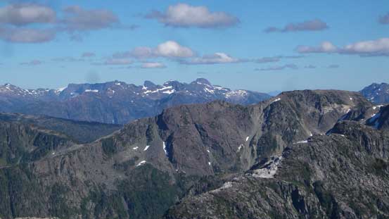
This photo shows there’s still fair amount of route-finding left

Getting closer now

Adam scrambling the summit block
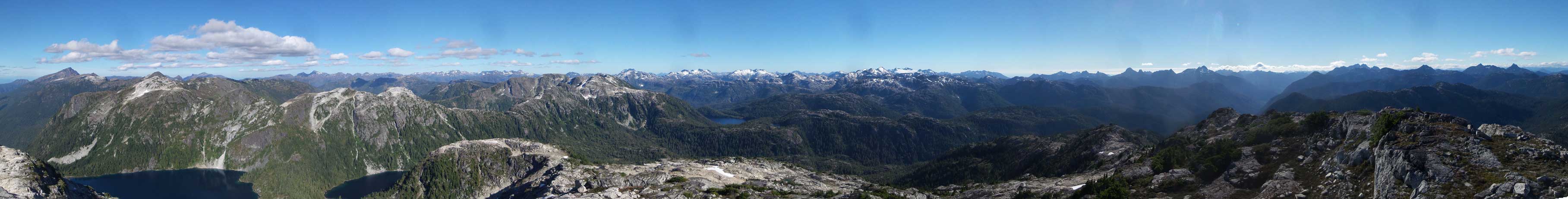
Summit Panorama from Mt. Burman. Click to view large size.
Looking back at Burman Lake and the Hindes
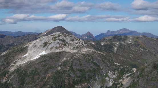
Limestone Cap in the foreground; Alexandra Peak behind on right skyline

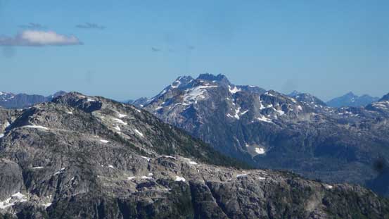
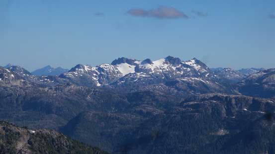
The big peak behind is Mt. Albert Edward
Way in the distance we could see The Red Pillar et al. on Comox Glacier
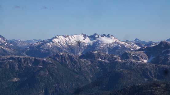
The iconic Mt. Septimus/Mt. Rosseau massif behind Phillips Ridge
Big Interior Mountain
Mt. Tom Taylor
Mariner Mountain
Carter Lake. We just traversed there a couple hours ago…

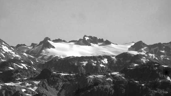
The Behinde with Mt. Colonel Foster and Rambler Peak behind its shoulders

The mighty Golden Hinde
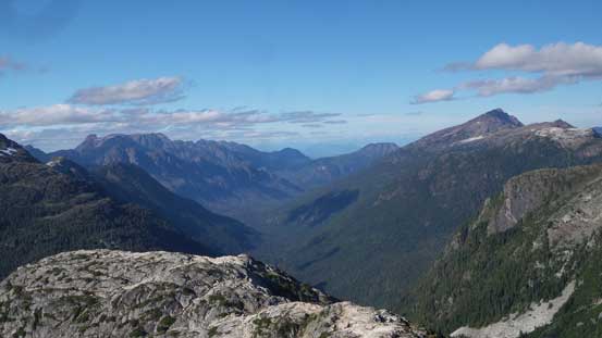
Looking down Wolf River Valley with Mt. McBride on right skyline
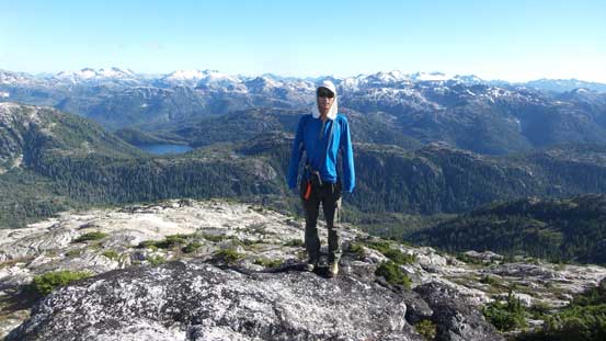
Me on the summit of Mt. Burman
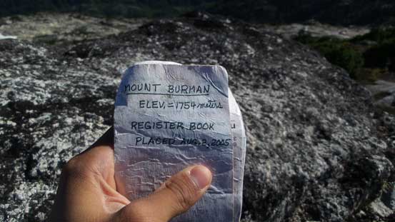
The summit register placed by an American party apparently

Just another shot before going down.
The views were really mind-blowing considering this was my first “real” mountain on the island and it’s right in the core of the good stuffs. We spent at least an hour lingering while waiting for the later afternoon/evening lighting. But once we got all the shots we wanted it’s time to head back to camp. From the northern subsidiary summit we all thought about the couple options but decided to reverse each of us’s own route. Down-climbing the final 4th class crux was not easy, but I thoroughly enjoyed it as I liked a bit of challenge sometimes.

Now it’s time to head back to camp…

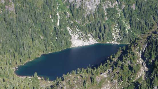
Schjelderup Lake

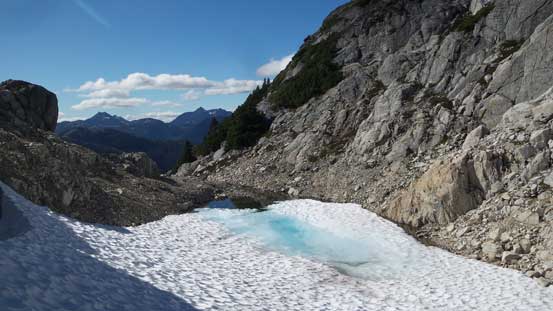
Back to that lovely tarn on the northern subsidiary bump
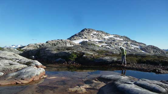
The same tarn with the summit of Mt. Burman behind
